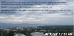
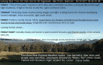
TONIGHT: Partially moonlit skies with Isolated showers…maybe rumble of thunder close to the Quebec border this evening. Patchy valley fog. A low around 60. Little wind.
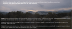
TOMORROW: Pick of the week. Sunshine becoming filtered by high cloudiness. A high in the mid to upper 70s. Light north winds.
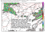
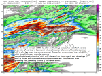
WEDNESDAY NIGHT: Fair and dry in the evening, then thickening clouds. A rising chance for rain or showers developing late. A low in the upper 50s to around 60. Light winds.
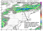
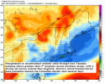
THURSDAY: Cloudy and gray. Periods of rain or showers. A high around 70. Light southeast winds.
Looking further ahead…
THURSDAY NIGHT: Cloudy. Scattered leftover showers exiting after midnight. Patchy valley fog. A low around 55.
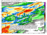
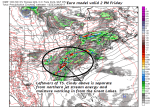
FRIDAY: Considerable cloudiness with intermittent rain developing around mid day. Rather cool. A high 65 to 70.
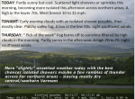
SATURDAY: More sun than clouds. An isolated shower possible. A low in the upper 50s. A high around 75.
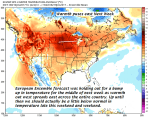
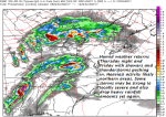
SUNDAY: Mixed clouds and sunshine. Chance for afternoon showers and possible thunderstorms far northern areas. A low 50 to 55. A high around 80.
Average low mid 50s to 60. Normal highs mid 70s to around 80.
RH/7-11[end]