-
- image0016
-

- image0021
-
- image0032
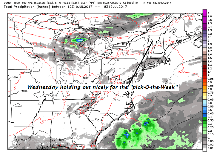
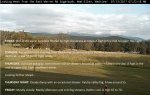
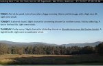
TODAY: Pick of the week. Lots of sun after a foggy morning. Warm and bit muggy with a high near 85. Light west winds.
TONIGHT: Scattered clouds. Slight chance for an evening shower far northern areas. Patchy valley fog. A low in the low 60s. Light west winds.
THURSDAY: Partly sunny. Slight chance for a late day shower or thunderstorm near the Quebec border. A high 80 to 85. Light west to southwest winds.
Looking further ahead…
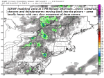
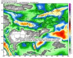
THURSDAY NIGHT: Widely scattered showers and thunderstorms developing toward midnight, otherwise partly cloudy. A low around 60.
FRIDAY: Partly sunny. Widely scattered afternoon and evening showers and thunderstorms mainly northern areas.A high upper 70s to low 80s.
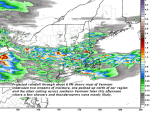
SATURDAY: Mixed clouds and sun. Slight chance for a shower or thunderstorm late. A low in the low 60s. A high mid to upper 70s.
SUNDAY: Partly to mostly sunny, more cloudiness late with a rising chance for showers and thunderstorms. A low 55 to 60. A high in the mid 70s.
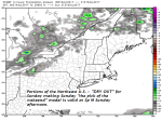
MONDAY: Cloudy. Periods of showers or intermittent rain. Slight chance for a afternoon thunderstorm. A low around 60. A high 65 to 70.
Average low mid 50s to 60. Normal highs mid 70s to around 80. Climatological peak of summer July 22nd…
RH/7-19[end]