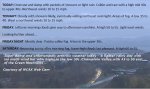
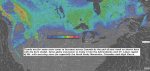
TONIGHT Halloween Eve: A few evening clouds (temperatures in the low 40s for Trick or Treaters, otherwise fair, colder. A low 32 to 35. Light southwest winds.
TOMORROW: Filtered morning sun giving way to thickening clouds in the afternoon. Chilly with a high in the mid 40s. South breeze 10 to 20 mph.
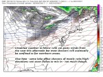
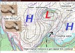
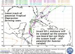
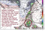
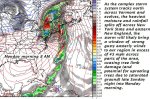
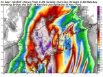
WEDNESDAY NIGHT: Cloudy. Showers becoming likely. A low in the low 40s. Southeast winds 10 mph.
THURSDAY: Mainly cloudy. Chance for lingering showers. A high around 60. South winds 10 to 20 mph.
Looking further ahead…
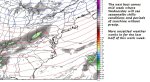
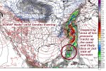
FRIDAY: Considerable cloudiness, with a good chance for lingering showers. Milder. A low in the low 50s. A high upper 50s to near 60.
SATURDAY: Sunshine filtered by increasing high cloudiness. A low 30 to 35. A high in the upper 40s.
SUNDAY: Mostly cloudy. Chance of showers. A low in the upper 30s. A high upper 40s to low 50s.
MONDAY: Mostly cloudy. Chance for showers. A low 50 to 55. A high around 60.
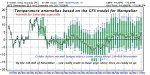
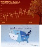
Average lows in the upper 20s to low 30s. Normal highs upper 40s to around 55 warm spots.
RH/11-31-17[end]
| Virus-free. www.avast.com |