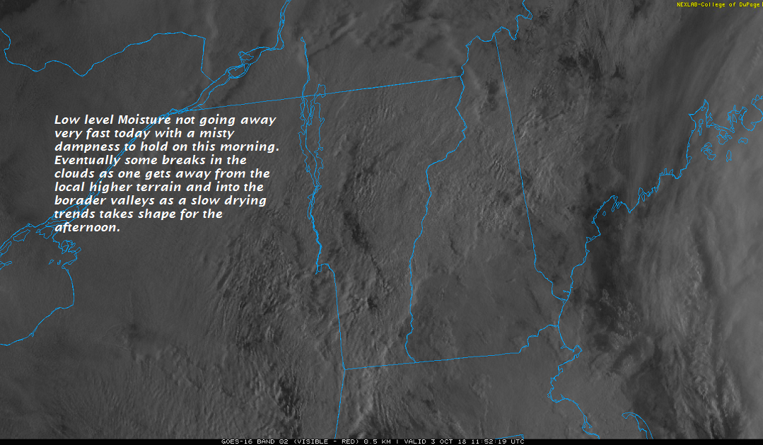
TODAY: Low clouds, mixing with intervals of sunshine. Humid with a slight chance for afternoon showers near the Quebec border. A high around 75. South to southwest breeze 10 to 20 mph.
TONIGHT: Scattered clouds. A bit humid. A low 60 to 65. South breeze 10 to 15 mph.
WEDNESDAY: Partly to mostly sunny warm and muggy. A high mid 70s to around 80. South to southwest winds 10 to 20 mph.
Looking further ahead…
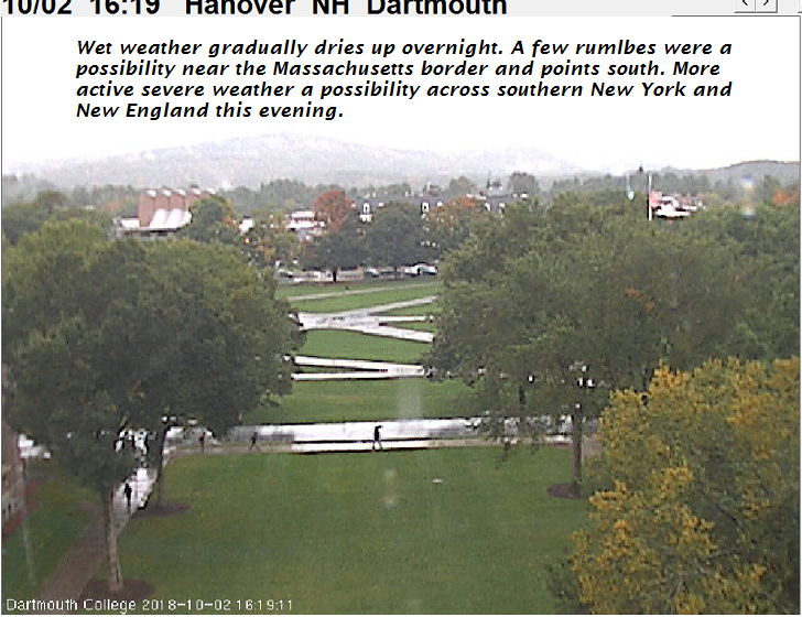
WEDNESDAY NIGHT: Mostly clear in the evening giving way to increasing high cloudiness. On the humid side with a low near 60.
THURSDAY: Mainly cloudy and damp. A good chance for showers, some possibly moderate to heavy with a rumble or two of thunder. A high in the low to mid 60s.
FRIDAY: Lot of clouds with a few breaks of afternoon sun. A low upper 40s. A high 50 to 55.
SATURDAY: Valley fog burns off to partial sun then more afternoon clouds. A low upper 30s to around 40. A high just around 50.
SUNDAY: Morning sun with afternoon cloudiness. Chilly. A low 32 to 35 with scattered frost. A high around 50.
Average lows upper 30s to low 40s. Normal highs mid 50s to 60
RH/10-9-18[end]
| Virus-free. www.avast.com |