Updated Tuesday Morning Forecast — October 2nd, 2018

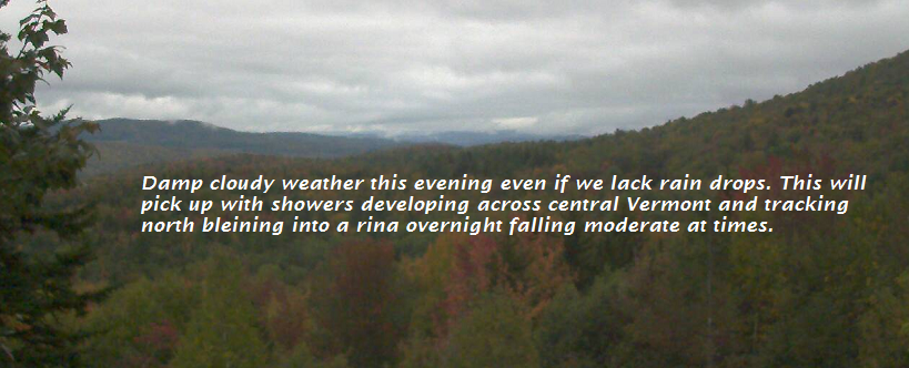
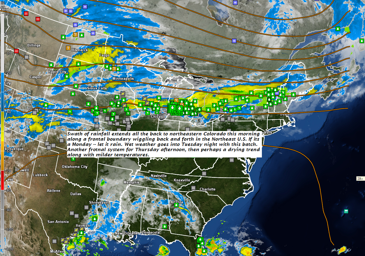
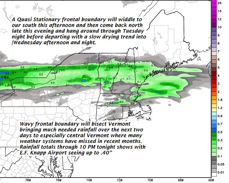
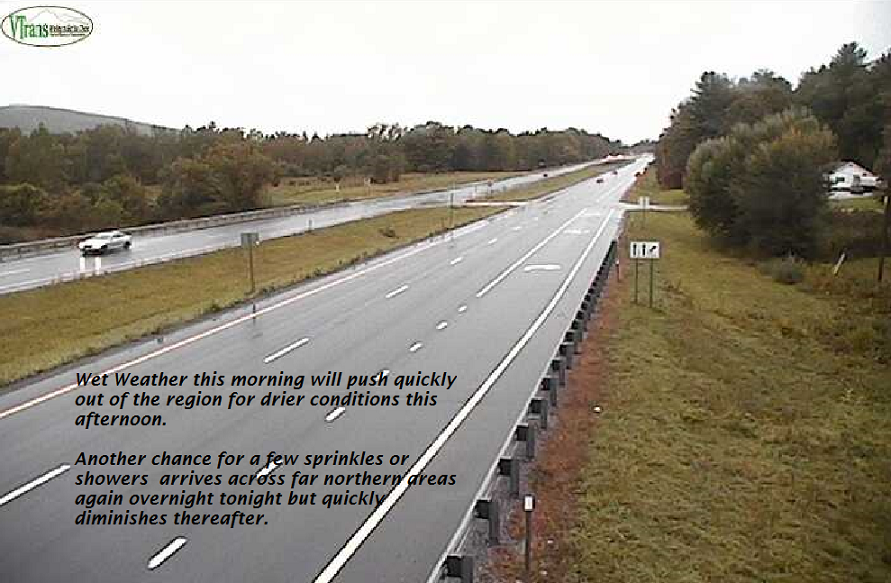
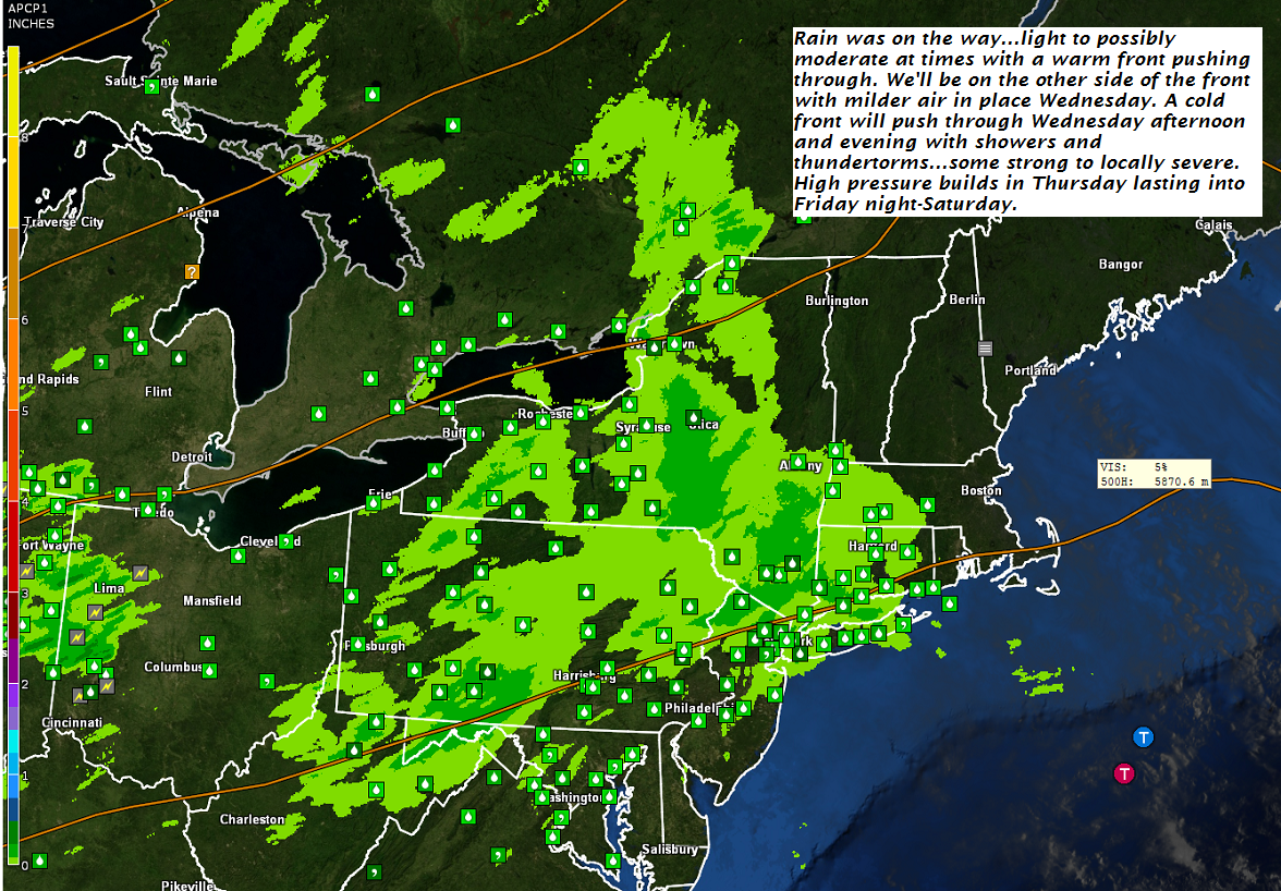
TODAY: Gray. Frequent showers or intermittent rain…moderate at times this afternoon.Continued chilly. A high 50 to 55. East to southeast breeze 10 to 15 mph.

TONIGHT: Cloudy. Showers, some moderate to heavy at time…maybe a rumble of thunder exiting overnight. A low around 50. Winds becoming northwesterly 10 mph overnight.

WEDNESDAY: Considerable cloudiness, but with a few breaks of sun away from the mountains. A high in the upper 50s. Light northwest winds.

Looking further ahead…

WEDNESDAY NIGHT: Scattered clouds. Considerable valley fog. A low around 45.

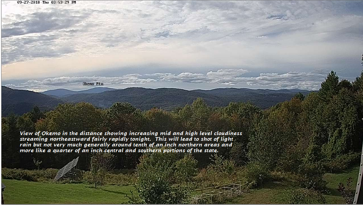
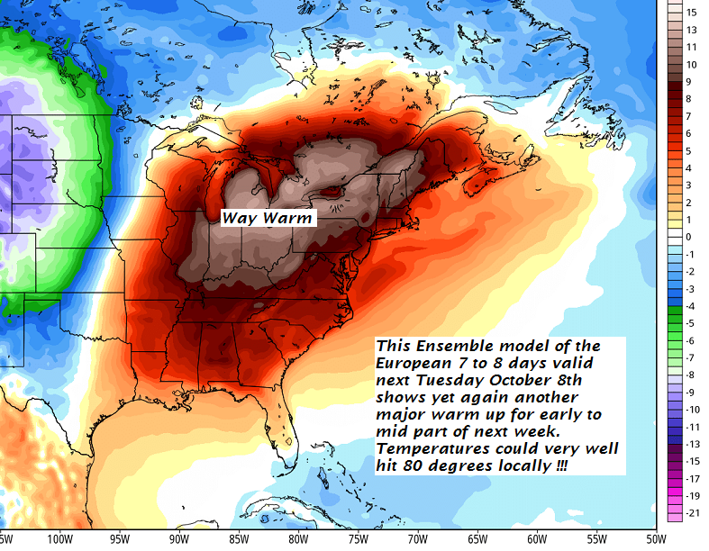
THURSDAY: Morning fog then partly sunny. More clouds in the afternoon with a chance for showers…maybe an isolated rumble of thunder. A high around 70.

FRIDAY: Pick of the week. Morning fog then bright autumn sunshine but rather cool. A low around 40. A high in the mid to upper 50s.

SATURDAY: Mostly sunny. A low in the mid 30s to low 40s. A high 60 to 65.

SUNDAY: Sun mixed with clouds. Slight chance for a shower. A low in the mid 50s. A high 65 to 70

Average lows upper 30s to mid 40s. Normal highs upper 50 to mid 60s.

RH/10-2-18[end]

Virus-free. www.avast.com

Updated Monday Evening Forecast — October 1st, 2018

TONIGHT: Cloudy. Periods of rain developing around or after midnight. A low 45 to 50. Light east winds.

TOMORROW: Gray. Periods of rain or showers some moderate to heavy at times. Maybe a rumble of thunder western and southern areas. A high 50 to 55. East to southeast breeze 10 to 15 mph.

TUESDAY NIGHT: Cloudy. Showers, some moderate to heavy at times in the evening with a rumble of thunder exiting overnight. A low around 50. Winds becoming northwesterly 10 mph overnight.

WEDNESDAY: Lots of clouds with a few breaks of sun in the afternoon. A high in the mid to upper 50s. Light northwest winds.

Looking further ahead…

WEDNESDAY NIGHT: Partly cloudy. Patchy valley fog. A low around 45.

THURSDAY: Mixed clouds and sun. A rising chance for showers in the afternoon. A high in the low 70s.

FRIDAY: Pick of the week. Morning fog then mostly sunny. A low in the upper 30s to low 40s. A high in the mid to upper 50s.

SATURDAY: Sun and clouds. A low in the mid 30s to low 40s. A high 60 to 65.

SUNDAY: Sun mixed with clouds. Slight chance for a shower. A low in the mid 50s. A high around 70.

Average lows upper 30s to mid 40s. Normal highs upper 50 to mid 60s.

RH/10-1-18[end]

Virus-free. www.avast.com

Updated Monday Morning forecast — October 1st, 2018

TODAY: Cloudy damp and chilly. Periods of rain or showers tapering to widely scattered sprinkles toward southern areas this afternoon. Areas of fog. A high mid 50s. Light north winds.

TONIGHT: Cloudy. Periods of rain developing late this evening and overnight. A low in the upper 40s to around 50. Light east winds.

TUESDAY: Gray. Periods of rain or showers some moderate to heavy at times. Maybe a rumble of thunder western and southern areas. A high in the mid 50s. East to southeast breeze 10 mph.

Looking further ahead…

TUESDAY NIGHT: Cloudy. Showers likely. A low around 50.

WEDNESDAY: Lots of clouds with a few breaks of sun in the afternoon. A high mid 50s to near 60.

THURSDAY: Mixed clouds and sun in the morning cloudy with a chance for showers in the afternoon. A low around 45. A high in the low 70s.

FRIDAY: Partly sunny. A low in the upper 30s to low 40s. A high in the mid to upper 50s.

SATURDAY: Sun and clouds. A low in the mid 30s to low 40s. A high 60 to 65.

SUNDAY: Sun mixed with clouds. Slight chance for a shower. A low in the mid 50s. A high around 70.

Average lows upper 30s to mid 40s. Normal highs upper 50 to mid 60s.

RH/10-1-18[end]

Virus-free. www.avast.com

Updated Friday Evening Forecast — September 28th, 2018

TONIGHT: Variably cloudy. Slight chance for sprinkle far northern areas late. Patchy valley fog. A low near 50. Light southwest winds.

TOMORROW: Periods sun mixed with clouds at times. A high 60 to 65. West breeze 10 to 20 mph.

SATURDAY NIGHT: Clear and partially moonlit. Patchy valley fog. A low upper 30s to low 40s. Light southwest winds.

SUNDAY: Sunshine mixed with afternoon clouds. Seasonably cool with a high in the lower 60s. Southwest breeze 10 to 15 mph.

Looking further ahead…

SUNDAY NIGHT: Clouding up. A rising chance for showers overnight.A low 45 to 50.

MONDAY: Mainly cloudy, damp and cool. Good chance for showers or intermittent rain. A high mid to upper 50s.

TUESDAY: Mainly cloudy. Good chance for showers possibly rumble of thunder. A low 50 to 55. A high around 70.

WEDNESDAY: Morning clouds giving way to increasing sunshine. A low around 50. A high in the mid to upper 50s.

THURSDAY: Mostly sunny. A low around 45. A high near 70.

Average lows 40 to 45. Normal highs 60 to 65.

RH/9-28-18[end]

Virus-free. www.avast.com

Updated Friday Morning forecast — September 28th, 2018

TODAY: Light showers exiting early, then more sun than clouds in the afternoon. A high near 65. South winds 10 mph.

TONIGHT: Variably cloudy. Slight chance for sprinkle far northern areas late. Patchy valley fog. A low near 50. Light southwest winds.

SATURDAY: Morning clouds, giving way to periods of sunshine. A high in the mid 60s. West winds 10 to 20 mph.

Looking further ahead…

SATURDAY NIGHT: Mostly clear. Patchy valley fog. A low in the mid 40s.

SUNDAY: Mixed sun and clouds. A high in the low 60s.

MONDAY: Some morning sun then clouding up with a chance for showers. A low around 50. A high near 60.

TUESDAY: Cloudy and gray. A chance for showers. A low in the mid 50s. A high 70 to 75.

WEDNESDAY: Gray skies with a chance for showers, then partial clearing late. A low 55 to 60. A high in the 60s.

THURSDAY: Mostly sunny. A low around 45. A high 65 to 70.

Average lows 40 to 45. Normal highs 60 to 65.

RH/9-28-18[end]

Virus-free. www.avast.com

Updated Thursday Evening Forecast — September 27th, 2018

TONIGHT: Thickening clouds leading to occasional rain mostly after midnight. A low 50 to 55. Light southeast winds.

TOMORROW: Slight chance for a leftover sprinkle mid morning, then more sun than clouds in the afternoon. A high near 65. South winds 10 mph.

FRIDAY NIGHT: Variably cloudy. Slight chance for sprinkle far northern areas late. Patchy valley fog. A low near 50. Light southwest winds.

SATURDAY: Morning clouds, giving way to periods of sunshine. A high in the mid 60s. West winds 10 to 20 mph.

Looking further ahead…

SATURDAY NIGHT: Mostly clear. A low in the mid 40s.

SUNDAY: Mixed sun and clouds. A high in the low 60s.

MONDAY: Some morning sun then clouding up with a chance for showers. A low around 50. A high near 60.

TUESDAY: Cloudy and gray. A chance for showers. A low in the mid 50s. A high 70 to 75.

WEDNESDAY: Gray skies with a chance for showers, then partial clearing late. A low 55 to 60. A high around 75.

Average lows 40 to 45. Normal highs 60 to 65.

RH/9-27-18[end]

Virus-free. www.avast.com

Updated Thursday Morning Forecast — September 27th, 2018

TODAY: Morning fog burns of to lots of sunshine with some high cloudiness. A high in the mid 60s. Little wind.

TONIGHT: Thickening clouds leading to scattered showers mainly after midnight. A low 50 to 55. Light southeast winds.

FRIDAY: Slight chance for a leftover sprinkle in the morning, then more sun than clouds in the afternoon. A high in the mid 60s. Southwest winds 10 mph.

Looking further ahead…

FRIDAY NIGHT: Partly cloudy. Patchy valley fog. A low near 50.

SATURDAY: Morning clouds, then partly sunny. A high in the mid 60s.

SUNDAY: Mixed sun and clouds. A low 40 to 45. A high in the upper 50s to low 60s.

MONDAY: Becoming unsettled. Lots of clouds with a chance for showers. A low 40 to 45. A high 55 to 60.

TUESDAY: Cloudy and gray. A chance for showers. A low in the 50s. A high in the around 70.

WEDNESDAY: Gray skies with a chance for showers. A low in the 50s. A high in the 60s.

Average lows 40 to 45. Normal highs 60 to 65.

RH/9-27-18[end]

Virus-free. www.avast.com

Updated Evening forecast — September 26th, 2018

TONIGHT: Evening showers and isolated thunderstorms, some locally heavy exiting by late evening. Otherwise partial clearing and moonlit with patchy valley fog. A low near 50. Light northwest winds.

TOMORROW: Areas of morning burning off to lots of sunshine with few high clouds. A high 60 to 65. Little wind.

THURSDAY NIGHT: Clear and moonlit evening, then increasing clouds. Slight chance for a sprinkle. Patchy valley fog. A low in the low 50s. Light southeast winds.

FRIDAY: Slight chance for a sprinkle, then partly to mostly sunny. A high in the upper 60s. Southwest winds 10 mph.

Looking further ahead…

FRIDAY NIGHT: Partly cloudy. Patchy valley fog. A low near 50.

SATURDAY: Morning clouds, then partly sunny. A high in the mid 60s.

SUNDAY: Mixed sun and clouds. A low upper 30s to low 40s. A high 55 to 60.

MONDAY: Becoming cloudy with a chance for rain or showers. A low 35 to 40. A high near 60.

Average lows in the low to mid 40s. Normal highs 60 to 65.

RH/9-26-18[end]

Virus-free. www.avast.com

Updated Wednesday morning forecast — September 26th, 2018

TODAY: Cloudy. Widely scattered showers..maybe rumble of thunder Champlain Valley this morning, otherwise clouds mixing with intervals of sunshine. Showers and thunderstorms this afternoon…some strong to locally severe with gusty winds, hail and heavy downpours. Mild and muggy. A high near 75. Southwesterly breeze 10 to 20 mph.

TONIGHT:Variably cloudy & partially moonlit. Evening showers and thunderstorms some strong to locally severe early, exiting mid to late evening. A low near 50. Light west winds.

THURSDAY: Areas of morning fog then lots of sunshine with few high clouds. A high 60 to 65. Little wind.

Looking further ahead…

THURSDAY NIGHT: Clear with considerable valley fog. A low near 50.

FRIDAY: Lots of sunshine with a few high clouds. A high around 70.

SATURDAY: Thickening clouds with a round of showers likely late morning into the early afternoon. A few breaks of sun developing. A low near 50. A high in the mid 60s.

SUNDAY: Clouds mixed with intervals of sunshine. A low upper 30s to low 40s. A high 55 to 60.

MONDAY: Lots of sunshine. A low 35 to 40. A high near 60.

Average lows in the low to mid 40s. Normal highs 60 to 65.

RH/9-25-18[end]

Virus-free. www.avast.com

Updated Tuesday morning Forecast — September 25th, 2018

TODAY: Cloudy. Periods of rain or showers becoming likely by late morning. Continued raw with a high mid 50s to near 60. Southeast breeze 10 to 20 mph.

TONIGHT: Evening showers exiting, otherwise mainly cloudy. Temperatures holding in the 50s. Southeast breeze 10 to 20 mph.

WEDNESDAY: Widely scattered showers, otherwise clouds mixed with periods of sunshine. Showers and thunderstorms developing later in the afternoon…some strong to locally severe. Milder and rather muggy with a high around 75. Southwesterly breeze 10 to 20 mph.

Looking further ahead…

WEDNESDAY NIGHT: Evening showers and thunderstorms exiting before midnight then partial clearing. A low near 50.

THURSDAY: Areas of morning fog gives way to lots of sunshine with high cloudiness. A high 60 to 65.

FRIDAY: Lots of sunshine with a few high clouds. A low near 50. A high around 70.

SATURDAY: Any morning sun gives way to thickening clouds leading to a chance for afternoon showers. A low near 50. A high in the 60s.

SUNDAY: Clouds mixed with intervals of sunshine. A low 35 to 40. A high in the mid 50s.

Average lows in the low to mid 40s. Normal highs not too far from 65.

RH/9-25-18[end]

Virus-free. www.avast.com