Updated Friday Evening Forecast — December 28th, 2018

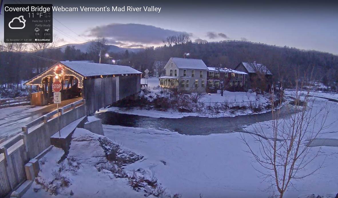
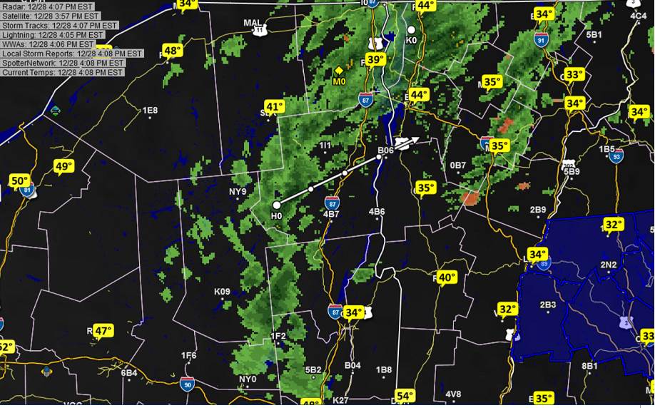
TONIGHT: Considerable cloudiness with areas of fog. Widely scattered sprinkles or light passing showers. Temperatures holding in the mid 30s to low 40s. Light southwest winds.

TOMORROW: Partly to mostly cloudy, blustery and turning colder. Scattered rain showers changing to wet snow showers and flurries especially in the morning. Early high mid 30s, then sharply colder in the 20s. Winds becoming west to northwest 10 to 20 mph.

SATURDAY NIGHT: Clear and frigid. A low 5 below to 10 above. Light northwest winds.

SUNDAY: Bright sunshine. A high upper teens northern areas to mid 20s elsewhere. Light winds.

Looking further Ahead…

SUNDAY NIGHT: Variable high cloudiness. A low 10 to 15.

MONDAY NEW YEARS EVE DAY: Lots of sunshine, then increasing afternoon cloudiness. A high around 35.

TUESDAY NEW YEARS DAY: Overcast. A wintry mix with slick travel in the morning. Rain showers transitioning to scattered snow showers and flurries in the afternoon. Sharply colder. A low in the low 30s. A high 40 to 45.

WEDNESDAY: Maybe a morning flurry, then mostly sunny blustery and colder. Temperatures in the teens..

THURSDAY: Mixed sun and clouds. A low 5 below to 5 above. A high in the 20s.

Average lows mid single digits to low teens. Average highs mid 20s to low 30s.

RH/12-28[end]

Updated Friday Morning Forecast — December 28th, 2018

Winter Weather Advisory into this afternoon…

TODAY: Overcast. Messy mixed bag of sleet, and freezing rain with treacherous travel through late morning. Intermittent light rain tapering to scattered showers. Temperatures rising slowly mid 30s to low 40s. Southeast winds 10 to 20 mph.

TONIGHT: Mostly cloudy. Areas of fog. Scattered light rain showers exiting overnight. A low in the mid to upper 30s. South winds 10 mph.

SATURDAY: Partly to mostly cloudy, blustery and turning colder. A round of rain showers mixing with wet snow showers or flurries northern areas. An early high 35 to 40, then colder in the 20s. Winds becoming west to northwest 10 to 25 mph and gusty.

Looking further Ahead…

SATURDAY NIGHT: Clear and cold. A low in the single digits

SUNDAY: Bright sunshine. A high in the low to mid 20s.

MONDAY NEW YEARS EVE DAY: Lots of sunshine, then increasing afternoon cloudiness. A low around 10. A high 32 to 35.

TUESDAY NEW YEARS DAY: Overcast. A wintry mix with slick travel in the morning. Rain showers transitioning to scattered snow showers and flurries in the afternoon. Sharply colder. A low 25 to 30. A high in the mid to upper 30s.

WEDNESDAY: Maybe a morning flurry, then mostly sunny. A low zero to 10 above. A high in the mid teens to around 20.

Average lows mid single digits to low teens. Average highs mid 20s to low 30s.

RH/12-27[end]

Updated Thursday night Forecast — December 27th, 2018

Winter Weather Advisory Overnight into mid afternoon Friday…

TONIGHT: Thickening clouds, leading to periods of light snow mixing with freezing rain before daybreak with slick travel. An early low upper teens to mid 20s. Southeast winds picking up 10 to 20 mph.

TOMORROW: Overcast. Messy mixed bag of light snow, sleet, and freezing rain with treacherous travel through late morning Intermittent light rain tapering to scattered showers. Temperatures rising slowly mid 30s to low 40s. Southeast winds 10 to 20 mph.

FRIDAY NIGHT: Mostly cloudy. Areas of fog. Scattered light rain showers exiting overnight. A low in the mid to upper 30s. South winds 10 mph.

SATURDAY: Partly to mostly cloudy, blustery and turning colder. A round of rain showers mixing with wet snow showers or flurries northern areas. An early high 35 to 40, then colder in the 20s. Winds becoming west to northwest 10 to 25 mph and gusty.

Looking further Ahead…

SATURDAY NIGHT: Clear and cold. A low in the single digits

SUNDAY: Bright sunshine. A high in the low to mid 20s.

MONDAY NEW YEARS EVE DAY: Lots of sunshine, then increasing afternoon cloudiness. A low around 10. A high 32 to 35.

TUESDAY NEW YEARS DAY: Overcast. A wintry mix with slick travel in the morning. Rain showers transitioning to scattered snow showers and flurries in the afternoon. Sharply colder. A low 25 to 30. A high in the mid to upper 30s.

WEDNESDAY: Maybe a morning flurry, then mostly sunny. A low zero to 10 above. A high in the mid teens to around 20.

Average lows mid single digits to low teens. Average highs mid 20s to low 30s.

RH/12-27[end]

Updated Thursday Morning forecast — December 27th, 2018

TODAY: Partly to mostly sunny, followed by increasing clouds later this afternoon. A high in the mid 20s. Little wind.

Winter Weather Advisory Overnight into mid afternoon Friday…

TONIGHT: Thickening clouds, leading to periods of light snow mixing with freezing rain before daybreak with treacherous travel. An early low upper teens to mid 20s. Southeast winds picking up 10 to 20 mph.

FRIDAY: Overcast. Messy mixed bag of light snow, sleet, and freezing rain with slick travel through late morning Periods of light rain and fog in the afternoon. Temperatures rising slowly into the mid to upper 30s. Southeast winds 10 to 20 mph.

Looking further Ahead…

FRIDAY NIGHT: Cloudy. Areas of fog. Light rain showers early evening tapering off to isolated sprinkles. Temperatures in the mid 30s to low 40s.

SATURDAY: Scattered sprinkles early…transition to a few wet snow showers or flurries especially northern areas. Turning colder. An early high 35 to 40, then colder in the 20s in the afternoon.

SUNDAY: Bright sunshine but much colder. A low in the single digits. A high in the upper teens to mid 20s.

MONDAY NEW YEARS EVE DAY: Lots of sunshine then increasing clouds in the afternoon. A low in the single digits. A high around 32.

TUESDAY NEW YEARS DAY: Overcast. A wintry mix with slick travel in the morning. Rain showers transitioning to scattered snow showers and flurries in the afternoon. Sharply colder. A low in the 20s. A high around 40.

WEDNESDAY: Maybe a morning flurry, then mostly sunny. A low 5 below to 10 above. A high in the teens.

Average lows mid single digits to low teens. Average highs mid 20s to low 30s.

RH/12-27[end]

Updated Wednesday Evening Forecast — December 26th, 2018

TONIGHT: A few flurries passing through this evening, otherwise partly to mostly cloudy. A low 5 to 15 above. Northwest winds 10 to 15 mph.

TOMORROW: Partly to mostly sunny, followed by more clouds later in the afternoon. A high upper teens to mid 20s. Little wind.

Winter Weather Advisory Overnight into mid afternoon Friday…

THURSDAY NIGHT: Thickening clouds, leading to periods of light snow mixing with freezing rain before daybreak with treacherous travel. A low upper teens to mid 20s. Southeast winds picking up 10 to 20 mph.

FRIDAY: Overcast. Messy mixed bag of light snow, and freezing rain…transitioning to light rain or rain showers. Slick travel likely in the morning. Temperatures rising slowly into the mid to upper 30s. Southeast winds 10 to 20 mph.

Looking further Ahead…

FRIDAY NIGHT: Cloudy. Areas of fog. Scattered light rain showers or sprinkles. Temperatures in the mid 30s to low 40s.

SATURDAY: Scattered sprinkles early…mixing with wet snow flakes in the afternoon and turning colder. An early high 35 to 40, then colder in the 20s in the afternoon.

SUNDAY: Sunny, but much colder. A low around zero. A high in the teens.

MONDAY NEW YEARS EVE: Partly sunny then clouding up. A low in the single digits. A high around 32.

TUESDAY NEW YEARS DAY: Overcast. A wintry mix with slick travel in the morning, rain showers exiting late in the afternoon. A low in the 20s. A high 40 to 45.

Average lows mid single digits to low teens. Average highs mid 20s to low 30s.

RH/12-26[end]

Updated Wednesday morning forecast — December 26th, 2018

TODAY: Sunshine mixing with clouds. A stray flurry or two, becoming a more frequent later today. A high 25 to 30. West to northwest winds 10 to 15 mph.

TONIGHT: Chance for mountain flurries, otherwise partly cloudy. A low 5 to 15 above. Northwest winds 10 to 15 mph.

THURSDAY: Partly to mostly sunny, followed by more clouds later in the afternoon. A high 20 to 25. Little wind.

Looking further Ahead…

THURSDAY NIGHT: Thickening clouds, leading to periods of light snow well after midnight. A low 20 to 25.

FRIDAY: Overcast. Messy mixed precipitation with periods of light snow transitioning to light rain or rain showers. Slick travel likely in the morning. A high reaching near 40.

SATURDAY: Scattered sprinkles or light rain showers in the morning transitions to west snow showers in the afternoon and turning sharply colder. A low 32 to 35. An early high 35 to 40 with temperatures falling into the 20s in the afternoon.

SUNDAY: Sunny, but much colder. A low around zero. A high in the teens.

MONDAY NEW YEARS EVE: Partly sunny then clouding up. A low in the single digits. A high around 32.

TUESDAY NEW YEARS DAY: Overcast. A wintry mix with slick travel in the morning, rain showers in the afternoon. A low in the 20s. A high 40 to 45.

Average lows mid single digits to low teens. Average highs mid 20s to low 30s.

RH/12-26[end]

Updated Monday Evening Christmas Eve — December 24th, 2018

TONIGHT CHRISTMAS EVE: A stray flurry or two this evening, otherwise clearing & moonlit. A low 5 to 10 above. Light northwest winds.

TOMORROW CHRISTMAS DAY: Morning clouds then lots of sunshine. A high 20 to 25. Northwest winds 10 mph.

TUESDAY NIGHT: A few clouds otherwise clear and moonlit. A low in the single digits. Light west winds.

WEDNESDAY: Mixed sun and cloud. Widely scattered flurries mainly mid day. A high 25 to 30. West to northwest winds 10 to 15 mph.

Looking further Ahead…

WEDNESDAY NIGHT: Mostly clear this evening more clouds overnight. A low zero to 10 above.

THURSDAY: Partly sunny with more clouds in the afternoon. A high in the 20s.

FRIDAY: Overcast. Messy mixed precipitation with periods of light snow transitioning to light rain or rain showers. Slick travel likely in the morning. A low in the 20s. A high reaching to near 40.

SATURDAY: A low mid to upper 30s. An early high 40 to 45 with temperatures falling into the 20s later in the day.

Average lows mid single digits to low teens. Average highs mid 20s to low 30s.

RH/12-24[end]

Updated Monday morning Forecast — December 24th, 2018

TODAY: Gray skies. Flurries developing south of the Barre-Montpelier area late this morning. Flurries and mountain snow showers this afternoon. A dusting to an inch mainly central and southern areas. A high of about 30. Light winds.

TONIGHT: A stray flurry or two this evening, otherwise partially moonlit. A low around 10 above. Light northwest winds.

TUESDAY CHRISTMAS DAY: Lots of sunshine. A high in the low 20s. Northwest winds 10 mph.

Looking further Ahead…

TUESDAY NIGHT: A few clouds otherwise moonlit. A low in the single digits.

WEDNESDAY: Sunshine mixing with a few cloudy periods. Widely scattered flurries mainly mid day. More sun and then clouds. A high 25 to 30.

THURSDAY: Partly to mostly sunny. A low zero to 10 above. A high in the 20s.

FRIDAY: Overcast. Messy mixed precipitation with periods of light snow transitioning to light rain or rain showers. Slick travel likely in the morning. A low in the 20s. A high reaching to near 40.

Average lows mid single digits to low teens. Average highs mid 20s to low 30s.

RH/12-24[end]

Updated Friday Evening forecast — December 21st, 2018

Winter Solstice 5:23 PM this evening Flood Watch in effect into Saturday afternoon…

TONIGHT: Cloudy. Periods of rain…tapering to scattered light showers. Watch for high water on area streams and rivers. Areas of dense fog.A low in the low to mid 30s. South winds 10 mph.

Full Cold Moon 12:49 PM Saturday

TOMORROW: Lots of clouds. Rain showers…transition to wet snow showers with less than an inch of accumulation across higher terrain. Turning blustery and colder. An early high 40 to 45, then temperatures falling through the 30s in the afternoon. Wind becoming westerly 10 to 20 mph and gusty.

SATURDAY NIGHT: Partly to mostly cloudy. A low in the upper teens. Northwest winds 10 to 15 mph.

SUNDAY: Morning clouds then mostly sunny, colder. A high in the mid 20s. Northwest winds 10 to 15 mph.

Looking further Ahead…

SUNDAY NIGHT: Partly cloudy. A low in the upper teens

MONDAY CHRISTMAS EVE: Mostly cloudy. Scattered mountain snow showers and valley flurries developing mainly southern areas. A high upper 20s to low 30s.

TUESDAY CHRISTMAS DAY: Mixed clouds and sun. Near seasonable temperatures A low around 10 above. A high in the low 20s.

WEDNESDAY: More sun and then clouds. A low in the single digits. A high near 20.

THURSDAY: Partly to mostly sunny. A low in the single digits and a high in the teens

Average lows 10 to 15. Average highs mid 20s to low 30s.

RH/12-21[end]

Updated Wednesday morning Forecast — December 19th, 2018

TODAY: Sunshine filtered by high clouds. A high pushing to near 30. Light southwest winds.

TONIGHT: Mostly clear. A low around 15. Light south wind.

THURSDAY: Sunshine, giving way to variable high cloudiness in the afternoon. Milder with a high near 40. Light south winds.

Looking further ahead…

THURSDAY NIGHT: Thickening clouds. Rain… likely after midnight. A risk for icy spots. An early low in the low 30s then rising temperature levels.

Winter Solstice 5:23 PM Friday December 21st

FRIDAY: Overcast. Soaking rain possibly moderate at times. Watch for icy spots back roads early. Turning much milder with gusty southeast winds. A high in the low to mid 50s.

Full Cold Moon 12:49 PM Saturday

SATURDAY: Mostly cloudy. Chance for passing rain showers mixing with wet snow flakes higher terrain. A low in the mid 30s. An early high near 45.

SUNDAY: Morning cloudiness giving way to mostly sunny skies in the afternoon. Much colder. A low in the upper teens. A high in the mid 20s.

MONDAY CHRISTMAS EVE: Mostly cloudy. Scattered mountain snow showers and valley flurries developing with minor accumulation. A low in the teens. A high near 32.

TUESDAY CHRISTMAS DAY: Mixed clouds and sun. Near seasonable temperatures A low 10 to 15. A high 25 to 30.

Average lows low to mid teens. Average highs upper 20s to mid 30s.

RH/12-19[end]