Updated Thursday Evening forecast — January 31st, 2019

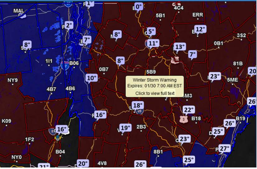
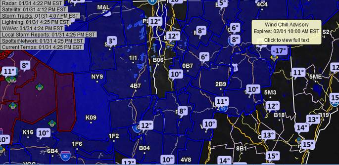
Wind chill Advisory 7 PM through 10 AM Friday…

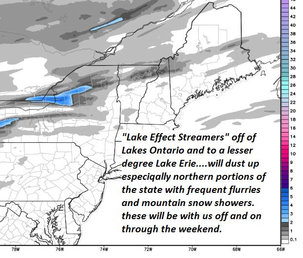
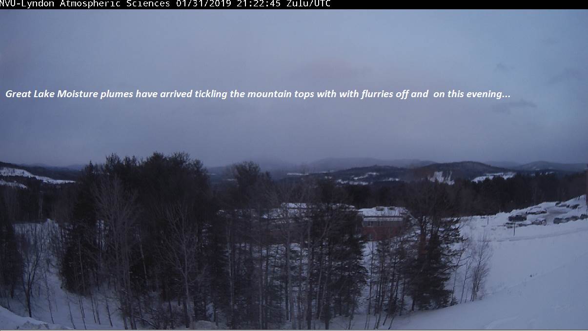
TONIGHT: A few flurries northern areas this evening, otherwise partly cloudy. A low zero to 10 below. West winds 10 to 15 mph lowering wind chills.

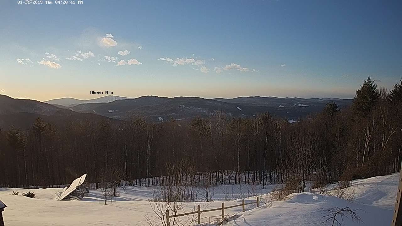
TOMORROW: Sunny and cold. A high 10 to 15 above. West winds 10 mph.

FRIDAY NIGHT: Clear in the evening, then increasing clouds overnight. A low zero 10 below. Light southwest winds.

SATURDAY: Mainly cloudy. Good chance for light accumulating snow or snow showers late morning on… central and northern areas. Accumulations up to an inch or two. A high 20 to 25. South to southwest winds 10 to 15 mph.

Looking further Ahead…

SATURDAY NIGHT: Becoming mostly clear. A low 5 above to 10 below.

SUPER BOWL SUNDAY: Partial morning sunshine, turning gray in the afternoon. Chance for a late day flurries. A high pushing toward 32.

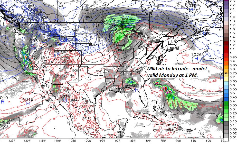
MONDAY: A period of light freezing rain with slick travel early. Gives way breaks of sunshine and much milder. A low near 32 degrees. A high 45 to 50.

TUESDAY: Gray skies. Chance for a few sprinkles. Very mild with lots of snow melt and areas of fog. A low mid to upper 30s. A high upper 40s to low 50s.

WEDNESDAY: Partly sunny. Back to near seasonable temperatures. A low in the single digits. A high in the 20s.

Average lows single digits. Average highs in the 20s.

RH/1-31-19[end]

Updated Thursday Morning Forecast — January 31st, 2019

Wind Chill Advisory through Noon Thursday…

TODAY: Sunshine mixed with clouds but frigid. A few late day flurries northern areas. A high just 5 to 10 above. Southwest winds 10 to 20 mph.

TONIGHT: Scattered flurries northern areas this evening, otherwise partly cloudy. A low zero to minus 15. West winds 10 to 15 mph lowering wind chills.

FRIDAY: Lots of sunshine. A high 10 to 15 above. West winds 10 mph.

Looking further Ahead…

FRIDAY NIGHT: Clear and cold. A low 5 to 15 below.

SATURDAY: Partial morning sun then mainly gray. A rising chance for light accumulating snow showers or flurries northern tier areas. Holding dry elsewhere. A high 20 to 25.

SUPER BOWL SUNDAY: Morning sunshine then increasing clouds. Scattered light snow showers and a risk of mixed precipitation late. A low 5 to 15 above. A high pushing toward 30.

MONDAY: A period of light freezing rain with slick travel early morning hours… giving way to breaks of sunshine and much milder. A low in the 20s. A high in the mid 40s to near 50.

TUESDAY: Gray skies. Chance for rain showers and very mild with lots of snow melt and areas of fog. A low mid to upper 30s. A high in the 40s.

WEDNESDAY: Partly sunny. Back to near seasonable temperatures. A low in the single digits. A high in the 20s.

Average lows single digits. Average highs in the 20s.

RH/1-31-19[end]

Updated Wednesday Evening Forecast — January 30th, 2019

Wind Chill Advisory 6 PM this Evening through Noon Thursday…

TONIGHT: Early evening flurries exiting the Northeast Kingdom, otherwise mostly clear blustery and cold. A low 0 to 10 below. West to southwest winds 10 to 20 mph lowering wind chills.

TOMORROW: Sunshine mixed with clouds but frigid. A few late day flurries northern areas. A high just 5 to 10 above. Southwest winds 10 to 20 mph.

THURSDAY NIGHT: Scattered flurries northern areas, otherwise partly cloudy. A low minus 5 to minus 15. West winds 10 to 15 mph lowering wind chills.

FRIDAY: Lots of sunshine. A high 10 to 15 above. West winds 10 mph.

Looking further Ahead…

FRIDAY NIGHT: Clear and cold. A low 5 to 15 below.

SATURDAY: Partial morning sun then cloudy. A rising chance for light accumulating snow northern areas. Dusting to 2 inches. A high upper teens to mid 20s.

SUPER BOWL SUNDAY: Morning sunshine then clouding up. Rising chance for light snow showers mixing with sleet and freezing rain toward evening. A low zero to 15 above. A high around 20.

MONDAY: A wintry mix early with slick travel… giving way to periods of sunshine and much milder. A low mid teens to mid 20s. A high in the 30s to around 40.

Average lows single digits. Average highs in the 20s.

RH/1-30-19[end]

Updated Wednesday Morning Forecast — January 30th, 2019

TODAY: Flurries winding down this morning. Intervals of afternoon sunshine, then more clouds late. Chance for a round snow showers or squalls late today. Blustery. A high upper teens, then temperatures falling in the afternoon. Southwest winds picking up 10 to 20 mph in the afternoon with some blowing & drifting.

Wind Chill Advisory 6 PM this Evening through Noon Thursday…

TONIGHT: Mostly clear & frigid. A low ranging 0 to 15 below. West to southwest winds 10 to 20 mph lowering wind chills.

THURSDAY: Sunshine mixed with clouds but frigid. A high just 5 to 10 above. Southwest winds 10 to 20 mph.

Looking further Ahead…

THURSDAY NIGHT: Scattered flurries northern areas, otherwise partly cloudy. A low zero to 10 below.

FRIDAY: Lots of sunshine. A high near 10 above.

SATURDAY: Morning sun, then more clouds later on. A rising chance for late day snow showers developing northern areas. Frigid. A low 5 to 15 below. A high in the 20s.

SUPER BOWL SUNDAY: Mainly cloudy. Occasional light accumulating snow showers or flurries mixing with sleet toward evening. A low in the 20s. A high near 30.

MONDAY: A wintry mix mainly in the morning with slick travel partly sunny and much milder. A low in the 20s. A high pushing to around 40.

Average lows single digits. Average highs in the 20s.

RH/1-30-19[end]

Updated Tuesday Evening Forecast — January 29th, 2019

Winter Storm Warning through 7 AM Wednesday. Winter Weather Advisory western Vermont

TONIGHT: Cloudy. Snow…moderate at times. Accumulation 3 to 7” Barre Montpelier area north, and 6 to 9” south. A low mid teens to near 20. Light west winds.

TOMORROW: Scattered flurries winding down in the morning. Intervals of afternoon sunshine with a leftover stray flurry or two. Blustery. An early high in the upper teens, then temperatures falling in the afternoon. Southwest winds picking up 10 to 20 mph.

WEDNESDAY NIGHT: Mostly clear. A low ranging 5 to 20 below in the cold spots. Southwest winds 10 to 20 mph.

THURSDAY: Sunshine mixed with clouds but frigid. A high around 5 above. Southwest winds 10 to 15 mph.

Looking further Ahead…

THURSDAY NIGHT: Scattered flurries toward the Northeast Kingdom. A low zero to 10 below.

FRIDAY: Chance for a few flurries Northeast Kingdom early, otherwise lots of sunshine. A high around 10 above.

SATURDAY: Sunny with few high clouds later on. Frigid. A low 5 to 15 below. A high upper teens to mid 20s.

SUNDAY: Mainly cloudy. Rising chance for light accumulating snow showers. A low around 20. A high 25 to 30.

Average lows single digits. Average highs in the 20s.

RH/1-29-19[end]

Updated Tuesday Morning Forecast — January 29th, 2019

Winter Storm Warning 11 AM through 7 AM Wednesday morning Green Mountains east…Winter Weather Advisory elsewhere…

TODAY: Mainly cloudy. Rising chance for flurries and mountain snow showers. A high upper teens to mid 20s. Southeast winds 10 to 20 mph.

TONIGHT: Cloudy. Snow…moderate at times especially overnight with several inches of accumulation. A low around 15. Light west winds.

WEDNESDAY: Scattered flurries winding down in the morning. Intervals of afternoon sunshine with a leftover stray flurry or two. Blustery. A highin the upper teens. Southwest winds picking up 10 to 20 mph.

Looking further Ahead…

WEDNESDAY NIGHT: Mostly clear. A low ranging 5 to 20 below in the cold spots.

THURSDAY: Sunshine mixed with clouds but frigid. A high 5 to 10 above.

FRIDAY: Chance for a few flurries Northeast Kingdom early, otherwise lots of sunshine. A low zero to 10 below. A high around 10 above.

SATURDAY: Sunny with few high clouds later on. Frigid. A low 5 to 15 below. A high upper teens to mid 20s.

SUNDAY: Mainly cloudy. Rising chance for light accumulating snow showers. A low around 20. A high 25 to 30.

Average lows single digits. Average highs in the 20s.

RH/1-29-19[end]

Updated Monday Evening Forecast — January 28th, 2019

TONIGHT: Fair with thickening clouds overnight. A low zero to 10 below. Light east winds.

Winter Storm Warning goes into effect late Tuesday morning through 7 AM Wednesday morning Greens east…

TOMORROW: Partial morning sun, then cloudy. Rising chance for flurries and mountain snow showers. A high upper teens to mid 20s. Southeast winds 10 to 20 mph.

TUESDAY NIGHT: Cloudy. Snow…moderate at times especially overnight with several inches of accumulation. A low in the teens. Light west winds.

WEDNESDAY: Snow…tapers to flurries before exiting. Partial afternoon sunshine and blustery. A highin the teens. Southwest winds picking up 10 to 20 mph.

Looking further Ahead…

WEDNESDAY NIGHT: Mostly clear. A low 5 to 15 below.

THURSDAY: Sunshine mixed with clouds but frigid. A high only in the single digits.

FRIDAY: Mostly sunny. A low zero to 10 below. A high in the single digits above zero.

SATURDAY: Sunny with few high clouds later on. A low 5 to 15 below. A high 15 to 20.

Average lows single digits. Average highs in the 20s.

RH/1-28-19[end]

Updated Monday Morning Forecast — January 28th, 2019

TODAY: Bright sunshine and blue skies with some high cloudiness late in the day. A high upper single digits to mid teens. Light northwest winds.

TONIGHT: Fair with thickening clouds overnight. A low zero to 10 below. Light east winds.

Winter Storm WatchTuesday into Wednesday

TUESDAY: Partial morning sun, then cloudy. Rising chance for flurries and mountain snow showers. A high in the mid teens to low 20s. Southeast winds 10 to 20 mph.

Looking further Ahead…

TUESDAY NIGHT: Cloudy. Snow…moderate at times especially overnight with several inches of accumulation. A low 15 to 20.

WEDNESDAY: Morning snow…tapering to scattered flurries. Otherwise partial afternoon sunshine. A highin the teens.

THURSDAY: Sunshine mixed with clouds in the morning, then clouding up in the afternoon. Chance for a few flurries. A low 5 to 15 below. A high barely reaching the low single digits.

FRIDAY: Morning flurries exit to partly to mostly sunny but frigid conditions. Becoming partly to mostly sunny. A low zero to 10 below. A high in the single digits above zero.

Average lows single digits. Average highs in the 20s.

RH/1-28-19[end]

Updated Friday Evening Forecast — January 25th, 2019

TONIGHT: Variable clouds and partially moonlit. Scattered snow showers or flurries. A dusting to an inch of fluff. A low in the single digits. Light west winds.

TOMORROW: Mixed clouds and sun. Colder with scattered flurries. A high 15 to 20. Southwest winds 10 to 20 mph.

SATURDAY NIGHT: Scattered clouds. A few stray flurries. A low 5 below to 10 above. Light south winds.

SUNDAY: Clouds with a few breaks of sun. Occasional light snow showers or flurries. Dusting to an inch or two. A high upper 20s to low 30s. South winds 10 to 20 mph.

Looking further Ahead…

SUNDAY NIGHT: Mostly cloudy. Chance for light snow showers or flurries. Less than an inch of accumulation. A low in the single digits.

MONDAY: Bright sunshine and blue skies. A high in the low to mid teens.

TUESDAY: Partial morning sunshine then clouding up. Chance for flurries toward the Champlain Valley. A low zero to 10 below. A high low 20s.

WEDNESDAY: Gray. Chance for accumulating snow. Significant accumulation possible. A low in the single digits. A highin the mid-teens to around 20

THURSDAY: Mixed sun and clouds with mountains flurries. A low in the single digits. A high in the teens.

Average lows single digits. Average highs in the 20s.

RH/1-25-19[end]

Updated Friday morning Forecast — January 25th, 2019

TODAY: Clouds mixed with periods of sun. Scattered flurries with an occasional mountain snow shower northern areas. Dusting to less than an inch. A high 25 to 30. West to southwest winds 10 to 20 mph.

TONIGHT: Variable clouds and partially moonlit. Scattered snow showers or flurries. A dusting to an inch of fluff. A low in the single digits. Light west winds.

SATURDAY: Mixed clouds and sun. Colder with scattered flurries. A high 15 to 20. Southwest winds 10 to 20 mph.

Looking further Ahead…

SATURDAY NIGHT: Scattered clouds. Chance for light accumulating flurries. A low 5 below to 10 above.

SUNDAY: Morning sun then clouding up. Occasional snow showers developing. Dusting to 2 inches. A high around 32.

MONDAY: Bright sunshine and blue skies. A low in the single digits. A high in the low to mid teens.

TUESDAY: Partial morning sunshine then clouding up. A low zero to 10 below. A high low 20s.

WEDNESDAY: Gray. Chance for accumulating snow. Significant accumulation possible. A low in the single digits. A highin the mid-teens to around 20

THURSDAY: Mixed sun and clouds with mountains flurries. A low in the single digits. A high in the teens.

Average lows single digits. Average highs in the 20s.

RH/1-25-19[end]