Updated Thursday Evening Forecast — March 7th, 2019

TONIGHT: A few mountain flurries exiting to clearing skies. A low ranging 5 below to 5 above. Light southwest winds.

TOMORROW: A few high clouds but lots of sunshine. A high upper 20s to low 30s. Light southwest winds.

FRIDAY NIGHT: Clear and starlit skies. A low in the single digits. Light southwest winds.

SATURDAY: A beauty – sunshine and blue skies. A high ranging mid 20s to around 32 coldest northern areas. Light south winds.

Looking further ahead…

SATURDAY NIGHT: Fair with increasing clouds. A low in the teens

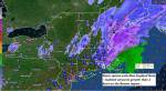
SUNDAY: Overcast. A rising likelihood of accumulating snow mixing with sleet, freezing rian and eventually rain late…leading to potentially hazardous travel. Becoming breezy to windy at times. An eventual high in the mid 30s.

MONDAY: Mostly cloudy & blustery at times. Scattered mountain snow showers and valley flurries. A low around 32. A high around 35.

TUESDAY: Lots of clouds. Chance for accumulating snow showers with minor accumulation. A low around 20. A a high in the mid 20s.

Average lows in the teens. Average highs in the 30s.

RH/3-7-19[end]

Updated Thursday morning Forecast — March 7th, 2019

TODAY: A few flurries near the mountains this morning and again late this afternoon. Otherwise clouds mixed with sunny periods. Well below normal in temperature. A high mid-teens to around 20. West to northwest winds 10 to 20 mph.

TONIGHT: Mostly clear. A low ranging 5 below to 5 above. Light southwest winds.

FRIDAY: A few high clouds but lots of sunshine. A high upper 20s to low 30s. Light southwest winds.

Looking further ahead…

FRIDAY NIGHT: Mostly clear. A low in the single digits.

SATURDAY: A beauty – sunshine and blue skies. A high ranging mid 20s to around 32.

SUNDAY: Overcast. A rising likelihood of snow or mixed precipitation leading to potentially hazardous travel. Becoming breezy at times. A low in the teens, and a high low to mid 30s.

MONDAY: Mostly cloudy & blustery at times. Scattered mountain snow showers and valley flurries. A low around 32. A high around 35.

TUESDAY: Lots of clouds. Chance for accumulating snow showers with minor accumulation. A low to mid 20s. A high upper 20s to around 30.

Average lows in the teens. Average highs in the 30s.

RH/3-7-19[end]

Roger Hill

Weatheringheights Consulting

186 MacKenzie Dr.

Worcester Vermont 05682

802 224 0456 work

802 522 3644 cell

Updated Wednesday Evening Forecast — March 6th, 2019

TONIGHT: Partly cloudy to mostly clear with a stray flurry. A low zero to 10 below. Light west winds.

TOMORROW: Sunny periods in the morning, more clouds in the afternoon and blustery. A high in the mid-teens to around 20. West to northwest winds 10 to 20 mph.

THURSDAY NIGHT: Mostly clear with some high clouds around. A low ranging 5 below to 5 above. Light southwest winds.

FRIDAY: Sunshine filtered through high clouds. A high upper 20s to near 32 degrees. Light southwest winds.

Looking further ahead…

FRIDAY NIGHT: Mostly clear. A low 5 to 15 above.

SATURDAY: A beauty – sunshine and blue skies. A high ranging mid 20s to around 32.

SUNDAY: Overcast. A rising likelihood of snow or mixed precipitation leading to potentially hazardous travel. Becoming breezy at times. An evening low 5 to 15 with a gradual rise in temperature reaching the low to mid 30s.

MONDAY: Partly to mostly cloudy & blustery at times. Scattered mountain snow showers and valley flurries. A low upper 20s to mid 30s. A high around 35.

Average lows in the teens. Average highs in the 30s.

RH/3-6-19[end]

Updated Wednesday morning Forecast — March 6th, 2019

TODAY: More sun than clouds and blustery at times with a stray flurry or two near the mountains. Well below normal temperatures with a highmid to upper teens. Northwest winds 10 to 20 mph lowering wind chills.

TONIGHT: Mostly clear and frigid. A low zero to 10 below. Light west winds.

THURSDAY: Sunshine mixed with cloudy periods. A high in the mid-teens to lower 20s. Northwest winds 10 to 20 mph in the afternoon.

Looking further ahead…

THURSDAY NIGHT: Mostly clear with some high clouds around. A low ranging 5 below to 5 above

FRIDAY: Sunshine filtered through high clouds. A high upper 20s to near 32 degrees.

SATURDAY: Mostly sunny. A low 5 to 15 above. A high ranging mid 20s to around 32.

SUNDAY: Overcast. A rising likelihood of snow or mixed precipitation leading to potentially hazardous travel. Becoming breezy at times. An evening low 5 to 15 with a gradual rise in temperature reaching the low to mid 30s.

MONDAY: Partly to mostly cloudy & blustery at times. Scattered mountain snow showers and valley flurries. A low upper 20s to mid 30s. A high around 35.

Average lows in the teens. Average highs in the 30s.

RH/3-6-19[end]

Updated Tuesday morning Forecast — March 5th, 2019

TODAY: Partly to mostly sunny this morning. Increasing clouds this afternoon…leading to scattered mountain snow showers & flurries. Accumulation a dusting to a half inch or so Barre-Montpelier area north. A high upper teens to mid 20s. Southwest winds 10 mph.

TONIGHT: Some leftover flurries exiting to mostly clear skies just a few clouds at times. A low 5 below to 5 above. Light west winds.

WEDNESDAY: Mixed sun and clouds. Well below normal temperatures. A high mid to upper teens. Northwest winds 10 to 15 mph.

Looking further ahead…

WEDNESDAY NIGHT: Mostly clear and cold. A low zero to 10 below.

THURSDAY: Sunshine mixed with cloudy periods. A high in the mid-teens to lower 20s.

FRIDAY: Sunshine filtered through high clouds. A low ranging 5 below to 10 above. A high mid 20s to low 30s.

SATURDAY: Mostly sunny. A low in the single digits. A high mid 20s to mid 30s.

SUNDAY: Overcast. Chance for wintry mix with snow and sleet accumulation transitioning to rain. Potentially hazardous travel. An early evening low 5 to 15. Temperatures rising upper 20s to mid 30s.

Average lows in the teens. Average highs in the 30s.

RH/3-5-19[end]

Updated Monday Evening Forecast — March 4th, 2019

TONIGHT: Partly cloudy. Can’t rule out a few stray mountain flurries. A low dropping into the single digits. Light west winds.

TOMORROW TOWN MEETING DAY: Partly sunny in the morning with more clouds in the afternoon. Scattered mountain snow showers & flurries later in the afternoon northern areas. A high upper teens to mid 20s. Southwest winds 10 mph.

TUESDAY NIGHT: Mostly clear with a few clouds at times. A stray flurry possible. Colder. A low 5 below to 5 above. Light west winds.

WEDNESDAY: Mixed clouds and sunshine but rather chilly and well below normal temperatures. A high mid to upper teens. Northwest winds 10 to 15 mph.

Looking further ahead…

WEDNESDAY NIGHT: Mostly clear and cold. A low zero to 10 below.

THURSDAY: Sunshine mixed with cloudy periods. A high in the mid teens to lower 20s.

FRIDAY: Sunshine filtered through high clouds. A low single digits above zero. A high mid 20s to low 30s.

SATURDAY: Mostly sunny. A low in the single digits. A high in the low to mid 30s.

SUNDAY: Clouding up. Chance for wintry mix transitioning to rain. Potentially hazardous travel. An early evening low in the teens. Temperatures rising to 35 to 40.

Average lows in the teens. Average highs in the 30s.

RH/3-4-19[end]

Updated Monday morning Forecast — March 4th, 2019

TODAY: Considerable clouds this morning with scattered light flurries exiting. Maybe a stray flurry or two near the mountains. A high in the upper 20s to low 30s. Northwest winds 10 to 15 mph.

TONIGHT: Partly cloudy. A low dropping into the single digits. Light west winds.

TUESDAY TOWN MEETING DAY: Partly sunny in the morning with more clouds in the afternoon. Chance for a few snow showers or flurries later in the afternoon northern areas. A high upper teens to mid 20s. Southwest winds 10 mph.

Looking further ahead…

TUESDAY NIGHT: Scattered clouds. Chance for a flurry. A low 5 below to 5 above.

WEDNESDAY: Mixed clouds and sunshine. A high ranging through the teens.

THURSDAY: Sunshine mixed with cloudy periods. A low zero to 10 below. A high in the mid teens to lower 20s.

FRIDAY: Mixed sun and clouds. A low mostly in the single digits above zero. A high 25 to 32.

Average lows in the teens. Average highs in the 30s.

RH/3-4-19[end]

Updated Friday Evening Forecast — March 1st, 2019

TONIGHT: Clear this evening, followed by increasing high clouds. A low 5 to 15 above. Little wind.

TOMORROW: Partial sunshine giving way to more clouds. Rising chance for a flurries far southern areas in the afternoon. A high 30 to 35. Light northeast winds.

SATURDAY NIGHT: Occasional light flurries with minor accumulation less than an inch or so. Partial clearing overnight. A low in the low to mid teens. Light west winds.

SUNDAY: Morning sunshine gives way to thickening afternoon clouds. A high 32 to 35. Light northwest winds.

Looking further ahead…

SUNDAY NIGHT: Overcast. Periods of snow developing in the evening with a few to several inches of accumulation. A low in the mid 20s.

MONDAY: Gray. Accumulating snow in the morning winding down as flurries in the afternoon. Several inches likely with the most toward southern Vermont. A high in the mid to upper 20s.

TUESDAY — TOWN MEETING DAY: Considerable cloudiness with scattered snow showers/flurries. A low in the single digits. A high upper teens to low 20s.

WEDNESDAY: Partly to mostly cloudy. Chance for mountain snow showers and valley flurries. A low 5 above to 5 below. A high in the low to mid teens.

Average lows upper single digits into the upper teens. Average highs in the low to mid 30s.

RH/3-1-19[end]

Updated Friday morning forecast — March 1st, 2019

TODAY: Sunny and gorgeous. Milder. A high upper 20s to low 30s. Light southwest winds.

TONIGHT: Clear this evening, followed by increasing clouds. A low in the single digits. Little wind.

SATURDAY: Partial sunshine gives to mostly cloudy skies. Scattered light snow showers or flurries toward southern areas. A high in the upper 20s to mid 30s. Light northeast winds.

Looking further ahead…

SATURDAY NIGHT: Evening clouds. Occasional light flurries with minor accumulation, then partial clearing. A low 15 to 20.

SUNDAY: Morning sunshine gives way to thickening afternoon clouds. A high in the mid 30s.

MONDAY: Gray. Accumulating snow in the morning…a few to several inches possible. Temperatures holding 25 to 30.

TUESDAY — TOWN MEETING DAY: Considerable cloudiness with scattered snow showers/flurries. A low in the single digits. A high in the teens.

WEDNESDAY: Partly to mostly cloudy. Chance for mountain snow showers and valley flurries. A low 5 above to 5 below. A high in the low to mid teens.

Average lows upper single digits into the upper teens. Average highs in the low to mid 30s.

RH/3-1-19[end]

Updated Thursday Evening forecast — February 28th, 2019

TONIGHT: Clear skies this evening giving way to cloudy periods overnight. A low 5 below to 5 above. Little wind.

TOMORROW: Some high cloudiness then sunny. Milder. A high in the mid 20s to low 30s. Light southwest winds.

FRIDAY NIGHT: Clear early then a few more clouds overnight. A low in the single digits. Little wind.

SATURDAY: Partial morning sunshine then cloudy periods in the afternoon. Scattered light snow showers or flurries toward southern areas. A high in the upper 20s to mid 30s. Light northeast winds.

Looking further ahead…

SATURDAY NIGHT: Evening clouds. Occasional light flurries with minor accumulation, then partial clearing. A low 15 to 20.

SUNDAY: Sunshine, mixed with more clouds in the afternoon. A high 32 to 35.

MONDAY: Gray. Chance for accumulating snow…possibly significant amounts. Temperatures holding in the 20s

TUESDAY — TOWN MEETING DAY: Chance for leftover snow showers or flurries giving way to intervals of afternoon sunshine. A low in the single digits. A high in the teens.

Average lows upper single digits into the upper teens. Average highs in the low to mid 30s.

RH/2-28-19[end]