
-

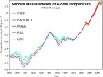
- image001 2
-
- image002 3
TODAY: More sun than clouds and blustery at times with a stray flurry or two near the mountains. Well below normal temperatures with a highmid to upper teens. Northwest winds 10 to 20 mph lowering wind chills.
TONIGHT: Mostly clear and frigid. A low zero to 10 below. Light west winds.
THURSDAY: Sunshine mixed with cloudy periods. A high in the mid-teens to lower 20s. Northwest winds 10 to 20 mph in the afternoon.
Looking further ahead…
THURSDAY NIGHT: Mostly clear with some high clouds around. A low ranging 5 below to 5 above
FRIDAY: Sunshine filtered through high clouds. A high upper 20s to near 32 degrees.
SATURDAY: Mostly sunny. A low 5 to 15 above. A high ranging mid 20s to around 32.
SUNDAY: Overcast. A rising likelihood of snow or mixed precipitation leading to potentially hazardous travel. Becoming breezy at times. An evening low 5 to 15 with a gradual rise in temperature reaching the low to mid 30s.
MONDAY: Partly to mostly cloudy & blustery at times. Scattered mountain snow showers and valley flurries. A low upper 20s to mid 30s. A high around 35.
Average lows in the teens. Average highs in the 30s.
RH/3-6-19[end]
