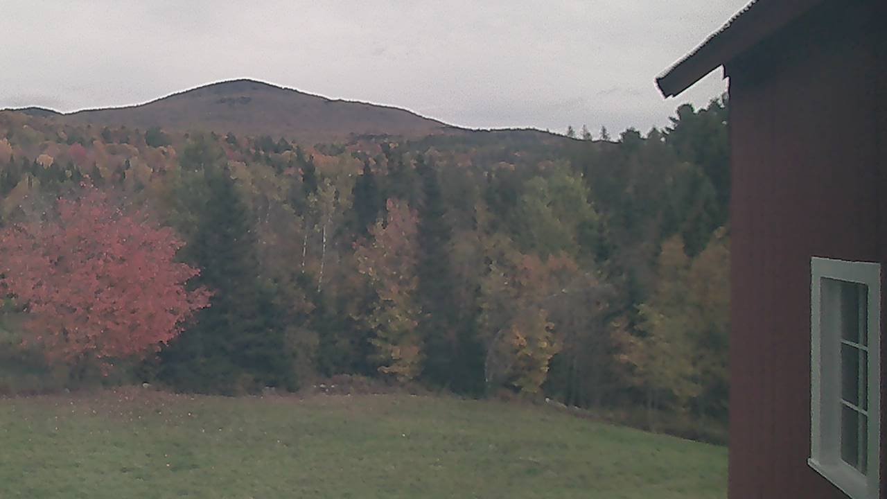
TONIGHT: Breaks in the clouds this evening, then cloudy. Spotty drizzle or light showers developing before daybreak. Mild. A low 50 to 55. Light southeast winds.
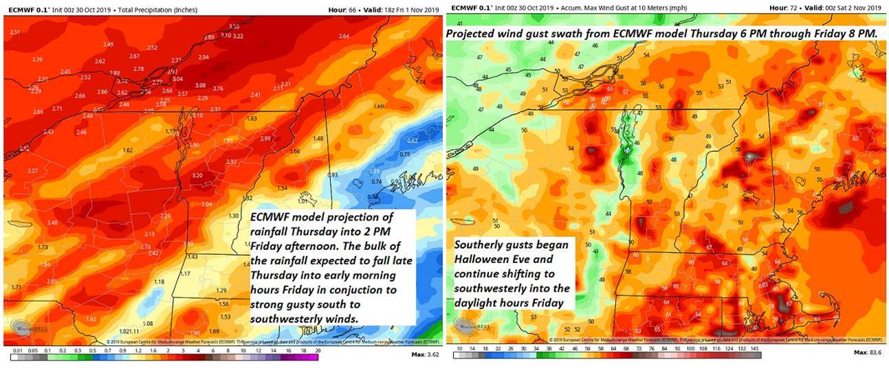
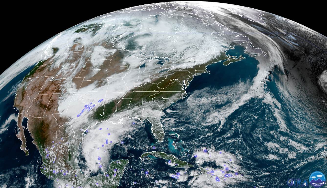
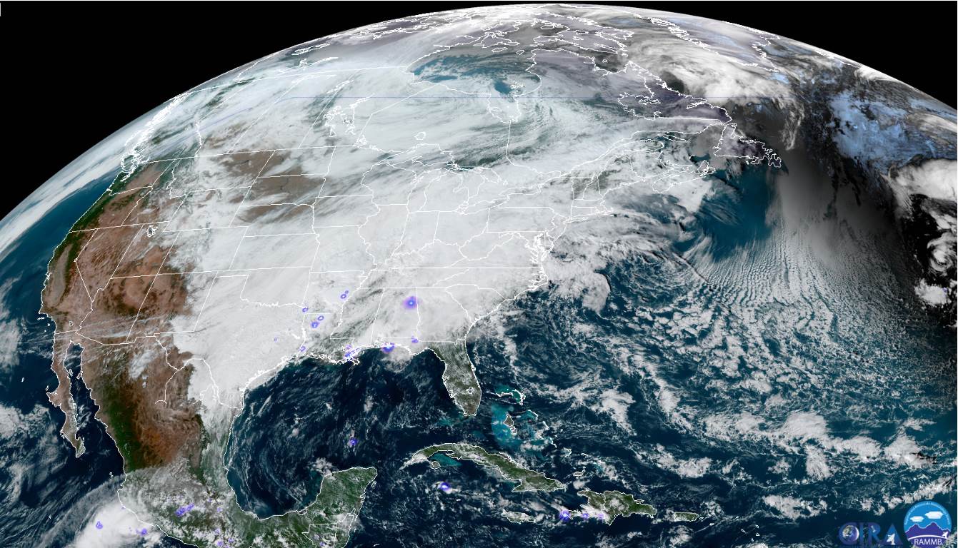
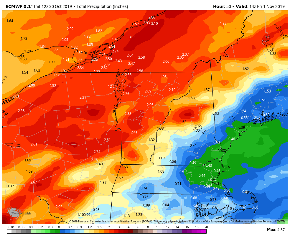
Flood Watch Thursday Afternoon through Friday Evening…
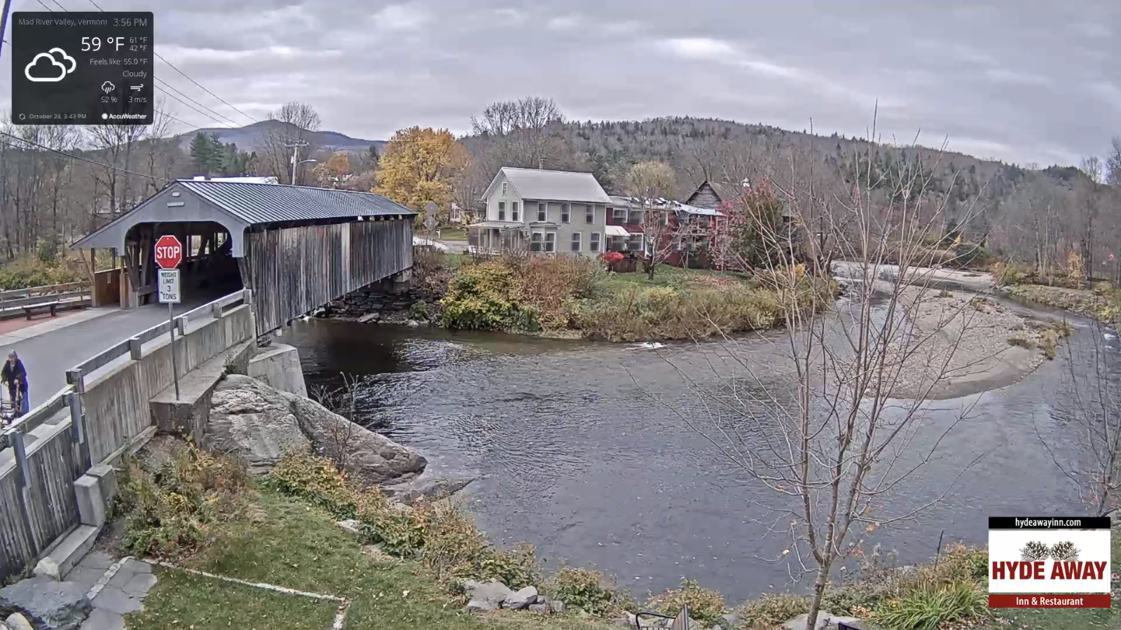
TOMORROW: Overcast. Intermittent light rain becoming moderate at times in the afternoon. Milder. A high pushing to near 65. South to southeast winds 10 to 15 mph.
HALLOWS EVE: Rainy and damp possibly moderate at times. Breezy at times. Temperatures upper 50s to near 60 for trick or treater’s Thursday evening.
THURSDAY OVERNIGHT: Overcast. Periods of rain, moderate to heavy at times and breezy to windy in the higher terrain. A low in the 50s.
FRIDAY: Morning rain…moderate at times exiting. Blustery to windy withintervals of sun in the afternoon. Temperatures around 45. Strong gusty southwesterly winds 10 to 30 mph with gusts 40 to 55 mph especially high terrain.
Looking further ahead…
FRIDAY NIGHT: Mostly clear much less blustery. A low 25 to 30.
SATURDAY: Partly to mostly sunny but colder. A high mid-40s.
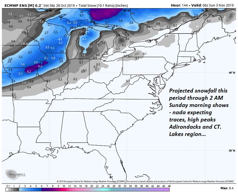
SUNDAY: Morning sun, then partly cloudy. Widely scattered rain showers mixed with wet snow flakes. A low near 32. A high near 45.
MONDAY: Mostly sunny. A low 25 to 30. A high around 45.
Average lows upper 20s to mid-30s. Average highs upper 40s to mid-50s.
RH/10-30-19[end]