Updated Monday Morning Forecast — April 6th, 2020

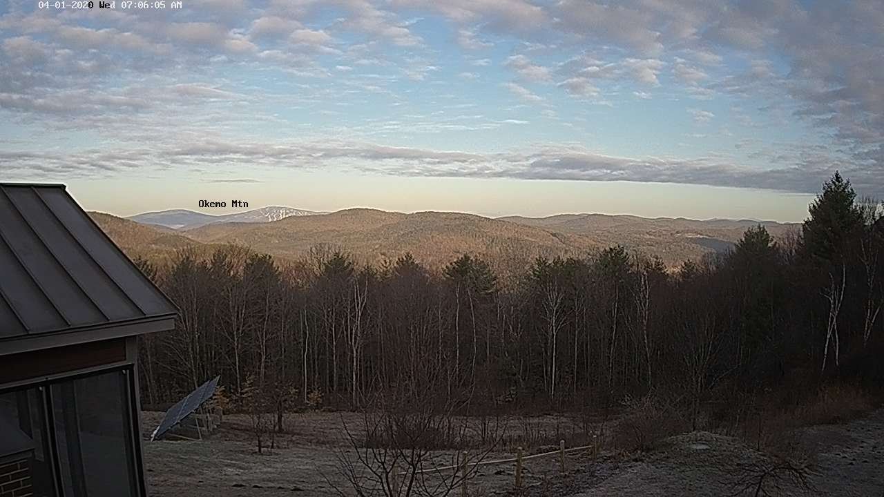
TODAY: Sunshine becoming filtered high cloudiness. A high upper 40s to around 50.Northwesterly winds pick up 10 to 20 mph this afternoon.

TONIGHT: Some high clouds otherwise mostly clear. A low 30 to 35. Light west winds.

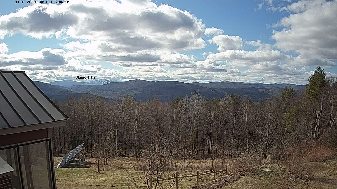
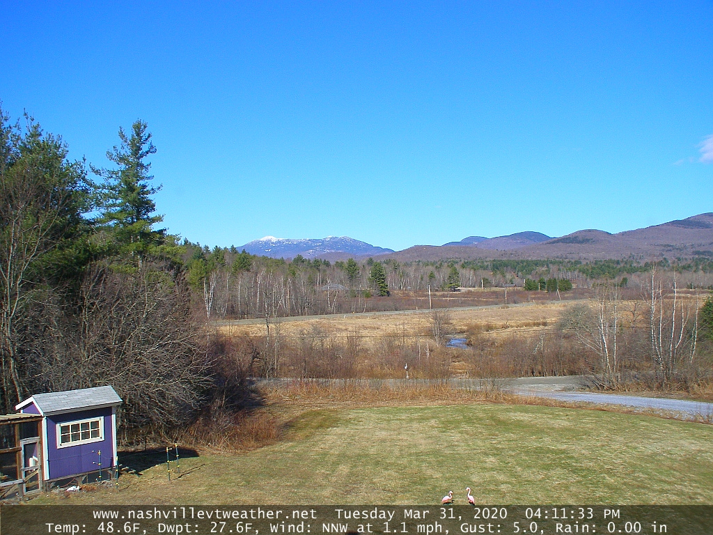
TUESDAY: Partly sunny. A high 50 to 55. West to northwest winds 10 to 15 mph.

Looking further ahead…

TUESDAY NIGHT: Lots of clouds. Rising chance for light snow south of the Barre-Montpelier area toward daybreak. A low in the upper 20s to mid-30s.

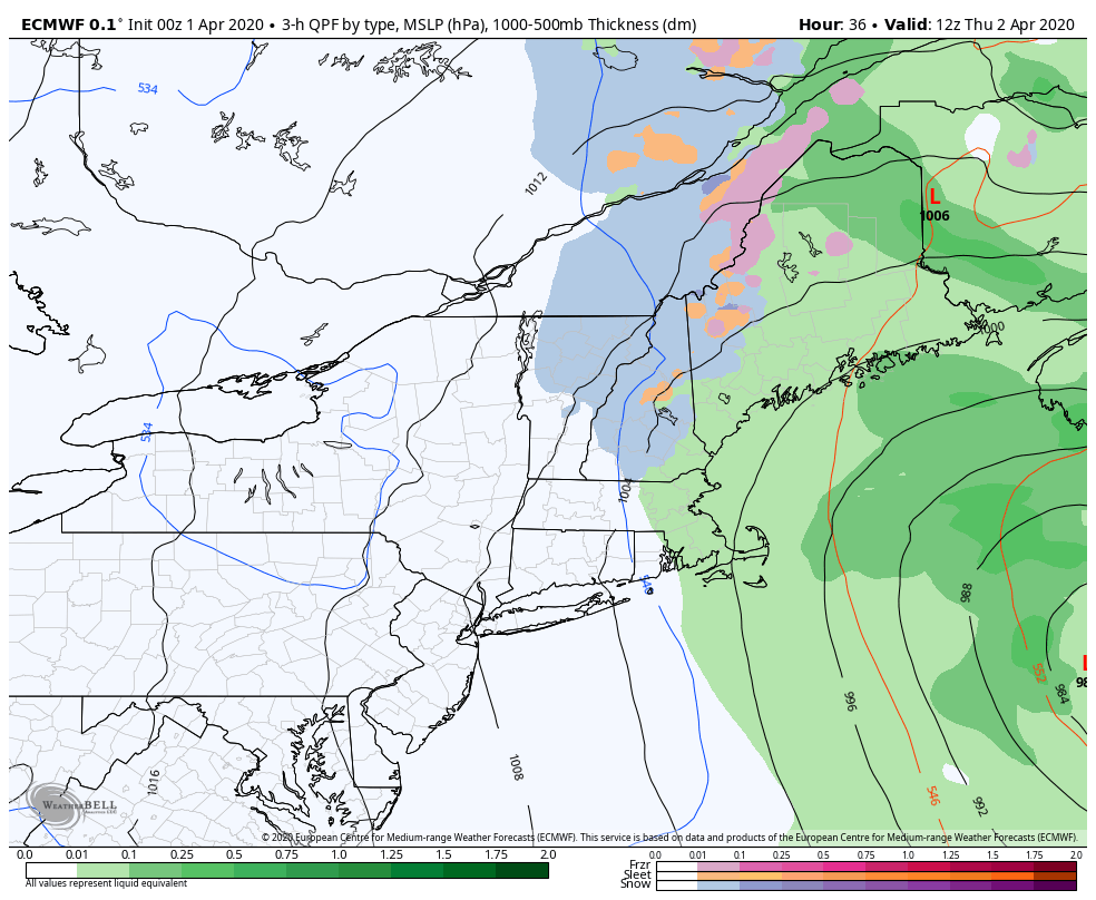
WEDNESDAY: Good chance for light accumulating snow toward southern areas in the morning mixing with rain in the afternoon before exiting. Snow accumulation southern areas up 2” high terrain. Dry with intervals of afternoon sun northern areas. A high around 45 north and in the upper 30s southern areas.

THURSDAY: Gray. Chance for periods of accumulating snow late morning on, mixed with rain valley floors. Snow accumulation 1 to locally 5” most across elevated terrain. A low in the upper 20s to mid-30s. A high just mid to upper 30s.

FRIDAY: Blustery and mostly cloudy. Scattered snow showers and flurries. Some additional minor accumulation. A low mid-20s to low 30s. Below normal in temperatures with a high in the low to mid 30s.

Average lows ranging mid-20s to low 30s, average highs upper 40s to mid-50s.

RH/4-3[end]

Updated Friday Evening Forecast — April 3rd, 2020

Quebec City in sunshine…

TONIGHT: Becoming partly to mostly cloudy with scattered rain showers toward
Rutland exiting
. A low 32 to 35. Light northeast winds.

TOMORROW: Clouds with a few intervals of sunshine. A high near 55. Light northwest winds.

SATURDAY NIGHT: Partly to mostly cloudy. A low 35 to 40. Little wind.

SUNDAY: Lots of clouds. Scattered brief rain showers later in the afternoon. A high 50 to 55. Light southwest winds.

Looking further ahead…

SUNDAY NIGHT: Scattered rain showers early, followed by partial clearing. A low upper 20s to near 32.

MONDAY: Morning sunshine becoming filtered by high clouds. A high 50 to 55.

TUESDAY: More clouds than sun. A low around 30. A high near 50.

WEDNESDAY: Clouds, with a chance for rain or snow showers far south. A few intervals of afternoon sun northern areas. A low 25 to 30. A high 45 to 50.

Average lows ranging thru the 20s, average highs 45 to 50.

RH/4-3[end]

Updated Friday Morning Forecast — April 3rd, 2020

TODAY: Frequent rain showers tapering off late from north to south. Maybe some hints of late afternoon sun developing northern areas. A high upper-40s to around 50. Northeast winds 10 mph.

TONIGHT: Cloudy. A low 32 to 35. Light northeast winds.

SATURDAY: Clouds with a few breaks of sunshine. A high 50 to 55. Light north winds.

Looking further ahead…

SATURDAY NIGHT: Partly cloudy. A low 32 to 35.

SUNDAY: Lots of clouds. Scattered brief rain showers late in the day. A high 50 to 55.

MONDAY: Morning sunshine then variable high clouds. A low upper 20s to near 32. A high in the low 50s.

TUESDAY: More clouds than sun. Scattered rain showers mixed with wet snow flakes high elevations. A low mid to upper 30s. A high 50 to 55.

WEDNESDAY: Clouds with a few intervals of afternoon sun. A low 35 to 40. A high 45 to 50.

Average lows ranging thru the 20s, average highs 45 to 50.

RH/4-3[end]

Updated Thursday Evening Forecast — April 2nd, 2020

TONIGHT: Cloudy. Wet snow showers with some accumulation in the higher terrain this evening…changing to rain showers overnight. An evening low 32 to 35, then temperatures rising slowly. North winds 10 mph.

TOMORROW: Mainly cloudy with scattered leftover rain showers eventually exiting south, maybe late day intervals of sun. A high mid to upper 40s. Northeast winds 10 mph.

FRIDAY NIGHT: Lots of clouds. A low 32 to 35. Light northeast winds.

SATURDAY: Mainly gray with intervals of late afternoon sun. A high 50 to 55. Light north winds.

Looking further ahead…

SATURDAY NIGHT: Scattered clouds. A low in the low 30s

SUNDAY: Lots of clouds. Scattered brief rain showers late in the day. A high 50 to 55.

MONDAY: Filtered sun through high clouds. A low 30 to 35. A high in the low 50s.

TUESDAY: Mixed sun and clouds. A low around 35. A high 55 to 60.

Average lows ranging thru the 20s, average highs 45 to 50.

RH/4-2[end]

Updated Wednesday Evening Forecast — April 1st, 2020

TONIGHT: Cloudy. Chance for snow showers developing toward daybreak NE. Kingdom. A low around 30. Light northwest winds.

TOMORROW: Gray and rather raw. Periods of wet snow developing mid-morning mixing with rain valley floors. Accumulation of a dusting to locally 3” Northeast Kingdom higher terrain. A high mid to upper 30s. North winds 10 to 15 mph.

THURSDAY NIGHT: Lots of clouds. Wet snow showers mixed with rain some valleys floors. A low around 35. North winds 10 mph.

FRIDAY: Mainly cloudy with scattered leftover rain showers eventually exiting south, maybe some late day intervals of sun. A high upper 40s to around 50. North winds 10 mph.

Looking further ahead…

FRIDAY NIGHT: Partly cloudy. A low 32 to 35.

SATURDAY: Partly cloudy in the morning them increasing sunshine in the afternoon. A high 50 to 55.

SUNDAY: Brief morning sun then clouding up. Scattered brief rain showers arriving late afternoon. A low around 30. A high in the mid-50s

MONDAY: Partly to mostly sunny. A low around 32. A high in the low 50s.

TUESDAY: Filtered sun thru high clouds. A low near 30. A high upper 40s to around 50.

Average lows ranging thru the 20s, average highs 45 to 50.

RH/4-1[end]

Updated Wednesday morning forecast — April 1st, 2020

TODAY: Morning sunshine gives way to increasing clouds. A high in the mid-40s. North winds 10 mph.

TONIGHT: Cloudy. Chance for snow showers developing toward daybreak NE. Kingdom. A low around 30. Light northwest winds.

THURSDAY: Gray and rather raw. Occasional wet snow showers developing mid-morning mixing with rain valley floors. Accumulation of a dusting to locally 3” Northeast Kingdom higher terrain. A high mid-30s to around 40. Northwest winds 10 to 15 mph.

Looking further ahead…

THURSDAY NIGHT: Lots of clouds. Wet snow showers mixed with rain some valleys floors. A low around 32.

FRIDAY: Mainly cloudy with scattered leftover rain showers eventually giving way to intervals of late day sunshine. A high upper 40s to around 50.

SATURDAY: Partly cloudy in the morning them increasing sunshine in the afternoon. A low around 32. A high 50 to 55.

SUNDAY: Brief morning sun then clouding up. Scattered rain showers in the afternoon. A low around 30. A high pushing to near 55.

MONDAY: A few clouds with periods of sunshine. A low 32 to 35. A high around 50.

Average lows ranging thru the 20s, average highs 45 to 50.

Updated Tuesday Evening Forecast — March 31st, 2020

TONIGHT: Mostly clear and little colder. A low around 25. Light northeast winds.

TOMORROW: Clouds after morning sun northern areas, mostly sunny otherwise. A high in the mid-40s. North winds 10 mph.

WEDNESDAY NIGHT: Clouding up north to south. A low around 32 degrees. Light northwest winds.

THURSDAY: Gray. Good chance for scattered wet accumulating snow showers mid to late morning while mixing with rain valley floors. Accumulation of a dusting to locally 3” Northeast Kingdom higher terrain. A high 35 to 40. Northwest winds 10 to 15 mph.

Looking further ahead…

THURSDAY NIGHT: Lots of clouds. Wet snow showers mixed with rain some valleys floors. A low 32 to 35.

FRIDAY: Clouds giving way to intervals of sunshine in the afternoon. A high in the mid-50s.

SATURDAY: Partly sunny. A low upper 20s. A high 50 to 55.

SUNDAY: Variably cloudy. Scattered rain showers in the afternoon. A low in the upper 20s to around 30. A high pushing to near 55.

MONDAY: Mostly sunny. A low around 40. A high in the low 50s.

Average lows ranging thru the 20s, average highs 45 to 50

RH/3-31[end]

Updated Tuesday Morning Forecast — March 31st, 2020

TODAY: Morning cloudiness gives way to partly to mostly sunny skies north to south. A high in the mid to upper 40s. North breeze 10 mph.

TONIGHT: Partly cloudy to mostly clear and little colder. A low in the low to mid 20s. Light northeast winds.

WEDNESDAY: Cloudy north of the Barre-Montpelier area with periods of sunshine central and south. A high mid to upper 40s. Northwest winds 10 mph.

Looking further ahead…

WEDNESDAY NIGHT: Clouding up north to south. A low around 32 degrees.

THURSDAY: Gray. Good chance for a period of wet accumulating snow showers developing northeast to southwest around the morning commute. Snow mixed with rain the afternoon. A high 40 to 45.

FRIDAY: Clouds giving way to intervals of sunshine in the afternoon. A low near 35. A high around 50.

SATURDAY: Partly sunny. A low upper 20s to low 30s. A high near 50.

SUNDAY: Variably cloudy. Scattered rain showers in the afternoon. A low in the upper 20s to around 30. A high pushing to near 55.

MONDAY: Mostly sunny. A low around 40. A high in the low 50s.

Average lows ranging thru the 20s, average highs 45 to 50

RH/3-31[end]

Updated Monday morning Forecast — March 30th, 2020

TONIGHT: Overcast. A period of light accumulating wet snow higher with a dusting to a slushy 2” toward central Green Mountains. Otherwise remaining cloudy with a chance for more snow showers or flurries overnight with possible snow coated roads. A low around 30. Light east winds.

TOMORROW: A few early clouds southern areas, other mostly sunny. A high mid to upper 40s. North breeze 10 to 15 mph.

TUESDAY NIGHT: Partly cloudy to mostly clear and little colder. A low in the low to mid 20s. Light northeast winds.

WEDNESDAY: Considerable cloudiness northern areas with periods of sunshine central and south. A high mid to upper 40s. Northwest winds 10 mph.

Looking further ahead…

WEDNESDAY NIGHT: Clouding up. A low around 32 degrees.

THURSDAY: Gray. Good chance for a period of wet accumulating snow showers late morning into the afternoon. Snow mixed with rain the afternoon. A high 40 to 45.

FRIDAY: Mixed clouds and intervals of sunshine. A low near 35. A high around 50.

SATURDAY: Partly sunny. A low upper 20s to low 30s. A high near 50.

Average lows ranging thru the 20s, average highs 45 to 50

RH/3-30[end]

Updated Monday morning forecast — March 30th, 2020

TODAY: Clouds with a few breaks of sunshine this morning. Mostly gray this afternoon. Scattered rain showers this afternoon mixed with wet snow flakes across the higher terrain late. A high around 45. Southeast winds 10 to 15 mph.

TONIGHT: Overcast. Scattered rain or snow showers this evening except Northeast Kingdom. Chance for few snow showers or flurries redeveloping overnight with light accumulations higher terrain. A low 30 to 35. Light northeast winds.

TUESDAY: Partial sunshine developing northern areas gradually spreading south. A high in the mid-40s. North breeze 10 mph.

Looking further ahead…

TUESDAY NIGHT: Partly cloudy to mostly clear and little colder. A low in the low to mid 20s.

WEDNESDAY: Considerable cloudiness. A high mid to upper 40s.

THURSDAY: Gray. Scattered wet snow showers mixed with rain valley floors in the afternoon. A low around 32 degrees. A high 40 to 45.

FRIDAY: Mixed clouds and intervals of sunshine. A low near 35. A high around 50.

SATURDAY: Partly sunny. A low upper 20s to low 30s. A high near 50.

Average lows ranging thru the 20s, average highs 45 to 50

RH/3-30[end]