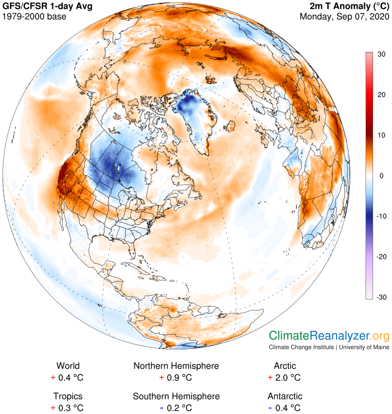
Frost Advisory overnight North central & Northeast Vermont – Freeze Warning Essex County
TONIGHT: Becoming mostly clear, with a few high clouds overnight. Patchy valley fog. A low in the low to mid 30s. Light northwest winds.
TOMORROW: Lots of sunshine, remaining crisp and cool. A high 60 to 65. Light west to southwest winds.
TUESDAY NIGHT: Mostly clear with a few high clouds. A low in the upper 40s. Light south winds.
WEDNESDAY: Partly sunny. A high reaching into the mid-70s. South to southwest breeze 10 to 15 mph.
Looking further ahead…
WEDNESDAY NIGHT: Fair early then mostly cloudy. Rising chance for rain showers after midnight. A low in the upper 40s.
THURSDAY: Scattered rain showers exiting in the afternoon. Some partial late day clearing. A high around 65.
FRIDAY: Sunshine mixed with clouds. Isolated showers far south. A low 35 to 40 with a risk for frost north and central area. A high in the low 60s.
SATURDAY: Morning clouds then partly sunny. A low in the 40s. A high in the 50s.
Average lows 45 to 50, Average highs mid-60s to around 70.
RH/9-14[end]