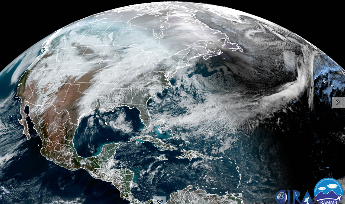
Winter Weather Advisory for lower valleys east of the Green Mountains slick spots this evening into early tomorrow morning…
TODAY: Mainly cloudy but with a few hints of sun this morning. Rain developing late in the day. A high ranging thru the 40s to near 50 western Vermont. Southeast winds 10 to 15 mph.
Flood Watch in effect late evening thru early Thursday morning…
TONIGHT: Cloudy, mild and wet. Periods of rain, moderate at times, tapering scattered light rain showers or sprinkles overnight. Areas of fog. An evening low mid to upper 30s east of the Green Mountains, watch for slick spots, then milder, otherwise in the 40s western Vermont. South winds 10 to 20 mph.
WEDNESDAY: A few morning sprinkles. Otherwise mild with variable clouds. A morning high 50 to 55, turning colder late with a stray mountain flurry as temperatures fall thru the 30s. Southwesterly winds 10 to 20 mph.
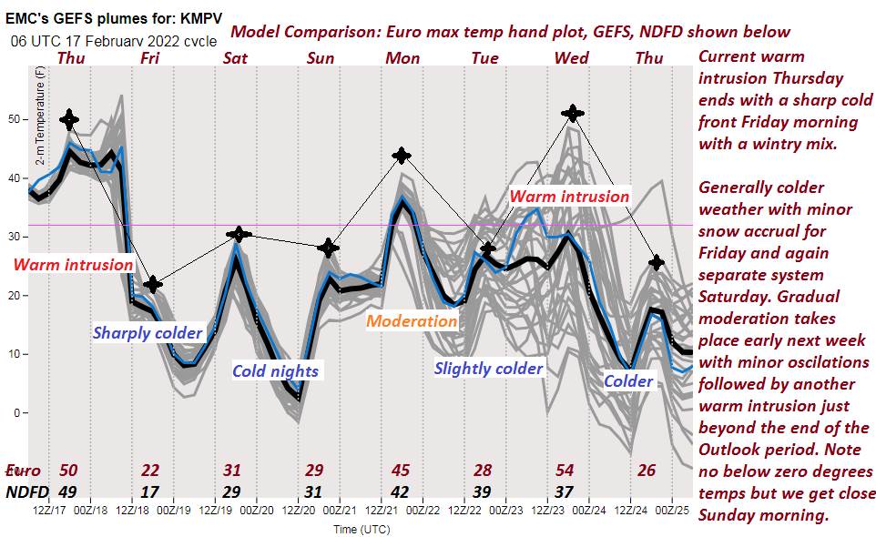
Looking further ahead…
WEDNESDAY NIGHT: Scattered clouds. Blustery with a few stray flurries early. Colder. A low zero to 5 above.
THURSDAY: Mixed sun and clouds & back to mid-winter temperatures. A high upper teens northern areas to lower 20s.
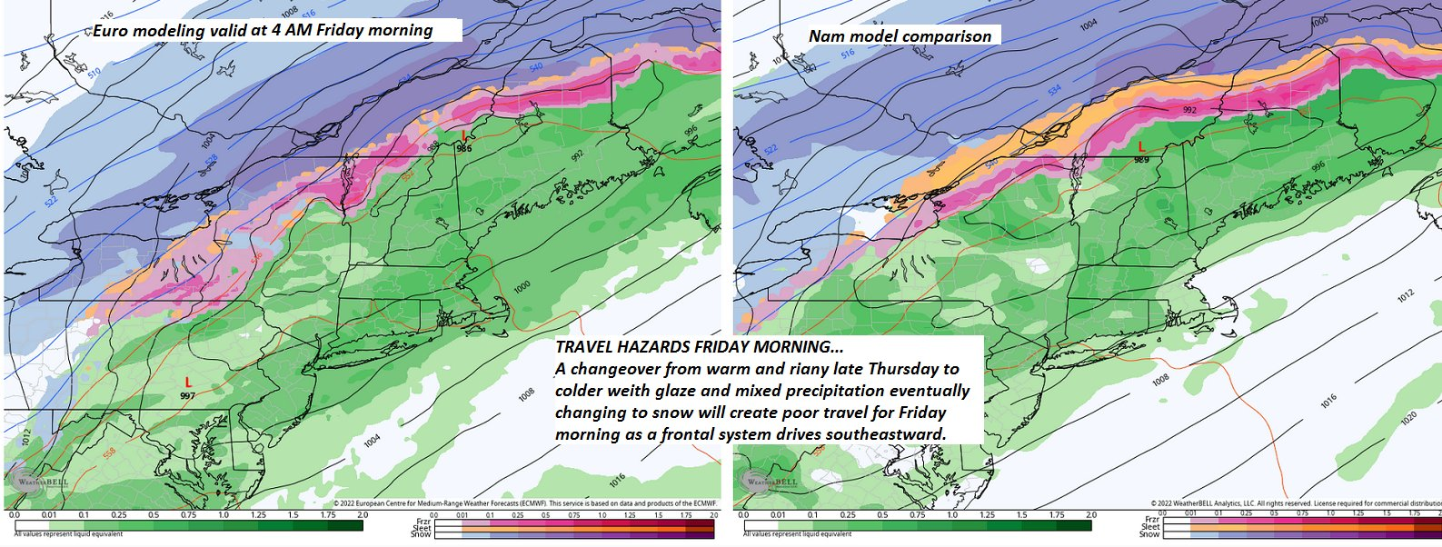
FRIDAY: Cloudy. Chance for snow…moderate at times, accumulations possibly around a half foot. A low 5 to 10. A high in the lower 20s.
SATURDAY: Lots of sunshine but below normal temperatures. A low in the single digits. A high 20 to 25.
SUNDAY: Thickening clouds, leading to scattered snow showers or squalls. A low around 10. A high 25 to 30.
Average lows 5 to 15. Average highs low to mid 30s
End of Met. Winter March 9th
RH/2-21 forecast][end]