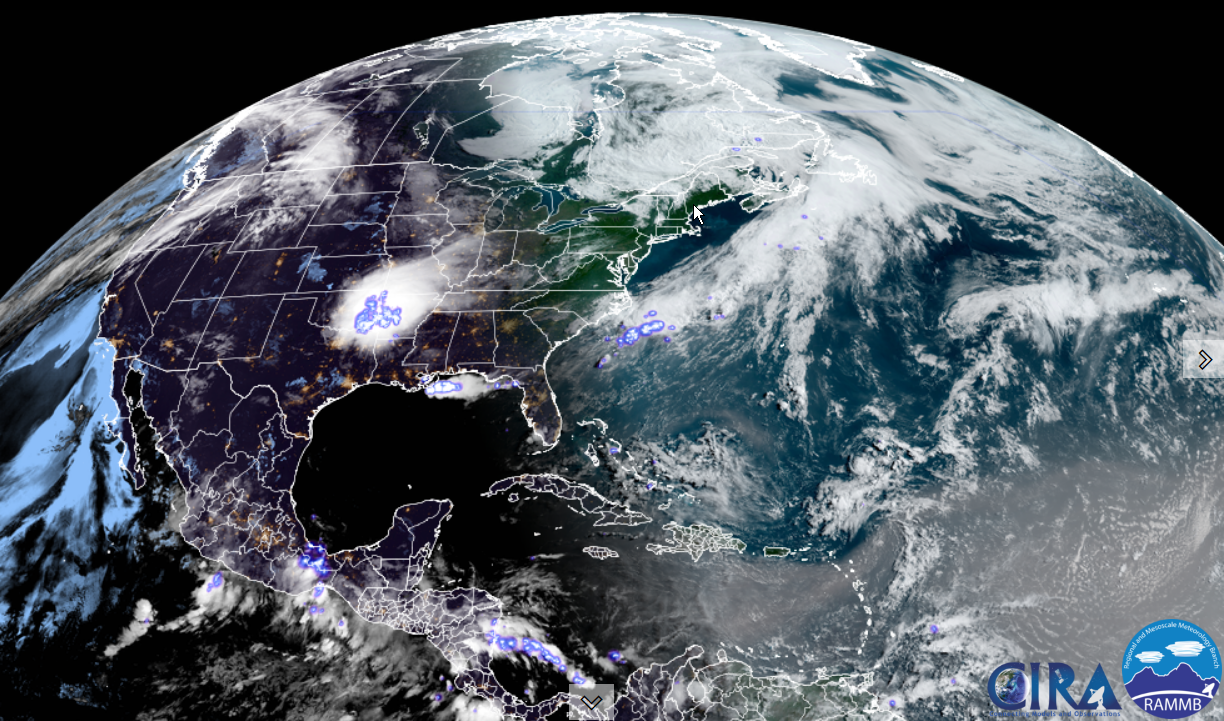
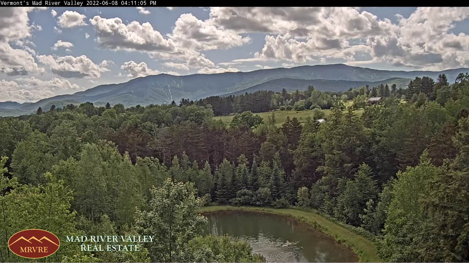
Updated Thursday Morning Forecast — May 26th, 2022

TODAY: Mainly cloudy this morning, with a brief sprinkle or two, then hints of sun this afternoon. Mild but breezy. A high about 75. South winds 10 to 20 mph, stronger Lake Champlain.

TONIGHT: Fair with high clouds this evening…thickening up overnight. A low near 60. South winds 10 mph stronger near Lake Champlain.

FRIDAY: Mainly gray. Scattered late day showers, with isolated embedded thunderstorms. Increasingly muggy. A high upper 70s to near 80. South to southwest breeze 10 to 15 mph.

Looking further ahead…

FRIDAY NIGHT: Cloudy. Occasional showers with a few rumbles of thunder possible. A low in the low 60s.

SATURDAY: Partly to mostly cloudy. Showers likely, with a few embedded afternoon thunderstorms, mainly southern Vermont. A high in the lower 70s.

SUNDAY: Morning fog, then sunshine with some high clouds. A low upper 40s to around 50. A high near 75.

MONDAY Memorial Day: Isolated showers far northern areas in the morning, otherwise clouds with intervals of sun. A low around 55. A high around 80.

TUESDAY: Mixed clouds and sun. A low 55 to 60. A high in the 70s.

Average lows ranging thru the 40s. Average highs upper 60s to low 70s.

RH/5-26forecast][end]

Updated Wednesday Evening Forecast — May 25th, 2022

TONIGHT: High cloudiness otherwise fair. A low around 50. Light southeast winds.

TOMORROW: Hints of sunshine but otherwise high overcast. Mild but breezy. A high near 75. South winds 10 to 20 mph, stronger Lake Champlain.

THURSDAY NIGHT: Fair with high clouds…thickening up overnight. A low around 60. South winds 10 mph stronger near Lake Champlain.

FRIDAY: Mostly cloudy. Showers…moderate at times, becoming likely in the afternoon. A risk for a few embedded late afternoon thunderstorms. Increasingly muggy. A high mid to upper 70s. South to southwest breeze 10 to 15 mph.

Looking further ahead…

FRIDAY NIGHT: Cloudy. Chance for showers & isolated evening thunderstorms. A low about 60.

SATURDAY: Partly to mostly cloudy. Chance for showers and isolated afternoon thunderstorms. A high upper 60s to near 70.

SUNDAY: Morning fog, then sunshine with some high clouds. A low 45 to 50. A high 70 to 75.

MONDAY Memorial Day: Partly sunny. More clouds with a chance for showers Monday night. A low around 55. A high around 80.

TUESDAY: Mixed clouds and sun. A low 55 to 60. A high in the low 80s.

Average lows ranging thru the 40s. Average highs upper 60s to low 70s.

RH/5-25forecast][end]

Updated Wednesday morning Forecast — May 25th, 2022

TODAY: Sunshine with mixed with mainly high clouds, more clouds southern areas. Pleasant. A high 70 to 75. Light west winds.

TONIGHT: High cloudiness otherwise fair. A low around 50. Light southeast winds.

THURSDAY: Hints of sunshine but otherwise high cloudiness. Mild but breezy. A high near 75. South winds 10 to 20 mph, stronger Lake Champlain.

Looking further ahead…

THURSDAY NIGHT: Lots of clouds. A low in the upper 50s to around 60.

FRIDAY: Mostly cloudy. Showers…moderate at times, becoming likely especially by the afternoon. A risk for a few embedded late afternoon thunderstorms. Increasingly muggy. A high 75 to 80.

SATURDAY: Considerable cloudiness. Chance for showers and isolated afternoon thunderstorms. A low about 60. A high

upper 60s to near 70.

SUNDAY: Morning fog, then filtered sunshine thru high clouds. A low 45 to 50. A high 70 to 75.

MONDAY Memorial Day: Partly sunny. A low around 55. A high around 80.

Average lows ranging thru the 40s. Average highs upper 60s to low 70s.

RH/5-25forecast][end]

Updated Tuesday Evening Forecast — May 24th, 2022

TONIGHT: Fair with a few cloudy periods. A low in the low to mid-40s. Light winds.

TOMORROW: Sunshine mixed with mainly high clouds. Pleasant A high 70 to 75. Light west winds.

WEDNESDAY NIGHT: High cloudiness otherwise fair. A low around 50. Light southeast winds.

THURSDAY: Hints of sunshine but otherwise high cloudiness. Mild but breezy. A high near 75. South winds 10 to 20 mph, stronger Lake Champlain.

Looking further ahead…

THURSDAY NIGHT: Variable cloudiness. Kind of muggy. A low in the upper 50s to around 60.

FRIDAY: Mostly cloudy. Showers…moderate at times, becoming likely especially by the afternoon. A risk for a few thunderstorms. Increasingly muggy. A high mid-70s to near 80.

SATURDAY: More clouds than sun. Chance for showers and isolated afternoon thunderstorms. A low in the low 60s. A high In the low 70s.

SUNDAY: Morning fog, then mixed sun and clouds. A low around 50. A high 70 to 75.

MONDAY Memorial Day: Partly sunny. A low in the 50s. A high around 80.

Average lows ranging thru the 40s. Average highs upper 60s to low 70s.

RH/5-24forecast][end]

Updated Tuesday Morning Forecast — May 24th, 2022

TODAY: Faded sunshine thru occasional high cloudiness. A high 65 to 70. Light variable winds.

TONIGHT: Fair with some high cloudiness. A low in the low to mid-40s. Light southwest winds.

WEDNESDAY: Sunshine mixed with high clouds. A high 70 to 75. Light variable winds.

Looking further ahead…

WEDNESDAY NIGHT: High cloudiness otherwise fair. A low in the upper 40s.

THURSDAY: Some hints of sunshine thru high overcast. A high near 75.

FRIDAY: Thickening clouds. A rising chance for showers, and perhaps a few thunderstorms in the afternoon. A low in the upper 50s. Increasingly muggy. A high mid-70s to near 80.

SATURDAY: Clouds with breaks of sun away from the mountains. Chance for showers and isolated afternoon thunderstorms. A low around 60. A high around 75.

SUNDAY: Clouds with a few breaks of sunshine. Widely scattered showers with rumble or two of thunder. A low 55 to 60. A high upper 60s to around 70.

MONDAY Memorial Day: Partly sunny. Scattered afternoon hit and miss showers and thunderstorms. A low in the mid to upper 50s. A high mid-70s to near 80.

Average lows ranging thru the 40s. Average highs upper 60s to low 70s.

RH/5-24forecast][end]

Updated Monday Evening Forecast — May 23rd, 2022

TONIGHT: Variable high cloudiness otherwise mostly clear. A low upper 30s to low 40s. Light northeast winds.

TOMORROW: Faded sunshine thru high cloudiness. A high upper 60s to around 70. Light variable winds.

TUESDAY NIGHT: Fair with high cloudiness. A low in the mid-40s. Light southwest winds.

WEDNESDAY: Mostly sunny with some high clouds. A high around 75. Light variable winds.

Looking further ahead…

WEDNESDAY NIGHT: Partly to mostly cloudy. A low 50 to 55.

THURSDAY: Lots of clouds but some hints of sunshine. A high around 70.

FRIDAY: Thickening clouds. A rising chance for showers, and perhaps a few thunderstorms. A low upper 50s to near 60. Increasingly muggy. A high 70 to 75.

SATURDAY: Morning clouds with scattered mountain showers, give way to partial clearing in the afternoon. A low upper 50s to around 60. A high upper 60s to around 70.

Average lows ranging thru the 40s. Average highs upper 60s to low 70s.

RH/5-23forecast][end]

Updated Monday evening Forecast — May 213rd, 2022

TONIGHT: Variable high cloudiness otherwise mostly clear. A low upper 30s to low 40s. Light northeast winds.

TOMORROW: Faded sunshine thru high cloudiness. A high upper 60s to around 70. Light variable winds.

TUESDAY NIGHT: Fair with high cloudiness. A low in the mid-40s. Light southwest winds. Light southeast winds.

WEDNESDAY: Mostly sunny with some high clouds. A high around 75. Light variable winds.

Looking further ahead…

WEDNESDAY NIGHT: Partly to mostly cloudy. A low 50 to 55.

THURSDAY: Lots of clouds but some hints of sunshine. A high around 70.

FRIDAY: Thickening clouds. A rising chance for showers, and perhaps a few thunderstorms. A low upper 50s to near 60. Increasingly muggy. A high 70 to 75.

SATURDAY: Morning clouds with scattered mountain showers, give way to partial clearing in the afternoon. A low upper 50s to around 60. A high upper 60s to around 70.

Average lows ranging thru the 40s. Average highs upper 60s to low 70s.

RH/5-23forecast][end]

Updated Monday morning Forecast — May 23rd, 2022

TODAY: Mainly gray this morning, but with periods of sun this afternoon. A high mid-60s. North to northwest winds 10 mph.

TONIGHT: Variable high cloudiness otherwise fair and dry. A low 40 to 45. Light northeast winds.

TUESDAY: Filtered sun through high cloudiness. A high upper 60s to around 70. Light east to southeast winds.

Looking further ahead…

TUESDAY NIGHT: Fair with high cloudiness. A low 40 to 45.

WEDNESDAY: Sunshine filtered through high cloudiness. A high 70 to 75.

THURSDAY: Lots of clouds but some hints of sunshine. A low 50 to 55. A high around 70.

FRIDAY: Cloudy. A rising chance for rain showers, maybe a rumble of thunder. A low mid to upper 50s. Increasingly muggy. A high in the lower 70s.

Average lows ranging thru the 40s. Average highs upper 60s to low 70s.

RH/5-23forecast][end]

Updated Friday Evening Forecast — May 20th, 2022

TONIGHT: High cloudiness or partly cloudy, Muggy western areas. Patchy valley fog. A low upper 50s east of the Greens, ranging to mid-60s Champlain Valley. South to southeast breeze 10 to 15 mph, stronger & gusty toward Lake Champlain.

Heat Advisory for Champlain & Connecticut River valleys.

TOMORROW: Sunshine mixing with afternoon clouds. Widely scattered late afternoon thunderstorms mainly northern areas. One or two may be strong to locally severe. Hot and sticky. A high upper 80s to around 90. Southwest winds 10 to 15 mph.

SATURDAY NIGHT: Some clouds northern areas with a lingering chance for a few thunderstorms northern areas. A low in the low to mid 60s. Little wind.

SUNDAY: Some morning sunshine, then afternoon cloudiness. Showers and thunderstorms likely…some strong to locally severe, warm and sticky. A high 85 to 90. Southwest breeze 10 to 20 mph.

Looking further ahead…

SUNDAY NIGHT: Any early evening showers/storms wind down to partial clearing overnight. Cooler and less humid. A low upper 40s to around 50.

MONDAY: Mainly gray with hints of sunshine. A high in the low 60s.

TUESDAY: Filtered sun through high cloudiness. A low 35 to 40. A high upper 60s to around 70.

WEDNESDAY: Morning sun gives way to thickening clouds. A low 50 to 55. A high near 70.

Average lows ranging 40 to 45. Average highs mid-60s to low 70s.

RH/5-20forecast][end]

Updated Friday Morning Forecast — May 20th, 2022

TODAY: Morning fog and low clouds burns off, then partly to mostly sunny skies. Pleasant. A high in the upper 70s.South winds 10 to 15 mph in the afternoon, stronger Champlain Valley.

TONIGHT: Lots of clouds, a little muggy. Patchy valley fog. A low upper 50s east of the Greens and 60 to 65 western areas. South breeze 10 mph stronger toward Lake Champlain.

Heat Advisory for Champlain & Connecticut River valleys.

SATURDAY: Sunshine mixing with afternoon clouds. Scattered mid to late afternoon thunderstorms mainly northwestern areas. One or two storms may be strong to locally severe. Hot and sticky. A high upper 80s to around 90. Southwest winds 10 to 15 mph.

Looking further ahead…

SATURDAY NIGHT: Partly cloudy. Chance for a few evening thunderstorms especially Canadian border area. A low 60 to 65.

SUNDAY: Clouds with intervals of sunshine. Scattered showers and thunderstorms…some strong to locally severe, warm and sticky. A high 85 to 90.

MONDAY: Cooler and less humid. Mainly gray with hints of sunshine. A low 50 to 55. A high around 65.

TUESDAY: Filtered sun through high cloudiness. A low mid-30s cooler hollow to around 40. A high upper 60s to around 70.

WEDNESDAY: Morning sun gives way to thickening clouds. A low 45 to 50. A high near 70.

Average lows ranging 40 to 45. Average highs mid-60s to low 70s.

RH/5-20forecast][end]