
Author Archives: Weathering Heights
Updated Monday Evening Forecast — October 23rd, 2023
TONIGHT: Becoming mostly clear for a time then more clouds overnight. Isolated valley fog areas of frost with the low near 32 degrees. Little wind.
TOMORROW: Patchy valley fog, burns off to sunshine mixed with cloudy periods. Turning milder. The high upper 50s. A light south wind.
TUESDAY NIGHT: Variable clouds. Slight chance for a sprinkle in far northern areas. A low in the mid-40s. Light southwest winds.
WEDNESDAY: Some brief partial morning sun, otherwise clouding up with scattered passing showers, especially near the Quebec border. Milder. A high in the low to mid-60s. Light south winds.
Looking further ahead
WEDNESDAY NIGHT: Mostly cloudy. A low around 45.
THURSDAY: Partly sunny and pleasantly mild. A high in the upper 60s.
FRIDAY: Mixed sunshine and clouds. A low 50 to 55. A high reaching into the low 70s.
SATURDAY: Mainly cloudy. Scattered showers developing. A low 50 to 55. A high in the mid-60s
Average lows are 30 to 35. Average highs in the low to mid-50s.
RH/10-23 forecast][end]
Updated Monday morning forecast — October 23rd, 2023
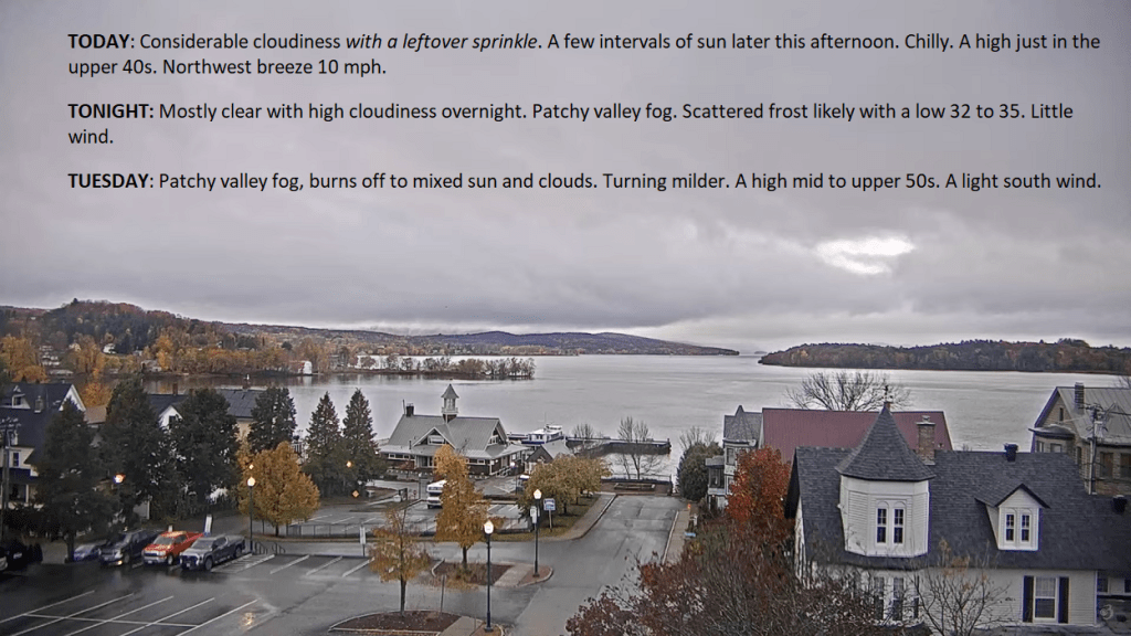
TODAY: Considerable cloudiness with a leftover sprinkle. A few intervals of sun later this afternoon. Chilly. A high just in the upper 40s. Northwest breeze 10 mph.
TONIGHT: Mostly clear with high cloudiness overnight. Patchy valley fog. Scattered frost likely with a low 32 to 35. Little wind.
TUESDAY: Patchy valley fog, burns off to mixed sun and clouds. Turning milder. A high mid to upper 50s. A light south wind.
Looking further ahead
TUESDAY NIGHT: Variable clouds. Slight chance for a sprinkle far northern areas. A low in the mid-40s.
WEDNESDAY: Some partial morning sun, otherwise thickening clouds with a threat for northern sprinkle. Milder. A high around 65.
THURSDAY: Sunshine mixing with more clouds in the afternoon. A low around 45. Warm for the time of year. A high in the upper 60s to near 70.
FRIDAY: Sunshine & mild, becoming filtered thru high cloudiness. A low 50 to 55. A high reaching close to 70.
SATURDAY: Mainly cloudy. Scattered showers developing. A low in the mid-50s. A high in the upper 60s
Average lows 30 to 35. Average highs in the low to mid 50s.
RH/10-23 forecast][end]
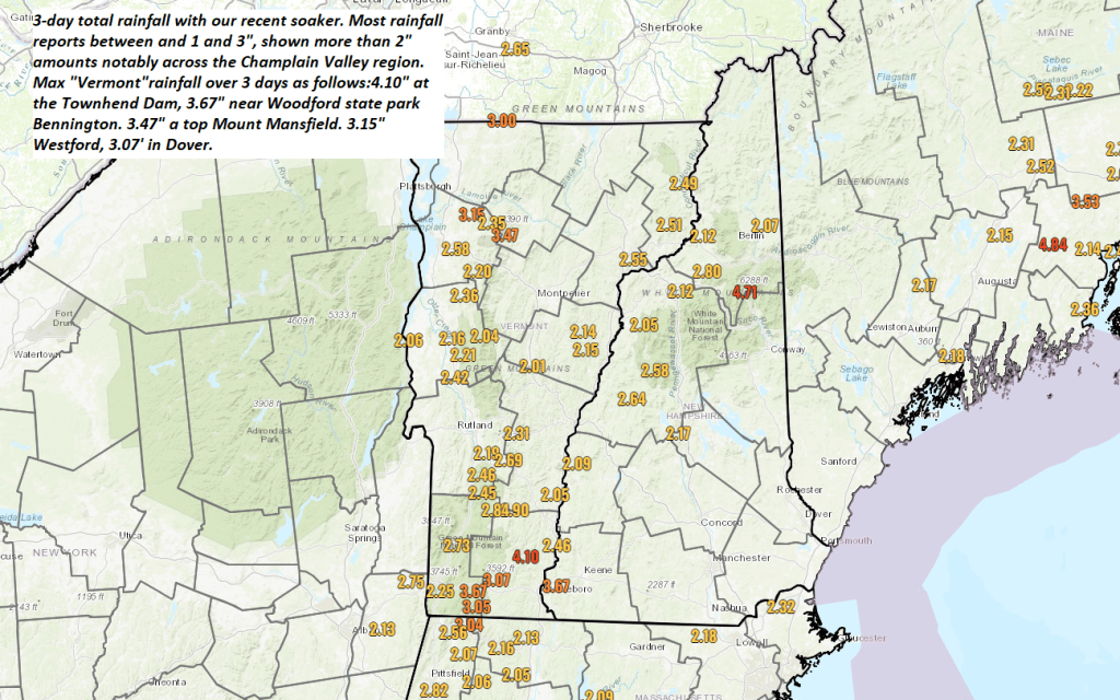
Healthy soaker with from about 1 to over 3 inches had fallen over the last 3 days ending this Monday morning here in the #GreenMountainState. Drier trends ahead…
Transition Day from a little drizzle/sprinkles in the northern Green Mountains…into breaks of sunshine and eventually intervals of sun by later today. A drying trend and warmer conditions much of the work week, exceptions right along portions of far northern Vermont…
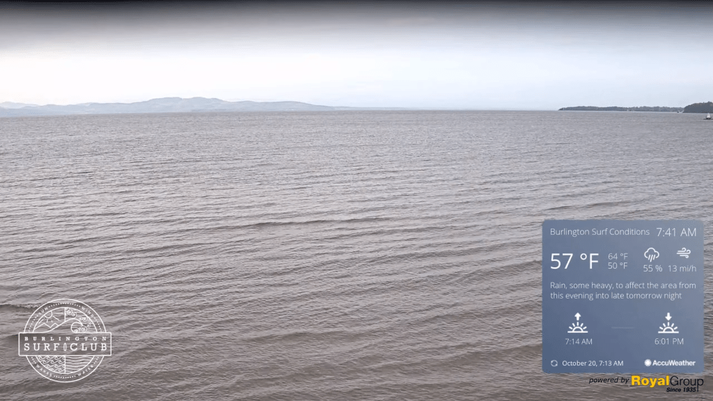
Updated Friday Evening Forecast — October 20th, 2023
TONIGHT: Cloudy. Showers…moderate at times this evening becoming more scattered overnight. Little change in temperatures in the low 50s. Light east winds.
TOMORROW: Gray & wet. Periods of rain. Areas of fog. A high of about 55. Light and variable winds become northwesterly at 10 to 15 mph later on.
SATURDAY NIGHT: Overcast.Showers…becoming more scattered overnight.A low 40 to 45. West winds around 10 mph.
SUNDAY: Gray, turning blustery and raw. Periods of rain are moderate at times in northern areas. Scattered showers further south. Temperatures fall through the upper and mid-40s. Northwest winds 10 to 20 mph.
Looking further ahead
SUNDAY NIGHT: Showers winding down, otherwise mostly cloudy. A low in the upper 30s around 40.
MONDAY: Considerable low cloudiness gives way to lots of afternoon sunshine but chilly. The high upper 40s.
TUESDAY: Patchy valley fog, burns off to sunshine with afternoon cloudiness. Scattered frost with a low 32 to 35. A high around 55.
WEDNESDAY: Lots of clouds. Chance for showers. A low around 40. A high mid to upper 50s.
Average lows are in the low to mid-30s. Average highs in the low to mid 50s.
RH/10-20 forecast][end]
Take it with a grain…but we should have some inroads in the “first snows” department. Over the next 15 days, see the difference between now (well below normal, if not record setting low) to snowfall that reaches into the northern tier and all of Canada

Updated Friday morning forecast — October 20th, 2023
TODAY: Lots of clouds. Showers, becoming likely this afternoon spreading south to north, moderate at times. A high in the upper 50s. South to southeast winds 10 to 15 mph.
TONIGHT: Cloudy. Showers…moderate at times this evening becoming more scattered overnight. A low about 50. Light east winds.
SATURDAY: Gray & wet. Periods of rain likely, moderate at times in the afternoon. Areas of fog. A high around 55. Light and variable winds.
Looking further ahead
SATURDAY NIGHT: Overcast.Showers or periods of rain likely…moderate to possibly heavy at times.A low in the mid-40s.
SUNDAY: Gray, turning blustery and raw. Showers or periods of rain moderate at times. Temperatures fall thru the upper and mid-40s.
MONDAY: Considerable low cloudiness gives way to lots of afternoon sunshine but chilly. A low in the upper 30s. A high upper 40s to around 50.
TUESDAY: Patchy valley fog, burns off to sunshine with afternoon cloudiness. A low in the mid-30s. A high around 55.
WEDNESDAY: Lots of clouds. Chance for showers. A low 40 to 45. A high mid to upper 50s.
Average lows in the low to mid 30s. Average highs in the low to mid 50s.
RH/10-19 forecast][end]
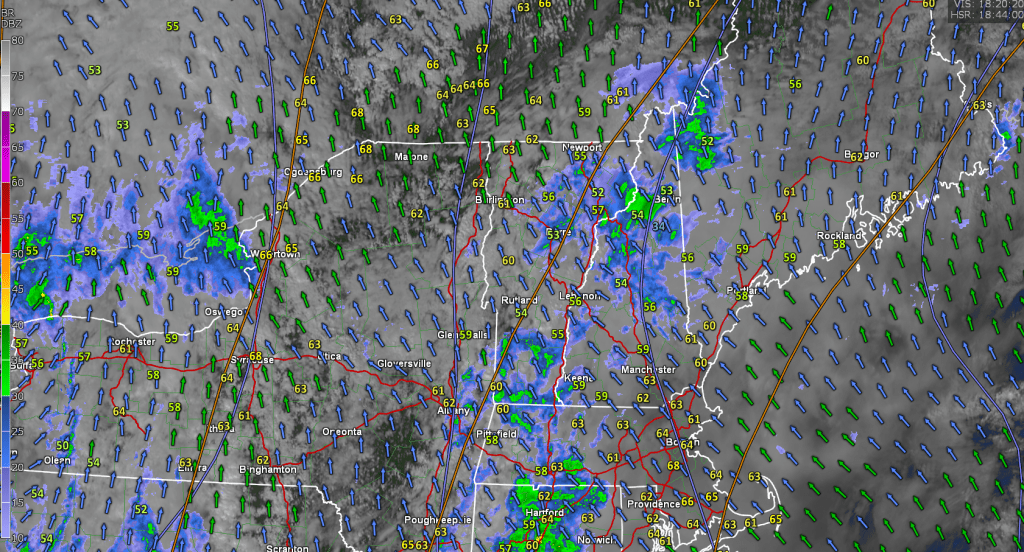
Moderate to possibly heavy rain event on the way arriving from the south this afternoon. Clear out clogged drains of leaves as from 1 to potentially 3 inch amounts fall this afternoon thru Sunday evening. Next dry weather days Monday & Tuesday…

Updated Thursday Evening Forecast — October 19th, 2023
TONIGHT: Fair with thickening high clouds. A low in the mid-40s. Light south to southeast winds are stronger across Lake Champlain.
TOMORROW: Mainly gray. Showers, becoming likely in the afternoon, moderate at times late. A high in the upper 50s. South to southeast winds 10 to 15 mph.
FRIDAY NIGHT: Cloudy. Showers…moderate at times in the evening becoming more scattered overnight. A low upper 40s to around 50. Light east winds.
SATURDAY: Gray & wet. Periods of rain are likely, moderate at times in the afternoon. Areas of fog. A high in the mid-50s. Light and variable winds.

Looking further ahead
SATURDAY NIGHT: Overcast.Good chance for lingering showers…moderate at times.A low in the upper 40s.
SUNDAY: Gray, and turning blustery. Good chance for showers to continue. Little change in temperature around 50.
MONDAY: Morning clouds then increasingly sunny. A low around 40. A high low 50s.
TUESDAY: Patchy valley fog, burns off to sunshine with some high clouds. A low around 32. A high around 55.
WEDNESDAY: Mostly cloudy. Chance for showers in northern areas. A low in the 40s. A high around 60.
Average lows are in the low to mid-30s. Average highs in the low to mid-50s.
RH/10-19 forecast][end]
