TONIGHT: Mostly cloudy. A spotty shower or sprinkle in northern areas. A low in the 50s. Light southwest breeze, stronger near Lake Champlain.
Full Hunters Moon 4:24 PM…
TOMORROW: Showers winding down in the afternoon, with increasing sunshine. Breezy at times. A high 65 to 70. Winds shifting southwest to northwesterly in the afternoon at 10 to 20 mph and gusty.
SATURDAY NIGHT: High cloudiness and dimly moonlit. Thickening clouds overnight.A low in the mid-30s. Northwest winds 10 mph.
SUNDAY: Considerable cloudiness with showers or periods of light rain developing. Wet snowflakes in northern Green Mountain summits. Sharply colder. A high in the mid to upper 40s. Light northwest winds.
Looking further ahead
SUNDAY NIGHT: Cloudy. Periods of rain likely,mixed with wet snow on higher mountain summits. A low in the upper 30s.
MONDAY: Cloudy. Periods of rain mixed with wet snow mountain summits. A high of around 45
TUESDAY: Periods of sunshine after a frosty morning. A low in the upper 20s. A high 40 to 45.
WEDNESDAY: Cloudy. A rising chance for wet accumulating snow & slippery travel on elevated terrain mixed with rain valley floors mainly in southern Vermont. A morning low of 25 to 30. A high mid to upper 30s.
Average lows are 30 to 35. Average highs in the low to mid-50s.
TODAY: Morning fog burns off to periods of sun, then more clouds this afternoon. Isolated sprinkles in northern areas this afternoon. A high around 70. Southwest winds 10 mph.
TONIGHT: Lots of clouds. A spotty shower or sprinkle north. A low in the 50s. Southwest breeze 10 mph.
Full Hunters Moon 4:24 PM…
SATURDAY: Scattered showers and damp in the morning, exiting to partial afternoon sunshine. Breezy at times. A high in the upper 60s. Northwest winds 10 to 20 mph.
Looking further ahead
SATURDAY NIGHT: High cloudiness.A low 35 to 40.
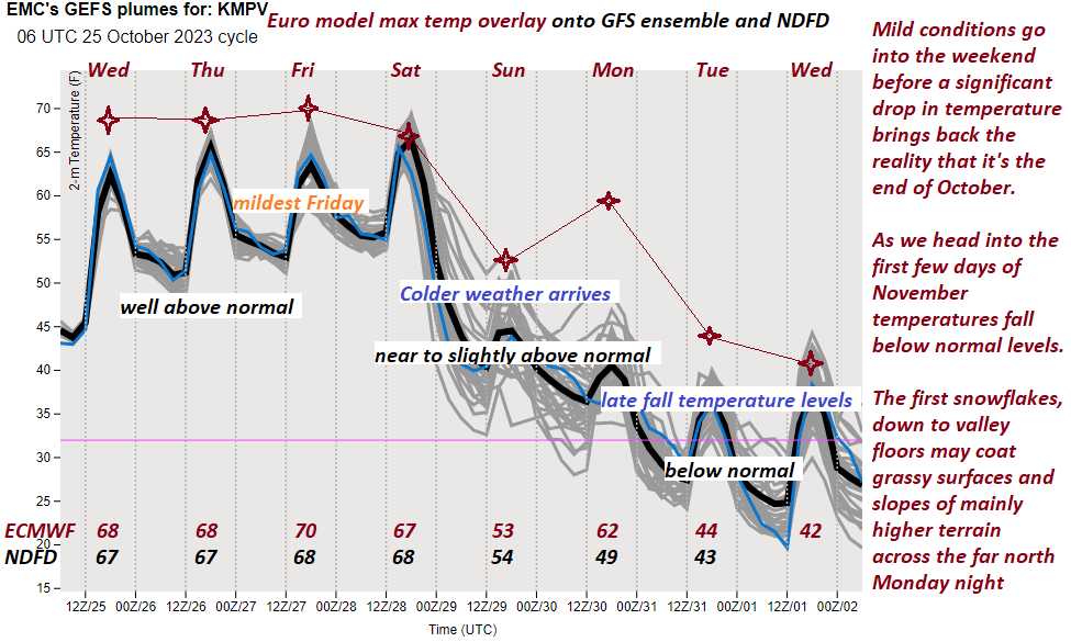
SUNDAY: Thickening clouds leading to a rising likelihood for rain…possibly mixing with wet snowflakes mountain summits. Chilly & raw. A high in the upper 40s.
MONDAY: Cloudy. Good chance for showers or periods of rain, moderate at times… possibly mixing with wet snowflakes mountain summits. A morning low mid to upper 30s. A high around 45
TUESDAY: Periods of sunshine after a frosty morning. A low in the upper 20s. A high 40 to 45.
WEDNESDAY: Cloudy. A rising chance for wet accumulating snow & slippery travel mixed with rain valley floors. A low ranging thru the 20s. A high in the mid to upper 30s.
Average lows 30 to 35. Average highs in the low to mid 50s.
TONIGHT: Clouds linger in northern areas with a few passing light showers, mainly this evening. Otherwise partly cloudy. A low near 55. Light south winds are stronger near Lake Champlain.
TOMORROW: Sunshine with more afternoon cloudiness. Above normal temperature. Isolated sprinkles in northern areas. The high upper 60s to near 70. Southwest winds 10 mph.
FRIDAY NIGHT: Lots of clouds. A spotty shower or sprinkle north. A low in the mid-50s. Southwest breeze 10 mph.
SATURDAY: Scattered showers and damp in the morning, exiting to intervals of afternoon sun. Breezy at times. A high in the upper 60s. Northwest winds 10 to 20 mph.
Looking further ahead
SATURDAY NIGHT: High cloudiness.A low 40 to 45.
SUNDAY: Thickening clouds leading to a rising likelihood for rain…possibly moderate at times. Colder and raw. A high in the upper 40s.
MONDAY: Cloudy. Chance for lingering showers…possibly mixed with wet snowflakes on higher terrain. A morning low around 40. A high 45 to 50.
TUESDAY: Periods of sunshine after a frosty morning. A low in the upper 20s. A high in the mid-40s.
Average lows are 30 to 35. Average highs in the low to mid-50s.
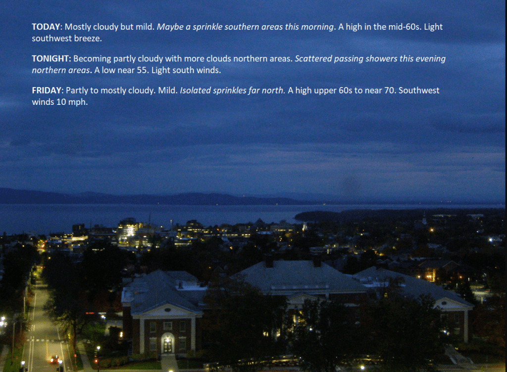
TODAY: Mostly cloudy but mild. Maybe a sprinkle in southern areas this morning. A high in the mid-60s. Light southwest breeze.
TONIGHT: Becoming partly cloudy with more clouds in northern areas.Scattered passing showers this evening in northern areas. A low near 55. Light south winds.
FRIDAY: Sunshine with more afternoon cloudiness. Mild. Isolated sprinkles far north. The high upper 60s to near 70. Southwest winds 10 mph.
Looking further ahead
FRIDAY NIGHT: Increasingly cloudy. A spotty shower or sprinkle. A low in the mid-50s.
SATURDAY: Scattered showers, damp, otherwise cloudy periods, then partial clearing late. A high in the upper 60s.
SUNDAY: Filtered sunshine in the morning, then thickening clouds leading to a chance for rain or showers…moderate at times. A low 40 to 45. A high in the upper 40s.
MONDAY: Cloudy. Chance for rain or showers. A low around 40. A high 45 to 50.
Average lows are 30 to 35. Average highs in the low to mid-50s.
TONIGHT: Variable clouds. Patches of valley fog. A low in the mid-40s to low 50s. Light southwest winds.
TOMORROW: Cloudy periods give way to increasing sunshine. Pleasantly mild. A high 65 to 70. Light southwest breeze.
THURSDAY NIGHT: Variable clouds.Chance for a few a passing showers in northern areas. A low 50 to 55. Light south winds.
FRIDAY: Sunshine with more afternoon cloudiness. Mild. Isolated sprinkles far north. A high around 70. Southwest winds 10 mph.
Looking further ahead
FRIDAY NIGHT: Increasingly cloudy. A spotty shower or sprinkle. A low in the mid to upper 50s.
SATURDAY: Scattered showers and damp, otherwise cloudy periods, then partial clearing late. A high in the mid to upper 60s.
SUNDAY: Filtered sunshine in the morning, then thickening clouds leading to a chance for rain or showers…moderate at times. A low in the upper 30s. A high 50 to 55.
MONDAY: Cloudy. Chance for rain or showers. A low in the 40s. A high in the 50s.
Average lows are 30 to 35. Average highs in the low to mid-50s.



 Weathering Heights, Roger Hill's weather forecasting service