A fantastic string of dry weather ahead. Sunshine predominates thru the work week, but mid and high clouds push in over this weekend. Any threats of precipitation looks flimsy at best.

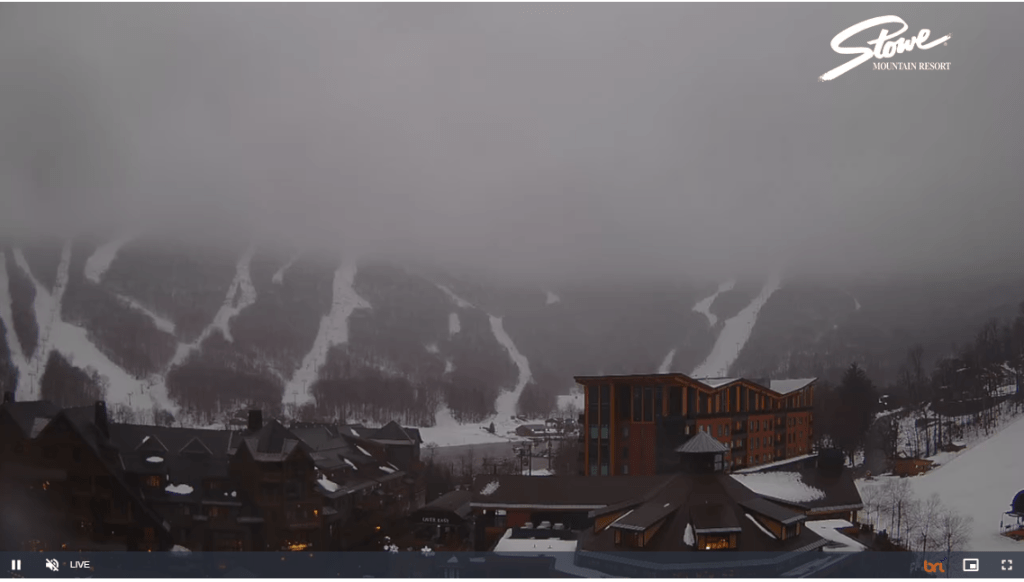
TODAY: Intervals of sunshine this morning give way to lots of clouds. A round or two of flurries or light mountain snow showers. A dusting to a half inch accumulation across elevated terrain. Temperatures in the mid to upper 30s. Southwest winds shifting to northwesterly 10 to 15 mph.
TONIGHT: Evening clouds, then clearing and colder. A low upper teens to around 20. Light northwest winds.
WEDNESDAY: Sunny. A high around 35. Light northwest winds.
Looking further ahead
WEDNESDAY NIGHT: Scattered clouds to mostly clear skies.A low in the mid to upper teens.
Winter Solstice December 21st 10:27 PM Thursday evening….
THURSDAY: A few morning northern clouds then sunny. A high in the mid-20s.
FRIDAY: Sunshine becoming filtered thru high clouds.A low upper single digits, to mid-teens. A high in the mid-20s.
SATURDAY: Increasing mainly high cloudiness. A low around 15. A high near 35.
SUNDAY: Morning clouds northern areas, then partly sunny. A low 20 to 25. A high pushing to near 40.
MONDAY CHRISTMAS DAY: Sunny. A low in the 20s. A high in the low to mid 40s.
Average lows are in the upper single digits to mid-teens. Average highs upper 20s to mid-30s
RH/12-19forecast][end]
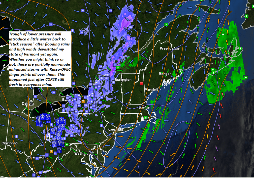
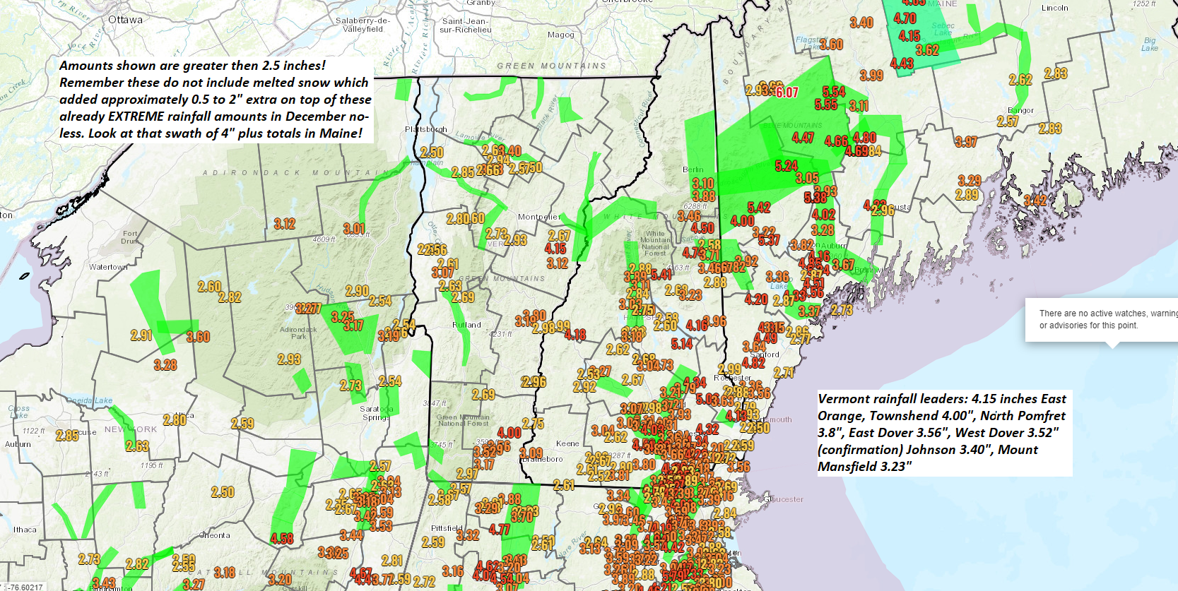
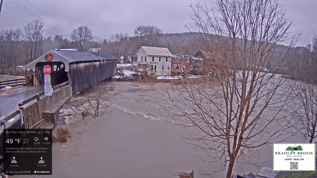
Flood Watch remains in effect thru Tuesday morning…
TONIGHT: A few early evening showers drying up. Otherwise partly to mostly cloudy. Colder. A low in the lower 30s. Southwest winds 10 mph.
TOMORROW: Intervals of sunshine then lots of clouds. Chance for a round of wet snow showers or flurries with less than an inch accumulation. A high near 35. Southwest winds shifting to northwesterly 10 to 20 mph.
TUESDAY NIGHT: Evening clouds, then clearing and colder. A low 20 to 25. Light northwest winds.
WEDNESDAY: Sunny & little more seasonable. A high around 35. Light northwest winds.
Looking further ahead
WEDNESDAY NIGHT: Scattered clouds to mostly clear skies.A low 15 to 20.
Winter Solstice December 21st 10:27 PM Thursday evening….
THURSDAY: A few morning northern clouds then sunny. A high around 25.
FRIDAY: Bright sunshine and blue skies. A low upper single digits, to mid-teens. A high in the mid-20s.
SATURDAY: A few morning clouds then mostly sunny. A low in the teens. A high in the mid-30s.
SUNDAY: Mostly sunny with a few clouds far north. A low 15 to 20. A high 32 to 35.
Average lows upper single digits to mid-teens. Average highs upper 20s to mid-30s
RH/12-18forecast][end]
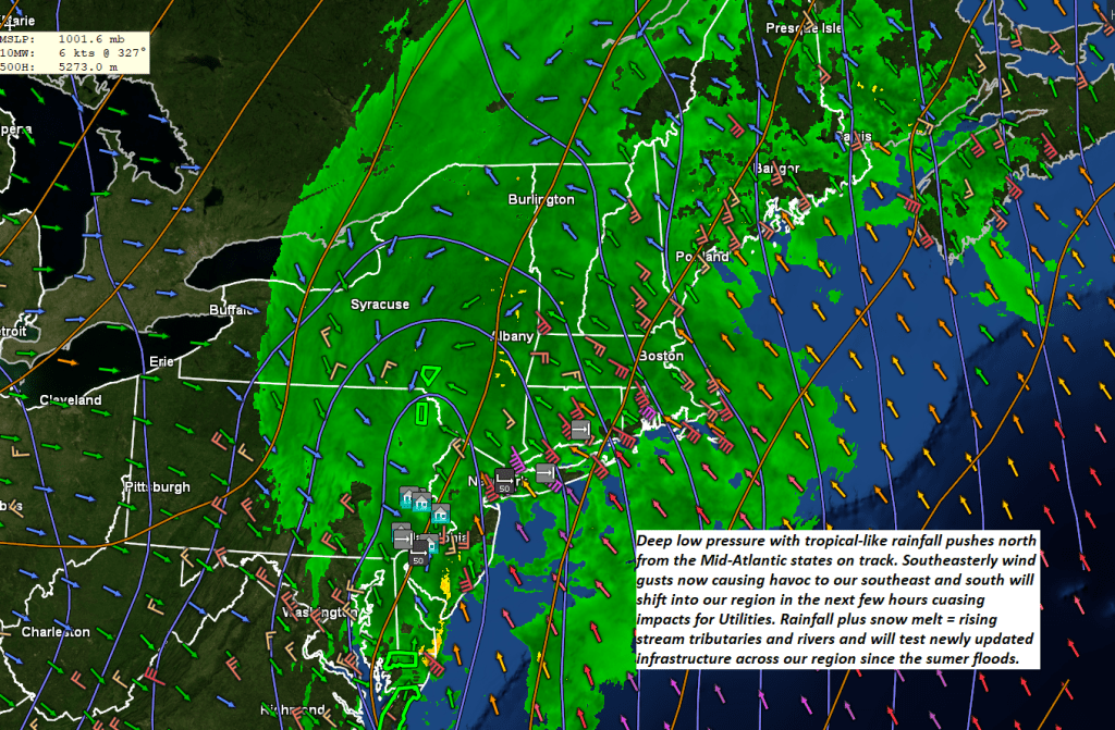
Wind Advisory western slopes and northern tier regions thru 4 PM. Flood Watch thru Tuesday morning…
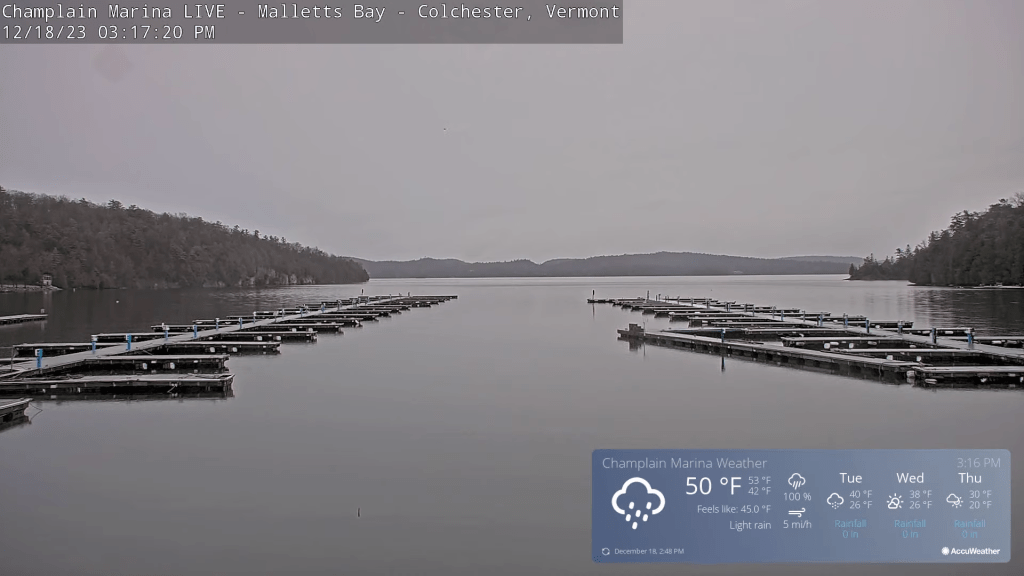
TODAY: Gray but very mild. Breezy to windy with windblown rain…heavy at times this morning into the early afternoon. Record high temperatures peak in the mid-50s. Southeasterly winds pick up to 15 to 30 mph with gusting 45 mph, shifting to westerly 10 to 25 mph with higher gusts in southern areas.
TONIGHT: A few early evening showers drying up. Otherwise partly to mostly cloudy. A low upper 20s to lower 30s. Southwest winds 10 to 15 mph.
TUESDAY: A few morning breaks of sun then lots of clouds with a few wet snow showers or flurries with little accumulation. A high in the low to mid 30s. Southwest winds shifting to northwesterly 10 to 20 mph.
Looking further ahead
TUESDAY NIGHT: Early evening clouds, then clearing and colder. A low 20 to 25.
WEDNESDAY: Mostly sunny & little more seasonable. A high around 35.
Winter Solstice December 21st 10:27 PM Thursday evening….
THURSDAY: A few morning clouds northern and western areas, then mostly sunny. A low 20 to 25. A high 25 to 30.
FRIDAY: Bright sunshine and blue skies. A low upper single digits, to mid-teens. A high around 25.
Average lows upper single digits to mid-teens. Average highs upper 20s to mid-30s
RH/12-18forecast][end]