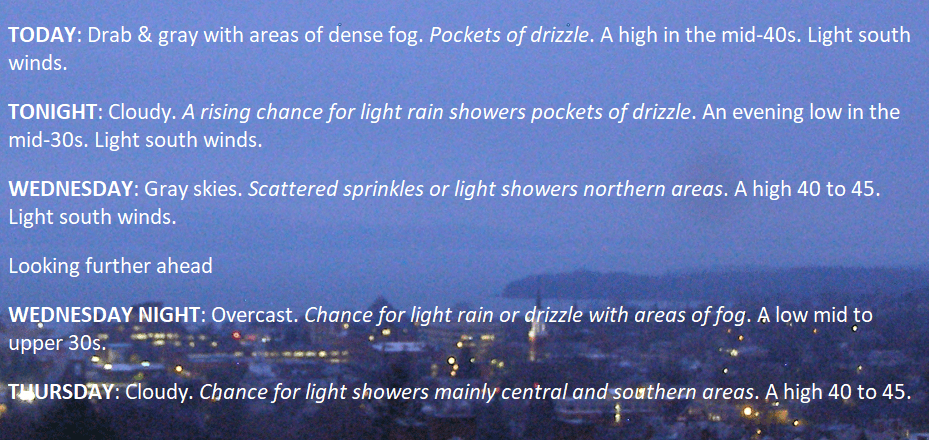
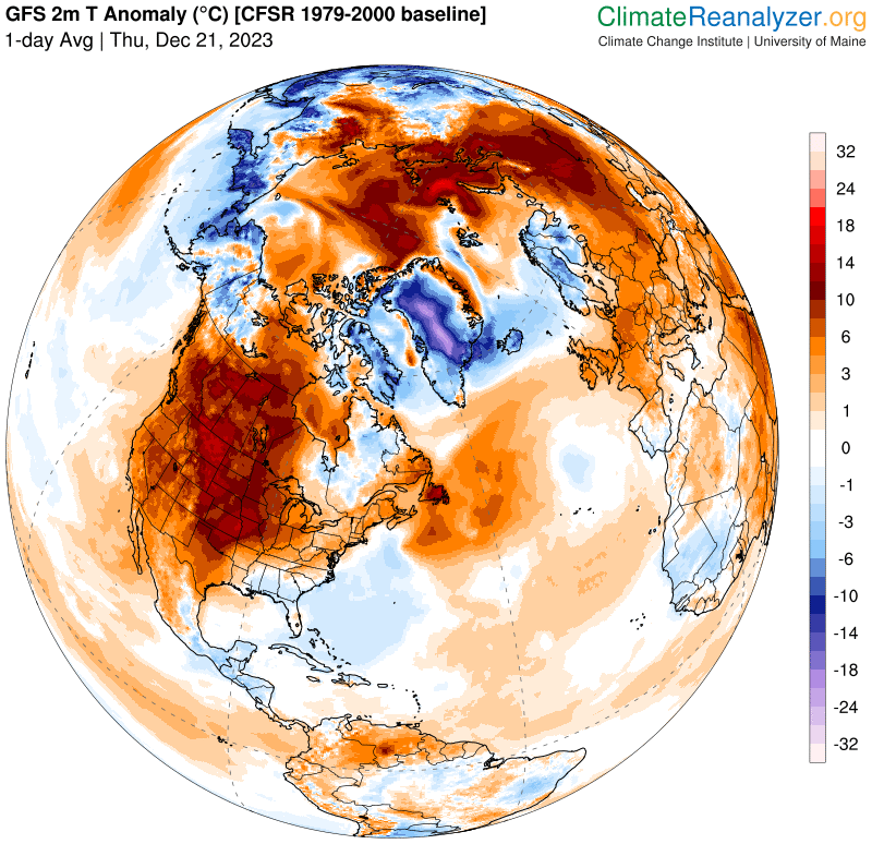
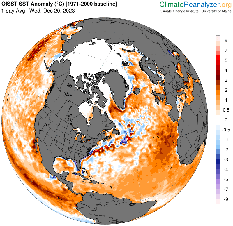
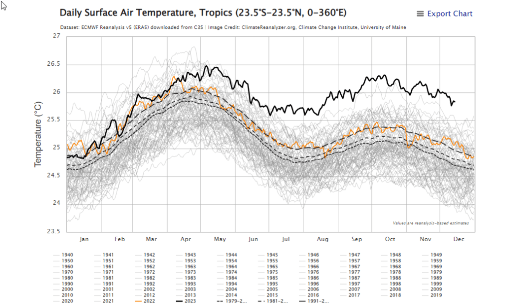
With the bigger storm systems over the central and western U.S., storms shift east and basically go to die over the Northeast. The net result is very stable dark, drab, and dreary weather with misty sprinkles, and dense fog for many days to come.

TONIGHT: A few high clouds this evening thickening up late. A low mid to upper teens. Light southeast winds.
TOMORROW: Clouds with an occasional break of sun. A high around 35. Light south winds stronger near Lake Champlain.
SATURDAY NIGHT: Lots of clouds. A chance for a few wet snow flurries mixed with spotty freezing rain. A dusting with possible icy spots especially central and southern areas. A low upper 20s near 30. Light south winds.
SUNDAY: More clouds than sunshine. A high 35 to 40. Light south winds.
Looking further ahead
SUNDAY NIGHT CHRISTMAS EVE: Scattered clouds to mostly clear early then clouding up.A low 25 to 30.
MONDAY CHRISTMAS DAY: Clouds mixed with intervals of sun. A high in the mid-40s.
TUESDAY: Cloudy periods. A rising chance for sprinkles late. A low around 32. A high in the 40s.
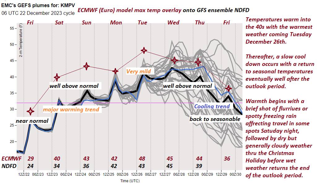
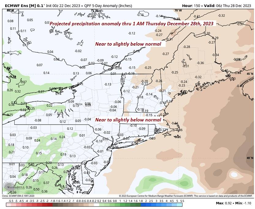
WEDNESDAY: Gray. Chance for periods of light rain with areas of dense fog. A low 35 to 40. A high in the 40s.
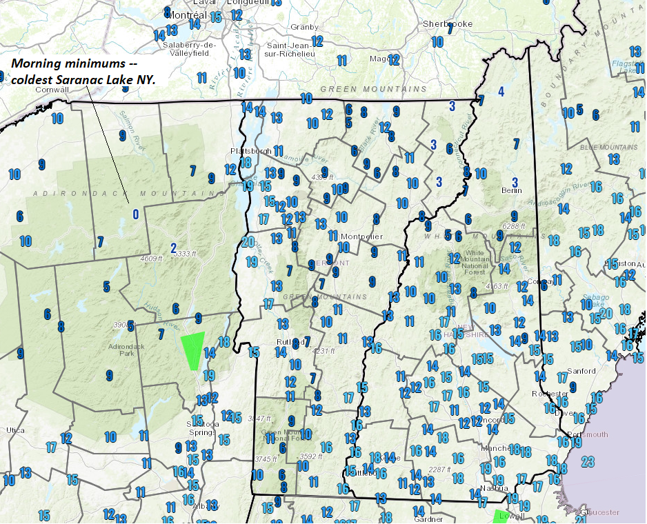
Average lows upper single digits to mid-teens. Average highs upper 20s to mid-30s
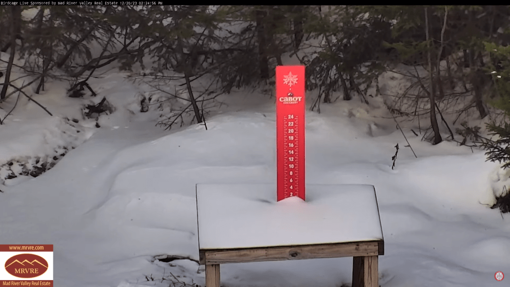
RH/12-22forecast][end]
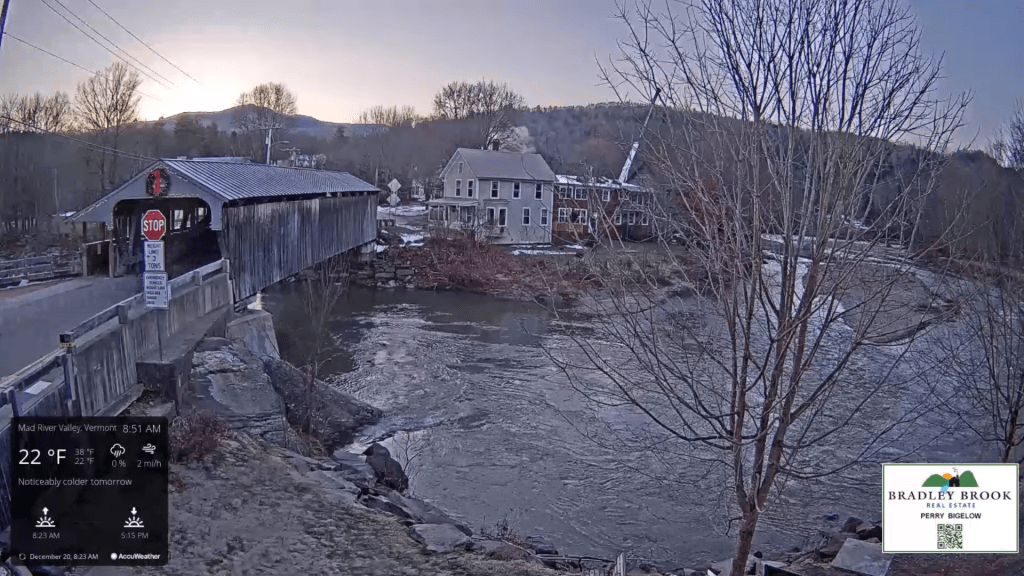
TODAY: Sunshine with a few high clouds later on.A high in the mid-20s. Little wind.
TONIGHT: A few high clouds in the evening thickening up late. A low mid to upper teens. Light southeast winds.
SATURDAY: Clouds with an occasional break or interval of sun. A high 35 to 40. Light south winds stronger near Lake Champlain.
Looking further ahead

SATURDAY NIGHT: Partly to mostly cloudy. A chance for a few wet snow flurries mixed with spotty freezing rain. A dusting with possible icy spots especially central and southern areas. A low 25 to 30.
SUNDAY: More clouds than sunshine. A high in the lower 40s.
MONDAY CHRISTMAS DAY: Clouds with intervals of sunshine. A low 25 to 30. A high in the mid-40s.
TUESDAY: More clouds than sun. A rising chance for sprinkles. A low around 32. A high in the 40s.
WEDNESDAY: Gray. Chance for periods of light rain with areas of dense fog. A low 35 to 40. A high in the 40s.
Average lows upper single digits to mid-teens. Average highs upper 20s to mid-30s
RH/12-22forecast][end]

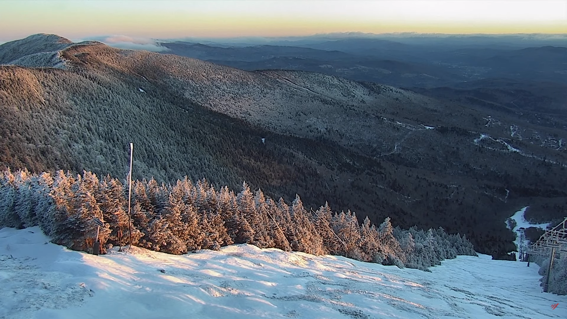
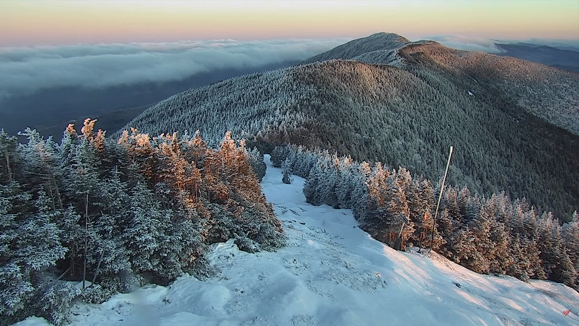
Winter Solstice 10:27 PM
TONIGHT: Clear with a couple high clouds. A low in the low teens. Light north winds.
TOMORROW: Sunshine with a few high clouds late.A high in the mid-20s. Little wind.
FRIDAY NIGHT: A few high clouds in the evening thickening up late. A low in the upper teens. Light southeast winds.
SATURDAY: Clouds with an occasional break or interval of sun. A high in the upper 30s. Light south winds stronger near Lake Champlain.
Looking further ahead
SATURDAY NIGHT: Partly to mostly cloudy. A chance for a few flurries with a dusting in spots central and southern areas. A low in the mid to upper 20s.
SUNDAY: Sunshine mixing with more clouds late. A high in the lower 40s.
MONDAY CHRISTMAS DAY: Variable cloudiness. A low 25 to 30. A high in the mid-40s.
TUESDAY: Mostly cloudy. A rising chance for sprinkles. A low upper 20s. A high 40 to 45.
Average lows upper single digits to mid-teens. Average highs upper 20s to mid-30s
RH/12-21forecast][end]
TODAY: A few morning clouds then mostly sunny. A high in the mid-upper 20s. Northerly winds continuing 10 mph.
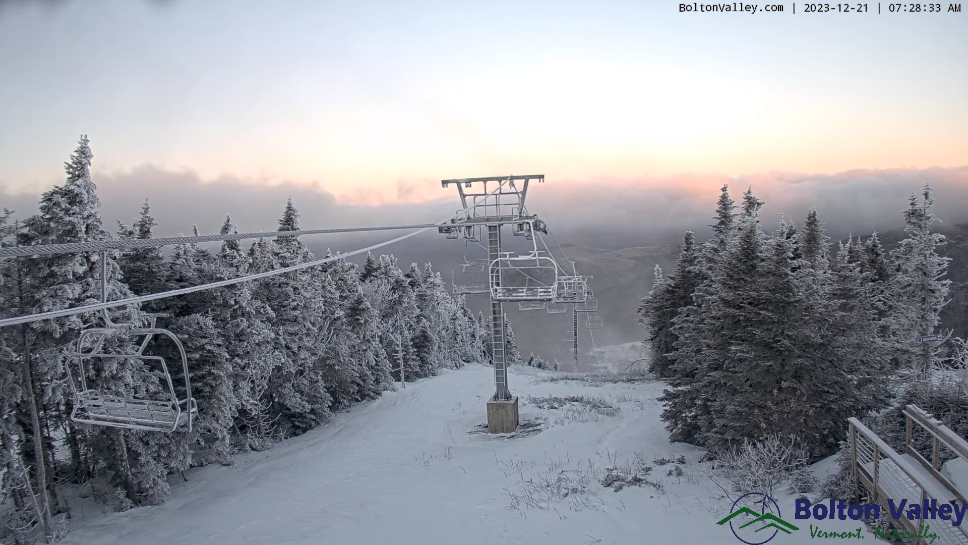
Winter Solstice December 10:27 PM this evening….
TONIGHT: Clear with a couple high clouds. A low ranging 5 to 15 above. Light north winds.
FRIDAY: Sunshine with a few high clouds late.A high 25 to 30. Little wind.
Looking further ahead
FRIDAY NIGHT: A few high clouds in the evening thickening up overnight. A low in the upper teens.
SATURDAY: Clouds with an occasional break or interval of sun. A chance for a few mountain flurries with a dusting in spots. A high in the upper 30s.
SUNDAY: Sunshine mixing with more clouds late. A low in the mid to upper 20s. A high in the lower 40s.
MONDAY CHRISTMAS DAY: Variable mainly high cloudiness. A low 25 to 30. A high in the mid-40s.
TUESDAY: Mostly cloudy. A rising chance for sprinkles. A low upper 20s. A high 40 to 45.
Average lows upper single digits to mid-teens. Average highs upper 20s to mid-30s
RH/12-21forecast][end]

TONIGHT: Cloudy periods this evening then clearing overnight.A low in the mid to upper teens. North winds continue at 10 mph.
TOMORROW: Mostly sunny. A high in the upper 20s. Northerly winds continuing 10 mph.

Winter Solstice December 21st 10:27 PM Thursday evening….
THURSDAY NIGHT: Clear with a couple high clouds. A low ranging 5 to 15 above. Light north winds.
FRIDAY: Sunshine with a few high clouds late.A high 25 to 30. Little wind.
Looking further ahead

FRIDAY NIGHT: A few high clouds. A low in the upper teens.
SATURDAY: Clouds with an occasional break or interval of sun. A high in the upper 30s.
SUNDAY: Sunshine mixing with more clouds late. A low 20 to 25. A high 40 to 45.
MONDAY CHRISTMAS DAY: Sunshine filtered thru high cloudiness. A low around 25. A high in the mid-40s.
TUESDAY: Mostly cloudy. A rising chance for rain & possible mixed precipitation later on. A low around 30. A high 40 to 45.
Average lows upper single digits to mid-teens. Average highs upper 20s to mid-30s
RH/12-19forecast][end]
TODAY: Sunny. A high around 35. Light northwest winds.
TONIGHT: Partly to mostly cloudy northern areas, otherwise clear.A low in the mid to upper teens. North winds 10 mph.
THURSDAY: Mostly sunny. A high in the upper 20s. North winds 10 mph.
Looking further ahead
Winter Solstice December 21st 10:27 PM Thursday evening….
THURSDAY NIGHT: Clear. A low upper single digits, to mid-teens.
FRIDAY: Sunshine with a few high clouds late.A high 25 to 30.
SATURDAY: Increasing clouds. A low 15 to 20. A high 35 to 40.
SUNDAY: Partly cloudy. A low 20 to 25. A high 40 to 45.
MONDAY CHRISTMAS DAY: Partly to mostly sunny. A low 25 to 30. A high in the mid-40s.
TUESDAY: Mostly cloudy. A rising chance for rain or showers late. A low around 30. A high 45 to 50.
Average lows upper single digits to mid-teens. Average highs upper 20s to mid-30s
RH/12-19forecast][end]
