Updated Tuesday Evening Forecast — January 2nd, 2024

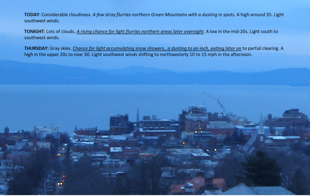
TONIGHT: Fair with some high cloudiness, giving way to more clouds overnight. A few stray overnight flurries near the Canadian border. A low 20 to 25. Light southwest winds.

TOMORROW: Considerable cloudiness. Widely scattered flurries. A high around 35. Light southwest winds.

WEDNESDAY NIGHT: Lots of clouds. Scattered flurries northern areas with a dusting. A low around 25. Light south to southwest winds.

THURSDAY: Gray skies. Chance for light accumulating snow showers…a dusting to an inch, exiting late to partial clearing. A high near 30. Light southwest winds shifting to northwesterly 10 to 15 mph in the afternoon.

Looking further ahead

THURSDAY NIGHT: Mostly clear.A low around 10.

FRIDAY: Sunshine in the morning gives way to lots of clouds in the afternoon. Widely scattered flurries. A high around 25.

SATURDAY: Sunshine filtered thru high cloudiness, thickening in the afternoon. A low 10 to 15. A high around 25.

SUNDAY: Thickening clouds, leading to the chance for snow or snow showers. A low in the mid to upper teens. A high in the mid-20s.

Average lows single digits to around 10 above. Average highs mid-20s to around 30

RH/1-1forecast][end]

Updated Tuesday Morning Forecast — January 2nd, 2024

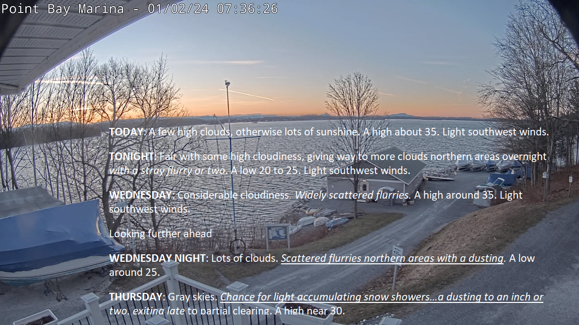
TODAY: A few high clouds, otherwise lots of sunshine. A high of about 35. Light southwest winds.

TONIGHT: Fair with some high cloudiness, giving way to more clouds in northern areas overnight with a stray flurry or two. A low 20 to 25. Light southwest winds.

WEDNESDAY: Considerable cloudiness. Widely scattered flurries. A high around 35. Light southwest winds.

Looking further ahead

WEDNESDAY NIGHT: Lots of clouds. Scattered flurries in northern areas with a dusting. A low around 25.

THURSDAY: Gray skies. Chance for light accumulating snow showers…a dusting to an inch or two, exiting late to partial clearing. A high near 30.  

FRIDAY: Morning sunshine then more clouds in northern areas. Chance for accumulating light snow showers in northern areas after dark. A low around 10. A high around 25.

SATURDAY: Sunshine filtered through high cloudiness, thickening up later on. A low 10 to 15. A high around 25.

SUNDAY: Thickening clouds, leading to the chance for snow or snow showers. A low in the mid to upper teens. A high in the mid-20s.

Average lows are single digits to around 10 above. Average highs mid-20s to around 30

RH/1-1forecast][end]

Updated Monday Morning Forecast — January 1st, 2023

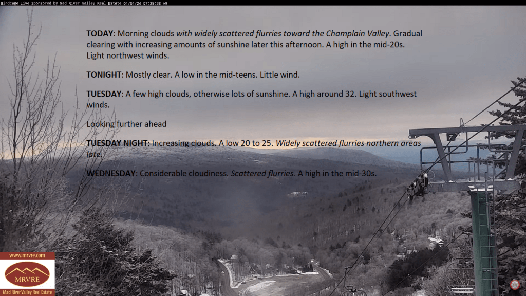
TODAY: Morning clouds with widely scattered flurries toward the Champlain Valley. Gradual clearing with increasing amounts of sunshine later this afternoon. A high in the mid-20s. Light northwest winds.

TONIGHT: Mostly clear. A low in the mid-teens. Little wind.

TUESDAY: A few high clouds, otherwise lots of sunshine. A high around 32. Light southwest winds.

Looking further ahead

TUESDAY NIGHT: Increasing clouds. A low 20 to 25. Widely scattered flurries in northern areas late.

WEDNESDAY: Considerable cloudiness. Scattered flurries. A high in the mid-30s.

THURSDAY: Gray skies with a few mountain flurries early, giving way to intervals of afternoon sun. A low around 25. A high in the low to mid-30s.

FRIDAY: Morning sunshine then partly sunny with more clouds in northern areas. Chance for accumulating light snow showers late. A low in the single digits above zero. A high around 25.

SATURDAY: Variable high cloudiness otherwise lot of sunshine. A low in the single digits. A high low to mid-20s.

Average lows are single digits to around 10 above. Average highs mid-20s to around 30

RH/12-29forecast][end]

Updated Friday Evening Forecast — December 29th, 2023

TONIGHT: Cloudy.Light rain showers transitioning to wet snow this evening, northwest to southeast. A slushy dusting valleys to near 2” higher elevations and slippery. A low 30 to 32. Light west winds.

TOMORROW: Gray and a little blustery at times. A few wet snow showers or flurries mainly in the mountains. Little temperature change with a high near 35. Northwest winds 10 mph.

SATURDAY NIGHT: Mostly cloudy.Widely scattered flurries. A low 20 to 25. Northwest winds 10 mph.

SUNDAY: Morning clouds with a stray flurry, partial afternoon sunshine. A high upper 20s. Northwest winds 10 mph.

Looking further ahead

SUNDAY NIGHT NEW YEARS EVE: Variable cloudiness. A morning low upper teens to around 20.

MONDAY NEW YEARS DAY: Morning clouds. Slight chance for a mountain flurry, then partial afternoon sunshine. A high mid to upper 20s.

TUESDAY: Partly to mostly sunny. A low 20 to 25. A high around 32.

WEDNESDAY: Lots of mid and high clouds. A low around 20. A high in the mid-30s.

Average lows mid-single digits to lower-teens. Average highs mid-20s to lower 30s.

RH/12-29forecast][end]

Updated Friday Morning Forecast — December 29th, 2023

Dense Fog Advisory thru 10 AM this morning…

TODAY: Gray skies. Occasional light rain showers. Areas of drizzle & dense fog mainly this morning. A high in the low 40s. Light south winds.

TONIGHT: Cloudy.Light rain showers transitioning to wet snow this evening northwest to southeast. A slushy inch or two of accumulation mainly elevated terrain. A low in the lower 30s. Light northwest winds.

SATURDAY: Gray and a little blustery at times. A few wet snow showers or flurries mainly in the mountains. Little temperature change with a high 32 to 35. Northwest winds 10 mph.

Looking further ahead

SATURDAY NIGHT: Mostly cloudy.Widely scattered flurries. A low 20 to 25.

SUNDAY: A few morning clouds northern areas, maybe a stray flurry, partial afternoon sunshine. A high upper 20s.

MONDAY NEW YEARS DAY: Morning clouds. Slight chance for a mountain flurry, then partial afternoon sunshine. A morning low upper teens to around 20. A high 25 to 30.

TUESDAY: Partly to mostly sunny. A low 15 to 20. A high in the mid-30s.

WEDNESDAY: Lots of mid and high clouds. A low around 20. A high mid-30s.

Average lows mid-single digits to lower-teens. Average highs mid-20s to lower 30s.

RH/12-29forecast][end]