Updated Friday Evening Forecast — March 29th, 2024

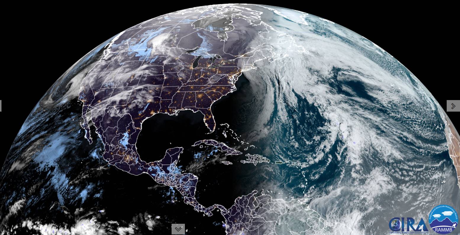
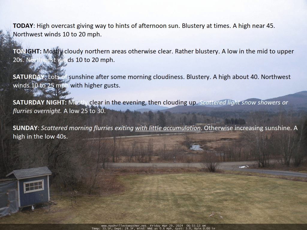
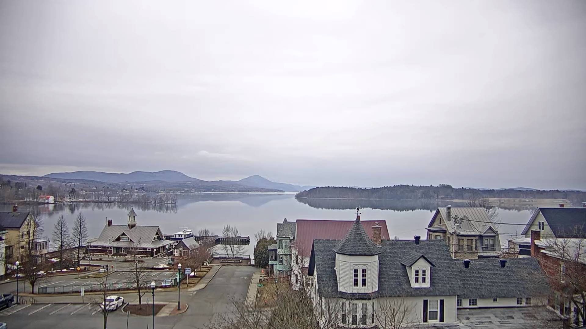
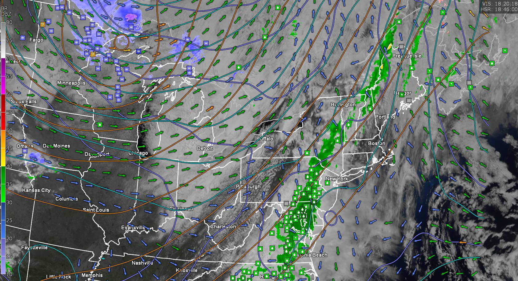
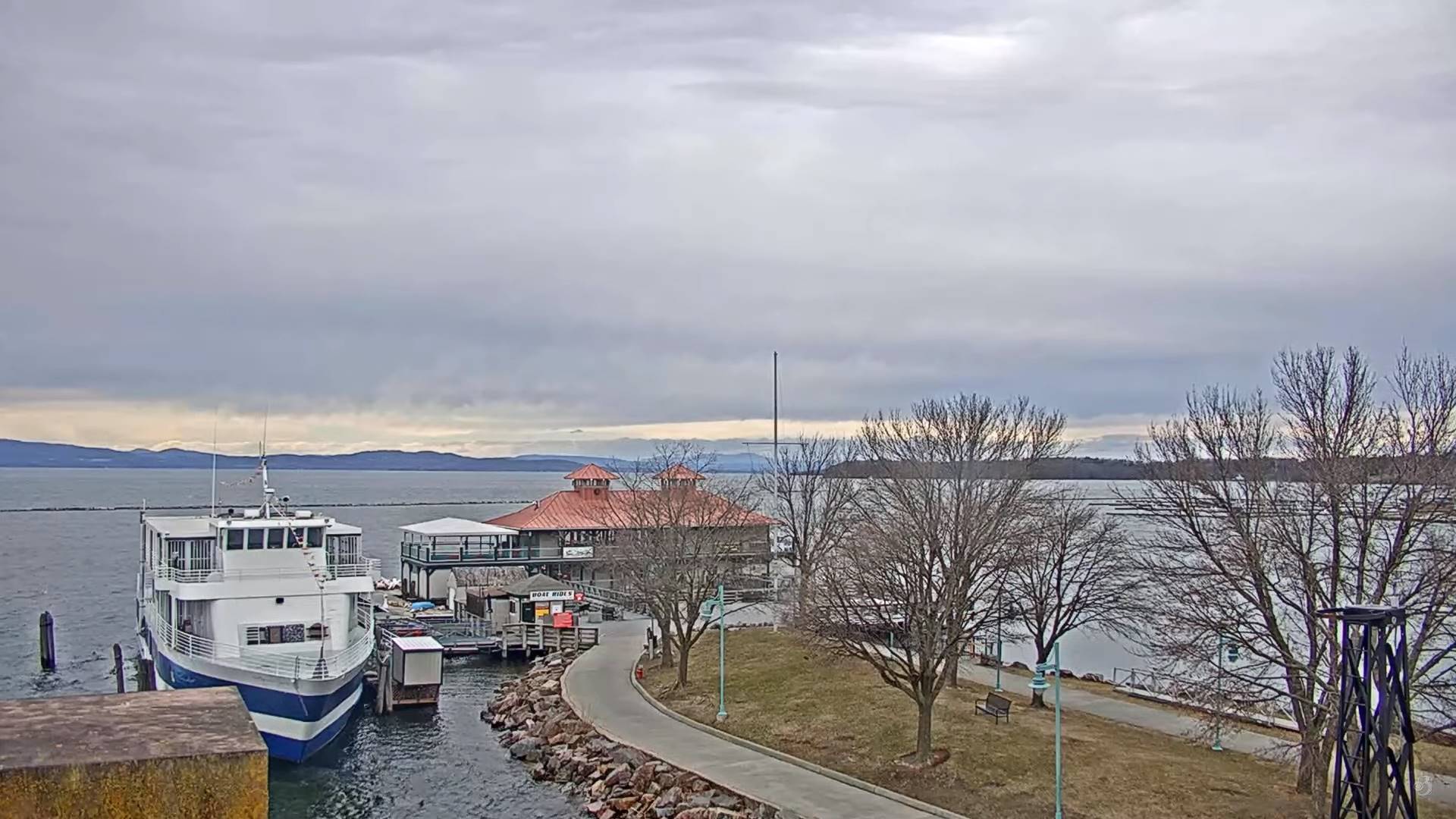
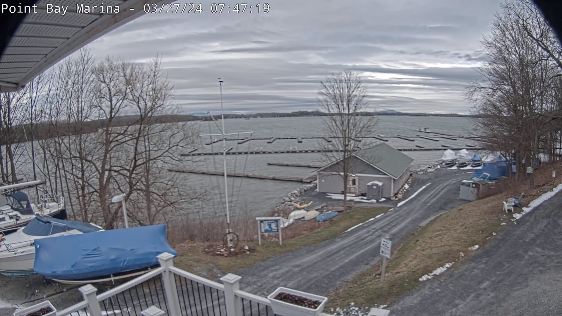
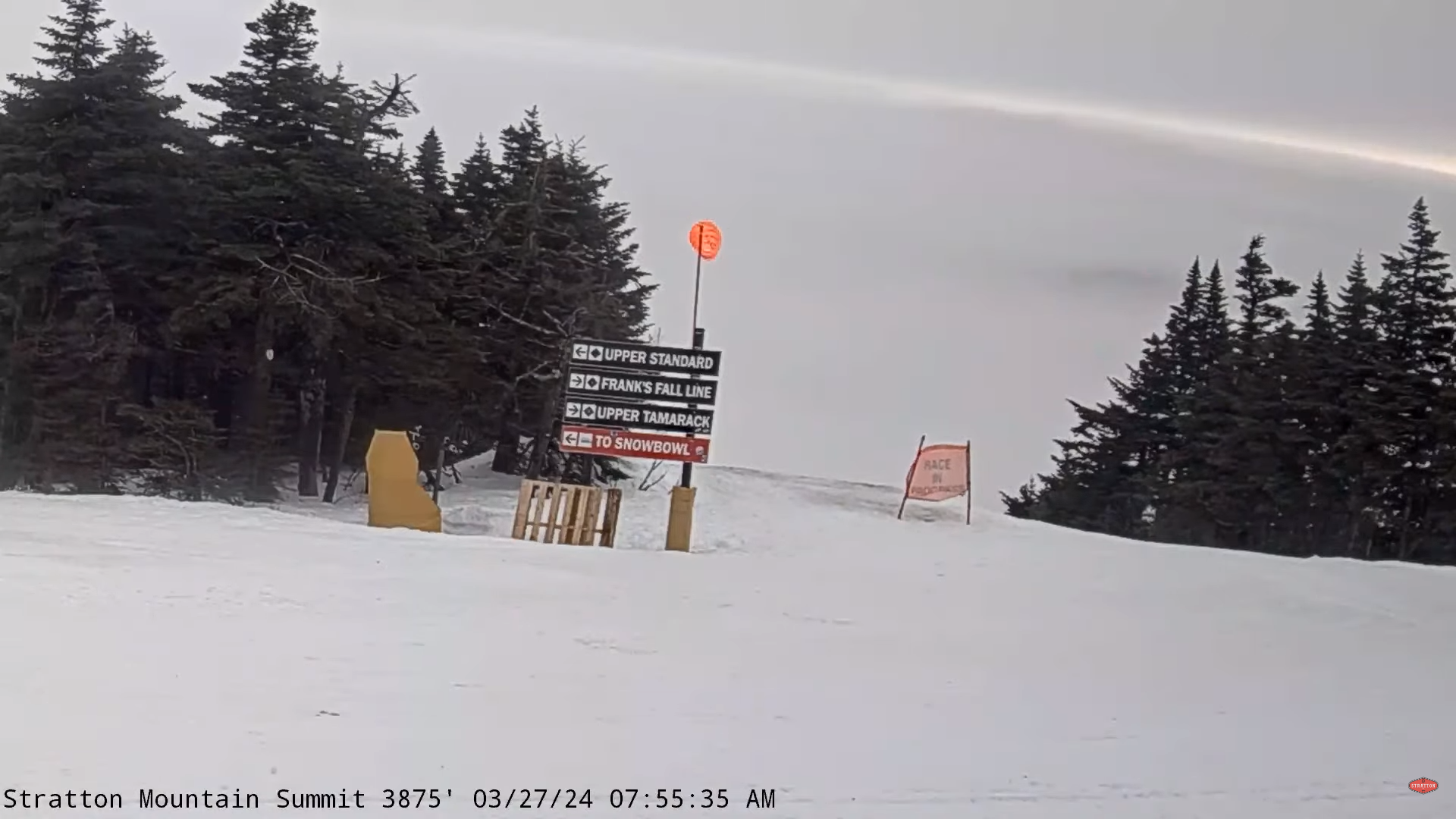
TONIGHT: Becoming mostly cloudy northern areas otherwise clear. Rather blustery.A low in the mid to upper 20s. Northwest winds 10 to 15 mph.

TOMORROW: Clouds across northern areas early give way to sunshine. Blustery. A high about 40. Northwest winds 10 to 25 mph in the morning decreasing in the afternoon.

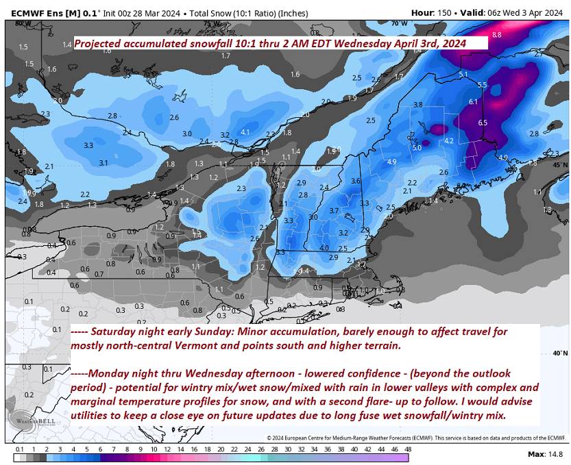
SATURDAY NIGHT: Mostly clear in the evening, then clouding up.Scattered flurries develop overnight. A low 25 to 30. Light northwest winds.

SUNDAY: Scattered flurries exiting around daybreak. Otherwise increasing sunshine. Still blustery in the afternoon. A high in the low 40s. Northwest winds 10 to 20 mph.

Looking further ahead

SUNDAY NIGHT: Mostly clear.A low around 30.

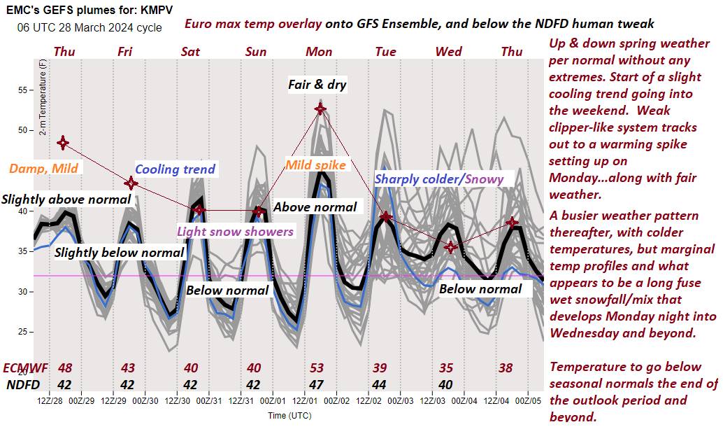
MONDAY: Partly to mostly cloudy. Chance for late afternoon sprinkles or wet snow flakes Northeast Kingdom. A high in the upper 40s.

TUESDAY: Sunshine giving way to more clouds in the afternoon. A low in the lower 30s. A high mid-40s to near 50.

WEDNESDAY: Rising chance for accumulating wet snow, a wintry mix with rain lower valleys. A few to several slushy inches of accumulation especially elevated terrain. A low near 32. A high mid to upper 30s.

Average lows low to mid-20s. Average highs mid to upper 40s

Total Solar Eclipse April 8th 3:25 PM EDT

Start of meteorological summer June 6th

RH/3-29forecast][end]

Updated Friday Morning Forecast — March 29th, 2024

TODAY: High overcast giving way to hints of afternoon sun. Blustery at times. A high near 45. Northwest winds 10 to 20 mph.

TONIGHT: Mostly cloudy northern areas otherwise clear. Rather blustery.A low in the mid to upper 20s. Northwest winds 10 to 20 mph.

SATURDAY: Lots of sunshine after some morning cloudiness. Blustery. A high about 40. Northwest winds 10 to 25 mph with higher gusts.

Looking further ahead

SATURDAY NIGHT: Mostly clear in the evening, then clouding up.Scattered light snow showers or flurries overnight. A low 25 to 30.

SUNDAY: Scattered morning flurries exiting with little accumulation. Otherwise increasing sunshine. A high in the low 40s.

MONDAY: More clouds than sun. Chance for late afternoon sprinkles or wet snow flakes. A low around 30. A high in the upper 40s.

TUESDAY: Clouds with intervals of sunshine. A low in the lower 30s. A high mid-40s to near 50.

WEDNESDAY: Rising chance for accumulating wet snow, a wintry mix with rain lower valleys. A few to several slushy inches of accumulation especially elevated terrain. A low near 32. A high mid to upper 30s.

Average lows low to mid-20s. Average highs mid to upper 40s

Total Solar Eclipse April 8th 3:25 PM EDT

Start of meteorological summer June 6th

RH/3-29forecast][end]

Updated Thursday Evening Forecast — March 28th, 2024

TONIGHT: Cloudy. A low 30 to 35. Light northwest winds.

TOMORROW: High overcast giving way to hints of afternoon sun. Blustery at times. A high in the low 40s. Northwest winds 10 to 20 mph.

FRIDAY NIGHT: Mostly cloudy early, then clearing and rather blustery.A low upper 20s. Northwest winds 10 to 20 mph.

SATURDAY: Lots of sunshine after some morning cloudiness. Blustery. A high around 40. Northwest winds 10 to 25 mph with higher gusts.

Looking further ahead

SATURDAY NIGHT: Mostly clear in the evening, then clouding up.A low around 25.

SUNDAY: Light snow showers or flurries with a light coating especially central and southern areas winding down in the early afternoon. Otherwise increasing sunshine. A high in the low to mid 40s.

MONDAY: Partly to mostly sunny. A low mid to upper-20s. A high in the mid-40s.

TUESDAY: Gray. Rising chance for accumulating wet snow, a wintry mix with rain lower valleys. A few slushy inches of accumulation possible in the mountains. A low in the lower 30s. A high mid to upper 30s.

Average lows low to mid-20s. Average highs mid to upper 40s

Total Solar Eclipse April 8th 3:25 PM EDT

Start of meteorological summer June 6th

RH/3-28forecast][end]

Updated Thursday Morning Forecast — March 28th, 2024

TODAY: Cloudy with areas of dense fog. Light rain showers this morning, especially southern and eastern 2/3rds of Vermont…exiting mid to late afternoon. Dry Champlain Valley. A high in the mid-40s. Light northwest winds.

TONIGHT: A few sprinkles far southeast areas early, otherwise cloudy. A low 30 to 35. Light northwest winds.

FRIDAY: High overcast giving way to hints of afternoon sun. Blustery at times. A high in the low 40s. Northwest winds 10 to 15 mph

Looking further ahead

FRIDAY NIGHT: Mostly cloudy early, then clearing.A low upper 20s.

SATURDAY: Lots of sunshine after some morning cloudiness. Blustery with gusty northwest winds. A high around 40.

SUNDAY: Light snow showers or flurries with a light coating especially central and southern areas winding down in the early afternoon. Otherwise increasing sunshine. A low around 25. A high in the low to mid 40s.

MONDAY: Partly to mostly sunny. A low mid to upper-20s. A high in the mid-40s.

TUESDAY: Gray. Rising chance for accumulating wet snow or snow showers…mixed with rain lower valleys. A few inches possible in the mountains. A low in the lower 30s. A high mid to upper 30s.

Average lows low to mid-20s. Average highs mid to upper 40s

Total Solar Eclipse April 8th 3:25 PM EDT

Start of meteorological summer June 6th

RH/3-28forecast][end]

Updated Wednesday Evening Forecast — March 27th, 2024

TONIGHT: Considerable cloudiness.Widely scattered light rain showers southern and eastern Vermont. A low 35 to 40. Light southwest winds.

TOMORROW: Cloudy. Showers likely, especially southern and eastern 2/3rd of Vermont…exiting mid to late afternoon. A high 45 to 50. Light northwest winds.

THURSDAY NIGHT: Mainly cloudy.A low 25 to 30. Light northwest winds.

FRIDAY: Considerable high cloudiness giving way to filtered sunshine. Blustery at times. A high 40 to 45. Northwest winds 10 to 15 mph

Looking further ahead

FRIDAY NIGHT: Mostly cloudy early, then clearing.A low upper 20s near 30.

SATURDAY: Scattered clouds northern areas, otherwise mostly sunny, but blustery with gusty northwest winds. A high around 40.

SUNDAY: Chance for light snow showers or flurries toward Rutland with a light coating possible in the morning exiting in the afternoon. Otherwise some partial afternoon sun northern areas. A low around 25. A high in the low to mid 40s.

MONDAY: Partly to mostly sunny. A low in the mid-20s. A high near 50.

Average lows low to mid-20s. Average highs mid to upper 40s

Total Solar Eclipse April 8th 3:25 PM EDT

End or meteorological winter was March 9th Start of meteorological summer June 6th

RH/3-25forecast][end]

Updated Wednesday Morning forecast — March 27th, 2024

TODAY: Mainly gray with a hint of afternoon sun. Occasional rain showers. A high upper 40s near 50. Light south winds, stronger near Lake Champlain.

TONIGHT: Considerable cloudiness.Widely scattered light rain showers southern and eastern Vermont. A low 35 to 40. Light southwest winds.

THURSDAY: Lots of clouds. Morning showers likely southern and eastern Vermont exiting in the afternoon. A high 45 to 50. Light northwest winds.

Looking further ahead

THURSDAY NIGHT: Mainly cloudy.A low 25 to 30.

FRIDAY: Considerable high cloudiness giving way to filtered sunshine. Blustery at times. A high 40 to 45.

SATURDAY: Partly cloudy northern areas, otherwise increasing sunshine, but blustery with gusty northwest winds. A low upper 20s near 30. A high around 40.

SUNDAY: Chance for light snow showers or flurries toward Rutland with a light coating possible in the morning exiting in the afternoon. Otherwise some partial afternoon sun northern areas. A low around 25. A high in the low to mid 40s.

MONDAY: Bright morning sun then some high cloudiness. A low in the mid-20s. A high near 50.

Average lows low to mid-20s. Average highs mid to upper 40s

Total Solar Eclipse April 8th 3:25 PM EDT

End or meteorological winter was March 9th Start of meteorological summer June 6th

RH/3-25forecast][end]

Updated Tuesday Evening Forecast — March 26th, 2024

TONIGHT: Cloudy. A rising chance for light sporadic rain showers this evening southern Vermont. A low around 35. Light southeast winds.

TOMORROW: Mainly gray. Occasional rain showers. A high 45 to 50. Light south winds, stronger near Lake Champlain.

WEDNESDAY NIGHT: Overcast.A few isolated showers southern and eastern areas. A low mid to upper 30s. Light southwest winds.

THURSDAY: Lots of clouds. Chance for showers, far southeast Vermont. A high around 50. Light winds.

Looking further ahead

THURSDAY NIGHT: Mainly cloudy.A low upper 20s around 30.

FRIDAY: Considerable high cloudiness with hints of sunshine. A high 40 to 45.

SATURDAY: Partly cloudy northern areas, otherwise increasing sunshine. A low around 25. A high upper 30s near 40.

SUNDAY: Mostly cloudy. A low 20 to 25. A high in the low to mid 40s.

Average lows low to mid-20s. Average highs mid to upper 40s

Total Solar Eclipse April 8th 3:25 PM EDT

End or meteorological winter was March 9th Start of meteorological summer June 6th

RH/3-25forecast][end]