Updated Thursday Morning Forecast — April 11th, 2024

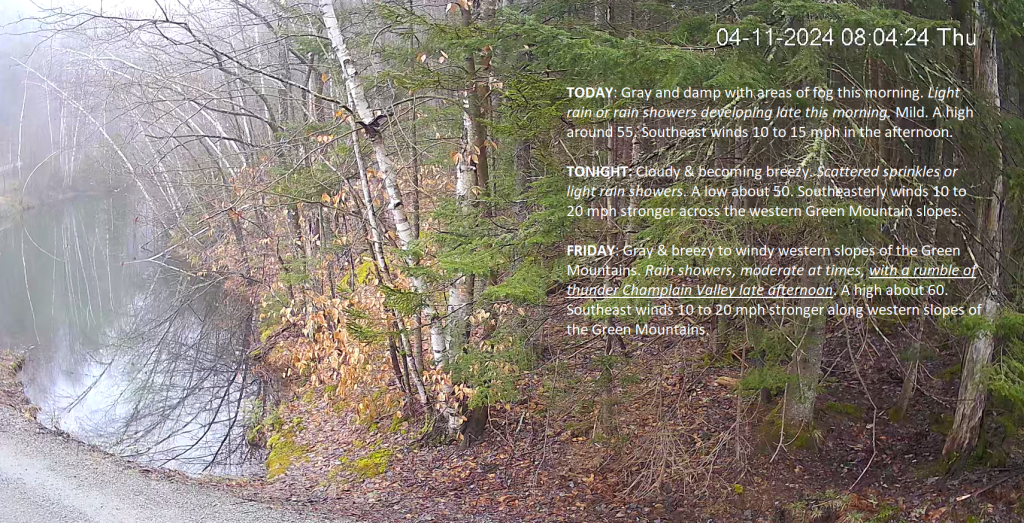
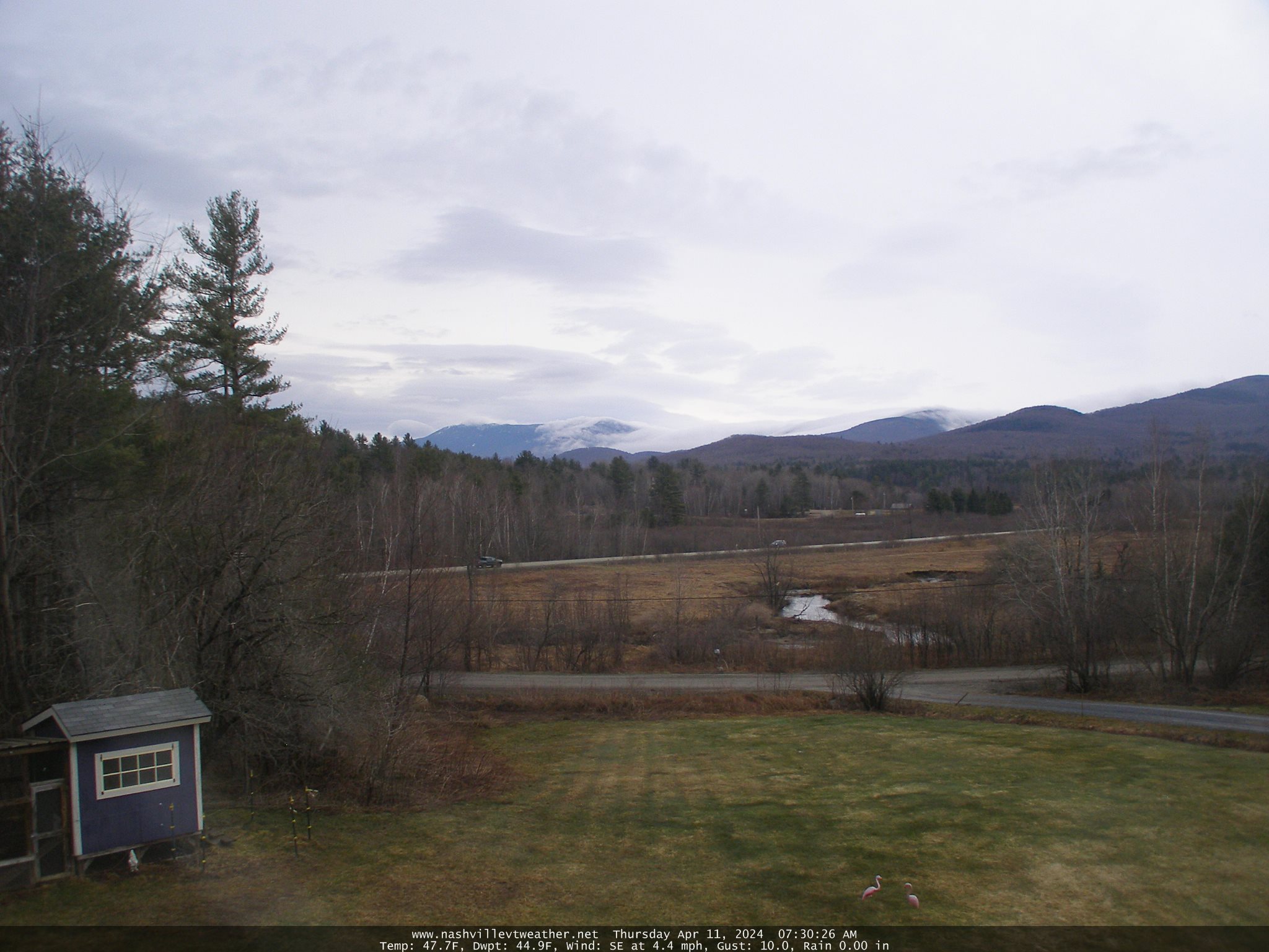
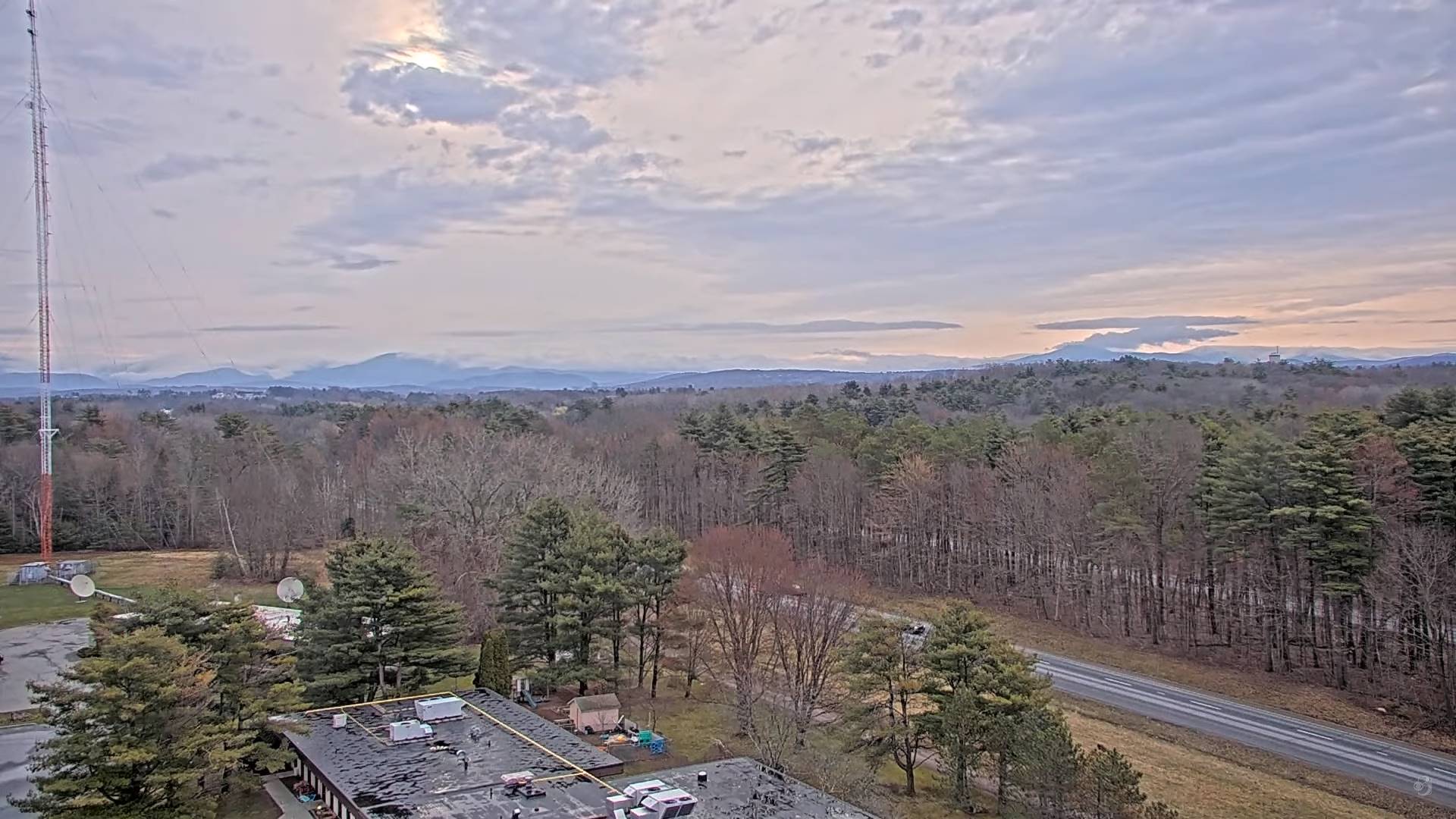
TODAY: Gray and damp with areas of fog this morning. Light rain or rain showers developing late this morning. Mild.A high around 55. Southeast winds 10 to 15 mph in the afternoon.

TONIGHT: Cloudy & becoming breezy. Scattered sprinkles or light rain showers.A low about 50. Southeasterly winds 10 to 20 mph stronger across the western Green Mountain slopes.

FRIDAY: Gray & breezy to windy western slopes of the Green Mountains. Rain showers, moderate at times, with a rumble of thunder Champlain Valley late afternoon. A high about 60. Southeast winds 10 to 20 mph stronger along western slopes of the Green Mountains.

Looking further ahead

FRIDAY NIGHT: Brief clearing in the evening, then partly to mostly cloudy with a shower or two returning.A low around 40.

SATURDAY: Partial morning sun, then more clouds in the afternoon & blustery. Chance for rain showers…mixing with wet snowflakes higher terrain toward evening. A high just the middle 40s.

SUNDAY: Sun mixing with more clouds. Slight chance for a late day shower far southern areas. A low around 35. A high in the lower 50s.

MONDAY: A possible rain shower toward evening, otherwise, variable cloudiness. A low upper 30s. A high about 55.

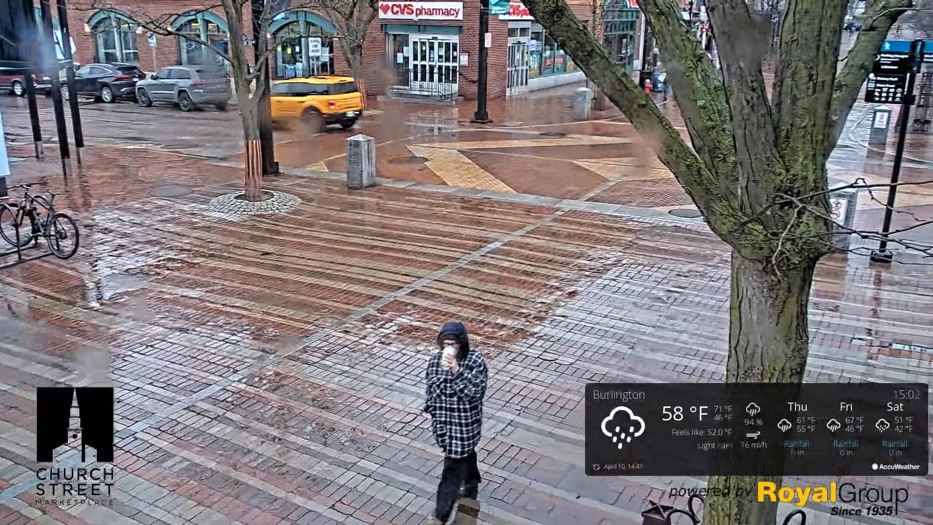
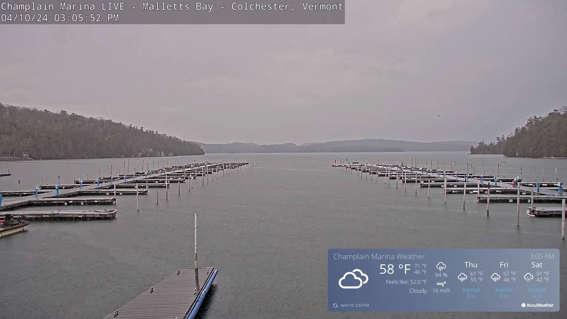
TUESDAY: Mostly sunny. A low near 35 to 40. A high pushing to near 60.

Average lows mid-20s to low 30s. Average 50 to 55

Start of meteorological summer June 6th

RH/4-11forecast][end]

Updated Wednesday Evening Forecast — April 10th, 2024

TONIGHT: A couple leftover showers early, exiting in the evening, otherwise considerable cloudiness.A low 40 to 45. Light southeast winds.

TOMORROW: Gray and damp. Good chance for spotty light rain showers or sprinkles developing in the afternoon. A high around 55. Southeast winds 10 to 15 mph in the afternoon.

THURSDAY NIGHT: Cloudy & becoming breezy. Scattered rain showers.A low upper 40s. Southeasterly winds 10 to 20 mph.

FRIDAY: Gray & breezy to windy western slopes of the Green Mountains. Chance for rain showers, moderate at times, with a possible thunderstorm western areas late afternoon. A high in the low 60s. Southeast winds 10 to 20 mph stronger along western slopes of the Green Mountains.

Looking further ahead

FRIDAY NIGHT: Becoming mostly clear.A low upper 30s to around 40.

SATURDAY: Brief morning sun, then cloudy. Chance for rain showers mixed with wet snowflakes higher terrain. A high 45 to 50.

SUNDAY: More clouds than sunshine. Maybe a showers far northern areas. A low in the mid-30s. A high near 55.

MONDAY: Early cloudiness with a possible rain shower. Partly to mostly sunny. A low around 40. A high in the upper 50s to around 60.

Average lows mid-20s to low 30s. Average 50 to 55

Start of meteorological summer June 6th

RH/4-10forecast][end]

Updated Wednesday Morning Forecast — April 10th, 2024

TODAY: Lots of clouds. A couple of rounds of rain showers. Partial sunshine develops northern areas late this afternoon. A high in the upper 50s to around 60. South to southeast winds 10 mph but stronger near Lake Champlain.

TONIGHT: A couple leftover showers early, exiting in the evening, otherwise considerable cloudiness.A low 40 to 45. Light southeast winds.

THURSDAY: Gray and damp. Good chance for spotty light rain showers or sprinkles developing in the afternoon. A high around 55. Southeast winds 10 to 15 mph in the afternoon.

Looking further ahead

THURSDAY NIGHT: Cloudy & becoming breezy. Scattered rain showers.A low upper 40s. Southeasterly winds 10 to 20 mph.

FRIDAY: Gray & breezy to windy western slopes of the Green Mountains. Chance for rain showers, moderate at times, maybe a rumble or two of thunder western areas. A high in the low 60s.

SATURDAY: Brief morning sun, then cloudy. Chance for rain showers mixed with wet snowflakes higher terrain. A low upper 30s to around 40. A high 45 to 50.

SUNDAY: More clouds than sunshine. Maybe a showers far northern areas. A low in the mid-30s. A high near 55.

MONDAY: Early cloudiness with a possible rain shower. Partly to mostly sunny. A low around 40. A high in the upper 50s to around 60.

Average lows mid-20s to low 30s. Average 50 to 55

Start of meteorological summer June 6th

RH/4-10forecast][end]

Updated Tuesday Evening Forecast — April 9th, 2024

TONIGHT: Fair and dry this evening, becoming partly to mostly cloudy & unsettled with showers arriving late.A low 35 to 40. Southeast winds 10 mph.

TOMORROW: Considerable clouds with scattered rain showers. Some partial clearing late afternoon. A high in the mid-50s. South to southeast winds 10 mph but stronger near Lake Champlain.

WEDNESDAY NIGHT: A couple leftover showers exit in the evening, otherwise lots of clouds.A low 40 to 45. Southeast winds 10 mph.

THURSDAY: Gray and damp. Good chance for spotty light rain showers or sprinkles developing in the afternoon. A high in the lower 50s. Southeast winds 10 mph.

Looking further ahead

THURSDAY NIGHT: Cloudy & breezy to windy. Scattered rain showers.A low upper 40s. Southeasterly winds 10 to 15 mph.

FRIDAY: Overcast & breezy to windy western slopes of the Green Mountains. Chance for rain showers, moderate at times, maybe a rumble or two of thunder. A high 55 to 60.

SATURDAY: Brief morning sun, then cloudy. Chance for rain showers mixed with wet snowflakes higher terrain. A low in the lower 40s. A high 45 to 50.

SUNDAY: Mixed sun and clouds. Maybe a mountain sprinkle. A low 35 to 40. A high 50 to 55.

Average lows mid-20s to low 30s. Average 50 to 55

Start of meteorological summer June 6th

RH/4-9forecast][end]

Updated Tuesday Morning Forecast — April 9th, 2024

TODAY: Pick of the week. Sunshine becoming filtered thru high clouds later this afternoon. Comfortably mild. A high in the low to mid 60s. Light west winds.

TONIGHT: Fair and dry this evening, becoming partly to mostly cloudy & unsettled with a rising chance for a few showers arriving late.A low 35 to 40. Southeast winds 10 mph.

WEDNESDAY: Considerable clouds with scattered rain showers. Some partial clearing late afternoon. A high in the mid-50s. South to southeast winds 10 mph.

Looking further ahead

WEDNESDAY NIGHT: A couple leftover showers exit in the evening, otherwise lots of clouds.A low 40 to 45.

THURSDAY: Gray and damp. Good chance for spotty light rain showers or sprinkles. A high in the lower 50s.

FRIDAY: Overcast & breezy to windy western slopes of the Green Mountains. Chance for rain showers, moderate at times. A low upper 40s. A high 55 to 60. Gusty southeasterly winds.

SATURDAY: Brief morning sun, then cloudy. Chance for rain showers mixed with wet snowflakes higher terrain. A low in the lower 40s. A high 45 to 50.

SUNDAY: Mixed sun and clouds. Maybe a mountain sprinkle. A low 35 to 40. A high 50 to 55.

Average lows mid-20s to low 30s. Average 50 to 55

Start of meteorological summer June 6th

RH/4-9forecast][end]