
Author Archives: Weathering Heights
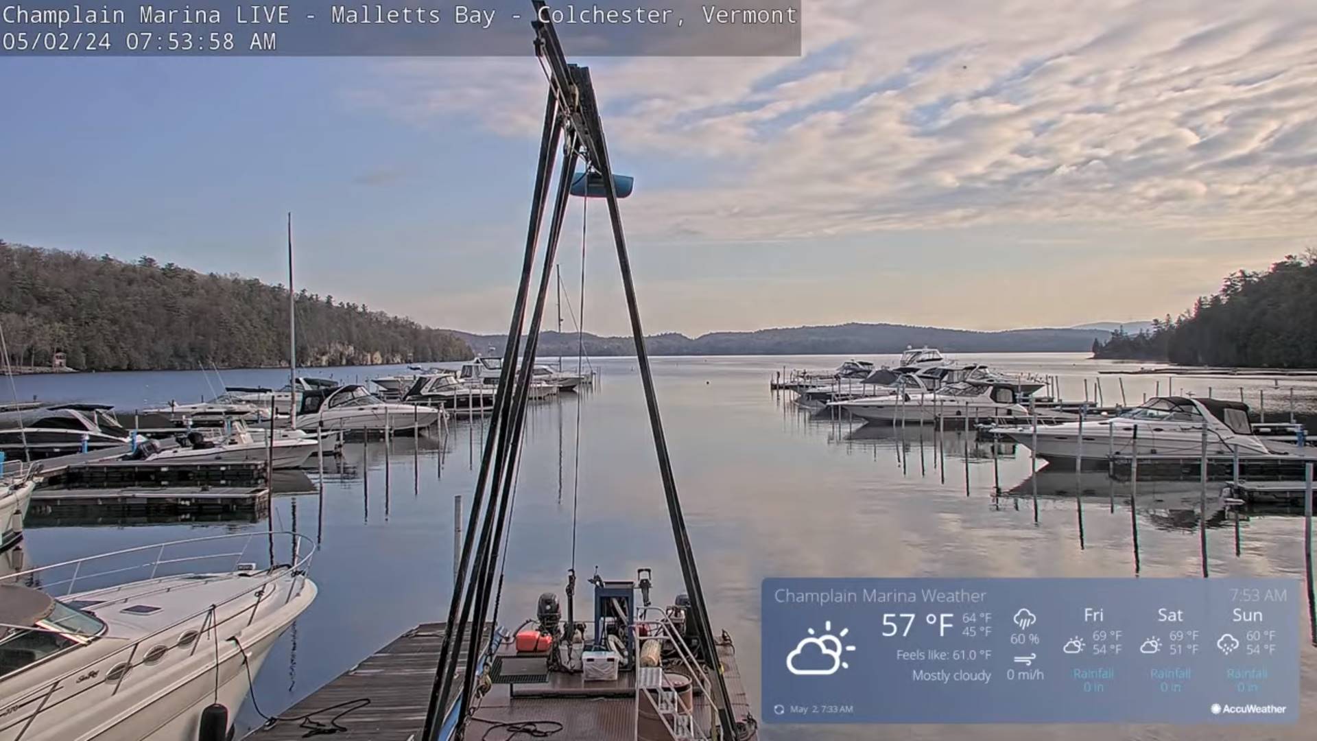
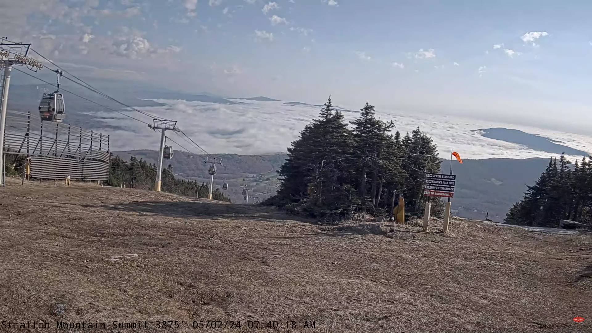
Updated Thursday Morning Forecast — May 2nd, 2024

TODAY: More clouds than sun & becoming breezy. Showers, moderate at times with a few rumbles of thunder exiting mid-morning. A second round of showers, some moderate, redeveloping early to mid-afternoon with isolated thunder especially toward the NE. Kingdom. A high in the mid-60s. Winds becoming west to northwesterly 10 to 15 mph.
TONIGHT: Mostly cloudy.A few leftover showers Northeast Kingdom exiting.A low mid to upper 40s. A light east winds.
FRIDAY: Lots of clouds maybe a break or two. Maybe a misty sprinkle. A high around 65. Light southeast winds.
Looking further ahead
FRIDAY NIGHT: Mostly cloudy.A low near 45.
SATURDAY: Variable…mainly high cloudiness. Maybe a sprinkle Champlain Islands in the afternoon. A high upper 50s.
SUNDAY: Lots of clouds. Chance for showers/rumbles of thunder possible. A low around 45. A high 60 to 65.
MONDAY: Morning low clouds then intervals of afternoon sun. Widely scattered showers, rumbles of thunder. A low upper 40s. A high 65 near 70.
Average lows low 30s to near 40. Average highs upper 50s to mid-60s.
Start of meteorological summer June 6th

RH/5-2forecast][end]
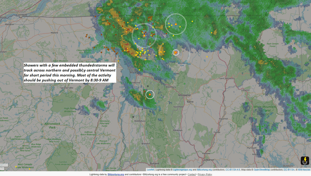
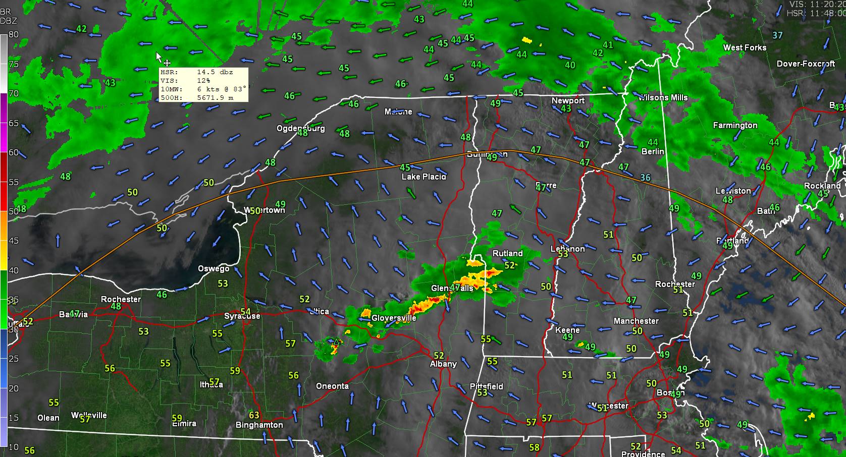
A break after some northern morning thunder with a second shot as some showers moderate at times and rumbles of thunder this early to mid afternoon toward the Kingdom. Quieter but still lots of clouds going into the weekend. Drier Friday and into Saturday.

Showers a few moderate to briefly heavy with sporadic lightning strikes for a time this morning across mainly northern and possibly central Vermont. Practice lightning safety
Updated Wednesday Evening Forecast — May 1st, 2024
TONIGHT: Partly cloudy for a time this evening. Overcast overnight, showers, moderate at times with a rumble of thunder toward daybreak.A low in the mid-40s to around 50. Light southeast winds.
TOMORROW: More clouds than sun & becoming breezy. Showers, moderate at times exiting mid-morning. A second round of showers, some moderate in the afternoon. A few rumbles of thunder possible NE. Kingdom. A high 60 to 65. Winds becoming west to northwesterly 10 to 20 mph.
THURSDAY NIGHT: Mostly cloudy.A few leftover showers Northeast Kingdom exiting.A low mid to upper 40s. A light east winds.
FRIDAY: Lots of clouds maybe a break or two. Maybe a misty sprinkle. A high near 65. Light southeast winds.

Looking further ahead
FRIDAY NIGHT: Mostly cloudy.A low in the mid-40s.
SATURDAY: Variable…mainly high cloudiness. Maybe a sprinkle Champlain Islands. A high upper 50s.
SUNDAY: Lots of clouds. Chance for showers/rumbles of thunder possible. A low 40 to 45. A high around 55.

MONDAY: Morning low clouds then intervals of afternoon sun. Widely scattered showers, rumbles of thunder. A low upper 40s. A high around 65.
Average lows low 30s to near 40. Average highs upper 50s to mid-60s.
Start of meteorological summer June 6th
RH/5-1forecast][end]
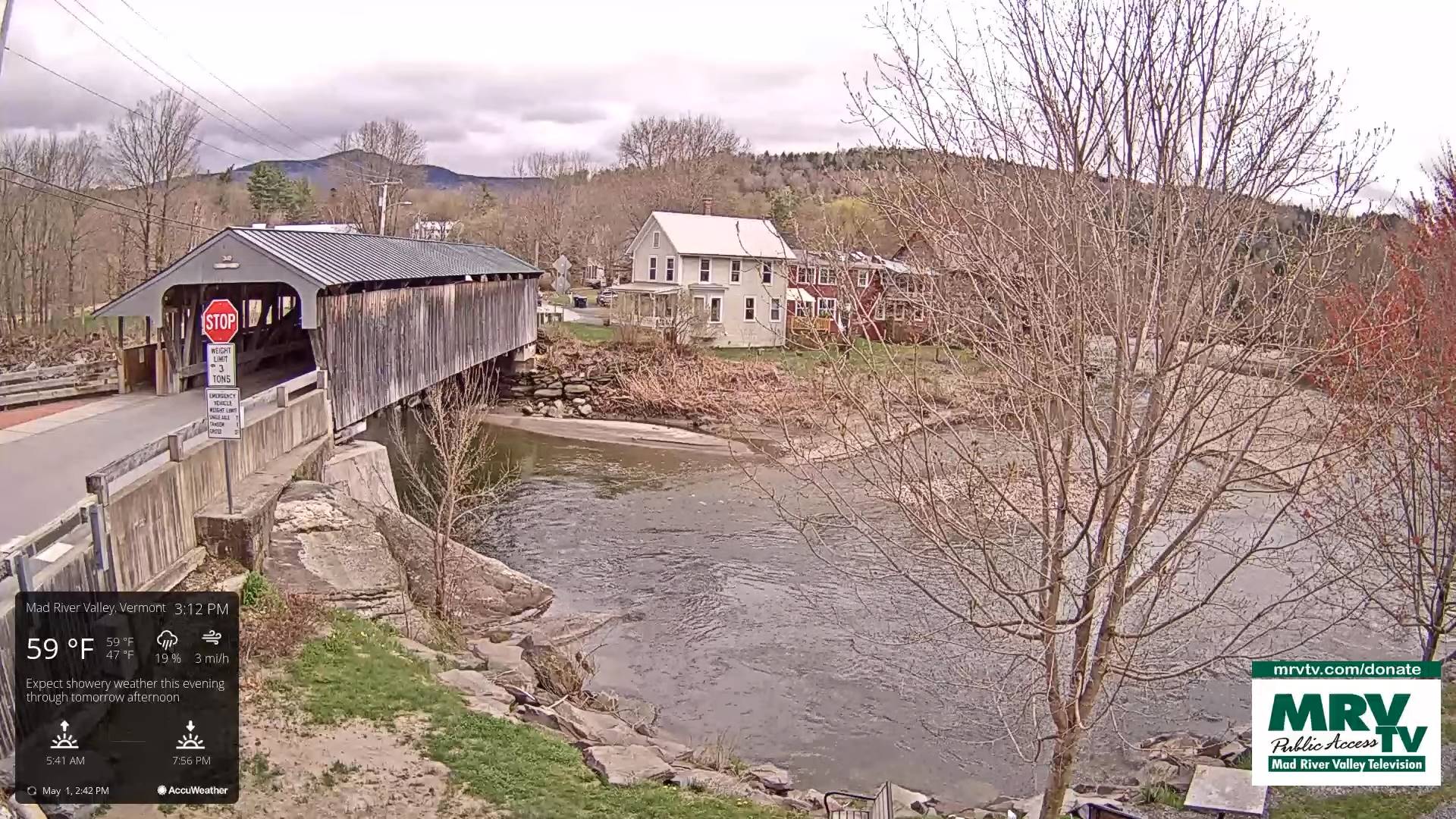
Updated Wednesday morning Forecast — May 1st, 2024

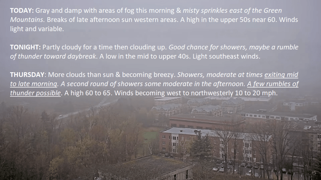
TODAY: Gray and damp with areas of fog this morning & misty sprinkles east of the Green Mountains. Breaks of late afternoon sun western areas.A high in the upper 50s near 60. Winds light and variable.
TONIGHT: Partly cloudy for a time then clouding up. Good chance for showers, maybe a rumble of thunder toward daybreak.A low in the mid to upper 40s. Light southeast winds.
THURSDAY: More clouds than sun & becoming breezy. Showers, moderate at times exiting mid to late morning. A second round of showers some moderate in the afternoon. A few rumbles of thunder possible. A high 60 to 65. Winds becoming west to northwesterly 10 to 20 mph.

Looking further ahead
THURSDAY NIGHT: Mostly cloudy.A few misty showers drying up by late evening.A low mid to upper 40s.
FRIDAY: Lots of clouds maybe a break or two. Maybe a misty sprinkle. A high near 65.

SATURDAY: Variable mainly high cloudiness. A low in the mid-40s. A high upper 50s.
SUNDAY: Lots of clouds. Chance for showers. A low 40 to 45. A high around 55.
MONDAY: Morning low clouds then intervals of afternoon sun. A low upper 40s. A high around 65.
Average lows low 30s to near 40. Average highs upper 50s to mid-60s.
Start of meteorological summer June 6th

RH/5-1forecast][end]
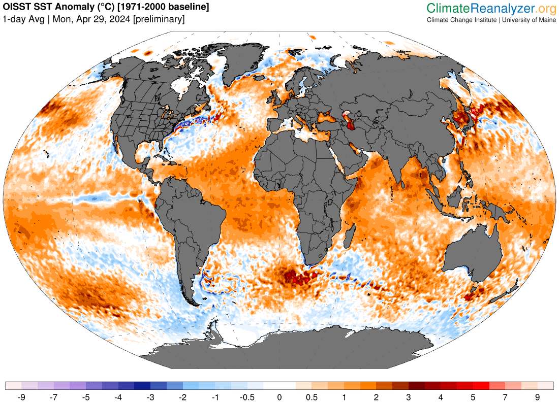
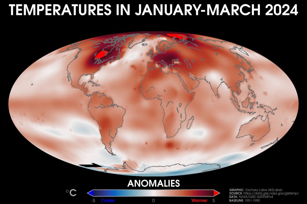
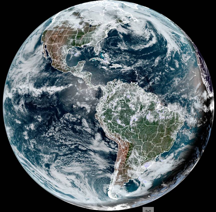
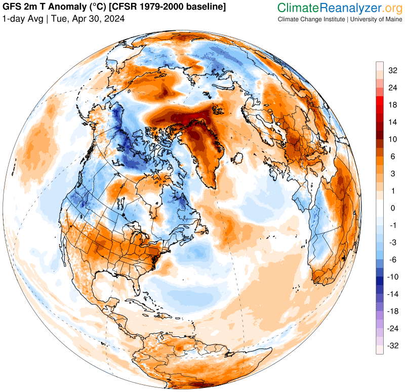
The only blue or colder than normal temperatures were in Antarctica. The planet continues to overheat in an alarming trend.
Coastal Maine? Nope we are socked in with Misty April showers into this first week of May. Tomorrow two batches of showers…moderate at times and the possibility of few rumbles of thunder arrives around daybreak overnight, and again Thursday afternoon. Breezy from the northwest in the afternoon Thursday.
Updated Tuesday Evening Forecast — April 30th, 2024
TONIGHT: Cloudy.Showers, moderate at times, drying up after midnight. A low in the mid-40s. Light southeast winds.
TOMORROW: Mainly gray with a threat for a few misty sprinkles near the mountains, with a few breaks of afternoon sun.A high in the lower 60s. Winds light and variable.
WEDNESDAY NIGHT: Partly cloudy then clouding up. Good chance for showers, maybe a rumble of thunder toward daybreak.A low around 45. Light south winds.
THURSDAY: Clouds mixing with intervals of sunshine. Scattered showers, some moderate at times with a rumble of thunder. A high 60 to 65. Winds becoming westerly 10 to 15 mph.
Looking further ahead
THURSDAY NIGHT: Mostly cloudy.A few misty sprinkles.A low mid to upper 40s.
FRIDAY: Lots of clouds maybe a break or two. A few mountain sprinkles. A high 60 to 65.
SATURDAY: Partial sunshine, early then more clouds in the afternoon. A low in the mid-40s. A high low to mid 60s.
SUNDAY: Lots of clouds. Scattered showers late morning on. A low 40 to 45. A high 55 to 60.
Average lows low 30s to near 40. Average highs upper 50s to mid-60s.
Start of meteorological summer June 6th
RH/4-30forecast][end]
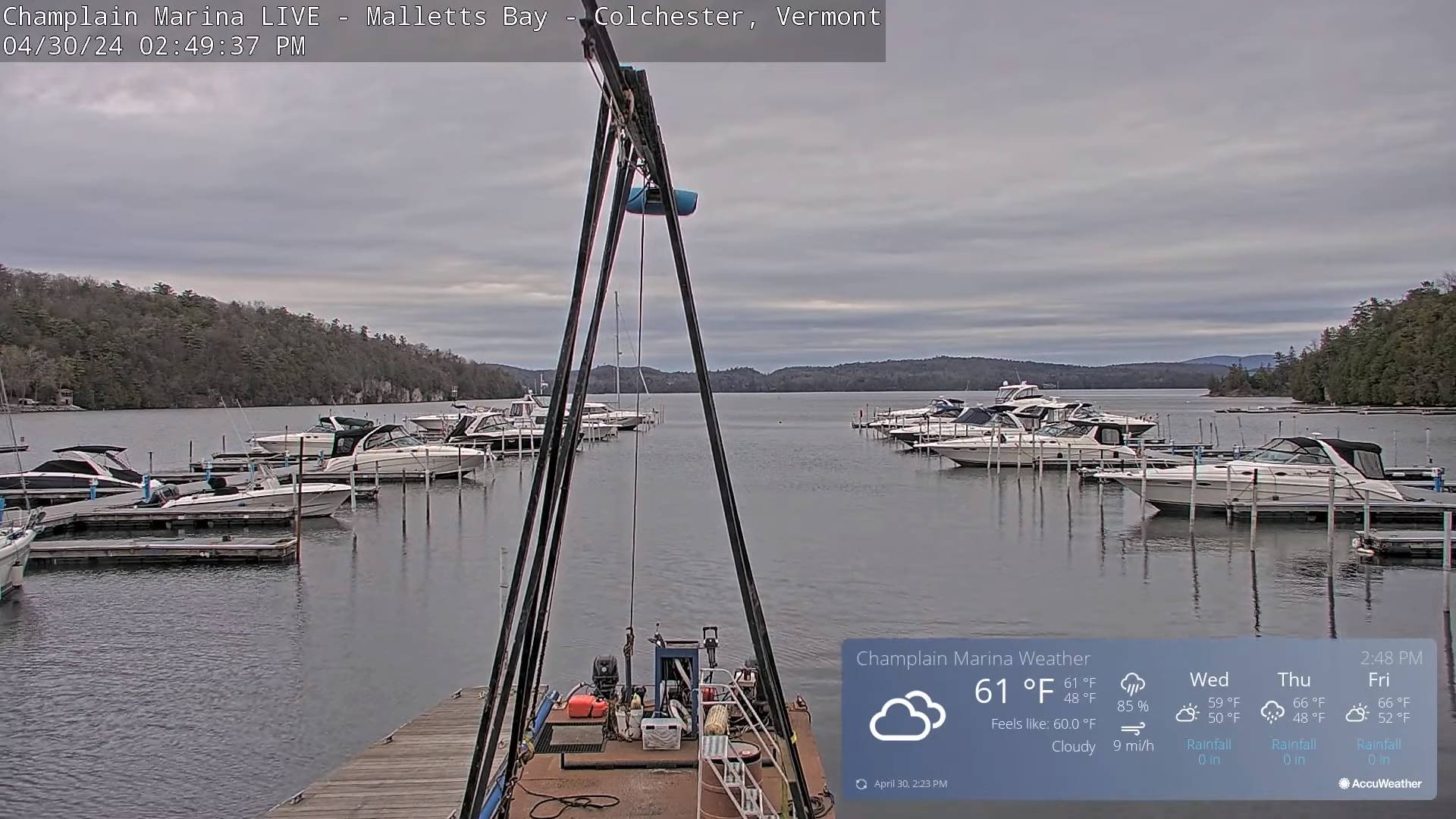
Updated Tuesday Morning Forecast — April 30th, 2024
TODAY: Considerable clouds. Scattered showers…moderate at times maybe a rumble of thunder. A high mid-50s to low 60s warmest western Vermont valleys. Southeast winds 10 mph.
TONIGHT: Cloudy.Showers, moderate at times, drying up after midnight. A low in the mid-40s. Light southeast winds.

WEDNESDAY: Mainly gray with a threat for a few misty sprinkles near the mountains, with a few breaks of afternoon sun.A high in the lower 60s. Winds light and variable.
Looking further ahead
WEDNESDAY NIGHT: Partly cloudy.A low around 45.

THURSDAY: Clouds mixing with intervals of sunshine. Scattered showers, some moderate at times with a rumble of thunder. A high 60 to 65.
FRIDAY: Thickening clouds. Isolated mountain sprinkles. A low mid to upper 40s. A high 60 to 65.
SATURDAY: Partial sunshine, early then more clouds in the afternoon. A low in the mid-40s. A high low to mid 60s.
SUNDAY: Lots of clouds. Scattered showers late morning on. A low 40 to 45. A high 55 to 60.

Average lows low 30s to near 40. Average highs upper 50s to mid-60s.
Start of meteorological summer June 6th
RH/4-29forecast][end]
