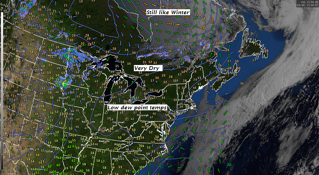
Updated Tuesday morning forecast — May 8th, 2018

TODAY: A beauty after some scattered morning frost with bright sunshine and a few afternoon clouds. A high 65 to 70. Light southwest winds.

TONIGHT: Clear but not as chilly. A low 45 to 50. Little wind.

WEDNESDAY: Blue skies and bright sunshine. A high in the low to mid 70s.Light south breeze.

Looking further ahead…

WEDNESDAY NIGHT: Mostly clear. A low 45 to 50.

THURSDAY: Morning sunshine then clouding up in the afternoon. A rising chance for showers later in the afternoon, maybe a rumble of thunder. A high around 70.

FRIDAY: Mixed clouds and sun after a frosty morning. A low 30 to 35. A high in the low 50s.

SATURDAY: Clouding up. Chance for rain developing. A morning low around 32 with areas of frost. Chilly with temperatures rising through the 40s.

SUNDAY: Lots of clouds. Chance for rain, possibly moderate to heavy at times. A low in the 40s. A high in the 50s.

Average lows 40 to 45. Normal highs around 65.

RH/5-8-18[end]

Virus-free. www.avast.com

Updated Monday night Forecast — May 7th, 2018

TONIGHT: Mostly clear with pockets of frost. A low around the mid 30s. Little wind.

TOMORROW: A beauty after some scattered morning frost with bright sunshine and a few afternoon clouds. A high 65 to 70. Light southwest winds.

TUESDAY NIGHT: Clear but not as chilly. A low 45 to 50. Little wind.

WEDNESDAY: Blue skies and bright sunshine. A high in the low to mid 70s.Light south breeze.

Looking further ahead…

WEDNESDAY NIGHT: Mostly clear. A low 45 to 50.

THURSDAY: Morning sunshine then clouding up in the afternoon. A rising chance for showers later in the afternoon, maybe a rumble of thunder. A high around 70.

FRIDAY: Morning clouds and rather chilly. Partial afternoon sunshine. A low 32 to 35. A high just around 50.

SATURDAY: Cloudy. Chance for periods of rain developing. A low in the mid 30s. Remaining very chilly and raw. A high in the mid 40s to around 50.

SUNDAY: Lots of clouds. Chance for rain, possibly moderate to heavy at times. A low in the 40s. A high 55 to 65.

Average lows 40 to 45. Normal highs around 65.

RH/5-7-18[end]

Virus-free. www.avast.com

Updated Monday Morning Forecast — May 7th, 2018

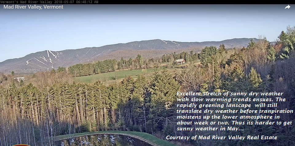
TODAY: Bright sunshine and blue skies but cool. A high in the upper 50s to low 60s. Northwest breeze 10 mph.

TONIGHT: Mostly clear. A low in the mid to upper 30s with a chance for frost. Light winds.

TUESDAY: A beauty after some scattered morning frost with bright sunshine and a few afternoon clouds. A high 65 to 70. Light southwest winds.

Looking further ahead…

TUESDAY NIGHT: Clear but not as chilly. A low 45 to 50.

WEDNESDAY: Blue skies and bright sunshine. A high ranging through the 70s.

THURSDAY: Morning sunshine then clouding up in the afternoon. A rising chance for showers later in the afternoon, maybe a rumble of thunder. A low mid 40s to around 50. A high upper 60s to lower 70s.

FRIDAY: Chance for morning showers giving way to partial afternoon sun. A low in the 30s. A high just 50 to 55.

Average lows 40 to 45. Normal highs around 65.

RH/5-7-18[end]

Virus-free. www.avast.com

Updated Friday evening forecast — May 4th, 2018

Tornado Watch through 10 PM Wind Advisory tonight through daybreak Saturday…

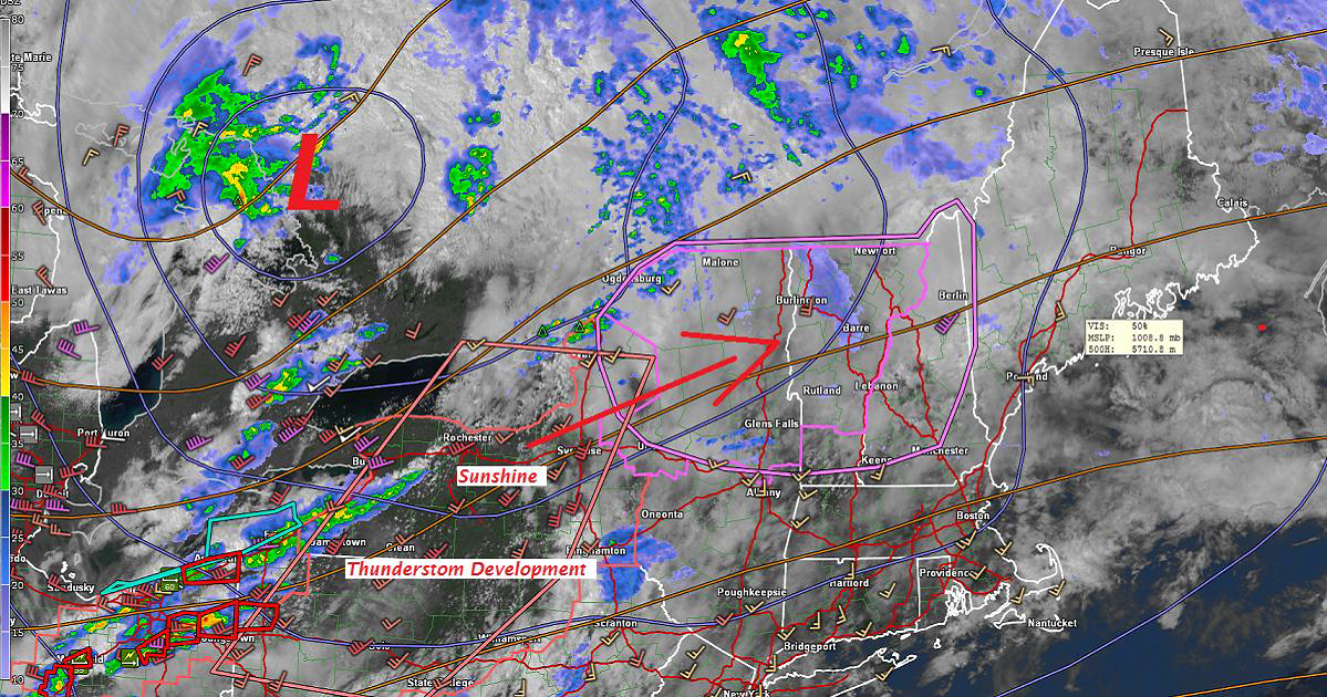
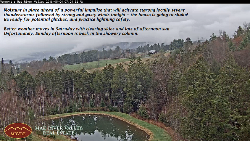
TONIGHT: Variably cloudy. A couple of rounds of strong to severe thunderstorms winding down toward midnight. Breezy to windy. A low in the mid 40s. West winds 10 to 25 with higher gusts over 40 mph across intermediate and higher terrain.

TOMORROW Green Up Day: Morning cloudiness gives way to increasing sunshine. Sill breezy to windy…diminishing through the day. A high in the mid 60s. West northwest winds 10 to 25 mph gradually diminishing.

SATURDAY NIGHT: Mostly clear. A low around 45. Light winds.

SUNDAY: Morning sun mixing with more clouds. Scattered showers developing in the afternoon. A high in the mid to upper 60s. Light southwest winds.

Looking further ahead…

SUNDAY NIGHT: Chance for showers, mixed with a few wet snow flakes in the high terrain. A low in the mid to upper 30s.

MONDAY: Bright sunshine and blue skies but rather cool. A high in the mid to upper 50s

TUESDAY: Sunny and gorgeous after some frost in the morning. A low 30 to 35 with scattered areas o9f frost. A high 65 to 70.

WEDNESDAY: Blue skies and bright sunshine. A low around 40. A high in the upper 60s.

THURSDAY: Morning sunshine then increasing high clouds. A low in the 40s. Warmer. A high in the upper 60s to mid 70s.

Average lows upper 30s to low 40s. Normal highs in the low to mid 60s.

RH/5-4-18[end]

Virus-free. www.avast.com

Updated Friday morning Forecast — May 4th, 2018

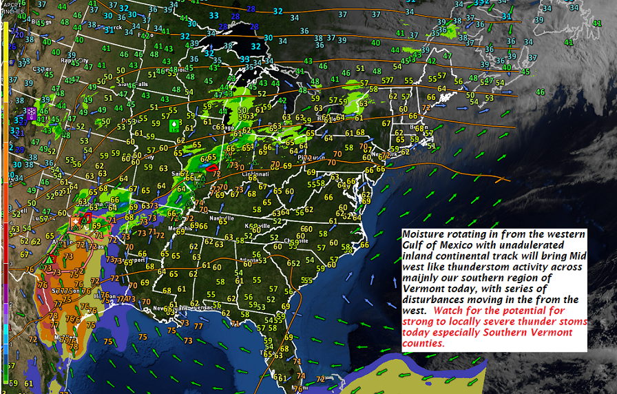
TODAY: Considerable cloudiness with areas of fog. Chance for morning sprinkle. Intervals of afternoon sun. Late afternoon showers and strong to locally severe thunderstorms producing gusty winds hail and lots of lighting. Becoming breezy. A high 70 to 75. Southwest winds 10 to 25 mph stronger late in the day.

Wind Advisory Windsor County south tonight through daybreak Saturday…

TONIGHT: Partly to mostly cloudy. A couple of rounds of showers and thunderstorms winding down toward midnight. Breezy to windy. A low in the mid 40s to around 50. West winds 10 to 25 with higher gusts over 40 mph.

SATURDAY Green Up Day: Morning cloudiness and still breezy, giving way to increasing sunshine. A high in the mid 60s. West northwest winds 10 to 25 mph gradually diminishing.

Looking further ahead…

SATURDAY NIGHT: Mostly clear. A low 40 to 45.

SUNDAY: Morning sun mixing with more clouds. Scattered showers developing in the afternoon. A high in the mid to upper 60s.

MONDAY: Bright sunshine and blue skies. A low upper 30s to low 40s. A high 55 to 60.

TUESDAY: Sunny and gorgeous after some frost in the morning. A low in the 30s. A high 65 to 70.

WEDNESDAY: Blue skies and bright sunshine. A low around 40. A high in the mid to upper 60s.

Average lows upper 30s to low 40s. Normal highs in the low to mid 60s.

RH/5-4-18[end]

Virus-free. www.avast.com

Updated Thursday Evening Forecast — May 3rd, 2018

TONIGHT: Mainly cloudy. A round of showers this evening…some briefly heavy, maybe a rumble of thunder. A low 55 to 60. Light southwest winds.

TOMORROW: Considerable morning cloudiness giving way to intervals of afternoon sun. Scattered showers and thunderstorms…some strong with locally gusty winds and hail. Becoming breezy. A high 70 to 75. Southwest winds 10 to 25 mph stronger late in the day.

FRIDAY NIGHT: Partly to mostly cloudy. Showers and isolated thunderstorms winding down in the evening. Breezy to windy. A low in the mid to upper 40s. West winds 10 to 25 with higher gusts across the hills.

SATURDAY Green Up Day: Morning cloudiness and still breezy giving way to increasing sunshine. A high in the mid 60s. West northwest winds 10 to 25 mph.

Looking further ahead…

SATURDAY NIGHT: Mostly clear. Cooler. A low 40 to 45.

SUNDAY: Partly sunny. Slight chance for passing showers Sunday evening. A high 65 to 70.

MONDAY: Lots of sunshine but cooler. A low upper 30s to low 40s. A high 55 to 60.

TUESDAY: Sunny and gorgeous. A low 35 to 40. A high 65 to 70.

WEDNESDAY: Blue skies and bright sunshine. A low around 40. A high in the mid to upper 60s.

Average lows upper 30s to low 40s. Normal highs in the low to mid 60s.

RH/5-3-18[end]

Virus-free. www.avast.com

Updated Thursday Morning Forecast — May 3rd, 2018

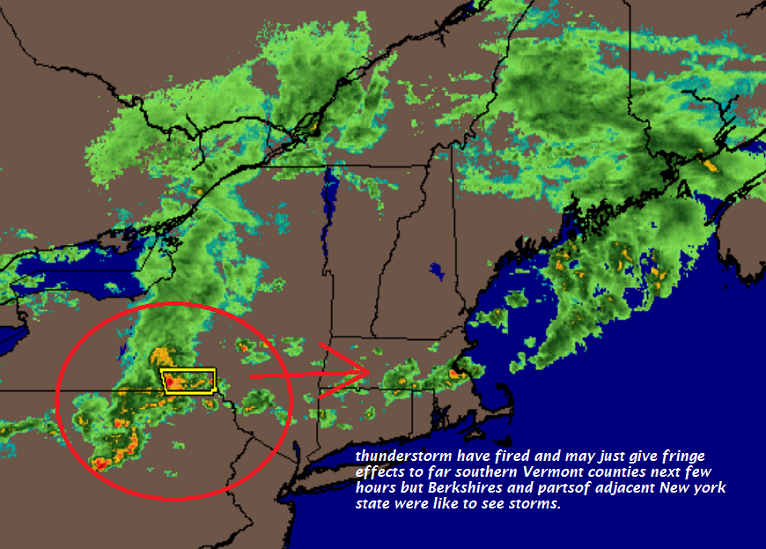
TODAY: Maybe few hints of sun this morning. Otherwise clouding up. Showers becoming likely by late morning some briefly moderate to heavy with few rumbles of thunder Northern areas. Scattered showers and strong thunderstorms this afternoon across southern areas. Breezy. A high in the low 70s. Southwest winds 10 to 20 mph.

TONIGHT: Mainly cloudy. Showers likely with a chance for thunderstorms, some could be locally heavy. A low 55 to 60. Light southwest winds.

FRIDAY: Showers and thunderstorms…some strong with locally gusty winds and hail. Otherwise mostly cloudy & becoming breezy. A high 70 to 75. Southwest winds 10 to 25 mph stronger late in the day.

Looking further ahead…

FRIDAY NIGHT: Gradual clearing, but breezy to windy especially in the evening. A low in the 40s.

SATURDAY Green Up Day: Morning cloudiness giving way to filter sunshine. A high 65 to 70.

SUNDAY: Partly sunny. Slight chance for passing showers Sunday evening. A low 40 to 45. A high mid 60s to near 70.

MONDAY: Lots of sunshine. A low upper 30s to mid 40s. A high in the low 60s.

TUESDAY: Sunny and gorgeous. A low 35 to 40. A high 65 to 70.

WEDNESDAY: Blue skies and bright sunshine. A low around 40. A high in the mid to upper 60s.

Average lows upper 30s to low 40s. Normal highs in the low to mid 60s.

RH/5-3-18[end]

Virus-free. www.avast.com

Updated Wednesday Evening Forecast — May 2nd, 2018

TONIGHT: Rain showers for a time early to mid evening becoming isolated toward midnight. Otherwise cloudy periods. A low mid 50s to around 60. Southwest winds 10 to 15 mph.

TOMORROW: Partial morning sun, then more clouds. Showers likely. Chance for a few embedded thunderstorms in the afternoon…some locally heavy. Breezy. A high in the low 70s. Southwest winds 10 to 20 mph.

THURSDAY NIGHT: Mainly cloudy. Showers likely with a chance for thunderstorms. A low 55 to 60. Light southwest winds.

FRIDAY: Showers and a chance for thunderstorms…some potentially strong with locally gusty winds. Otherwise mostly cloudy & becoming breezy. A high 70 to 75. Southwest winds 10 to 25 mph

Looking further ahead…

FRIDAY NIGHT: Gradual clearing and breezy to windy in the evening. A low in the 40s.

SATURDAY Green Up Day: More sunshine than clouds. A high in the 60s.

SUNDAY: Partly to mostly sunny. A low upper 30s to low 40s. A high in the low to mid 60s.

MONDAY: Sunshine mixing with afternoon clouds. A low in the 30s with areas of frost possible. A high around 65.

TUESDAY: Sunshine mixed with afternoon clouds. A low 35 to 40. A high 65 to 70.

Average lows upper 30s to low 40s. Normal highs in the low to mid 60s.

RH/5-2-18[end]

Virus-free. www.avast.com

Updated Wednesday morning forecast — May 2nd, 2018

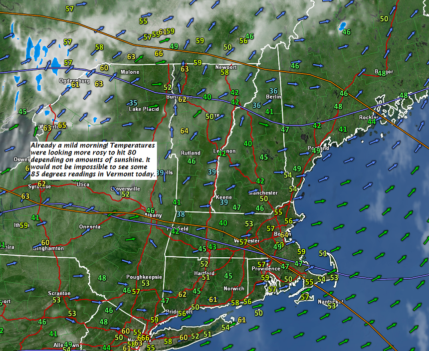
TODAY: Morning sun then more clouds this afternoon. Breezy and a touch humid. A high 75 to around 80. West to southwest winds 10 to 25 mph.

TONIGHT: Lots of clouds. Widely scattered showers. A low in the mid 50s. Southwest winds 10 to 20 mph.

THURSDAY: Partial morning sun, then more clouds. Showers likely with a few embedded thunderstorms possible, mainly in the afternoon…some locally heavy. Breezy. A high in the low 70s. West southwest winds 10 to 20 mph.

Looking further ahead…

THURSDAY NIGHT: Mainly cloudy. Showers likely with a chance for thunderstorms. A low in the mid 50s.

FRIDAY: Showers and a chance for thunderstorms…some potentially strong with gusty winds. Otherwise mostly cloudy & becoming breezy to windy late. A high near 70.

SATURDAY Green Up Day: Partly sunny. A low 40 to 45. A high in the mid to upper 60s.

SUNDAY: Partly to mostly sunny. A low upper 30s to low 40s. A high in the low to mid 60s.

MONDAY: Mostly sunny. A low in the 30s with areas of frost possible. A high low to mid 60s.

Average lows upper 30s to low 40s. Normal highs in the low to mid 60s.

RH/5-2-18[end]

Virus-free. www.avast.com

Updated Tuesday Morning forecast — May 1st, 2018

TODAY: Chance for a few rain showers passing through this morning . Otherwise, clouds mixing with lots of sunshine this afternoon. Warmer. A high in the low to mid 60s. Light northwest winds.

TONIGHT: Mostly clear. Patchy valley fog. A low in the 40s. Light southwest winds.

WEDNESDAY: Partly sunny. Chance for a late day shower. A touch of humidity and breezy in the afternoon. A high mid 70s to near 80. West to southwest winds 10 to 20 mph.

Looking further ahead…

WEDNESDAY NIGHT: Lots of clouds. Isolated showers or thunderstorms. A low in the mid 50s.

THURSDAY: Partial morning sun, then more clouds. A good chance for showers with possible afternoon thunderstorms. Breezy in the afternoon. A high mid 60s to around 70.

FRIDAY: Showers and a chance for thunderstorms…some heavy. Otherwise mostly cloudy. A low in the mid 50s. A high in the 60s.

SATURDAY: Partly sunny. A low near 45. A high 60 to 65.

SUNDAY: Partly to mostly sunny. A low mid 30s possible frost. A high low to mid 60s.

Average lows upper 30s to low 40s. Normal highs in the low to mid 60s.

RH/5-1-18[end]