test
 |
Virus-free. www.avast.com |

test
|
Virus-free. www.avast.com |
Roger Hill
Weathering Heights Consulting
186 MacKenzie Dr.
Worcester VT 05682
|
Virus-free. www.avast.com |
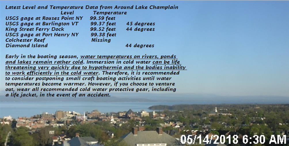
TODAY: A beauty with morning sunshine giving way to a few high clouds. Mild with a high in the mid to upper 70s. Light southwest winds.
TONIGHT: Fair northern areas with partly to mostly cloudy skies toward the south. Maybe a shower toward Rutland toward daybreak. A low in the low to mid 50s. Light south wind.
TUESDAY: Mostly cloudy. A few scattered passing showers…maybe an afternoon thunderstorm southern areas. A high 70 to 75. Light south winds.
Looking further ahead…
TUESDAY NIGHT: Mostly clear. Patchy valley fog. A low 40 to 45.
WEDNESDAY: Variable high cloudiness, otherwise periods of sunshine.A low in the 40s. A high about 70.
THURSDAY: Mostly sunny after morning fog. A low near 50. A high around 70.
FRIDAY: Filtered sunshine gives way to thickening clouds later on. A low in the 40s. A high in the upper 60s.
Average lows 45 to 50. Normal highs mid to upper 60s.
RH/5-14[end]
|
Virus-free. www.avast.com |
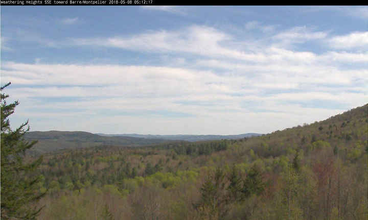
TONIGHT: Fair early, then thickening clouds overnight. An early low 32 to 35 with scattered frost likely. Little wind.
TOMORROW: Cloudy south but periods of sun north. Showers or a period of rain toward Rutland exiting late. A high around 60 northern areas, but cooler near 50 Rutland south. Light southwest winds.
SATURDAY NIGHT: Becoming clear and frosty. Areas of dense valley fog. A low around 35. Little wind.
SUNDAY Mother’s Day: Lots of sunshine. A high in the mid 60s. Southeast winds 10 mph.
Looking further ahead…
SUNDAY NIGHT:. Mostly clear. Patchy valley fog. A low around 45.
MONDAY: Morning low clouds and fog, then mostly sunny. A high in the low 70s.
TUESDAY: Lots of sunshine. A low in the 40s. A high in the mid 70s.
WEDNESDAY: Partly sunny.A low in the 30s. A high near 70.
THURSDAY: Partly sunny. Slight chance for showers. A low in the 50s. A high in the low to mid 60s.
Average lows in the mid to upper 40s. Normal highs mid to upper 60s.
RH/5-11[end]
|
Virus-free. www.avast.com |
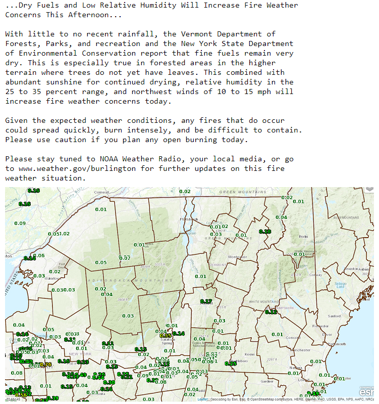
TODAY: Some morning cloudiness otherwise lots of sunshine but a cool day. A high in the low to mid 50s. Northwest breeze 10 to 15 mph.
TONIGHT: Fair early, then thickening clouds. An early low 32 to 35 with scattered frost likely. Little wind.
SATURDAY: Mainly cloudy. Showers or a period of rain Bare-Montpelier area and points south exiting as a few leftover showers late. Rather cool. A high in the upper 40s southern areas, to low 50s northern areas. Light south winds.
Looking further ahead…
SATURDAY NIGHT: Gradual clearing. Dense valley fog developing overnight. Scattered frost. A low near 32.
SUNDAY Mother’s Day: Morning low clouds and fog, giving way to lots of afternoon sunshine. A high 60 to 65.
MONDAY: Mixed clouds and sun. A low 40 to 45. A high upper 60s to low 70s
TUESDAY: Lots of sunshine. A low in the 40s. A high in the mid to upper 70s.
WEDNESDAY: Partly to mostly cloudy. Chance for showers and thunderstorms . A low 50 to 55. A high near 70.
THURSDAY: Partly sunny. Slight chance for showers. A low in the 50s . A high in the low to mid 60s.
Average lows in the mid to upper 40s. Normal highs mid to upper 60s.
RH/5-11-18[end]
|
Virus-free. www.avast.com |
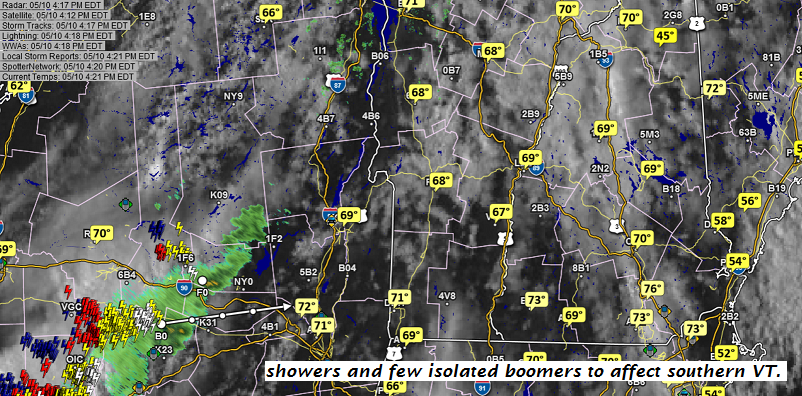
TONIGHT: Mostly cloudy with scattered rain showers exiting before daybreak. A low mid 30s to near 40. Northwest winds 10 to 20 mph.
TOMORROW: A few morning clouds then lots of sunshine. A high 50 to 55. Northwest breeze 10 to 20 mph.
FRIDAY NIGHT: Fair early, then thickening clouds. An early low 32 to 35 with scattered frost likely. Little wind.
SATURDAY: Mainly cloudy. Showers or a period of rain Bare-Montpelier area and points south exiting as a few leftover showers late. Rather cool. A high in the upper 40s southern areas, to low 50s northern areas. Light south winds.
Looking further ahead…
SATURDAY NIGHT: Gradual clearing. Dense valley fog developing overnight. A low 30 to 35.
SUNDAY Mother’s Day: Morning clouds giving way to lots of afternoon sunshine. A high 60 to 65.
MONDAY: Mixed clouds and sun. A low 35 to 40. A high 65 to 70.
TUESDAY: Lots of sunshine. A low 40 to 45. A high A in the low 70s.
WEDNESDAY: Partly to mostly cloudy. Scattered showers . A low around 50. A high in the upper 60s to near 70.
Average lows 40 to 45. Normal highs around 65.
RH/5-10-18[end]
|
Virus-free. www.avast.com |
TODAY: Morning sunshine gives way to increasing clouds. Showers arriving in the afternoon, maybe a rumble of thunder late. A high in the low 70s. South winds 10 to 20 mph
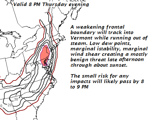
TONIGHT: Mostly cloudy with scattered rain showers exiting before daybreak. A low mid 30s to near 40. Northwest winds 10 to 20 mph.
FRIDAY: A few morning clouds then lots of sunshine. A high 50 to 55. Northwest breeze 10 to 15 mph.
Looking further ahead…
FRIDAY NIGHT: Fair early, then thickening clouds. An early low 32 to 35 with scattered areas of frost.
SATURDAY: Considerable cloudiness most of the area with chance for showers. Dry with hints of sun across far northern areas. A high low to mid 50s warmest northern areas.
SUNDAY Mother’s Day: Partly sunny but dry. A low in the 40s. A high 60 to 65..
MONDAY: Mixed clouds and sun. A low 35 to 40. A high 65 to 70.
TUESDAY: Lots of sunshine. A low 40 to 45. A high A in the low 70s.
WEDNESDAY: Partly to mostly cloudy. Scattered showers . A low around 50. A high in the upper 60s to near 70.
Average lows 40 to 45. Normal highs around 65.
RH/5-10-18[end]
|
Virus-free. www.avast.com |
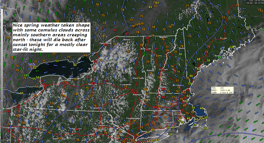
TONIGHT: Mostly clear and starlit skies. A low 45 to 50. Light south winds
TOMORROW: Morning sunshine quickly gives way to increasing clouds. Showers arriving in the afternoon, maybe a rumble of thunder late. A high in the low 70s. South winds 10 to 20 mph
THURSDAY NIGHT: Mostly cloudy with scattered rain showers exiting before daybreak. A low around 35 with a frost threat northern areas. Northwest winds 10 to 20 mph.
FRIDAY: A few morning clouds then lots of sunshine. A high 50 to 55. Northwest breeze 10 to 15 mph.
Looking further ahead…
FRIDAY NIGHT: Fair early, then thickening clouds. An early low 32 to 35 with scattered areas of frost.
SATURDAY: Considerable cloudiness most of the area with chance for showers. Dry with hints of sun across far northern areas. A high in the upper 40s to mid 50s warmest northern areas.
SUNDAY Mother’s Day: Sunshine filtered through periodic high cloudiness but dry. A low in the 40s. A high upper 50s to mid 60s.
MONDAY: Sunshine mixing with afternoon clouds. A low 35 to 40. A high 65 to 70.
TUESDAY: Mostly sunny. A low 40 to 45. A high 70 to 75.
WEDNESDAY: Partly cloudy. Scattered showers and a chance for thunderstorms. A low 45 to 50. A high 75 to 80.
Average lows 40 to 45. Normal highs around 65.
RH/5-9-18[end]
|
Virus-free. www.avast.com |
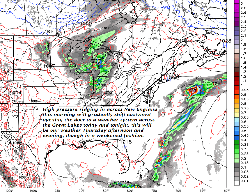
TODAY: A beauty. Blue skies and bright sunshine a few afternoon clouds. A high in the mid to upper 70s. Light south breeze.
TONIGHT: Mostly clear. A low 45 to 50. Light winds
THURSDAY: Morning sunshine then clouding up in the afternoon. Showers arriving in the afternoon, maybe a rumble of thunder late. A high in the low 70s. Light south winds.
Looking further ahead…
THURSDAY NIGHT: Good chance for rain showers exiting overnight. A low around 35 with a frost threat northern areas.
FRIDAY: Mixed clouds and sun after a frosty morning. A high in the low to mid 50s.
SATURDAY: Clouding up. Good chance for rain or showers developing. A morning low 32 to 35 with areas of frost possible. Chilly with temperatures rising through the 40s to mid 50s late.
SUNDAY Mother’s Day: Sunshine filtered through periodic high cloudiness but dry. A low in the 40s. A high upper 50s to mid 60s.
MONDAY: Mostly sunny. A low 35 to 40. A high 65 to 70.
TUESDAY: Mostly sunny. A low 40 to 45. A high 70 to 75.
WEDNESDAY: Partly cloudy. Scattered showers and a chance for thunderstorms. A low 45 to 50. A high 75 to 80.
Average lows 40 to 45. Normal highs around 65.
RH/5-9-18[end]
|
Virus-free. www.avast.com |
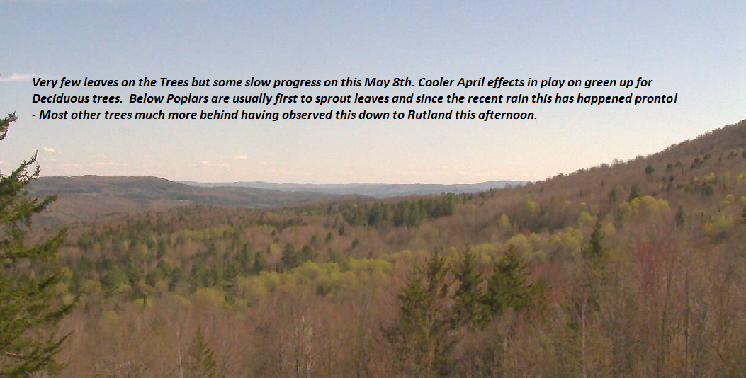
TONIGHT: Clear but not as chilly. A low 45 to 50. Little wind.
TOMORROW: Blue skies and bright sunshine a few afternoon clouds. A high in the low to mid 70s. Light south breeze.
WEDNESDAY NIGHT: Mostly clear. A low 45 to 50. Light winds
THURSDAY: Morning sunshine then clouding up in the afternoon. A rising chance for showers later in the afternoon, maybe a rumble of thunder. A high around 70. Light south winds.
Looking further ahead…
THURSDAY NIGHT: Good chance for rain showers exiting overnight. A low around 35 with a frost threat.
FRIDAY: Mixed clouds and sun after a frosty morning. A high in the low 50s.
SATURDAY: Clouding up. Chance for rain developing. A morning low around 32 with areas of frost. Chilly with temperatures rising through the 40s.
SUNDAY Mother’s Day: Lots of morning clouds with showers exiting. A low in the 40s. A high mid to upper 50s.
MONDAY: Mostly sunny. A low around 40. A high pushing to near 70.
Average lows 40 to 45. Normal highs around 65.
RH/5-8-18[end]
|
Virus-free. www.avast.com |

