Updated Monday Evening forecast — April 30th, 2018

TONIGHT: Lots of clouds. Widely scattered light showers early this evening. More rain showers likely again overnight. Areas of fog. A low around 40. Light west winds.

TOMORROW: Maybe a leftover rain shower early. Otherwise, clouds with periods of sunshine with chance for sprinkle late. Warmer. A high 60 to 65. Light northwest winds.

TUESDAY NIGHT: Scattered clouds. Patchy valley fog. A low 40 to 45. Light southwest winds.

WEDNESDAY: Partly sunny. Chance for a late day shower. A touch of humidity and breezy in the afternoon. A high around 75. West to southwest winds 10 to 25 mph.

Looking further ahead…

WEDNESDAY NIGHT: Lots of clouds. A low in the mid 50s.

THURSDAY: Partial morning sun, then more clouds. A good chance for showers and possible thunderstorms late afternoon. A bit on the muggy side. Breezy in the afternoon. A high 70 to 75.

FRIDAY: Showers and a chance for thunderstorms…some heavy. Otherwise mostly cloudy. A low in the mid 50s. A high in the 60s.

SATURDAY: Partly sunny. A low near 45. A high 60 to 65.

SUNDAY: Partly to mostly sunny. A low around 40. A high in the 60s.

Average lows upper 30s to low 40s. Normal highs in the low to mid 60s.

RH/4-30[end]
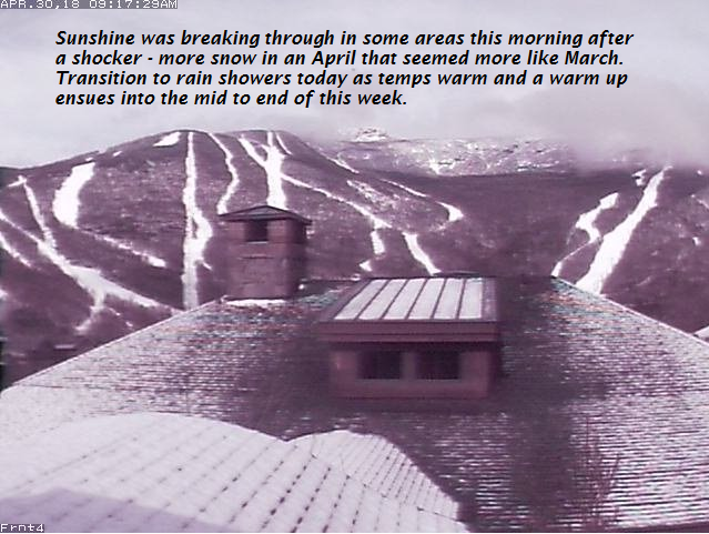
Updated Monday morning Forecast — April 30th, 2018

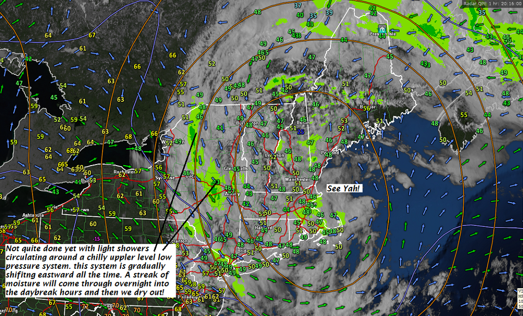
TODAY: Mainly cloudy. A few breaks of sun this afternoon. Scattered wet snow showers winding down this morning . Rain showers likely again this afternoon. A high mid 40s to around 50. Northwest winds 10 mph this afternoon.

TONIGHT: Lots of clouds. A few rain showers likely again especially overnight. Areas of fog. A low around 40. Light west winds.

TUESDAY: Maybe a leftover rain shower this morning. Increasing sunshine in the afternoon and much warmer. A high in the low to mid 60s. Light northwest winds.

Looking further ahead…

TUESDAY NIGHT: Mostly clear. Patchy valley fog. A low around 45.

WEDNESDAY: Morning sunshine then thickening clouds. A rising chance for a late day shower, maybe rumbles of thunder far northern areas late. Becoming a bit humid. A high mid 70s to around 80.

THURSDAY: Mixed clouds and sun in the morning. A good chance for showers and possible thunderstorms in the afternoon. Somewhat muggy. A low in the mid to upper 50s. A high in the low to mid 70s.

FRIDAY: Showers and a chance for thunderstorms…some heavy. Otherwise mostly cloudy. A low 55 to 60. A high around 70.

Average lows upper 30s to low 40s. Normal highs in the low to mid 60s.

RH/4-30[end]

Updated Friday Evening Forecast — April 27th, 2018

TONIGHT: Mainly cloudy. Continued showery tapering off overnight. A low about 45. Light southeast winds.

TOMORROW: Clouds mixing with intervals of sun. Scattered rain showers developing in the afternoon. A high in the low 60s. Southwest winds 10 to 20 mph.

SATURDAY NIGHT: Cloudy. Periods of light rain likely. Areas of fog. A low near 40. Light southeast winds.

SUNDAY: Gray skies. Rain showers…mixed with a few wet snow flakes high terrain in the morning. Raw with a high around 45. Light west winds.

Looking further ahead…

SUNDAY NIGHT: Mainly cloudy, maybe a leftover evening shower. A low 32 to 35.

MONDAY: Considerable cloudiness. Widely scattered sprinkles. A high 45 to 50.

TUESDAY: Partly to mostly cloudy and turning warmer.. A low around 40. A high upper 50s to low 60s.

WEDNESDAY: Sunshine gives way to afternoon cloudiness. Chance for late day showers. A low around 40. A high around 75.

THURSDAY: More clouds than sun. Widely scattered showers. Maybe a rumble of thunder. A low in the 50s. A high 65 to 75.

Average lows upper 30s to around 40. Normal highs in the in the low 60s.

RH/4-27[end]

Virus-free. www.avast.com

Updated Friday morning forecast — April 27th, 2018

TODAY: Filtered sun early then thickening clouds. Light rain arriving early to mid afternoon. A high in the mid 50s. South breeze 10 to 15 mph.

TONIGHT: Mainly cloudy. Continued showery tapering off overnight. A low 40 to 45. Light southeast winds.

SATURDAY: Clouds mixing with intervals of sun. Scattered rain showers developing in the afternoon. A high in the low to mid 60s. Southwest winds 10 to 15 mph.

Looking further ahead…

SATURDAY NIGHT: Mostly cloudy. Chance for a shower. A low 40 to 45.

SUNDAY: Mainly gray with scattered rain showers mixed with a few mountain top snowflakes. Colder with a high around 45.

MONDAY: Considerable cloudiness. Chance for more showers. A low mid 30s. A high 45 to 50.

TUESDAY: Lots of clouds. Scattered rain showers. A low 35 to 40. A high mid 40s to low 50s.

WEDNESDAY: Partly to mostly sunny. A low 35 to 40. A high reaching into the mid 70s.

Average lows upper 30s to around 40. Normal highs in the in the low 60s.

RH/4-27[end]

Virus-free. www.avast.com

Updated Thursday Evening forecast — April 26th, 2018

TONIGHT: A few leftover showers exiting northern areas this evening. Otherwise becoming partly cloudy. Patchy river valley fog. A low 35 to 40. Light southwest winds.

TOMORROW: Considerable cloudiness. Occasional light showers especially in the afternoon. A high in the mid 50s. South breeze 10 to 15 mph.

FRIDAY NIGHT: Mainly cloudy. Continued showery. A low 40 to 45. Light southeast winds.

SATURDAY: Clouds mixing with intervals of sun. Scattered rain showers developing in the afternoon. A high in the low to mid 60s. Southwest winds 10 to 15 mph.

Looking further ahead…

SATURDAY NIGHT: Mostly cloudy. Chance for a shower. A low 35 to 45.

SUNDAY: Mainly gray with scattered rain showers. A high in the 50s.

MONDAY: Considerable cloudiness. Chance for more showers. A low mid 30s. A high 45 to 50.

TUESDAY: Lot5s of clouds with scattered rain showers. A low 35 to 40. A high mid 40s to low 50s.

Average lows upper 30s to around 40. Normal highs in the in the low 60s.

RH/4-26[end]

Virus-free. www.avast.com

Updated Thursday morning Forecast — April 26th, 2018

TODAY: Occasional light rain tapering to scattered showers later this afternoon. Otherwise gray and murky or misty, maybe a late day break of sun. A high in the mid 50s. Light west breeze.

TONIGHT: Chance for a leftover shower exiting northern areas. Otherwise becoming partly to mostly cloudy. Patchy river valley fog. A low in the mid to upper 30s. Light southwest winds.

FRIDAY: Considerable cloudiness. Occasional light rain. A high 55 to 60. South breeze 10 to 15 mph.

Looking further Ahead…

FRIDAY NIGHT: Mainly cloudy. Continued showery. A low in the mid 40s.

SATURDAY: Clouds mixing with intervals of sun. Scattered rain showers developing in the afternoon. A high in the low to mid 60s.

SUNDAY: Mainly gray with scattered rain showers. A low 40 to 45. A high in the 50s.

MONDAY: Considerable cloudiness. Chance for more showers. A low in the 32 to 35. A high in the 50s beginning of a warming trend.

Average lows upper 30s to around 40. Normal highs in the in the low 60s.

Virus-free. www.avast.com

Updated Friday Evening Forecast — April 6th, 2018

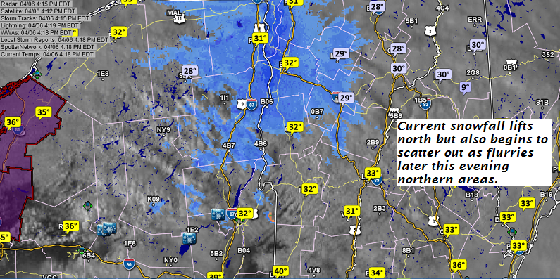
TONIGHT: Variable cloudiness. Snow showers taper to scattered flurries late this evening. Some additional minor accumulation. A low around 25. Southwest breeze 10 to 15 mph.

TOMORROW: Morning clouds with scattered flurries northern areas. Intervals of afternoon sun.A high near 35. West winds picking up 10 to 25 mph with few higher gusts in the afternoon.

SATURDAY NIGHT: Mostly clear with a few high clouds. A low 15 to 20. Light winds.

SUNDAY: Morning sun then partly to mostly cloudy. Isolated mountain flurries. A high near 35. Northwest winds 10 to 15 mph.

Looking further Ahead…

SUNDAY NIGHT: Becoming mostly clear. A low 15 to 20.

MONDAY: Morning sunshine then high cloudiness. A high 35 to 40.

TUESDAY: Mainly gray. Chance for snow or rain showers. A low 20 to 25. A high near 40.

WEDNESDAY: Chance for snow or rain showers. Breaks of sun. A low mid to upper 20s. A high around 45.

THURSDAY: A low around 30. A high near 50.

Average lows mid 20s to low 30s. Normal highs in the upper 40s to mid 50s.

RH/4-6[end]

Virus-free. www.avast.com

Updated Friday Morning Forecast — April 6th, 2018

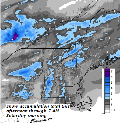
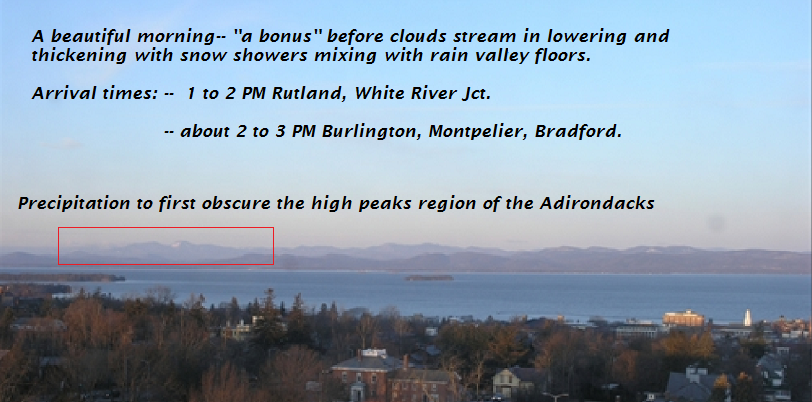
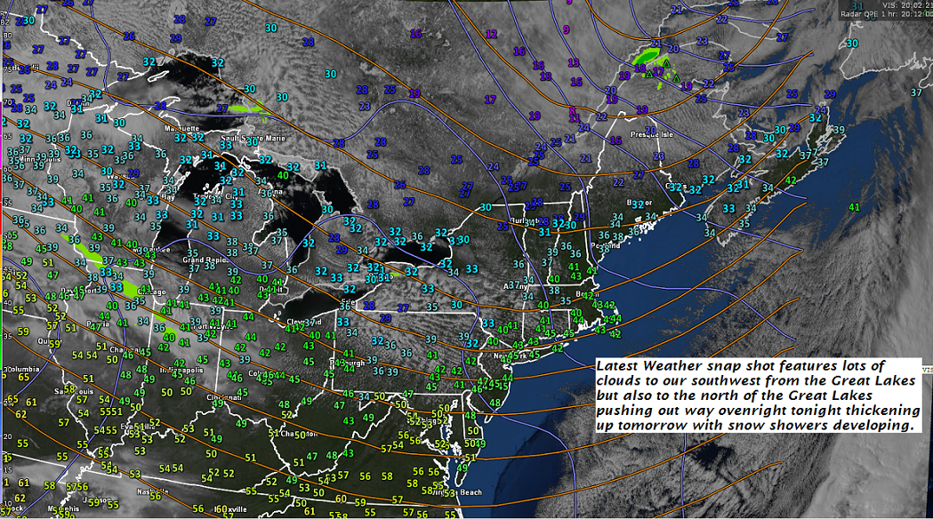
TODAY: Morning sun then clouding up. Accumulating wet snow showers, mixed with rain valley floors arriving later this afternoon. Accumulation around an inch especially higher terrain”. A high mid to upper 30s. South winds picking up 10 to 15 mph.

TONIGHT: Variable cloudiness. Occasional flurries or mountain snow showers, with minor slushy accumulation. A low around 25. Southwest breeze 10 to 15 mph.

SATURDAY: Morning clouds with scattered flurries northern areas. Intervals of afternoon sun.A high in the mid to upper 30s. West winds picking up 10 to 25 mph with few higher gusts in the afternoon.

Looking further Ahead…

SATURDAY NIGHT: Mostly clear with a few high clouds. A low 15 to 20.

SUNDAY: Morning sun then partly to mostly cloudy. Isolated mountain flurries. A high 30 to 35.

MONDAY: Morning sunshine then high cloudiness. A low 15 to 20. A high around 40.

TUESDAY: Mainly gray. Chance for snow or rain showers. A low in the upper 20s. A high near 40.

WEDNESDAY: Chance for snow or rain showers. Breaks of sun. A low mid to upper 20s. A high around 40.

Average lows mid 20s to low 30s. Normal highs in the upper 40s to mid 50s.

RH/4-6[end]

Virus-free. www.avast.com

Updated Thursday Evening Forecast — April 5th, 2018

TONIGHT: Clear except for increasing high clouds overnight. A low mid teens to low 20s. Light southwest winds.

TOMORROW: Gray skies. Accumulating wet snow showers, mixing with rain valley floors spreading south to north late morning on. Accumulation 1 to 2 locally more in the higher terrain”. A high mid to upper 30s. South winds 10 to 20 mph.

FRIDAY NIGHT: Mostly cloudy. Periods of light accumulating snow showers about an inch additional accumulation. A low around 25. Southwest breeze 10 to 15 mph.

SATURDAY: Morning clouds with scattered flurries northern areas. Intervals of afternoon sun.A high in the mid to upper 30s. West winds picking up 10 to 25 mph with few higher gusts.

Looking further Ahead…

SATURDAY NIGHT: A low 15 to 20.

SUNDAY: Sunshine giving way to more clouds in the afternoon. Stray mountain flurries. A high 30 to 35.

MONDAY: Morning sun giving way to increasing clouds. A low 15 to 20. A high around 40.

TUESDAY: Mainly gray. Chance for snow or rain showers. A low in the upper 20s. A high near 40.

WEDNESDAY: Chance for snow or rain showers. Breaks of sun. A low mid to upper 20s. A high around 40.

Average lows mid 20s to low 30s. Normal highs in the upper 40s to mid 50s.

RH/4-5[end]

Virus-free. www.avast.com

Updated Thursday morning forecast — April 5th, 2018

TODAY: A few leftover flurries this morning exiting to increasing sunshine this afternoon. Blustery, well below normal in temperature. A high in the lower 30s. West to northwest winds 10 to 25 mph with higher gusts this morning gradually diminishing.

TONIGHT: Clear except for increasing high clouds overnight. A low upper teens to low 20s. Light southwest winds.

FRIDAY: Gray skies. Chance for accumulating wet snow mixing…with rain valley floors arriving in the afternoon. Accumulation 1 to 2”. A high mid to upper 30s. South winds 10 to 15 mph.

Looking further Ahead…

FRIDAY NIGHT: Mostly cloudy. Periods of light accumulating snow or snow showers. A low in the 20s.

SATURDAY: Morning clouds chance for a flurry, then periods of afternoon sun.A high around 40.

SUNDAY: Sunshine giving way to more clouds in the afternoon. Chance for mountain snow showers and valley flurries. A low upper teens to low 20s. A high in the low to mid 30s.

MONDAY: Morning sun giving way to increasing clouds. A low near 15. A high mid 30s to low 40s.

TUESDAY: Overcast and gray. Chance for light accumulating snow. A low in the 20s. A high upper 30s to near 40.

WEDNESDAY: Chance for snow showers or flurries, then intervals of sun. A low 25 to 30. A high around 40.

Average lows mid 20s to low 30s. Normal highs in the upper 40s to mid 50s.

RH/4-5[end]

Virus-free. www.avast.com