
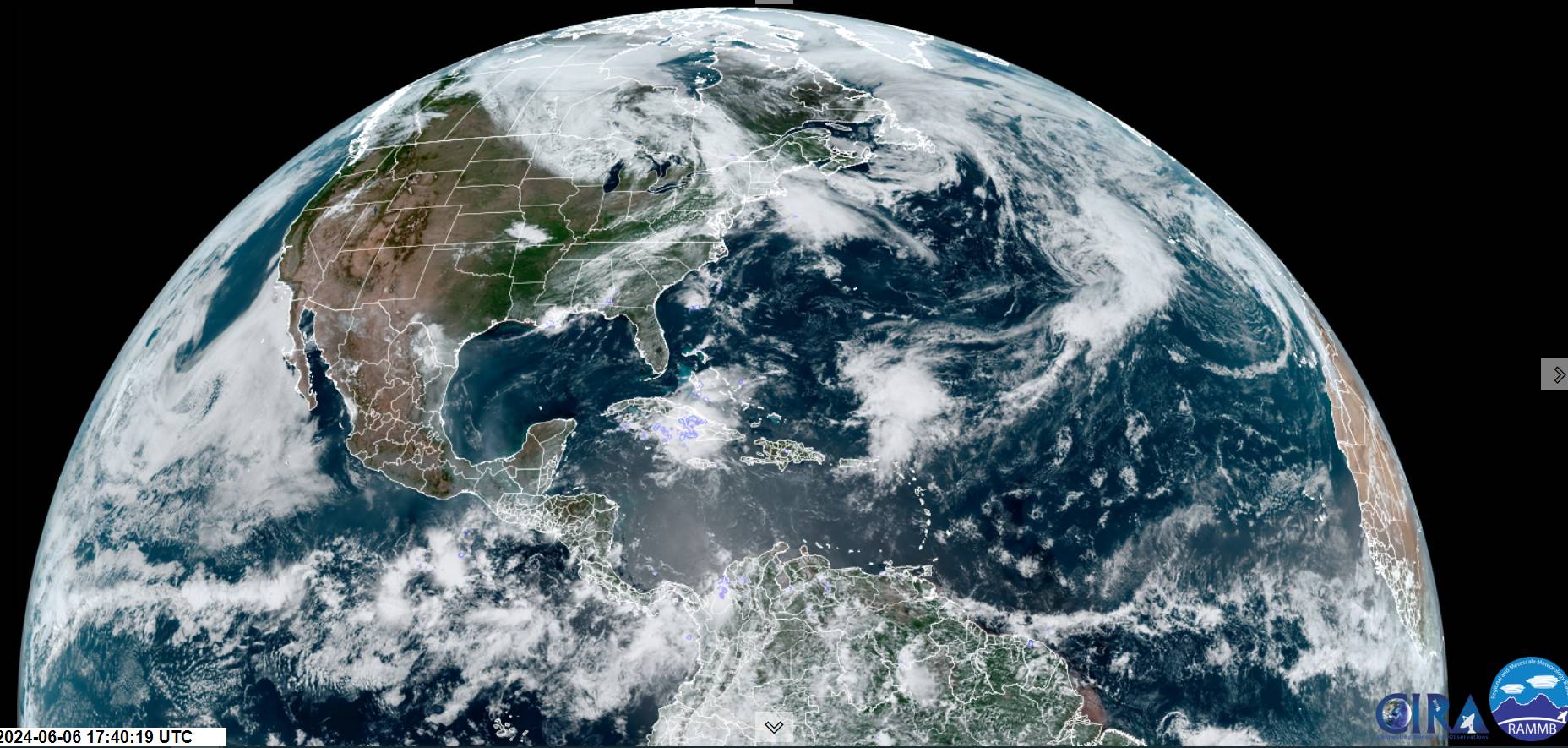
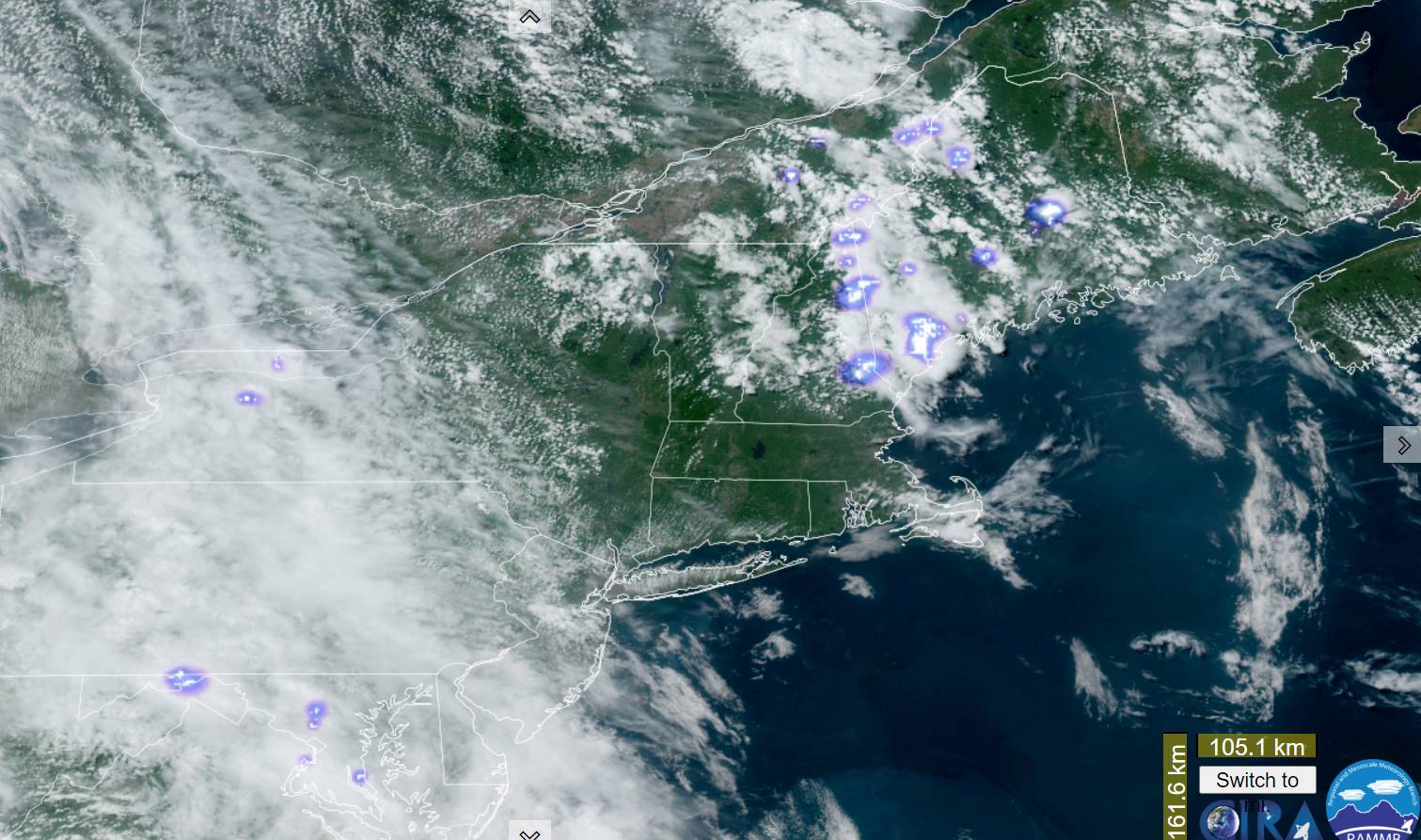
Low pressure to be dominant over the next few to several days situated in the northern Great Lakes swirling in cooler than normal conditions, and daily doses of showers and some isolated thunder far northern areas. Back to Spring!

TONIGHT: Cloudy. A band of showers, some moderate to heavy at times with and embedded thunderstorm or two,exiting to partial clearing later overnight.A low around 60. Light south to southwest winds.
TOMORROW: Mixed sun and clouds.Scattered mainly afternoon showers with a rumble of thunder northern areas. A high near 75, not so humid. Southwest breeze 10 mph.
FRIDAY NIGHT: Mostly cloudy. Scattered showers drying up. A low in the lower 50s. Light southwest winds.

SATURDAY: Lots of clouds & breezy.Afternoon showers becoming likely.A high in the upper 60s. West breeze 10 to 15 mph.
Looking further ahead
SATURDAY NIGHT: Scattered showers drying up early. Cloudy Chance for more showers arriving toward daybreak. A low 50 to 55.

SUNDAY: Partly to mostly cloudy & cool. Chance for showers, maybe a rumble of afternoon thunder. A high in the upper 60s.
MONDAY: Morning sun, then mostly cloudy. Chance for a shower or two. A low around 50. A high around 65.
TUESDAY: Clouds mixed with some sun. Scattered light sprinkles. A low around 50. A high upper 60s.
Average lows mid-40s to low 50s. Average highs 70 to 75.
RH/6-5forecast][end]
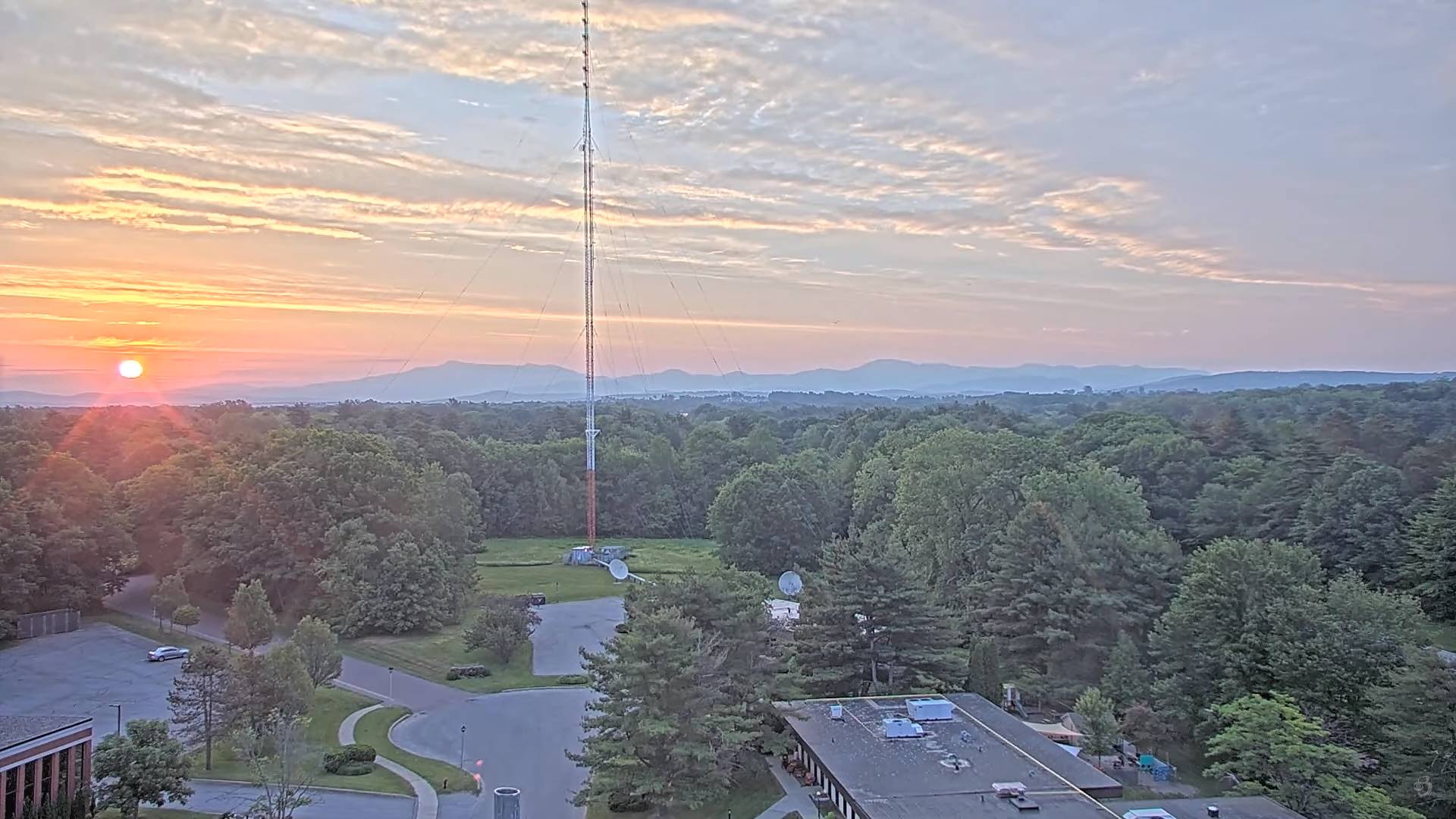
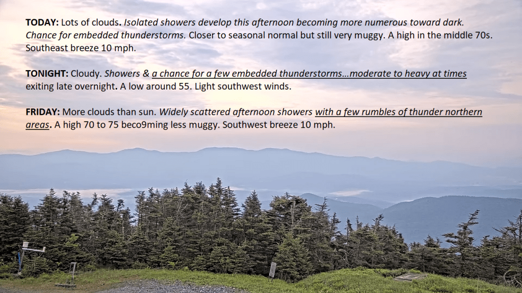
TODAY: Lots of clouds. Isolated showers develop this afternoon becoming more numerous toward dark. Chance for embedded thunderstorms.Closer to seasonal normal but still very muggy. A high in the middle 70s. Southeast breeze 10 mph.
TONIGHT: Cloudy.Showers & a chance for a few embedded thunderstorms…moderate to heavy at times exiting late overnight. A low around 55. Light southwest winds.
FRIDAY: More clouds than sun.Widely scattered afternoon showers with a few rumbles of thunder northern areas. A high 70 to 75 becoming less muggy. Southwest breeze 10 mph.
Looking further ahead
FRIDAY NIGHT: Mostly cloudy. Scattered showers and isolated rumbles of thunder winding down. A low 50 to 55.
SATURDAY: Lots of clouds.Chance for showers, maybe a rumble of thunder.A high mid to upper 60s.
SUNDAY: Partly to mostly cloudy & cool. Chance for showers, maybe a rumble of thunder. A low 50 to 55. A high in the upper 60s.
MONDAY: Morning sun, then mostly cloudy. Chance for a shower or two. A low around 50. A high around 65.
TUESDAY: Clouds mixed with some sun. Scattered light sprinkles. A low around 50. A high upper 60s.
Average lows mid-40s to low 50s. Average highs 70 to 75.
RH/6-5forecast][end]
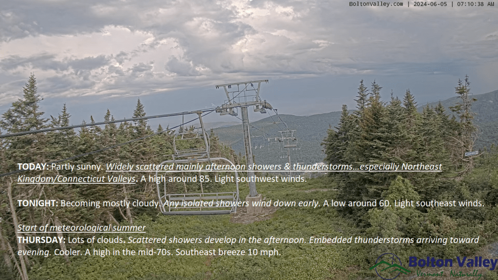
TONIGHT: Becoming mostly cloudy. Isolated showers wind down early. A low around 60. Light southeast winds.
Start of meteorological summer
TOMORROW: Lots of clouds. Scattered showers develop in the afternoon. Embedded thunderstorms arriving toward evening.Cooler.A high in the mid-70s. Southeast breeze 10 to 15 mph.
THURSDAY NIGHT: Overcast.Showers & embedded heavier thunderstorms likely…exiting later overnight. A low 55 to 60. Light south winds.
FRIDAY: Lots of clouds.Widely scattered afternoon showers with a few rumbles of thunder. A high around 70. Light southwest winds.
Looking further ahead
FRIDAY NIGHT: Mostly cloudy. Scattered showers and isolated rumbles of thunder winding down. A low near 55.
SATURDAY: Considerable cloudiness.Chance for showers, some heavy and isolated rumbles of thunder.A high in the upper 60s near 70.
SUNDAY: Mostly cloudy damp and cool. Chance for showers. A low 50 to 55. A high mid to upper 60s.
MONDAY: Sunshine then mostly cloudy. Chance for showers and possible thunderstorms. A low 50 to 55. A high in the mid-60s.

Average lows mid-40s to low 50s. Average highs 70 to 75.
RH/6-5forecast][end]
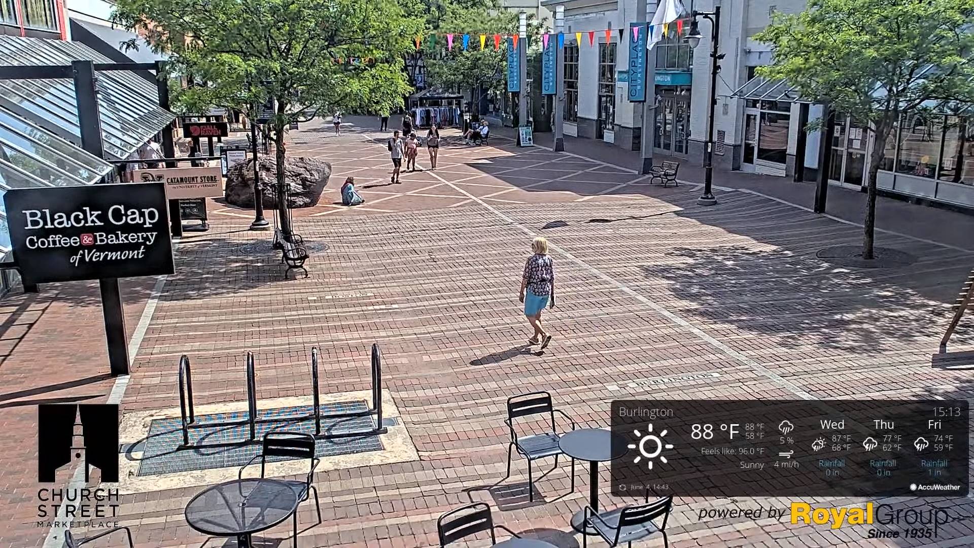
TODAY: Partly sunny.Widely scattered mainly afternoon showers & thunderstorms…especially Northeast Kingdom/Connecticut Valleys. A high around 85. Light southwest winds.
TONIGHT: Becoming mostly cloudy. Any isolated showers wind down early. A low around 60. Light southeast winds.
Start of meteorological summer
THURSDAY: Lots of clouds. Scattered showers develop in the afternoon. Embedded thunderstorms arriving toward evening.Cooler.A high in the mid-70s. Southeast breeze 10 mph.
Looking further ahead
THURSDAY NIGHT: Overcast.Showers & embedded heavier thunderstorms likely…exiting later overnight. A low 55 to 60.
FRIDAY: Lots of clouds.Widely scattered afternoon showers with a few rumbles of thunder. A high around 70.
SATURDAY: Considerable cloudiness.Chance for showers, some heavy and isolated rumbles of thunder.A low near 55. A high in the upper 60s near 70.
SUNDAY: Mostly cloudy damp and cool. Chance for showers. A low 50 to 55. A high mid to upper 60s.
MONDAY: Sunshine then mostly cloudy. Chance for showers and possible thunderstorms. A low 50 to 55. A high in the mid-60s.
Average lows mid-40s to low 50s. Average highs 70 to 75.
RH/6-5forecast][end]

TONIGHT: Maybe an early sprinkle southern areas, otherwise fair with high clouds. A low upper 50s.Light south to southeast winds.
TOMORROW: Morning sun, then afternoon clouds.Widely scattered afternoon showers & thunderstorms especially Connecticut and Champlain Valleys. A high around 85. Light southwest winds.
WEDNESDAY NIGHT: Partly to mostly cloudy. Any isolated showers wind down early. . A low around 60. Light southeast winds.

Start of meteorological summer
THURSDAY: Mainly gray. Scattered showers in the afternoon. Isolated embedded heavy thunderstorms toward evening.Cooler.A high in the mid-70s. Southeast breeze 10 mph.
Looking further ahead
THURSDAY NIGHT: Overcast.Showers & a few embedded heavier thunderstorms likely…exiting after midnight. A low 55 to 60.

FRIDAY: Lots of clouds.Widely scattered afternoon showers with a few rumbles of thunder. A high around 70.
SATURDAY: Considerable cloudiness.Chance for showers, some heavy and isolated rumbles of thunder.A low near 55. A high in the upper 60s near 70.
SUNDAY: Mostly cloudy damp and cool. Chance for showers. A low 50 to 55. A high mid to upper 60s.
Average lows mid-40s to low 50s. Average highs 70 to 75.
RH/6-4forecast][end]

TODAY: Sunshine with some high cloudiness. A high in the mid-80s…with low humidity. Light & variable winds.
TONIGHT: Mostly clear. A low mid to upper 50s.Light southeast winds.
WEDNESDAY: Morning sun, then afternoon clouds.Scattered afternoon showers & thunderstorms. A high around 85. Light south to southwest winds.

Looking further ahead
WEDNESDAY NIGHT: Partly to mostly cloudy. Isolated to widely scattered evening showers and thunderstorms wind down. A low around 60.
Start of meteorological summer June 6th
THURSDAY: Mainly gray. Good chance for showers with embedded thunderstorms…some heavy late in the day. A cooling trend.A high in the mid-70s.

FRIDAY: Lots of clouds.Scattered showers and late afternoon thunderstorms. A low 55 to 60. A high around 70.
SATURDAY: Considerable cloudiness.Chance for showers and afternoon thunderstorms, some heavy.A low near 55. A high in the upper 60s near 70.
SUNDAY: Mostly cloudy damp and cool. Chance for showers…some heavy with isolated rumbles of thunder. A low 50 to 55. A high mid to upper 60s.
Average lows mid-40s to low 50s. Average highs 70 to 75.
RH/6-4forecast][end]

