Updated Friday Morning Forecast — May 12th, 2023

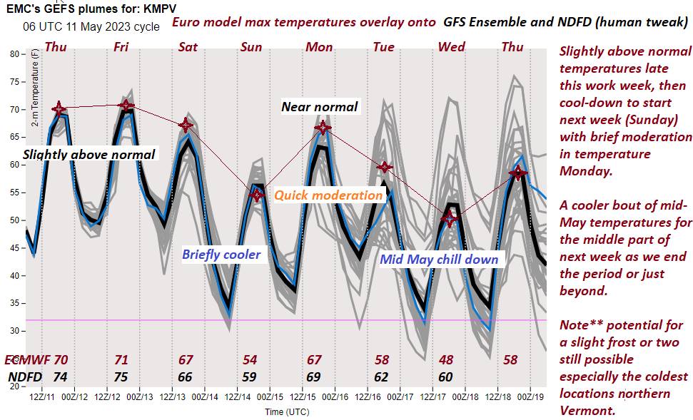
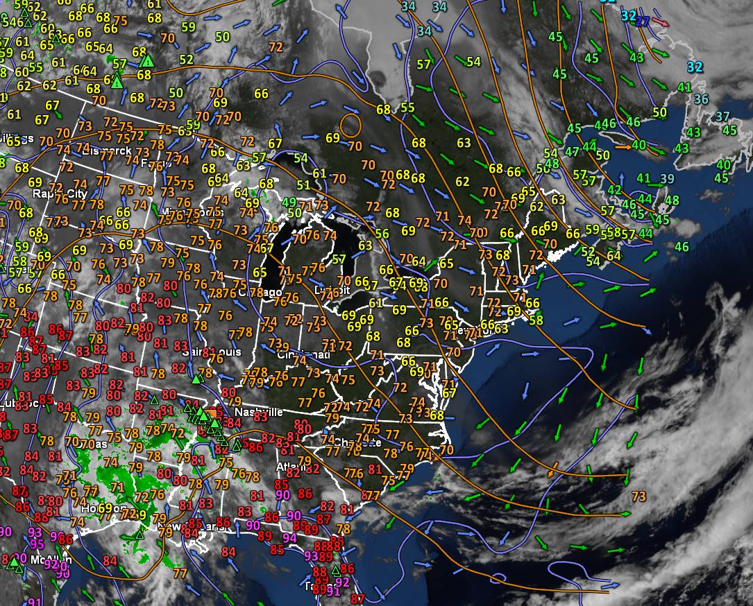
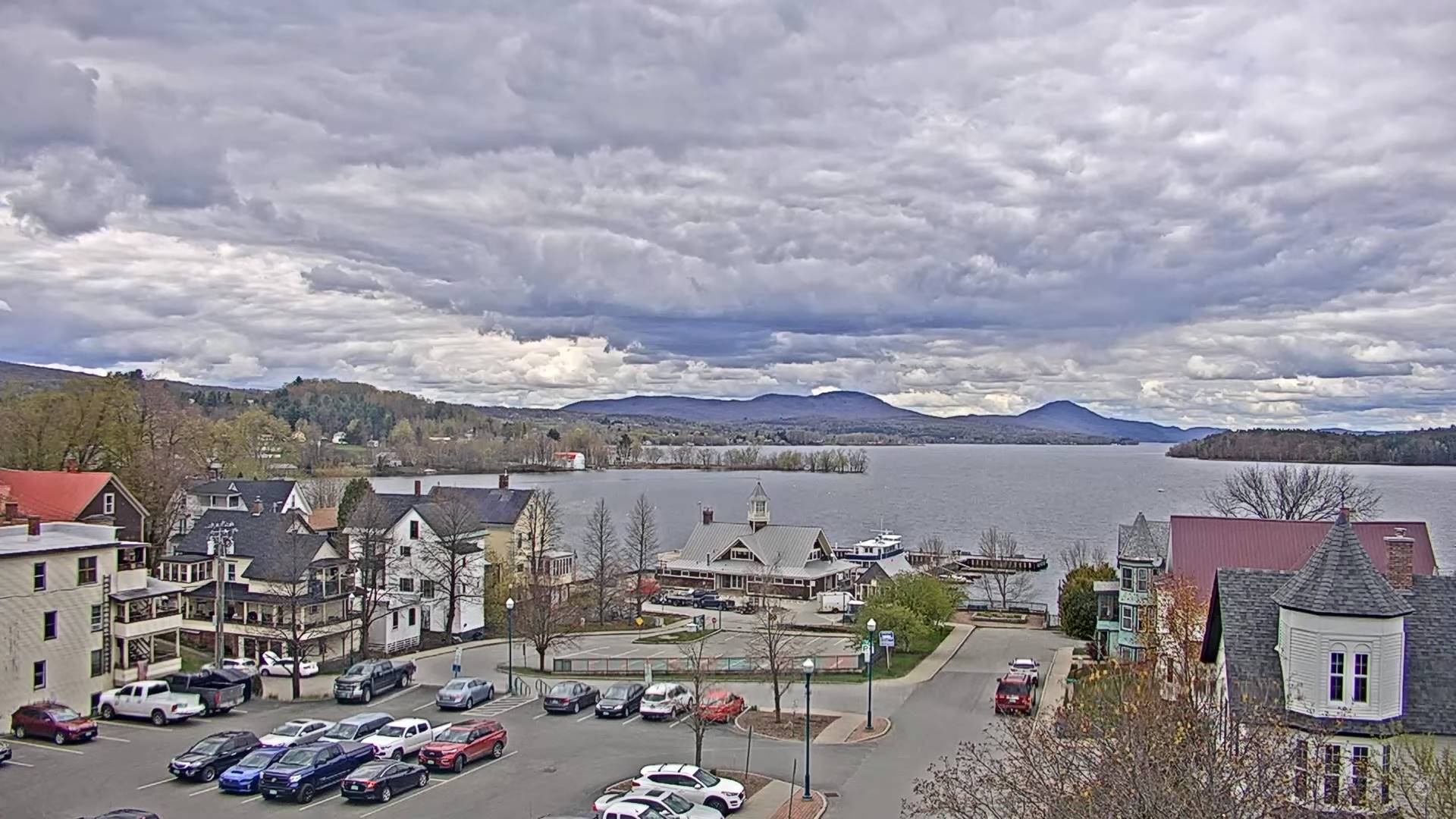
TODAY: Morning showers exiting early to periods of sunshine. Maybe an isolated shower Northeast Kingdom. A high around 75. Southwest breeze shifting to northwesterly 10 to 15 mph.

TONIGHT: Some evening clouds then mostly clear. A low around 50. Northwest winds pick up 10 mph overnight.

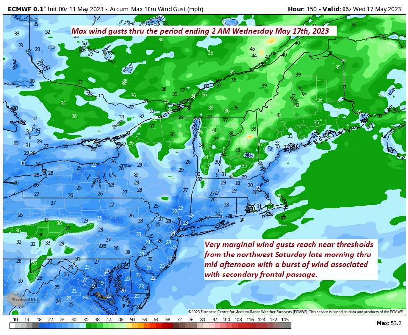
SATURDAY: Partial morning sun, then sunny and breezy in the afternoon. A high in the mid-60s. Northwest winds 10 to 20 mph.

Looking further ahead

SATURDAY NIGHT: Mostly clear & colder. A low 35 to 40, with a touch of frost possible.

SUNDAY MOTHERS DAY: Morning clouds then mostly sunny but cool and blustery at times. A high only around 55.

MONDAY: Partly sunny in the morning then cloudy. Maybe a shower late. A low 35 to 40. A high around 65

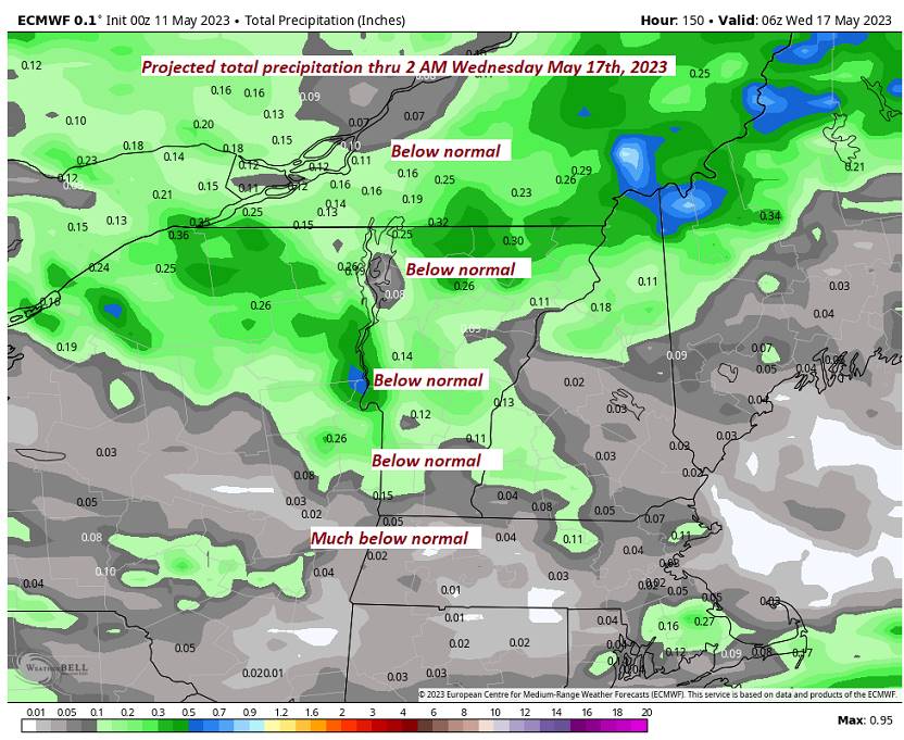
TUESDAY: Partly to mostly cloudy. Chance for showers northern areas more widespread later on. A low 45 to 50. A high 60 to 65.

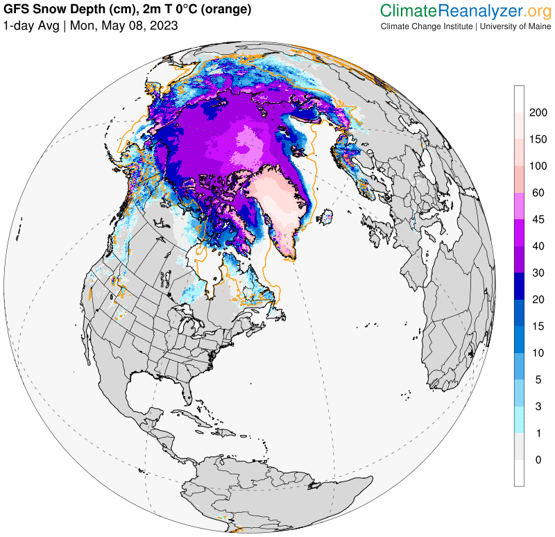
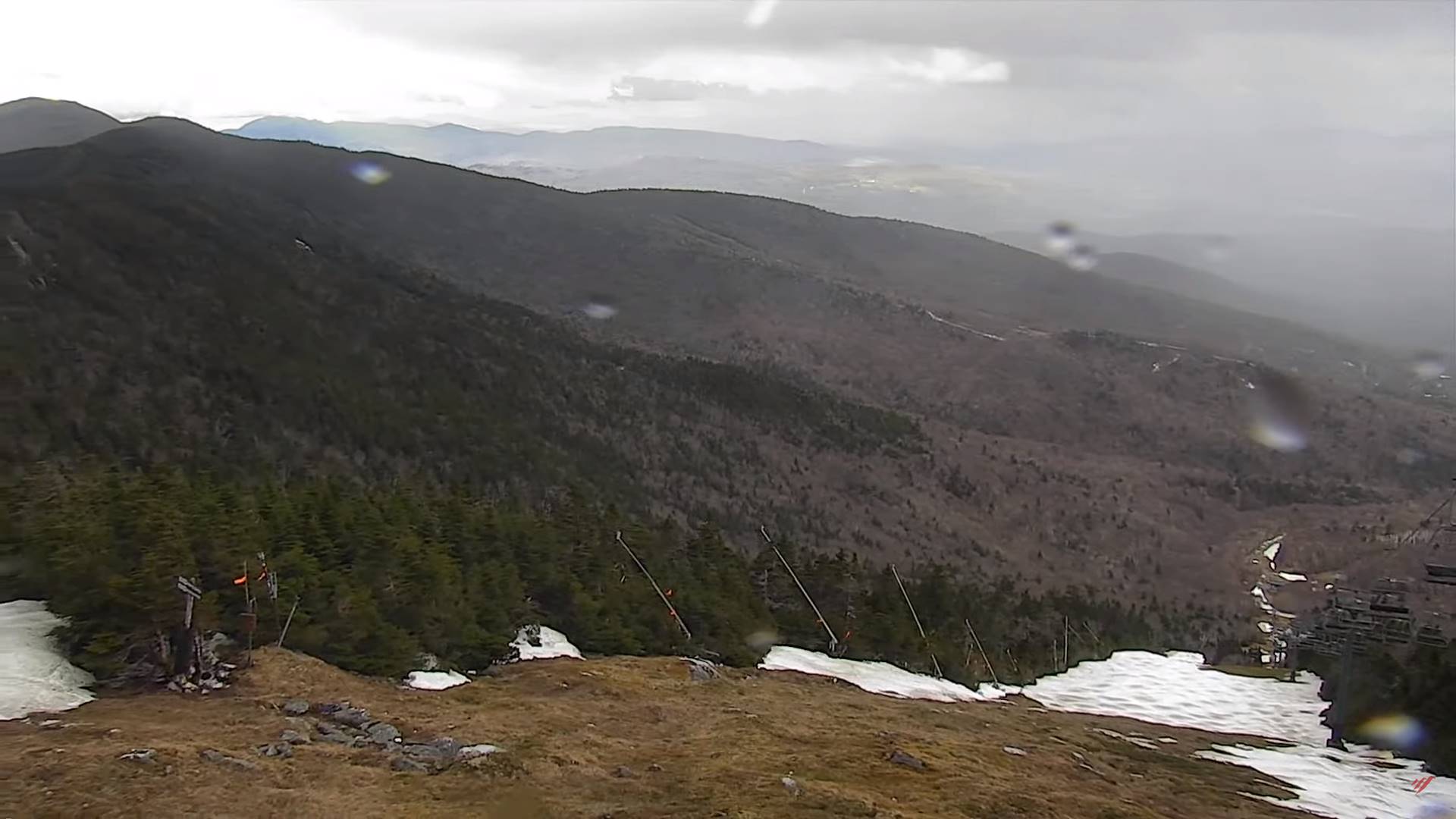
WEDNESDAY: Mostly cloudy. Scattered rain showers possibly mixed with wet snowflakes higher terrain. A low mid-30s to around 40. A high low to mid 50s.

Average lows ranging upper 30s to mid-40s. Average highs low to mid 60s

Start of Meteorological summer June the 6th.

RH/5-11 forecast][end]

Updated Thursday Evening Forecast — May 11th, 2023

TONIGHT: Fair with some high clouds this evening, thickening up overnight. A chance for showers arriving western areas late. A low in the low 50s. Light southwest winds.

TOMORROW: Variably cloudy, with a chance for morning showers. Partly sunny in the afternoon with an isolated shower or thunderstorm northeastern Vermont. A high around 75. Southwest breeze shifting to northwesterly 10 to 15 mph.

FRIDAY NIGHT: Some evening cloudy periods with a slight chance for a shower. A low in the lower 50s. Northwest winds pick up 10 mph overnight.

SATURDAY: Partial morning sun, then sunny and breezy at times. A high in the mid-60s. Northwest winds 10 to 25 mph and gusty.

Looking further ahead

SATURDAY NIGHT: Mostly clear. A low mid to upper 30s, with threat for isolated frost.

SUNDAY MOTHERS DAY: Morning clouds then partly sunny. A high upper 50s.

MONDAY: Partly sunny in the morning with more clouds in the afternoon. A rising chance for showers Monday evening. A low near 40. A high in the mid-60s.

TUESDAY: Morning cloudiness with a few showers possible, then partial clearing. A low in the 40s. A high around 60.

Average lows ranging upper 30s to mid-40s. Average highs low to mid 60s

Start of Meteorological summer June the 6th.

RH/5-11 forecast][end]

Updated Thursday Morning Forecast — May 11th, 2023

TODAY: Mostly sunny with few more afternoon clouds. An isolated pop up shower or thunderstorm possible. A high near 75. Light west to northwest breeze.

TONIGHT: A mostly clear evening, giving way to lots of clouds overnight with a rising chance for a shower western areas toward daybreak .A low in the low 50s. Light southwest winds.

FRIDAY: Clouds with breaks of sun. Scattered passing morning showers, more isolated in the afternoon with a rumble of thunder possible. A high around 75. Southwest breeze shifting to northwesterly 10 to 15 mph.

Looking further ahead

FRIDAY NIGHT: Scattered clouds. Maybe a leftover shower. A low in the lower 50s.

SATURDAY: Some morning cloudiness, then mostly sunny. A high in the mid-60s.

SUNDAY MOTHERS DAY: Filtered sunshine thru high clouds. A low upper 30s around 40. A high upper 50s.

MONDAY: Partly sunny in the morning with more clouds in the afternoon. A rising chance for showers Monday evening. A low near 40. A high in the mid-60s.

TUESDAY: Morning cloudiness with a few showers possible, then partial clearing. A low in the 40s. A high around 60.

Average lows ranging upper 30s to mid-40s. Average highs low to mid 60s

Start of Meteorological summer June the 6th.

RH/5-11 forecast][end]

Updated Wednesday Evening Forecast — May 10th, 2023

TONIGHT: A few early evening clouds, then clear & partially moonlit. A low around 45. Light southwest winds.

TOMORROW: Lots of sunshine. Isolated to widely scattered showers Champlain Valley and southern Vermont with threat for a rumble of thunder. A high near 75. Northwest breeze 10 mph.

THURSDAY NIGHT: A mostly clear evening, giving way to lots of clouds overnight with a rising chance for a few showers far northern areas. A low around 50. Light southwest winds.

FRIDAY: Clouds with breaks of sun. Good chance for morning showers, becoming isolated in the afternoon with a possible thunderstorm or two. A high near 75. Southwest breeze shifting to northwesterly 10 to 15 mph.

Looking further ahead

FRIDAY NIGHT: Scattered clouds. Maybe a leftover shower. A low in the lower 50s.

SATURDAY: Some morning cloudiness, then mostly sunny. A high in the mid-60s.

SUNDAY: Filtered sunshine thru high clouds. A low 35 to 40. A high upper 50s around 60.

MONDAY: Partly sunny in the morning with more clouds in the afternoon. A rising chance for showers late. A low in the low 40s. A high 60 to 65.

TUESDAY: Morning cloudiness with a few showers possible, then partial clearing. A low 40 to 45. A high around 60.

Average lows ranging upper 30s to mid-40s. Average highs low to mid 60s

Start of Meteorological summer June the 6th.

RH/5-10 forecast][end]

Updated Wednesday Morning Forecast — May 10th, 2023

TODAY: Sunshine mixing with a few afternoon clouds. A high mid to upper 60s. Northwest breeze 10 mph.

TONIGHT: A few early evening clouds, then clear & partially moonlit. A low in the low to mid 40s. Light west winds.

THURSDAY: Morning sunshine then partly sunny in the afternoon. Chance for a few afternoon showers & possible rumbles of thunder…Champlain Valley and southern Vermont. A high in the low 70s. Northwest breeze 10 mph.

Looking further ahead

THURSDAY NIGHT: Mostly clear in the evening, giving way to high cloudiness, thickening up overnight. A low in the upper 40s.

FRIDAY: Clouds with breaks of sun. Good chance for morning showers, becoming isolated in the afternoon with a possible thunderstorm or two. A high low to mid 70s.

SATURDAY: Some morning cloudiness, then mostly sunny. A low around 50. A high in the mid-60s.

SUNDAY: Filtered sunshine thru high clouds. A low 35 to 40. A high upper 50s around 60.

MONDAY: Partly sunny in the morning with more clouds in the afternoon. A rising chance for showers late. A low in the low 40s. A high 60 to 65.

TUESDAY: Morning cloudiness with a few showers possible, then partial clearing. A low 40 to 45. A high around 60.

Average lows ranging upper 30s to mid-40s. Average highs low to mid 60s

Start of Meteorological summer June the 6th.

RH/5-10 forecast][end]

Updated Tuesday Evening Forecast — May 9th, 2023

TONIGHT: Clear and partially moonlit. A low 30 to 35 with areas of frost. Little wind.

TOMORROW: Sunshine mixed with some afternoon clouds. A high mid-60s. Northwest breeze 10 mph.

WEDNESDAY NIGHT: A few early evening clouds, then clear & partially moonlit. A low in the mid-40s. Light west winds.

THURSDAY: Morning sunshine then partly sunny in the afternoon. Chance for a few afternoon showers & thunderstorms especially Champlain Valley and southern Vermont. A high 70 to 75. Northwest breeze 10 mph.

Looking further ahead

THURSDAY NIGHT: Fair with high cloudiness, thickening up some later on. A low in the upper 40s.

FRIDAY: Clouds mixing with intervals of sun. Widely scattered afternoon shower & thunderstorms. A high near 75.

SATURDAY: Filtered sunshine thru high cloudiness. A low around 50. A high in the mid-60s.

SUNDAY: Filtered sunshine. A low 35 to 40. A high 60 to 65.

Average lows ranging upper 30s to mid-40s. Average highs low to mid 60s

Start of Meteorological summer June the 6th.

RH/5-9 forecast][end]

Updated Tuesday morning Forecast — May 9th, 2023

TODAY: Lots of sunshine with a few afternoon clouds. A high mid to upper 50s. North to northwest winds 10 mph.

TONIGHT: Clear and partially moonlit. A low 30 to 35 with areas of frost likely. Little wind.

WEDNESDAY: Sunshine mixed with some afternoon clouds. A high around 65. Northwest breeze 10 mph.

Looking further ahead

WEDNESDAY NIGHT: A few early evening clouds, then clear & partially moonlit. A low in the mid-40s.

THURSDAY: Morning sunshine then partly sunny in the afternoon. An isolated shower southern areas. A high

70 to 75.

FRIDAY: Partly sunny. Chance for passing showers and thunderstorms. A low 40 to 45. A high reaching the mid-70s.

SATURDAY: Filtered sunshine thru high cloudiness. A low in the upper 40s. A high around 65.

SUNDAY: Filtered sunshine. A low in the mid to upper 30s. A high 60 to 65.

Average lows ranging upper 30s to mid-40s. Average highs low to mid 60s

Start of Meteorological summer June the 6th.

RH/5-9 forecast][end]

Updated Monday Evening Forecast — May 8th, 2023

TONIGHT: Clear & moonlit. A low in the low to mid-30s with a scattered frost. Light north winds.

TOMORROW: Sunny, with a few afternoon clouds. A high in the upper 50s. North to northwest winds 10 mph.

TUESDAY NIGHT: Clear and partially moonlit. A low 32 to 35 with areas of frost. Little wind.

WEDNESDAY: Sunshine mixed with some afternoon clouds. A high near 65. Northwest breeze 10 mph.

Looking further ahead

WEDNESDAY NIGHT: Clear & partially moonlit. A low 40 to 45.

THURSDAY: Lots of sunshine with a few high clouds. A high in the lower 70s.

FRIDAY: Partly sunny. Chance for passing showers and thunderstorms. A low 40 to 45. A high reaching the mid-70s.

SATURDAY: Filtered sunshine thru high cloudiness. A low 45 to 50. A high near 65.

SUNDAY: Hints of sunshine thru high cloudiness. A low in the mid to upper 30s. A high upper 50s.

Average lows ranging upper 30s to mid-40s. Average highs low to mid 60s

Start of Meteorological summer June the 6th.

RH/5-8 forecast][end]

Updated Monday morning Forecast — May 8th, 2023

TODAY: Sunny. A high in the low 60s. Northwest winds 10 to 20 mph.

TONIGHT: Clear & moonlit. A low in the low to mid-30s with a scattered frost. Light north winds.

TUESDAY: Sunny, with a few afternoon clouds. A high in the upper 50s to near 60. North to northwest winds 10 mph.

Looking further ahead

TUESDAY NIGHT: Clear and moonlit. A low in the low to mid 30s with scattered frost.

WEDNESDAY: Mostly sunny. A high near 65.

THURSDAY: Lots of sunshine with a few high clouds. A low in the low 40s. A high around 70.

FRIDAY: Partly sunny. Chance for passing showers and thunderstorms. A low 40 to 45. A high reaching the mid-70s.

SATURDAY: Filtered sunshine thru high cloudiness. A low 45 to 50. A high near 65.

SUNDAY: Hints of sunshine thru high cloudiness. A low in the mid to upper 30s. A high upper 50s.

Average lows ranging upper 30s to mid-40s. Average highs low to mid 60s

Start of Meteorological summer June the 6th.

RH/5-8 forecast][end]

Updated Friday Evening Forecast — May 5th, 2023

TONIGHT: Mostly clear with a few high clouds. Patchy valley fog overnight. A low 35 to 40. Light southeast winds.

TOMORROW: Patchy morning fog then partly sunny. A high reaching the mid-60s. Northwest winds 10 to 15 mph.

SATURDAY NIGHT: Mostly clear. Patchy valley fog. A low 40 to 45. Light northwest winds.

SUNDAY: More clouds than sunshine. A high near 65. Northwest breeze 10 mph.

Looking further ahead

SUNDAY NIGHT: Variably cloudy, then clearing overnight. A low near 45.

MONDAY: Mostly sunny. A high near 60.

TUESDAY: Patchy valley fog then partly to mostly sunny. A low 40 to 45. A high lower 60s.

WEDNESDAY: Mostly sunny. A low 35 to 40. A high near 65.

Average lows ranging mid-30s to low 40s. Average highs 60 to 65.

Start of Meteorological summer June the 6th.

RH/5-5 forecast][end]