
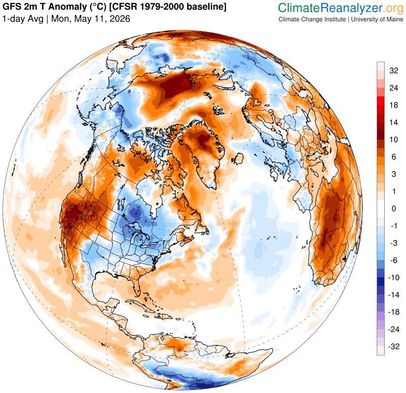
TONIGHT: Becoming mostly clear. Any northern border sprinkles exit early. A low 30 to 35. Light northwest winds.
TOMORROW: Brief early sun, then lots of clouds. A high in the low 50s Northwest winds 10 mph.

TUESDAY NIGHT: Mostly cloudy. A low around 35. Winds becoming light southeasterly.
WEDNESDAY: Gray. Becoming wet and raw. Rising chance for periods of rain, moderate at times mid-day on. A high 50 to 55. Southeast winds 10 to 15 mph.

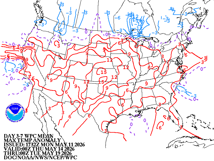
Looking further ahead
WEDNESDAY NIGHT: Overcast. Chance for periods of rain, moderate at times. A low near 45.
THURSDAY: Gloomy. Chance for periods of rain, moderate at times. Highs near 55.
FRIDAY: Chance for early showers exiting. Otherwise, clouds with break of sun possible.High upper 50s south to low 60s north.
SATURDAY: More sun than clouds. Widely scattered afternoon showers with a few rumbles of thunder. Lows 40s. Highs 60s.
Average low: upper 30s to mid-40s Average high mid to upper 60s.
Start of meteorological summer or warmest 90 days June 6th…
RH/5-11/forecast][end] Fox Trot Delta Tango
