
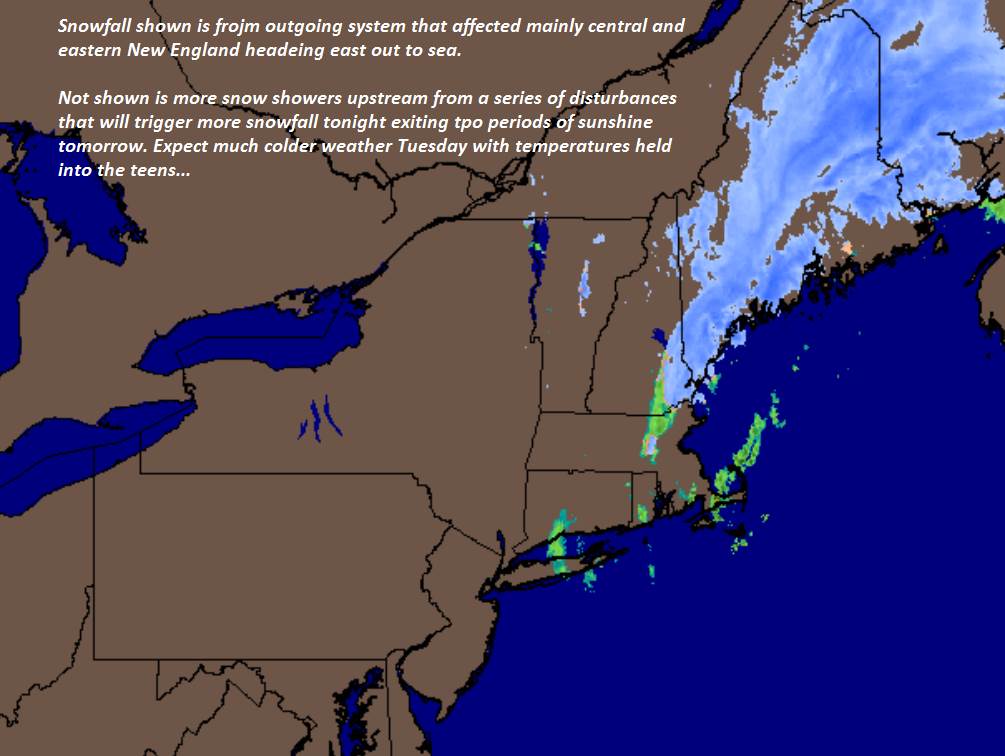
TODAY: Scattered flurries this morning. Flurries and mountain snow showers developing later this afternoon with minor accumulation. A high near 35. Winds becoming west to northwesterly 10 to 15 mph.
TONIGHT: Occasional flurries and mountain snow showers most persistent near the Greens. Accumulation dusting to 2 inches possibly more western slopes. A low in the mid teens. Northwest winds 10 to 25 mph.
TUESDAY: Blustery with lowered wind chills. Any leftover morning flurries exiting to periods of afternoon sunshine. Temperatures holding in the teens. Northwesterly winds 10 to 25 mph.
Looking further ahead…
TUESDAY NIGHT: Mostly clear and frigid. A low 5 below to 5 above.
WEDNESDAY: Mostly sunny. A high in the mid to upper 20s.
THURSDAY: Lots of sunshine, giving way to increasing high clouds. A low in the teens. A high 35 to 40.
FRIDAY: Overcast. Periods of rain possibly moderate at times with pockets of freezing rain and icy travel early. A low in the low 30s. A high in the mid 40s to low 50s.
Average lows low to mid teens.. Average highs upper 20s to mid 30s.
RH/12-17[end]
