
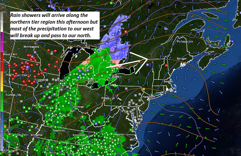
TODAY: Lots of clouds but milder. A rising chance for rain showers northern areas late this afternoon. A high peaking near 40. South breeze 10 to 15 mph.
TONIGHT: Mainly cloudy. Scattered sprinkles far northern areas this evening – watch for slick spots! A low near 32. Light southwest winds.
SATURDAY: Clouds mixed with intervals of sun. A high near 40. Winds becoming northwesterly 10 to 20 mph.
Looking further ahead…
SATURDAY NIGHT: Becoming mostly clear and colder. A low in the single digits.
SUNDAY: Increasing clouds. A rising chance for mixed precipitation with slick travel developing late far southern areas. A high in the mid 30s.
MONDAY: Gray skies. Scattered flurries especially in the mountains with minor accumulation possible. A low in the 20s. A high near 35.
TUESDAY: Mostly cloudy, much colder and blustery. Chance for lingering flurries and mountain snow showers. Some minor accumulation. Lowering wind chills. Temperatures in the teens.
WEDNESDAY: Mixed clouds and sun. A low in the single digits. A high in the 20s.
THURSDAY: Lots of sunshine, giving way to increasing clouds. A low in the teens. A high pushing near 40.
Average lows mid teens to around 20. Average highs ranging 30 to 35.
RH/12-14[end]
