
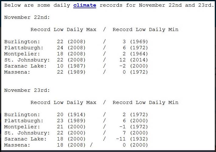
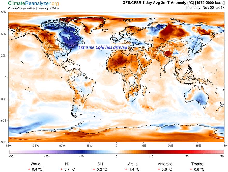
TODAY: Morning flurries especially I-89 corridor with a dusting of accumulation, otherwise periods of sunshine but frigid. Record cold high temperatures of close to 10 above. Northwest winds 10 to 20 mph lowering wind chills
Full Beaver Moon 12:39 AM
TONIGHT: Scattered clouds otherwise fully moonlit. Near record lows 5 below to 5 above. Light northwest winds.
FRIDAY: Sunny. A high in the low 20s begins a warming trend. Light southwest winds.
Looking further ahead…
FRIDAY NIGHT: Clear and cold. A low near 10 above.
SATURDAY: Sunshine filtered by high cloudiness thickening up late. A high in the mid 30s.
SUNDAY: Gray. Periods of rain likely with a risk for pockets of freezing rain early east of the Green Mountains. A low in the upper 20s to low 30s. A high in the upper 30s.
MONDAY: Cloudy. Good chance for a mixed bag of precipitation developing late in the day. A low around 30. A high around 40.
TUESDAY: Chance for periods of wet snow or mixed precipitation. A low around 30. A high near 35.
Average lows low to mid 20s. Average highs upper 30s to low 40s.
RH/11-22-18[end]
