
-
- image0013
-
- image002
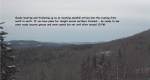
Winter Storm Warning Northeast Kingdom, Winter Weather Advisory elsewhere 7 PM this evening…into Friday afternoon
TONIGHT: Accumulating snow developing from south to north this evening…moderate at times. 2 to 5”on the ground by daybreak. A low around 25. Light southeast winds.
TOMORROW: Gray. Snow… especially morning hours tapering off with brief sleet and pockets of freezing rain possible before winding down midafternoon. A high in the low 30s. Light northeast winds.
FRIDAY NIGHT: Considerable clouds. Scattered light snow showers or flurries with additional minor accumulation. A low around 30. West breeze 10 mph.
SATURDAY: Scattered mountain snow showers…with some minor accumulation. Scattered rain showers valley floors, otherwise intervals of sun developing and blustery. A high in the upper 30s. West to northwest winds 10 to 25 mph.
Looking further ahead…
SATURDAY NIGHT: Scattered evening snow showers or flurries with a skiff of accumulation. A low in the mid to upper teens.
SUNDAY: Partly sunny, giving way more clouds in the afternoon. A high near 30.
MONDAY: Overcast. Chance for accumulating wet snow possible mixed precipitation. A low in the teens. A high around 32.
TUESDAY: Sunny but frigid. A low in the single digits. A high only in the mid teens.
Average lows mid 20s to low 30s. Average highs 40 to 45.
RH/11-15-18[end]
