
Updated Thursday morning Forecast — November 9th, 2023

Winter Weather Advisory thru 1 PM this afternoon…
TODAY: Cloudy. A wintry mix with slippery travel this morning…transitioning to scattered light rain showers this afternoon, but a few pockets of freezing rain may linger east of the Green Mountains. A late day high in the mid to upper 30s, warmer western areas. Southeast winds 10 to 15 mph.
TONIGHT: Mostly cloudy. Scattered light showers of mixed precipitation. A low ranging thru the low and mid-30s. Winds becoming southwest 10 mph.
FRIDAY: Clouds and occasional period of sun. Widely scattered sprinkles mixed with wet snowflakes mountain summits. A high around 45. West winds 10 to 20 mph.
Looking further ahead
FRIDAY NIGHT: Mostly cloudy. A few mountain flurries.A low in the mid to upper 20s.
SATURDAY: Lots of clouds. Slight chance for a mountain flurry. A high around 35.
SUNDAY: Mostly sunny. Chilly. A low near 25. A high near 35.
MONDAY: Variable cloudiness. Scattered light snow showers or flurries. A low 20 to 25. A high around 40.
TUESDAY: Considerable cloudiness. Occasional wet snow showers mixed with rain showers valley floors. A low around 32. A high upper 30s to around 40.
Average lows mid-20s to low 30s. Average highs mid-40s to 50.
RH/11-7 forecast][end]
A bit of lull has moved across portions of Vermont, but mixed precipitation resumes, with poor travel conditions especially east of the Green Mountains.

Messy mix in progress making for poor travel conditions. snow transitions from snow sleet to freezing rain, with a few pockets of freezing rain lingering east of the Greens this afternoon. Most areas to see improvement after 1 or 2 PM, sooner west of the Green Mountains.
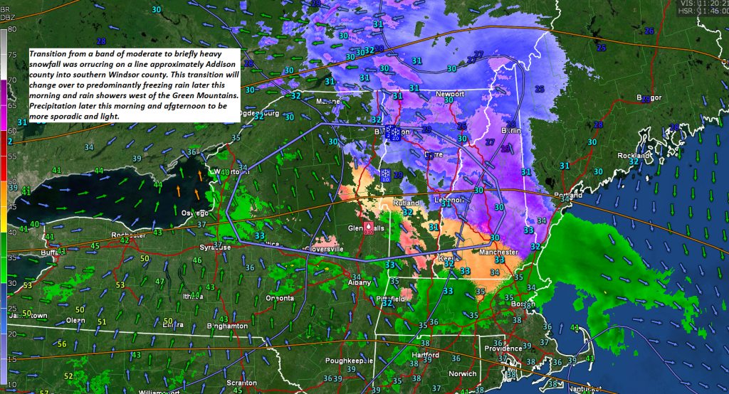
Updated Wednesday Evening Forecast — November 8th, 2023
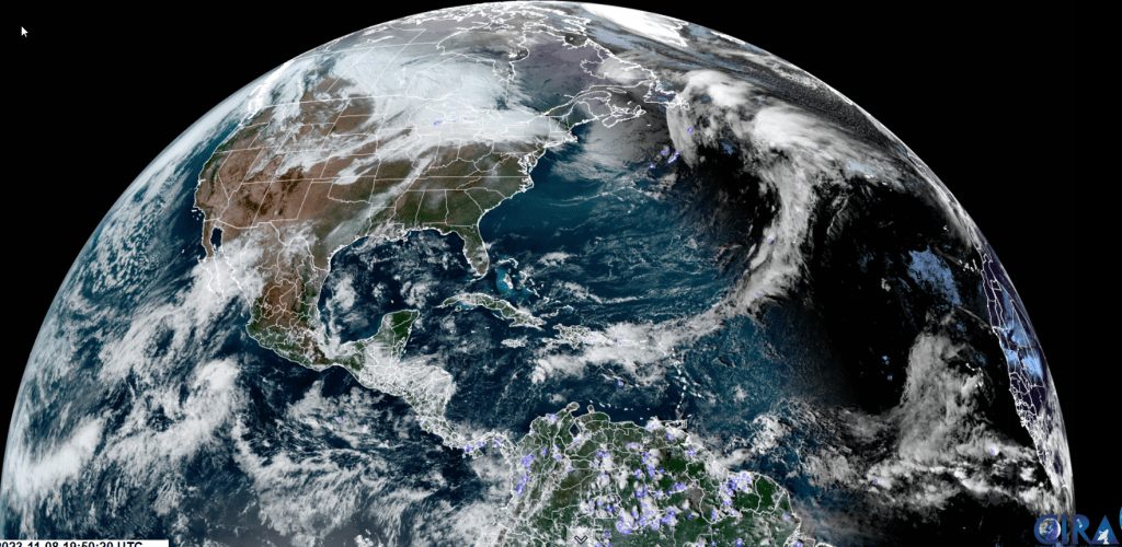
Winter Weather Advisory 11 PM thru 1 PM Thursday Afternoon…
TONIGHT: Thickening high clouds this evening leading to wet snow developing overnight with 1 to 2”transitioning to sleet and freezing rain with poor travel. A low around 25. Light north winds.
TOMORROW: Overcast. A wintry mix with slippery travel for the morning transitioning to scattered light rain showers in the afternoon. A high in the upper-30s. Southeast winds 10 to 15 mph.
THURSDAY NIGHT: Variable cloudiness with lingering light showers of mixed precipitation. A low around 32 degrees. Winds becoming southwest 10 mph.
FRIDAY: Clouds and occasional period of sun. Widely scattered sprinkles mixed with wet snowflakes higher terrain. A high in the low 40s. West winds 10 to 20 mph.
Looking further ahead
FRIDAY NIGHT: Mostly cloudy. Possible mountain flurries.A low in the upper 20s
SATURDAY: A few morning flurries little to no accumulation. Otherwise periods of afternoon sun. A high around 35.
SUNDAY: Mostly sunny. Chilly. A low near 25. A high around 35.
MONDAY: Variable mainly high cloudiness. A low 20 to 25. A high in the mid-30s.
Average lows mid-20s to low 30s. Average highs mid-40s to 50.
RH/11-7 forecast][end]
Updated Wednesday morning Forecast — November 8th, 2023
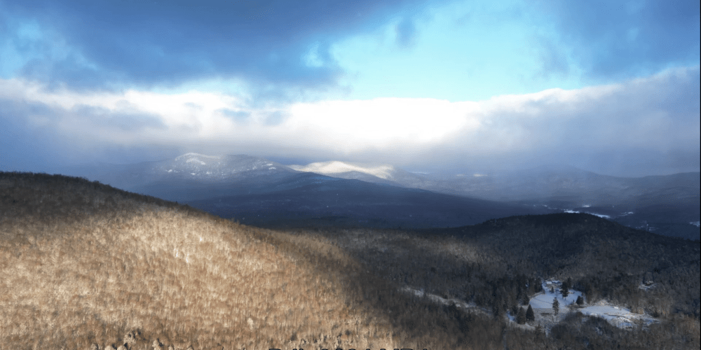
TODAY: Clouds with leftover mountain flurries mixing with some afternoon sunshine filtered through high clouds, & continued blustery. A high in the upper 30s. Northwest winds 10 to 15 mph.
Winter Weather Advisory 11 PM tonight thru 1 PM Thursday Afternoon…
TONIGHT: Thickening clouds. Wet snow develops after midnight with up to an inch of accumulation, changing and mixing with sleet and freezing rain. A low around 25. Light north winds.
THURSDAY: Overcast. A wintry mix with slippery travel is likely for the morning commute improving in the afternoon and transitioning to scattered light rain showers. A high in the upper 30s. Southeast breeze 10 mph.
Looking further ahead
THURSDAY NIGHT: Variable cloudiness.Isolated sprinkles.A low is around 32 degrees.
FRIDAY: Clouds and occasional period of sun. Widely scattered sprinkles mixed with wet snowflakes on higher terrain. A high in the low 40s.
SATURDAY: A few morning flurries little to no accumulation. Otherwise periods of afternoon sun. A low in the upper 20s. A high around 35.
SUNDAY: Lots of sunshine with a few high clouds. Chilly. A low near 25. A high around 35.
Average lows are mid-20s to low 30s. Average highs are mid-40s to 50.
RH/11-7 forecast][end]
Sticks…to a dress-up in a decent coating of snow
Parts of the region had some snow. As breaks in the clouds develop into intervals of sun later on, a very pretty snowscape in some areas this morning.
Wow, there was a solid inch and half of the white stuff in the north-central Green Mountains and adjacent hills to the east this morning. Our weather should improve with breaks giving way to intervals of sun. Nasty messy mixed precip tonight/tomorrow morning.
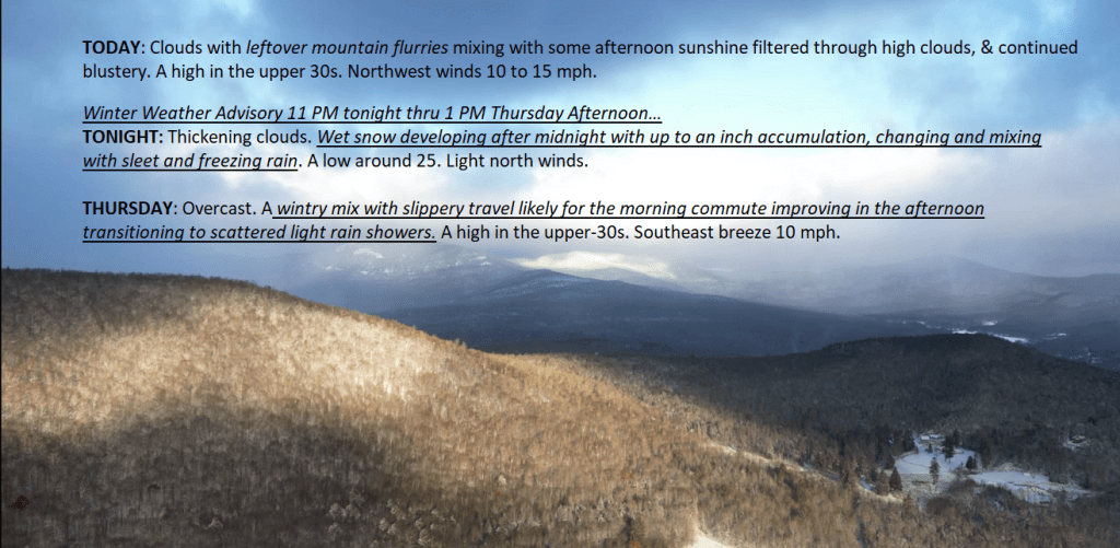
Updated Tuesday Evening Forecast — November 7th, 2023

TONIGHT: Considerable clouds & blustery. A few leftover rain showers, changing to snow flurries in northern areas, before exiting. Watch for slick spots. Blustery. A low 25 to 30. Northwest winds 10 to 20 mph.
TOMORROW: Clouds mixing with some afternoon sunshine filtered through high clouds, & continued blustery. A high in the upper 30s. Northwest winds 10 to 15 mph.
WEDNESDAY NIGHT: High cloudiness thickening up. A wintry mix develops central and southern areas toward daybreak. A low around 25. Light north winds.
THURSDAY: Overcast. A wintry mix with minor accumulation & slick travel is likely for the morning commute. A high around 35. Southeast breeze 10 mph.
Looking further ahead
THURSDAY NIGHT: Variable cloudiness.Isolated sprinkles.A low in the mid-30s.
FRIDAY: Clouds and occasional period of sun. Widely scattered sprinkles mixed with wet snowflakes on higher terrain. A high 40 to 45.
SATURDAY: A few morning flurries little to no accumulation. Otherwise periods of afternoon sun. A low in the upper 20s. A high 35 to 40.
SUNDAY: Lots of sunshine with a few high clouds. Chilly. A low 20 to 25. A high mid to upper 30s.
Average lows are mid-20s to low 30s. Average highs are mid-40s to 50.
RH/11-7 forecast][end]

