
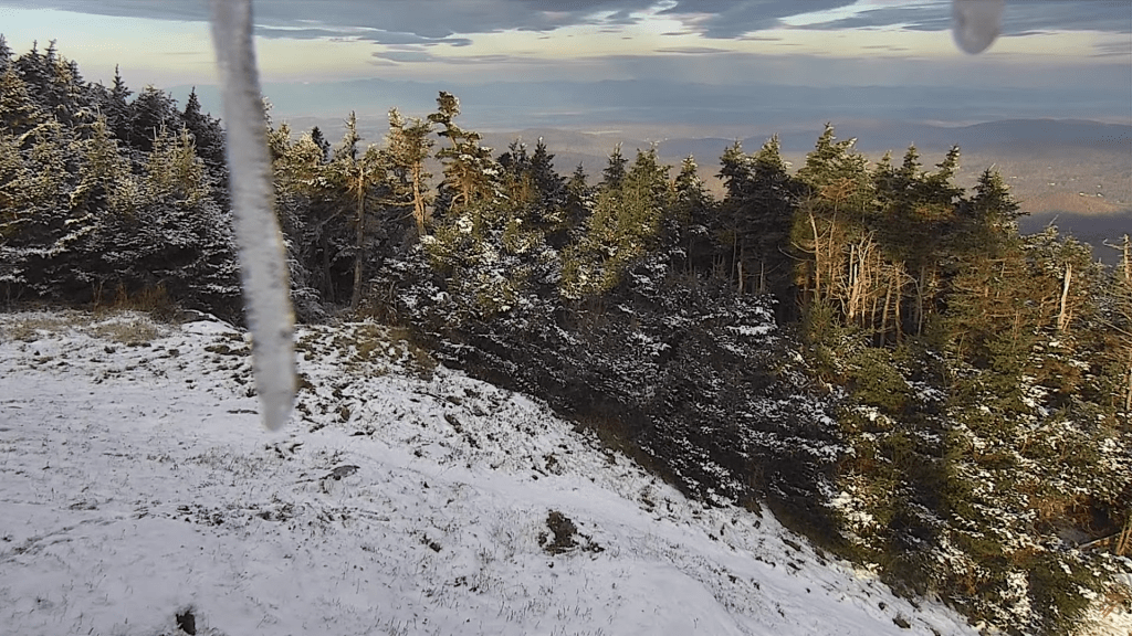
Parts of the region had some snow. As breaks in the clouds develop into intervals of sun later on, a very pretty snowscape in some areas this morning.
Wow, there was a solid inch and half of the white stuff in the north-central Green Mountains and adjacent hills to the east this morning. Our weather should improve with breaks giving way to intervals of sun. Nasty messy mixed precip tonight/tomorrow morning.
Updated Tuesday Evening Forecast — November 7th, 2023

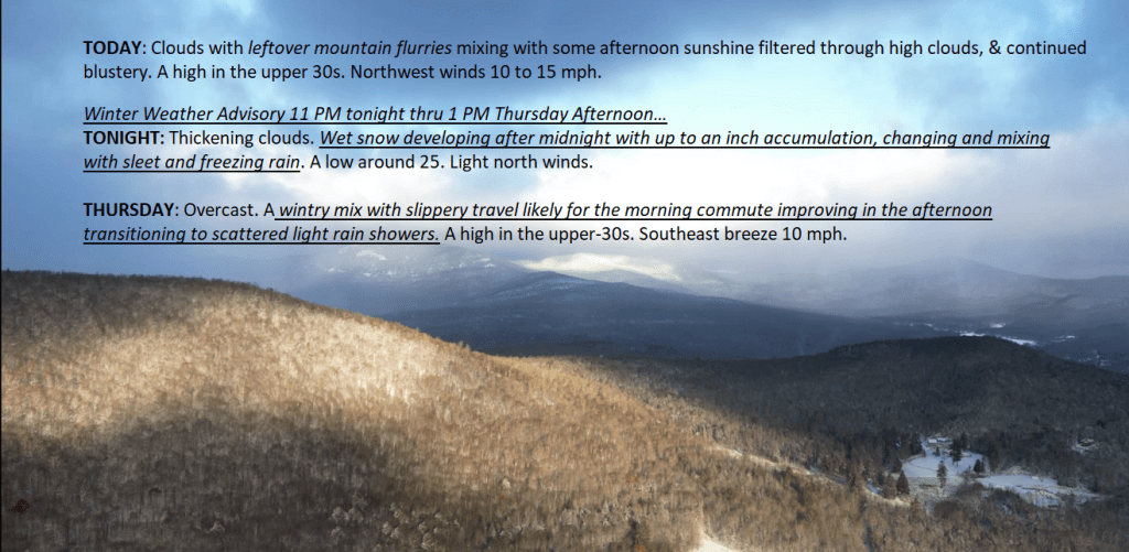
TONIGHT: Considerable clouds & blustery. A few leftover rain showers, changing to snow flurries in northern areas, before exiting. Watch for slick spots. Blustery. A low 25 to 30. Northwest winds 10 to 20 mph.
TOMORROW: Clouds mixing with some afternoon sunshine filtered through high clouds, & continued blustery. A high in the upper 30s. Northwest winds 10 to 15 mph.
WEDNESDAY NIGHT: High cloudiness thickening up. A wintry mix develops central and southern areas toward daybreak. A low around 25. Light north winds.
THURSDAY: Overcast. A wintry mix with minor accumulation & slick travel is likely for the morning commute. A high around 35. Southeast breeze 10 mph.
Looking further ahead
THURSDAY NIGHT: Variable cloudiness.Isolated sprinkles.A low in the mid-30s.
FRIDAY: Clouds and occasional period of sun. Widely scattered sprinkles mixed with wet snowflakes on higher terrain. A high 40 to 45.
SATURDAY: A few morning flurries little to no accumulation. Otherwise periods of afternoon sun. A low in the upper 20s. A high 35 to 40.
SUNDAY: Lots of sunshine with a few high clouds. Chilly. A low 20 to 25. A high mid to upper 30s.
Average lows are mid-20s to low 30s. Average highs are mid-40s to 50.
RH/11-7 forecast][end]
Updated Tuesday morning Forecast — November 7th, 2023

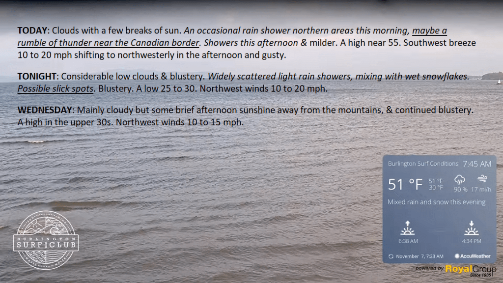
TODAY: Clouds with a few breaks of sun. An occasional rain shower in northern areas this morning, maybe a rumble of thunder near the Canadian border. Showers this afternoon & milder. A high near 55. Southwest breeze 10 to 20 mph shifting to northwesterly in the afternoon and gusty.
TONIGHT: Considerable low clouds & blustery. Widely scattered light rain showers, mixing with wet snowflakes. Possible slick spots. Blustery. A low 25 to 30. Northwest winds 10 to 20 mph.
WEDNESDAY: Mainly cloudy but some brief afternoon sunshine away from the mountains, & continued blustery. A high in the upper 30s. Northwest winds 10 to 15 mph.
Looking further ahead
WEDNESDAY NIGHT: High cloudiness thickening up overnight.A wintry mix developing central and southern areas toward daybreak. A low around 25.
THURSDAY: Overcast. A wintry mix with minor accumulation & slick travel is likely for the morning commute. A high around 35.
FRIDAY: Considerable clouds. Widely scattered light snow showers or flurries mix with rain in the afternoon. A low in the mid-30s. A high 40 to 45.
SATURDAY: Chance for morning flurries with some spotty minor accumulation. Otherwise, clouds give way to periods of afternoon sun. A low in the upper 20s. A high 35 to 40.
SUNDAY: Lots of sunshine with a few high clouds. Chilly. A low 20 to 25. A high mid to upper 30s.
Average lows are mid-20s to low 30s. Average highs are mid-40s to 50.
RH/11-7 forecast][end]
Updated Tuesday morning Forecast — November 7th, 2023
Updated Monday Morning Forecast — November 6th, 2023
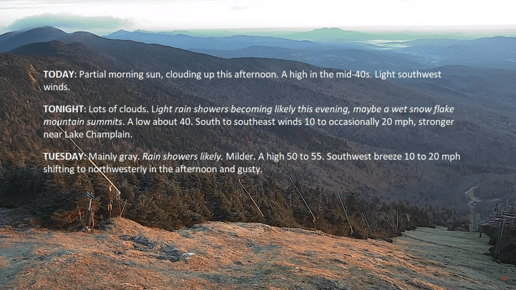
TODAY: Partial morning sun, clouding up this afternoon. A high in the mid-40s. Light southwest winds.
TONIGHT: Lots of clouds. Light rain showers becoming likely this evening, maybe a wet snow flake mountain summits. A low about 40. South to southeast winds 10 to occasionally 20 mph, stronger near Lake Champlain.
TUESDAY: Mainly gray. Rain showers likely. Milder. A high 50 to 55. Southwest breeze 10 to 20 mph shifting to northwesterly in the afternoon and gusty.
Looking further ahead
TUESDAY NIGHT: Considerable low clouds. Widely scattered light rain showers tailing off as a few mountain flurries. Possible slick spots. A low in the upper 20s.
WEDNESDAY: Mainly cloudy but some brief sunshine. A high around 40.
THURSDAY: Overcast. A light wintry mix with minor accumulation but slick travel in spots. A low in the mid-20s. A high around 35.
FRIDAY: Spotty wintry mix early mainly higher terrain… transitioning to widely scattered light showers or sprinkles.
A low 32 to 35. A high 40 to 45.
Average lows mid-20s to low 30s. Average highs mid-40s to 50.
RH/11-6 forecast][end]
Nice Monday across the #GreenMountains with decent sunshine to start, but that goes away gradually with the incoming weather disturbance affecting the region with #RainShowers tonight lingering into tomorrow evening with some minor flurries.
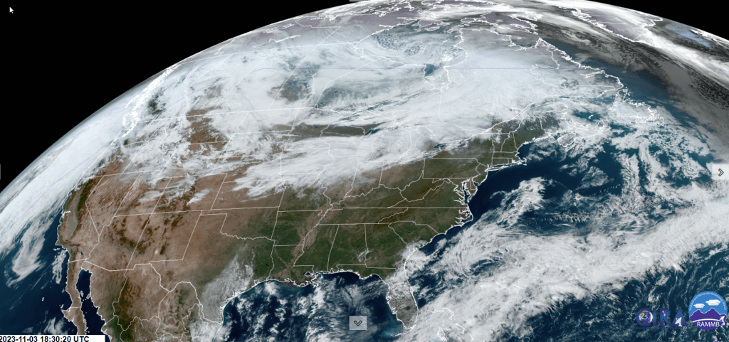
Updated Friday Evening Forecast — November 3rd, 2023
TONIGHT: Overcast.A rising chance for showers far northern regions overnight.Milder with a low around 40. Southwest winds 10 to 15 mph.
TOMORROW: Scattered sprinkles northern areas, otherwise clouds mixing with a few breaks of sun.A high about 50. Light southwest winds.
Time Change — Fall back 1 hour to EST…
SATURDAY NIGHT: Lots of clouds.Scattered sprinkles. A low 35 to 40. Little wind.
SUNDAY: An isolated sprinkle early then intervals of late afternoon sunshine. A high in the mid-40s. Northwest breeze 10 mph.
Looking further ahead
SUNDAY NIGHT: Some high cloudiness otherwise clear. A low upper 20s.
MONDAY: Some early sun, then lots of clouds. A high in the mid to upper 40s.
TUESDAY: Considerable cloudiness. Good chance for rain showers…tailing off as a few mountain flurries. A morning low near 40. Milder. A high 50 to 55
WEDNESDAY: Mainly cloudy but some brief sunshine. A leftover valley sprinkle or mountain flurry. A low 32 to 35. A high in the upper 30s to near 40.
Average lows in the upper 20s to mid-30s. Average highs are mid-40s to low 50s.
RH/11-2 forecast][end]
Updated Friday Morning Forecast — November 3rd, 2023
TODAY: Variable mid and high cloudiness with intervals of sunshine. A high in the upper 40s to around 50. South to southwest breeze 10 to 15 mph stronger near Lake Champlain.
TONIGHT: Clouding up.A rising chance for a couple showers in far northern areas toward daybreak.Milder with a low around 40. Southwest winds 10 to 15 mph.
SATURDAY: Scattered sprinkles in northern areas, otherwise clouds mix with a few breaks of sunshine.A high of about 50. Light northwest winds.
Looking further ahead
SATURDAY NIGHT: mostly cloudy.An isolated sprinkle. A low in the mid-30s.
SUNDAY: Mostly cloudy. An isolated sprinkle in the morning, then intervals of late afternoon sunshine. A high in the upper 40s.
MONDAY: Mixed sun and clouds. A low upper 20s to around 30. A high 45 to 50.
TUESDAY: Considerable cloudiness. Chance for rain showers. A low near 40. A high in the mid-50s.
WEDNESDAY: Mainly cloudy but some brief sunshine. A leftover valley sprinkle or mountain flurry. A low 32 to 35. A high in the upper 30s to near 40.
Average lows the upper 20s to mid-30s. Average highs are mid-40s to low 50s.
RH/11-2 forecast][end]
