Updated Thursday Evening Forecast — November 30th, 2023

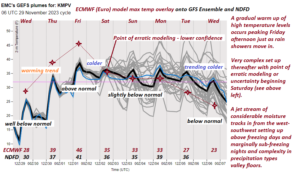
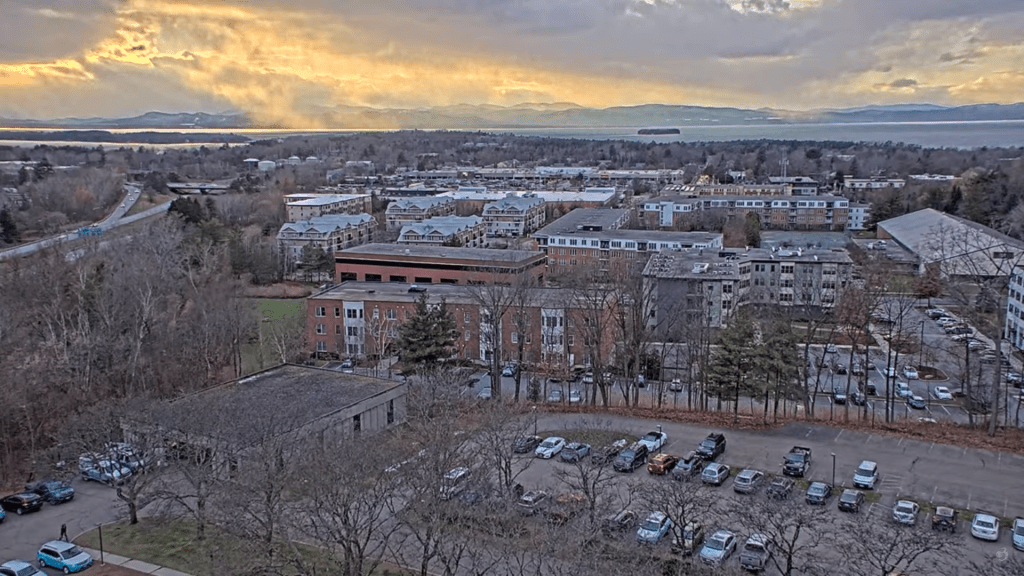
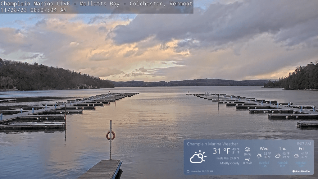
TONIGHT: Fair with high clouds. An evening low around 32. Southwest winds 10 mph stronger near Lake Champlain.

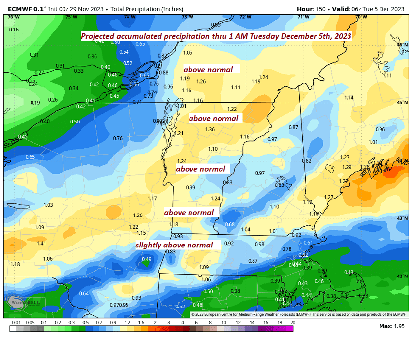
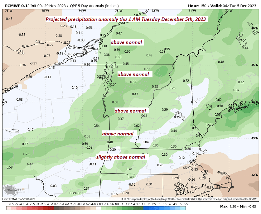
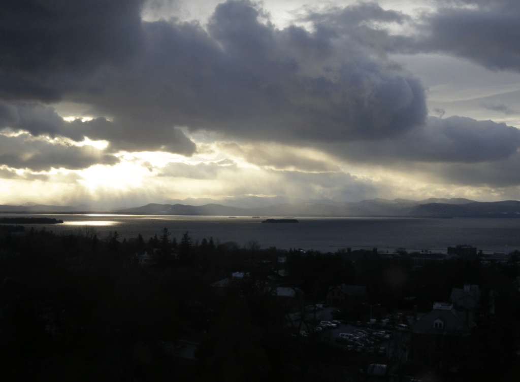
TOMORROW: Becoming mostly cloudy but milder. A few sprinkles far north, give way to periods of light rain later in the afternoon. A high pushing into the mid-40s. Light southwest winds.

FRIDAY NIGHT: Overcast.A period of light rain with a wintry mix above 1500 ft. exiting to isolated leftover sprinkles around midnight. Watch for icy spots. A low 32 to 35. Light south winds.

SATURDAY: Mainly gray. Scattered rain showers. A high mid to upper 30s. Little wind.

Looking further ahead

SATURDAY NIGHT: Widely scattered light rain showers with pockets of freezing rain with slick travel.  A low around 32.

SUNDAY: Clouds with a break or two of sun. Chance for rain showers or a wintry mix mainly higher terrain. A high in the mid to upper 30s.

SUNDAY NIGHT: Overcast. Chance for rain changing to accumulating wet snow, possibly significant. A low near 30.

MONDAY: Gray. Chance for accumulating wet snow with significant amounts in the morning tapering to scattered flurries in the afternoon. Temperatures near 32 degrees falling into the 20s late.

TUESDAY: Partly sunny. Lows 15 to 25. Highs mid to upper 20s. 

Average lows upper teens to mid-20s. Average highs mid-30s to around 40.

RH/11-30forecast][end]

Updated Thursday Morning Forecast — November 30th, 2023

TODAY: Early cloudiness gives way to sunshine, with some high clouds this afternoon. Warming trend. A high upper 30s to near 40. South to southwest winds 10 mph, stronger near Lake Champlain.

TONIGHT: Fair with high cloudiness.An evening low around 32. South to southwest winds 10 mph stronger near the lake.

FRIDAY: Thickening clouds & milder. Isolated rain showers far north, gives way to periods of light rain later in the afternoon. A high pushing to near 45. Light southwest winds.

Looking further ahead

FRIDAY NIGHT: Overcast.A periods of light rain likely in the evening with a with a wintry mix higher elevations exiting to isolated leftover sprinkles.Watch for icy spots overnight. A low 30 to 35.

SATURDAY: Mainly gray. Scattered rain showers. A high mid to upper 30s.

SUNDAY: Clouds with a break or two of sun. Chance for rain showers or a wintry mix mainly higher terrain. A low around 32. A high in the mid to upper 30s.

MONDAY: Overcast. Chance for accumulating wet snow possibly moderate to heavy at times with significant amounts tapering to light snow showers or flurries in the afternoon. Temperatures near 32 degrees falling into the 20sd late.

TUESDAY: Partly sunny. Lows 15 to 25. Highs mid to upper 20s.  

Average lows are in the upper teens to mid-20s. Average highs mid-30s to around 40.

RH/11-29forecast][end]

Updated Wednesday Evening Forecast — November 29th, 2023

TONIGHT: Partially cloudy and moonlit. Widely scattered flurries northern Greens. A low in the mid to upper teens. Light south winds stronger near Lake Champlain.

TOMORROW: Pick of the week. Morning sunshine, becomes filtered through high clouds. Milder. A high in the mid-30s. South to southwest winds 10 mph, stronger near Lake Champlain.

THURSDAY NIGHT: Partly to mostly cloudy.Slight chance for a rain or wet snow shower near the Quebec border.A low of about 30. South to southwest winds 10 mph stronger near the lake.

FRIDAY: Milder but clouding up. Isolated rain showers becomes more widespread later in the afternoon. A high pushing to near 45. Light southwest winds.

Looking further ahead

FRIDAY NIGHT: Overcast.Good chance for periods of light rain with a wintry mix higher elevations.A low 32 to 35.

SATURDAY: Gray skies. Widely scattered rain showers mixed with wet snow in the higher terrain. A high mid to upper 30s.

SUNDAY: Clouds with a break or two of sun. Chance for rain showers or a wintry mix mainly higher terrain. A low around 30. A high near 35.

MONDAY: Cloudy. Chance for accumulating wet snow or snow showers of a few inches…trending toward rain. A low upper 20s. A high in the mid-30s.

Average lows upper teens to mid-20s. Average highs mid-30s to around 40.

RH/11-29forecast][end]

Updated Wednesday Morning Forecast — November 29th, 2023

TODAY: A few early flurries drying up. Otherwise more clouds than sun. A high in the mid-20s to around 30. Southwest winds 10 mph.

TONIGHT: Scattered clouds this evening then mostly cloudy. Widely scattered flurries northern Greens. A low in the mid to upper teens. Light south to southwest winds.

THURSDAY: Pick of the week. Filtered sunshine thru high clouds. A high mid to upper 30s. Southwest winds 10 mph.

Looking further ahead

THURSDAY NIGHT: Partly to mostly cloudy.Slight chance for a rain or wet snow shower near the Quebec border.A low of about 30.

FRIDAY: Milder. Mainly cloudy. A rising chance of rain showers mixed with a few wet snowflakes mountain slopes. A high pushing to near 45.

SATURDAY: Mostly cloudy. An occasional rain shower mixed with wet snow in the higher terrain. A low 25 to 30. A high around 35.

SUNDAY: Gray. Chance for rain showers or a wintry mix mainly higher terrain. A low around 30. A high near 35.

MONDAY: Cloudy. Chance for wet snow or snow showers possibly significant…trending toward rain mid-morning on. A low upper 20s. A high in the mid-30s.

Average lows upper teens to mid-20s. Average highs mid-30s to around 40.

RH/11-27forecast][end]

Updated Tuesday Evening Forecast — November 28th, 2023

TONIGHT: Variable clouds northern areas, with a dusting to locally an inch from mountain lake effect flurries. Mostly clear with moonlit skies southern areas. A low in the teens. West winds 10 mph.

TOMORROW: Sun and clouds. A high in the mid to upper 20s. Southwest winds 10 mph.

WEDNESDAY NIGHT: Cloudy periods. A low in the mid to upper teens. Light south to southwest winds.

THURSDAY: Pick of the week. Bright sunshine becoming filtered thru high clouds in the afternoon. A high mid to upper 30s. Southwest winds 10 mph.

Looking further ahead

THURSDAY NIGHT: Partly to mostly cloudy.A low in the low 30s.

FRIDAY: Milder. Thickening clouds. A rising chance of rain showers mixing with wet snowflakes high terrain late. A high pushing to near 45.

SATURDAY: Clouds with intervals of sun. A low around 15. A high in the mid-30s.

SUNDAY: Gray. Chance for rain showers mixed with wet snow higher elevations. A low 15 to 20. A high in the mid-30s.

Average lows upper teens to mid-20s. Average highs mid-30s to around 40.

RH/11-27forecast][end]

Updated Tuesday morning Forecast — November 28th, 2023

TODAY: Sun and clouds. Scattered mountain lake-effect flurries with a dusting to locally an inch in spots. A high in the upper 20s. West breeze 10 to 15 mph

TONIGHT: Variable clouds in northern areas, with a dusting to locally an inch from mountain lake effect flurries. Mostly clear with moonlit skies in southern areas. A low in the teens. West to northwest winds 10 mph.

WEDNESDAY: Sun and clouds. Isolated flurries. A high in the mid to upper 20s. Southwest winds 10 mph.

Looking further ahead

WEDNESDAY NIGHT: Cloudy periods. A low in the mid to upper teens.

THURSDAY: Pick of the week. Bright sunshine becomes filtered through high clouds in the afternoon. A high mid to upper 30s.

FRIDAY: Milder. Thickening clouds. A rising chance of rain showers mixing with wet snowflakes on high terrain late. A low around 30. A high pushing to near 45.

SATURDAY: Clouds with intervals of sun. A low around 15. A high in the mid-30s.

SUNDAY: Gray. Chance for rain showers mixed with wet snow at higher elevations. A low 15 to 20. A high in the mid-30s.

Average lows upper teens to mid-20s. Average highs are mid-30s to around 40.

RH/11-27forecast][end]