TONIGHT: Overcast.Rain…this evening, mainly light with areas of dense fog developing. A few leftover sprinkles overnight. Watch for icy spots. A low about 32 to 35. Light south winds.
TOMORROW: Mainly gray. A few light rain showers in northern areas. A high near 40. Little wind.
SATURDAY NIGHT: Widely scattered light rain showers with pockets of freezing rain & possible slick travel northern tier regions. A low in the low 30s.
SUNDAY: Clouds with a break or two of sun. Rain likely in the afternoon…transitioning to wet snow late across upper mountain slopes. A high in the upper 30s.
Looking further ahead
SUNDAY NIGHT: Overcast. Rain going over to accumulating wet snow down to valley floors…moderate to heavy at times with several inches likely.. A low near 32.
MONDAY: Gray. Good chance for occasional light accumulating snow showers or flurries. A high 32 to 35.
TUESDAY: Intervals of sun after a morning mountain flurry. Lows 10 to 15. Highs in the mid-20s.
WEDNESDAY: High cloudiness but fair and cold. A low in the single digits above zero. A high 20 to 25.
Average lows upper teens to mid-20s. Average highs are mid-30s to around 40.
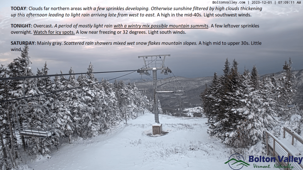
TODAY: Clouds in far northern areas with a few sprinkles developing. Otherwise, sunshine filtered by high clouds thickening up this afternoon leading to light rain arriving late from west to east. A high in the mid-40s. Light southwest winds.
TONIGHT: Overcast.A period of mostly light rain with a wintry mix possible mountain summits. A few leftover sprinkles overnight. Watch for icy spots.A low near freezing or 32 degrees. Light south winds.
SATURDAY: Mainly gray. Scattered rain showers mixed wet snow flakes mountain slopes. A high mid to upper 30s. Little wind.
Looking further ahead
SATURDAY NIGHT: Widely scattered light rain showers with pockets of freezing rain & possible slick travel northern tier regions. A low 32 to 35.
SUNDAY: Clouds with a break or two of sun. Rain showers likely…with wet snow developing late across mountains slopes. A high in the mid-30s.
SUNDAY NIGHT: Overcast. Good chance for rain transitioning to accumulating wet snow. A few to several inches possible above valley floors especially in southern and central areas. A low around 30.
MONDAY: Gray. Good chance for occasional light accumulating snow showers or flurries. Temperatures near 32 degrees falling gradually falling thru the 20s.
TUESDAY: Intervals of sun after a morning flurry. Lows 15 to 25. Highs mid to upper 20s.
Average lows upper teens to mid-20s. Average highs mid-30s to around 40.