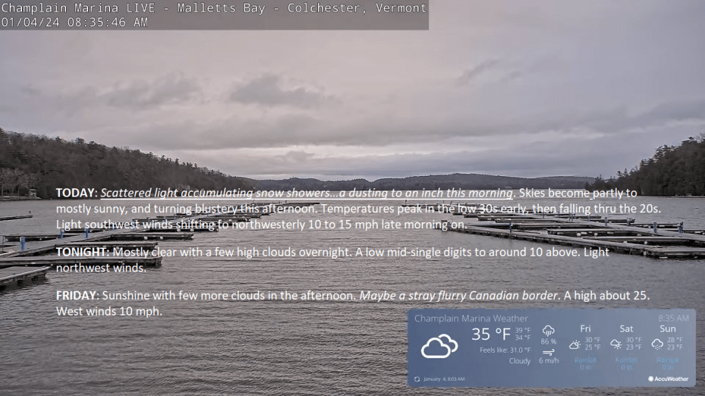
An arctic cold front was moving through the Green Mountain State with scattered snow showers and a dusting to about an inch. Good news we should break into partial or more sunshine this afternoon. Temp’s peak this morning then gradually fall.

TONIGHT: Lots of clouds. A rising chance for flurries in far northern areas later overnight. A low in the mid-20s. Light south to southwest winds.

TOMORROW: Scattered light accumulating snow showers…a dusting to an inch in the morning. Skies becoming partly to mostly sunny and turning blustery. A high around 30. Light southwest winds shifting to northwesterly 10 to 15 mph late morning on.
THURSDAY NIGHT: Mostly clear with a few high clouds.A low around 10 above. Light northwest winds.
FRIDAY: Sunshine with a few more clouds later in the afternoon. Maybe a stray flurry Canadian border. A high of about 25. West winds 10 mph.

Looking further ahead
FRIDAY NIGHT: Variable mainly high cloudiness.A stray northern border flurry.A low mid to upper teens.
SATURDAY: Sunshine filtered through high cloudiness, then cloudy in the afternoon. A high mid to upper 20s.

SUNDAY: Gray. Good chance for accumulating snow or snow showers, possibly moderate at times south of the Barre-Montpelier area with a few inches of accumulation. A low in the upper teens. A high in the mid-20s.
MONDAY: Mostly cloudy. Lows in the mid-teens. A high near 30.

Average lows are single digits to around 10. Average highs mid-20s to around 30
RH/1-3forecast][end]

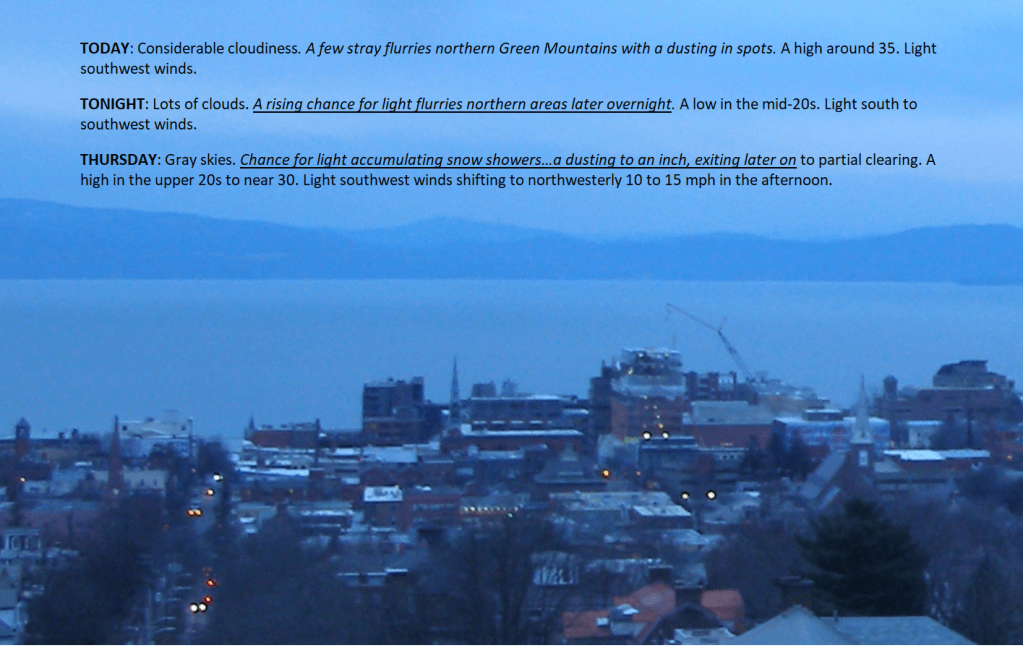
TODAY: Considerable cloudiness. A few stray flurries northern Green Mountains with a dusting in spots. A high around 35. Light southwest winds.
TONIGHT: Lots of clouds. A rising chance for light flurries northern areas later overnight. A low in the mid-20s. Light south to southwest winds.
THURSDAY: Gray skies. Chance for light accumulating snow showers…a dusting to an inch, exiting later on to partial clearing. A high in the upper 20s to near 30. Light southwest winds shifting to northwesterly 10 to 15 mph in the afternoon.

Looking further ahead
THURSDAY NIGHT: Mostly clear.A low around 10.
FRIDAY: Sunshine with few more clouds in the afternoon. Maybe a stray flurry Canadian border. A high 20 to 25.

SATURDAY: Sunshine filtered thru high cloudiness, thickening in the afternoon. A low upper teens. A high in the mid-20s.
SUNDAY: Thickening clouds, leading to the chance for snow or snow showers. A low in the upper teens. A high in the mid-20s.
Average lows single digits to around 10 above. Average highs mid-20s to around 30

RH/1-3forecast][end]
TONIGHT: Fair with some high cloudiness, giving way to more clouds overnight. A few stray overnight flurries near the Canadian border. A low 20 to 25. Light southwest winds.
TOMORROW: Considerable cloudiness. Widely scattered flurries. A high around 35. Light southwest winds.
WEDNESDAY NIGHT: Lots of clouds. Scattered flurries northern areas with a dusting. A low around 25. Light south to southwest winds.
THURSDAY: Gray skies. Chance for light accumulating snow showers…a dusting to an inch, exiting late to partial clearing. A high near 30. Light southwest winds shifting to northwesterly 10 to 15 mph in the afternoon.
Looking further ahead

THURSDAY NIGHT: Mostly clear.A low around 10.
FRIDAY: Sunshine in the morning gives way to lots of clouds in the afternoon. Widely scattered flurries. A high around 25.
SATURDAY: Sunshine filtered thru high cloudiness, thickening in the afternoon. A low 10 to 15. A high around 25.
SUNDAY: Thickening clouds, leading to the chance for snow or snow showers. A low in the mid to upper teens. A high in the mid-20s.

Average lows single digits to around 10 above. Average highs mid-20s to around 30
RH/1-1forecast][end]
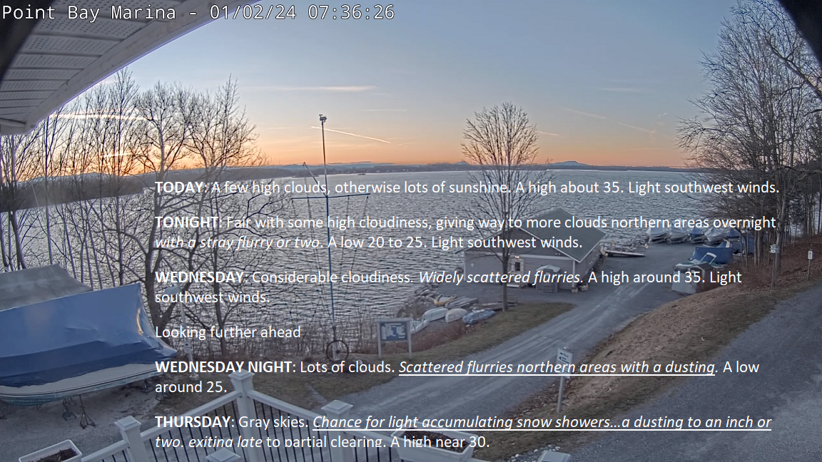
TODAY: A few high clouds, otherwise lots of sunshine. A high of about 35. Light southwest winds.
TONIGHT: Fair with some high cloudiness, giving way to more clouds in northern areas overnight with a stray flurry or two. A low 20 to 25. Light southwest winds.

WEDNESDAY: Considerable cloudiness. Widely scattered flurries. A high around 35. Light southwest winds.
Looking further ahead
WEDNESDAY NIGHT: Lots of clouds. Scattered flurries in northern areas with a dusting. A low around 25.
THURSDAY: Gray skies. Chance for light accumulating snow showers…a dusting to an inch or two, exiting late to partial clearing. A high near 30.
FRIDAY: Morning sunshine then more clouds in northern areas. Chance for accumulating light snow showers in northern areas after dark. A low around 10. A high around 25.
SATURDAY: Sunshine filtered through high cloudiness, thickening up later on. A low 10 to 15. A high around 25.

SUNDAY: Thickening clouds, leading to the chance for snow or snow showers. A low in the mid to upper teens. A high in the mid-20s.
Average lows are single digits to around 10 above. Average highs mid-20s to around 30
RH/1-1forecast][end]

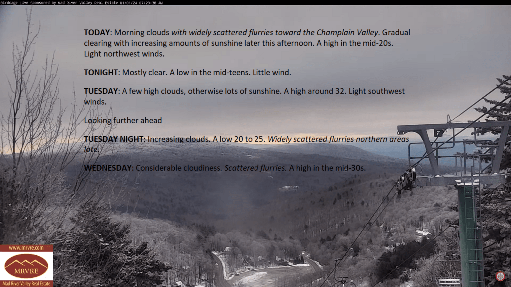
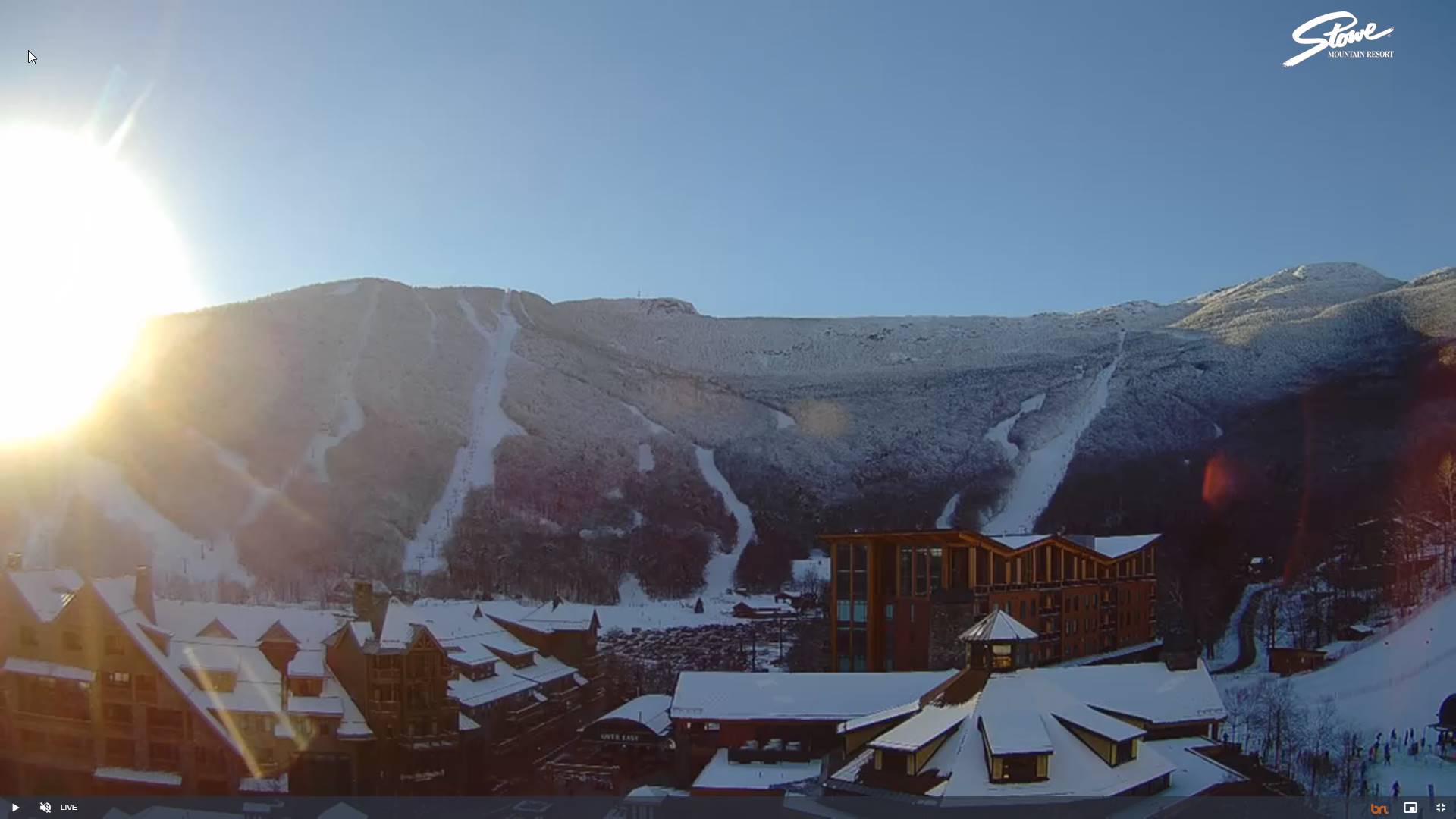
TODAY: Morning clouds with widely scattered flurries toward the Champlain Valley. Gradual clearing with increasing amounts of sunshine later this afternoon. A high in the mid-20s. Light northwest winds.
TONIGHT: Mostly clear. A low in the mid-teens. Little wind.
TUESDAY: A few high clouds, otherwise lots of sunshine. A high around 32. Light southwest winds.

Looking further ahead
TUESDAY NIGHT: Increasing clouds. A low 20 to 25. Widely scattered flurries in northern areas late.
WEDNESDAY: Considerable cloudiness. Scattered flurries. A high in the mid-30s.
THURSDAY: Gray skies with a few mountain flurries early, giving way to intervals of afternoon sun. A low around 25. A high in the low to mid-30s.
FRIDAY: Morning sunshine then partly sunny with more clouds in northern areas. Chance for accumulating light snow showers late. A low in the single digits above zero. A high around 25.
SATURDAY: Variable high cloudiness otherwise lot of sunshine. A low in the single digits. A high low to mid-20s.

Average lows are single digits to around 10 above. Average highs mid-20s to around 30
RH/12-29forecast][end]