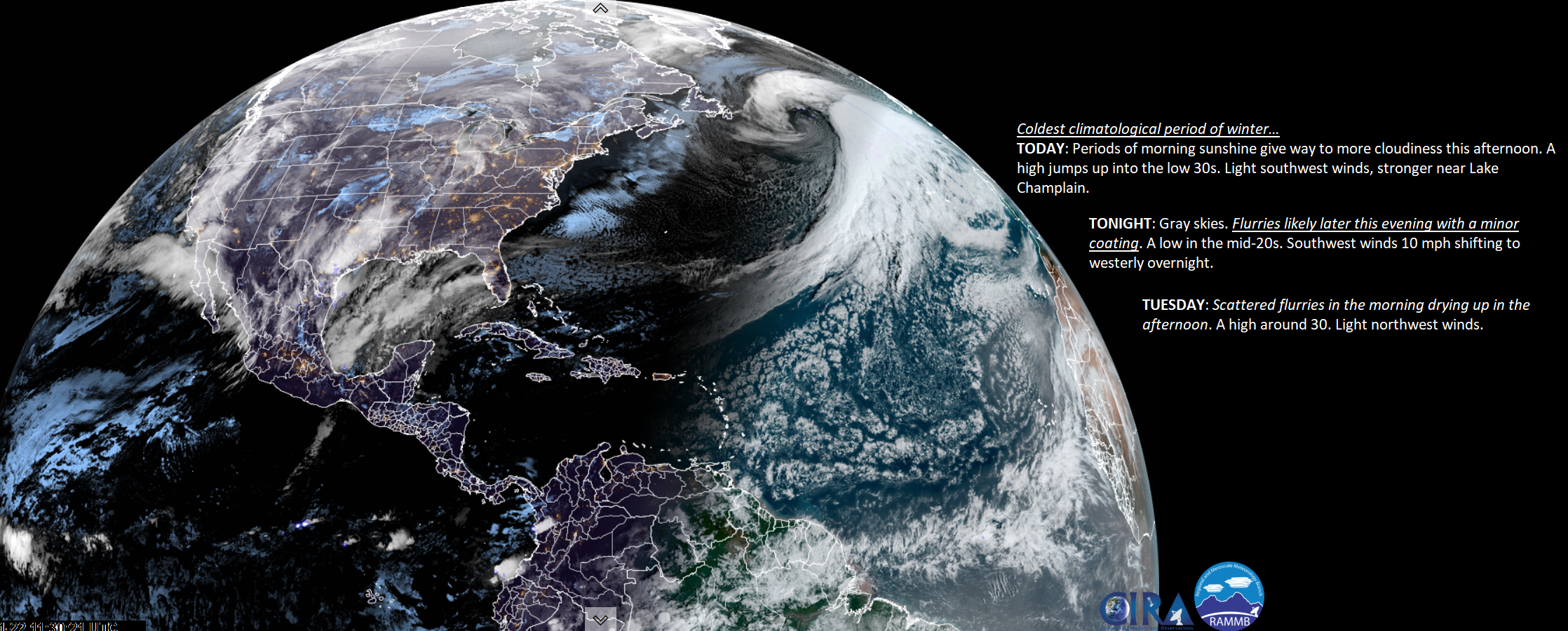
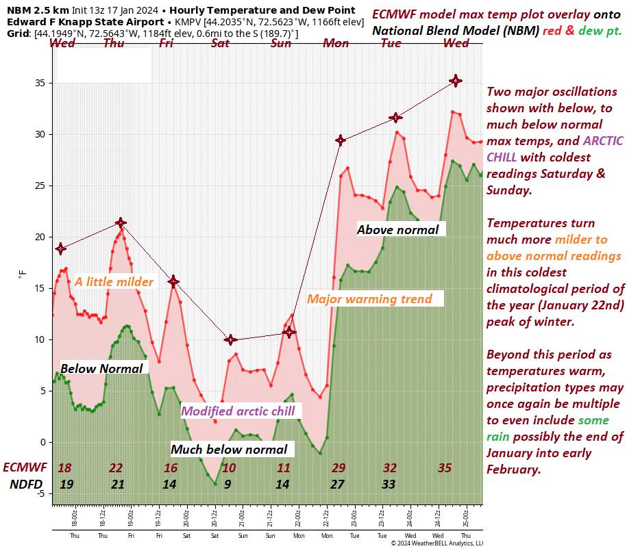
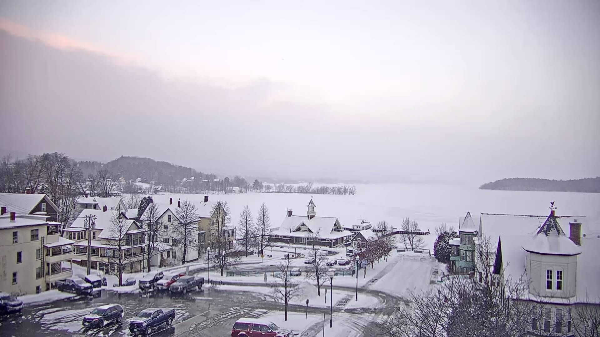
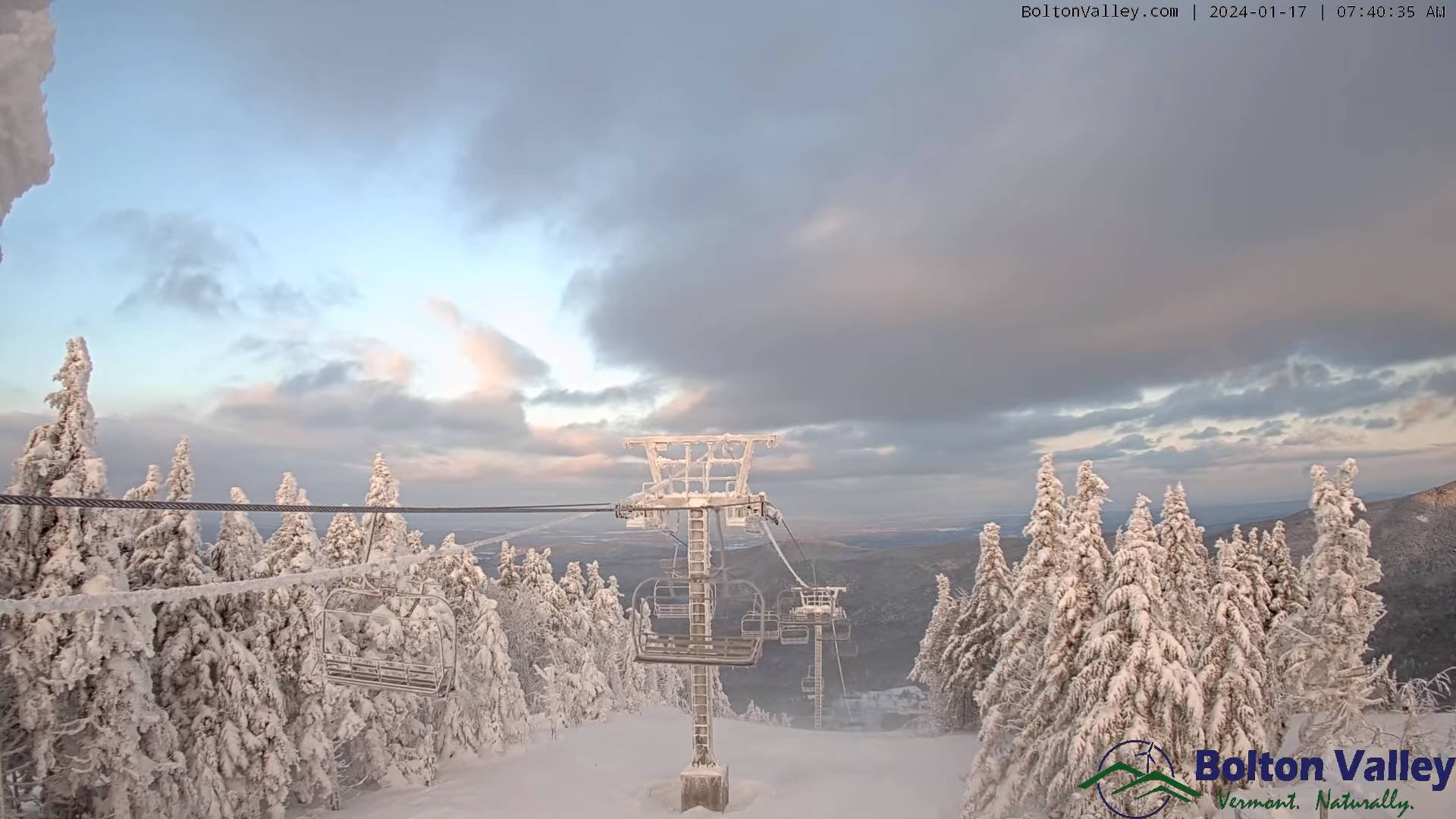
Pretty start to the day today, and dry with a major warm-up. Temperatures punch into the lower 30s today. A disturbance to our west across the Great Lakes region will track into Vermont this evening with a coating of snow tonight…

TONIGHT: Lots of clouds.A few flurries. Frigid.A low 5 below to 5 above. Light northwest winds.
TOMORROW: Gray & cold. Occasional snow showers likely in the afternoon. A dusting to an inch. A high upper single digits north, to low teens. Northwest winds 10 mph.
SATURDAY NIGHT: Cloudy. Occasional snow showers likely in progress. A dusting to 2 inches of fluff.A low 5 to 10 above. Light northwesterly winds.
SUNDAY: Clouds with a few leftover morning flurries, then becoming partly to mostly sunny. A high 10 to 15. Northwest winds 10 mph.
Looking further ahead
SUNDAY NIGHT: Mostly clear and frigid. A low zero to ten below.
MONDAY: Some morning sun, then high cloudiness. Not so cold. A high in the upper 20s.
TUESDAY: Overcast. Scattered flurries & mountain snow showers with a light accumulations mainly in the morning. Some intervals of afternoon sun. A low in the upper teens to near 20. A high 25 to 30.
WEDNESDAY: Gray. Chance for light to moderate snow accumulation…followed by a wintry mix with icy travel possible transitioning to period of light rain. A low around 25. A high 32 to 35.
Average lows single digits. Average highs mid to upper 20s coldest period of winter.
RH/1-19forecast][end]
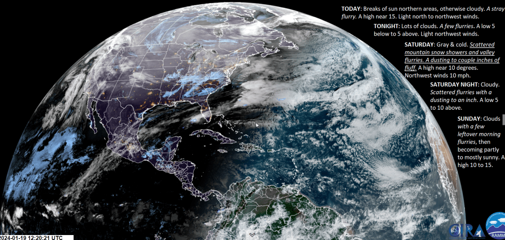
TODAY: Breaks of sun northern areas, otherwise cloudy. A stray flurry. A high near 15. Light north to northwest winds.
TONIGHT: Lots of clouds.A few flurries. A low 5 below to 5 above. Light northwest winds.

SATURDAY: Gray & cold. Scattered mountain snow showers and valley flurries. A dusting to couple inches of fluff. A high near 10 degrees. Northwest winds 10 mph.
Looking further ahead

SATURDAY NIGHT: Cloudy. Scattered flurries with a dusting to an inch.A low 5 to 10 above.
SUNDAY: Clouds with a few leftover morning flurries, then becoming partly to mostly sunny. A high 10 to 15.
MONDAY: Some morning sun, then high cloudiness. A low 5 below to 5 above. A high upper 20s to near 30.
TUESDAY: Overcast. Scattered flurries & mountain snow showers with a light accumulations mainly in the morning. Some intervals of afternoon sun. Not so cold. A low in the upper teens to near 20. A high 25 to 30.

WEDNESDAY: Gray. Chance for light to moderate snow accumulation…followed by a wintry mix with icy travel possible. A low around 25. A high around 32 degrees.
Average lows single digits. Average highs mid to upper 20s coldest period of winter.

RH/1-19forecast][end]
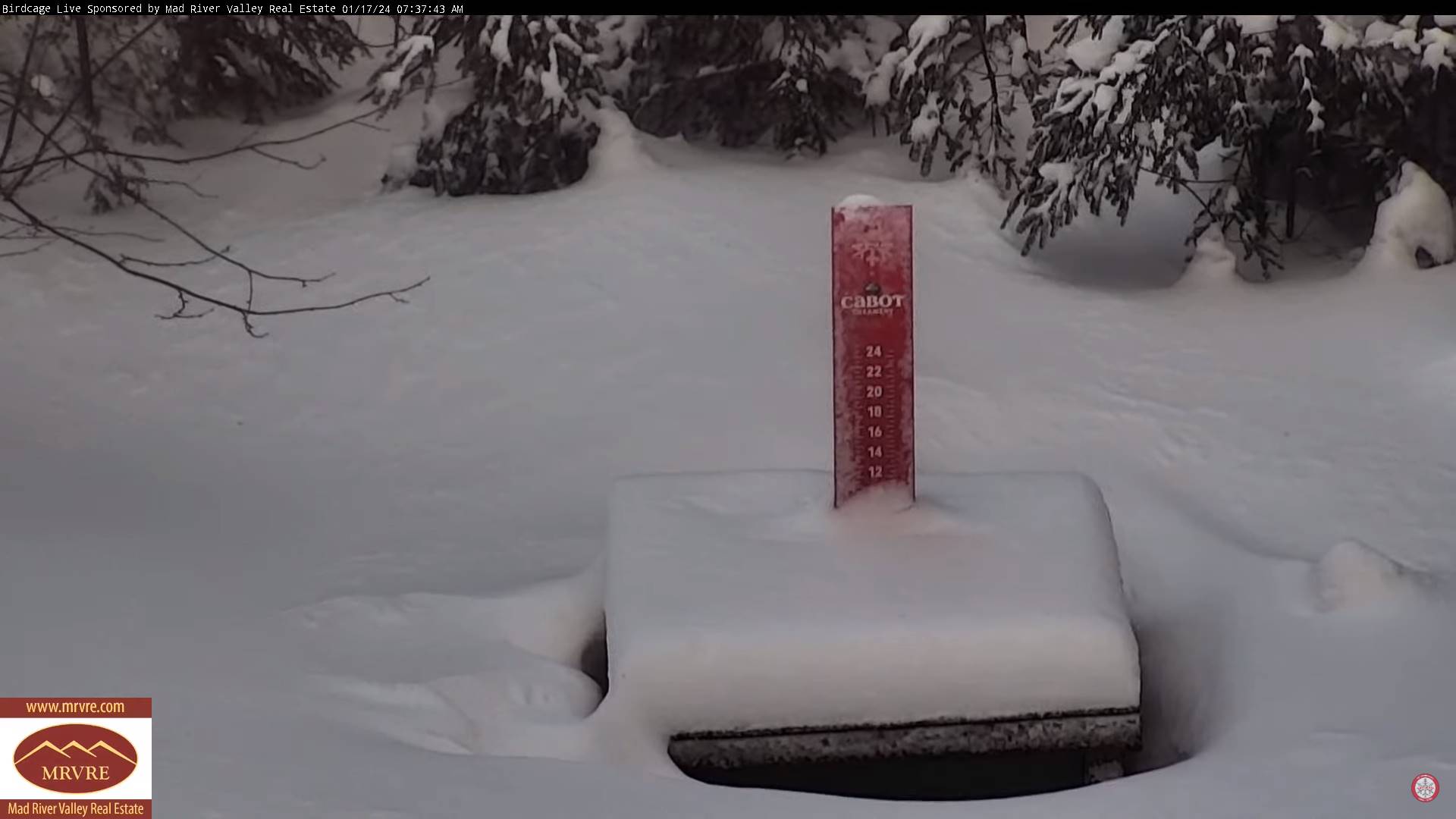
TONIGHT: Mainly cloudy. Occasional mountain snow showers and valley flurries. A dusting to locally 2 inches of fluffy accumulation. A low 5 to 10 above. Little wind.
TOMORROW: Breaks of sun northern areas, otherwise clouding up. A stray flurry. A high near 15. Light north to northwest winds.
FRIDAY NIGHT: Lots of clouds.Chance for mountain snow showers, valley flurries overnight with a minor coating. A low about zero to 5 above. Light northwest winds.
SATURDAY: Gray & cold. Persistent scattered mountain snow showers and valley flurries. A dusting to couple inches of fluff. A high near just 10 degrees. Northwest winds 10 mph.
Looking further ahead
SATURDAY NIGHT: Cloudy. Chance for flurries.A low zero to 5 above.
SUNDAY: Clouds with a few flurries early, then partly sunny in the afternoon. A high 10 to 15.
MONDAY: Some morning sun, then thickening clouds. A low in the single digits. A high mid-20s.
TUESDAY: Mainly gray. Widely scattered flurries or mountain snow showers. A low in the upper teens to near 20. A high 25 to 30.
Average lows single digits. Average highs mid to upper 20s coldest period of winter.
RH/1-18forecast][end]

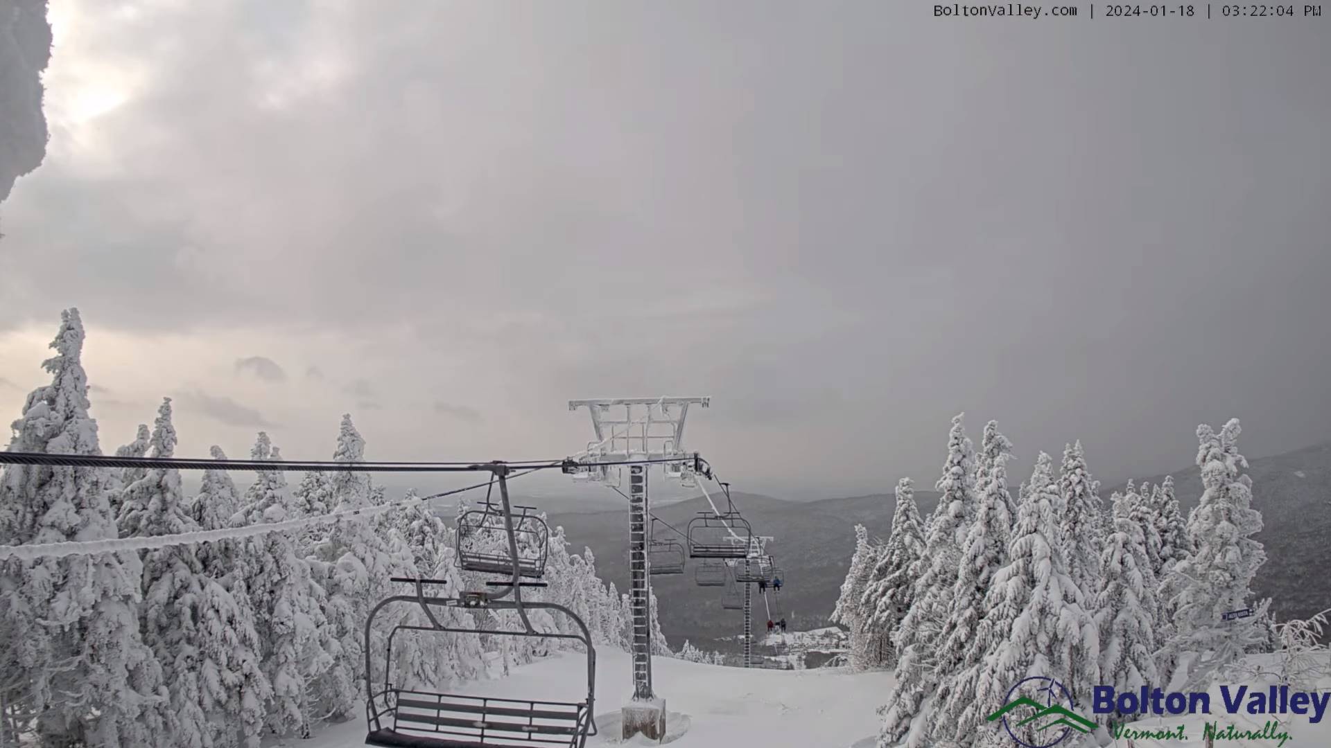
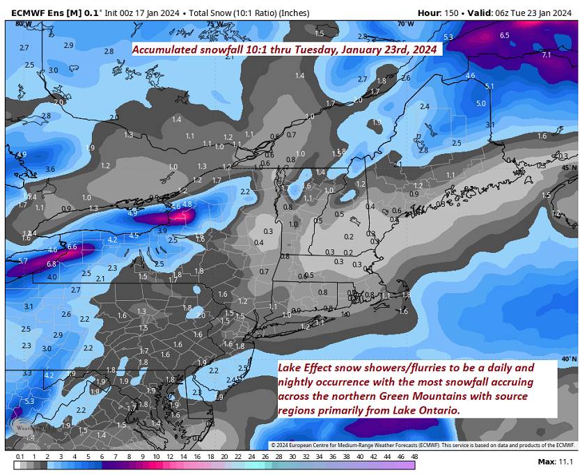
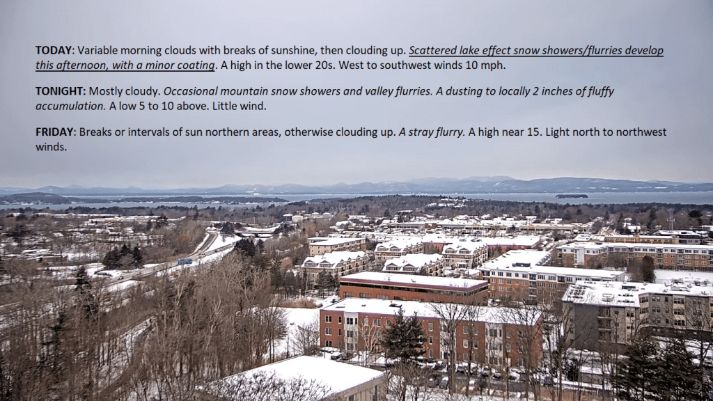
TODAY: Variable morning clouds with breaks of sunshine, then clouding up. Scattered lake effect snow showers/flurries develop this afternoon, with a minor coating. A high in the lower 20s. West to southwest winds 10 mph.
TONIGHT: Mostly cloudy. Occasional mountain snow showers and valley flurries. A dusting to locally 2 inches of fluffy accumulation. A low 5 to 10 above. Little wind.
FRIDAY: Breaks or intervals of sun northern areas, otherwise clouding up. A stray flurry. A high near 15. Light north to northwest winds.
Looking further ahead
FRIDAY NIGHT: Lots of clouds.Chance for mountain snow showers, valley flurries overnight with a minor coating. A low about zero to 5 above.
SATURDAY: Gray & cold. Persistent scattered mountain snow showers and valley flurries. A dusting to couple inches of fluff. A high near just 10 degrees.
SUNDAY: Clouds with a few flurries early, then partly to mostly sunny in the afternoon. A low zero to 5 above. A high 10 to 15.

MONDAY: Some morning sun, then thickening clouds with more flurries northern areas. A low in the single digits. A high mid-20s.
TUESDAY: Mainly gray. Widely scattered flurries or mountain snow showers. A low in the upper teens to near 20. A high 25 to 30.

Average lows single digits. Average highs mid to upper 20s coldest period of winter.
RH/1-18forecast][end]
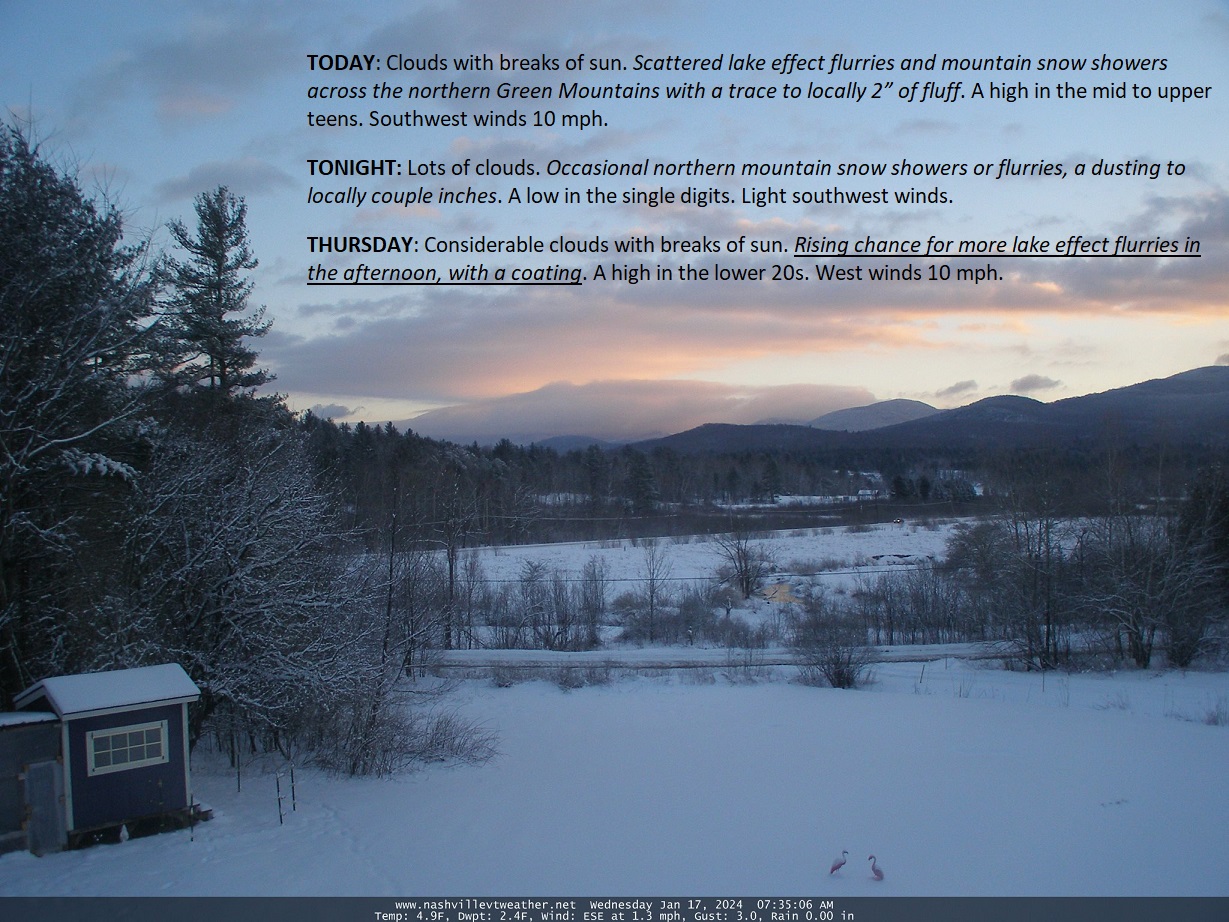
TODAY: Clouds with breaks of sun. Scattered lake effect flurries and mountain snow showers across the northern Green Mountains with a trace to locally 2” of fluff. A high in the mid to upper teens. Southwest winds 10 mph.
TONIGHT: Lots of clouds. Occasional northern mountain snow showers or flurries, a dusting to locally couple inches.A low in the single digits. Light southwest winds.
THURSDAY: Considerable clouds with breaks of sun. Rising chance for more lake effect flurries in the afternoon, with a coating. A high in the lower 20s. West winds 10 mph.
Looking further ahead
THURSDAY NIGHT: Partly to mostly cloudy. A stray flurry or two. A low about zero to 5 above.
FRIDAY: Breaks of sun far north, otherwise lots of clouds. A few mountain flurries. A high 10 to 15.
SATURDAY: Gray. Chance of mountain snow showers and valley flurries. A low 5 below to 5 above. A high about 10.
SUNDAY: Morning clouds with a few mountain flurries, becoming partly to mostly sunny later on. A low zero to 5 above. A high 10 to 15 above
MONDAY: Some morning sun, then mostly cloudy. A low zero to 10 above. A high pushing to near 30.
Average lows single digits. Average highs mid-20s to upper 20s coldest period of winter.
RH/1-17forecast][end]

Winter Weather Advisory expires later this evening…
TONIGHT: Light snow exits by 9 PM to a couple stray flurries. Lingering clouds northern areas, partly cloudy elsewhere. A low mid-single digits to low teens. Northwest winds 10 mph.
TOMORROW: Clouds with a few breaks of sun. A stray mountain flurry. A high in the mid to upper teens. Southwest winds 10 mph.
WEDNESDAY NIGHT: Variable clouds. A few stray flurries.A low zero to 10 above. Light southwest winds.
THURSDAY: Mostly cloudy. Occasional lake effect flurries, with minor coatings. A high upper teens to around 20. West winds 10 mph.
Looking further ahead
THURSDAY NIGHT: A stray flurry or two. A low 5 below to 5 above.

FRIDAY: Intervals of sun far north, otherwise lots of clouds. A few mountain flurries. A high 10 to 15.
SATURDAY: Mainly gray. Chance of a flurry. A low 5 below to 5 above. A high near 10.
SUNDAY: Morning clouds then increasing sunshine. A low zero to 10. A high in the teens.
MONDAY: High cloudiness. A low 5 below to 10 above. A high 25 to 30.
Average lows single digits. Average highs mid-20s to upper 20s

RH/1-16forecast][end]
