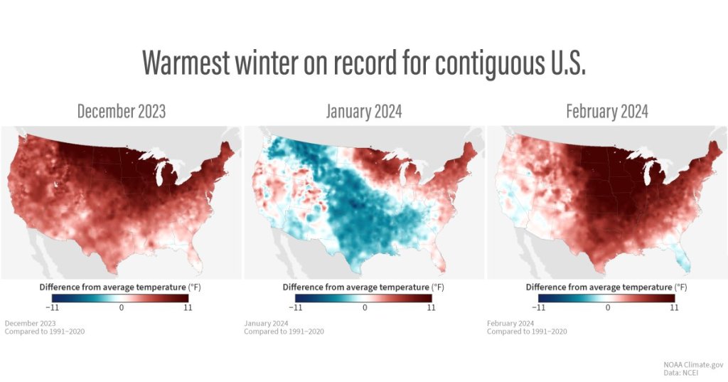
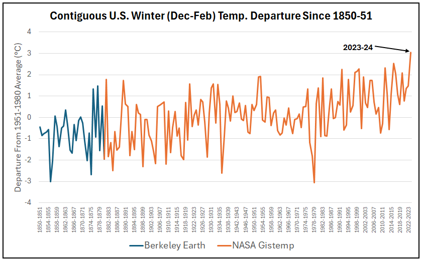
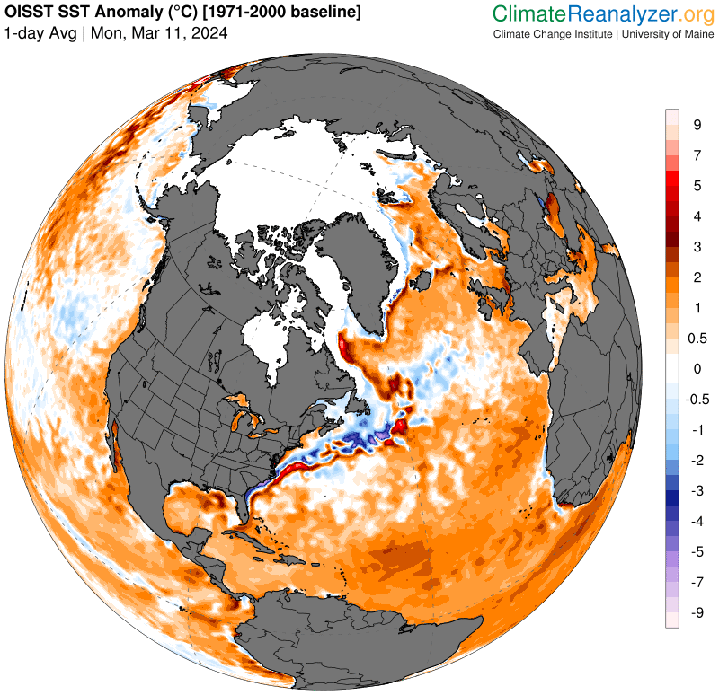
As you might have already guessed, it’s official. Climate Change + El Nino = Record warmth…


TONIGHT: Mostly clear with a few high clouds.A low mid-20s. Little wind.
TOMORROW: Morning sun, then afternoon cloudy periods with a scattered light passing sprinkles or rain showers. A high near 50.Light winds.
WEDNESDAY NIGHT: Partly cloudy, with more clouds overnight. Chance for a passing rain shower with risk for icy spots.A low 30 to 35. Light southeast winds.
THURSDAY: Maybe a northern mountain sprinkle early, then partly sunny & milder. A high in the lower 50s. Southeast breeze 10 mph.
Looking further ahead
THURSDAY NIGHT: Cloudy. A rising chance for periods of light rain, with a risk of a wintry mix east of the Green Mountains.A low around 35.
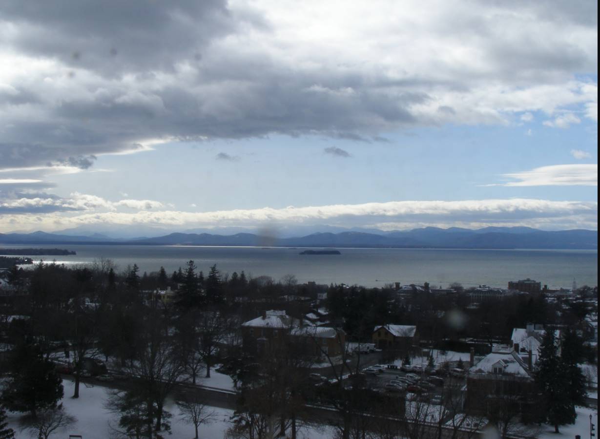
FRIDAY: Gray. Chance for rain showers mixed with wet snow flakes high terrain.A high mid-40s.
SATURDAY: Mostly cloudy. Widely scattered rain showers mixed with wet snowflakes in the mountains. A low around 32. A high in the mid-40s.
SUNDAY: Lots of clouds.Scattered rain showers in the afternoon. A low 30 to 35. A high upper 40s.
MONDAY: Partly sunny. Chance for a few passing flurries or sprinkles. A low 30 to 32. A high around 40 to 45.

Average lows mid-teens to low 20s. Average highs mid-30s to low 40s
RH/3-12forecast][end]
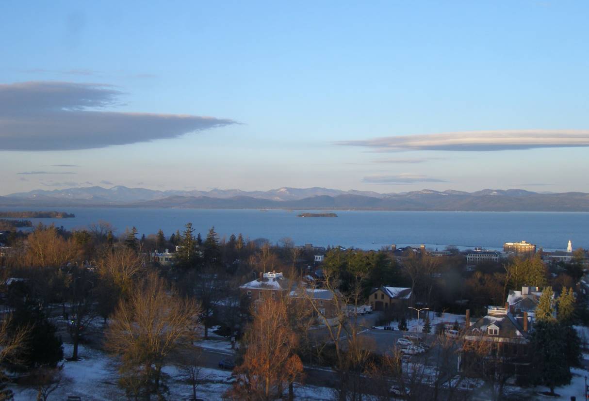
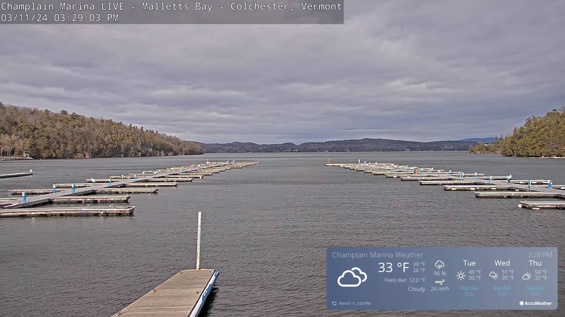
TODAY: Pick of the week. Gorgeous, bright sun and blue skies & milder. A high in the low 40s. Northwest winds 10 to 15 mph.
TONIGHT: Mostly clear with a few high clouds.A low mid-20s. Little wind.
WEDNESDAY: Morning sun, then more afternoon clouds. Widely scattered sprinkles late in the afternoon. A high around 50.Light winds.

Looking further ahead
WEDNESDAY NIGHT: Variable clouds. Chance for a passing rain shower with risk for an icy spots.A low 30 to 35.
THURSDAY: Mixed sun and clouds & milder. A high in the lower 50s.
FRIDAY: Increasingly cloudy.A rising chance for rain showers in the afternoon with a few wet snow flakes high terrain.A low around 35. A high mid-40s.
SATURDAY: Mostly cloudy. Widely scattered rain showers mixed with wet snowflakes in the mountains. A low around 32. A high in the mid-40s.

SUNDAY: Lots of clouds.Scattered rain showers in the afternoon. A low 30 to 35. A high upper 40s.
MONDAY: Partly sunny. Chance for a few passing flurries or sprinkles. A low 30 to 32. A high around 40 to 45.
Average lows mid-teens to low 20s. Average highs mid-30s to low 40s

RH/3-12forecast][end]

Winter Storm Warnings and Advisories thru 8 PM, & Wind Advisories thru 2 AM Tuesday morning…
TONIGHT: Mountain flurries wind down this evening, then mostly clear with a couple of clouds overnight. A low 20 to 25. Northwest winds 10 to 20 mph becoming light overnight.
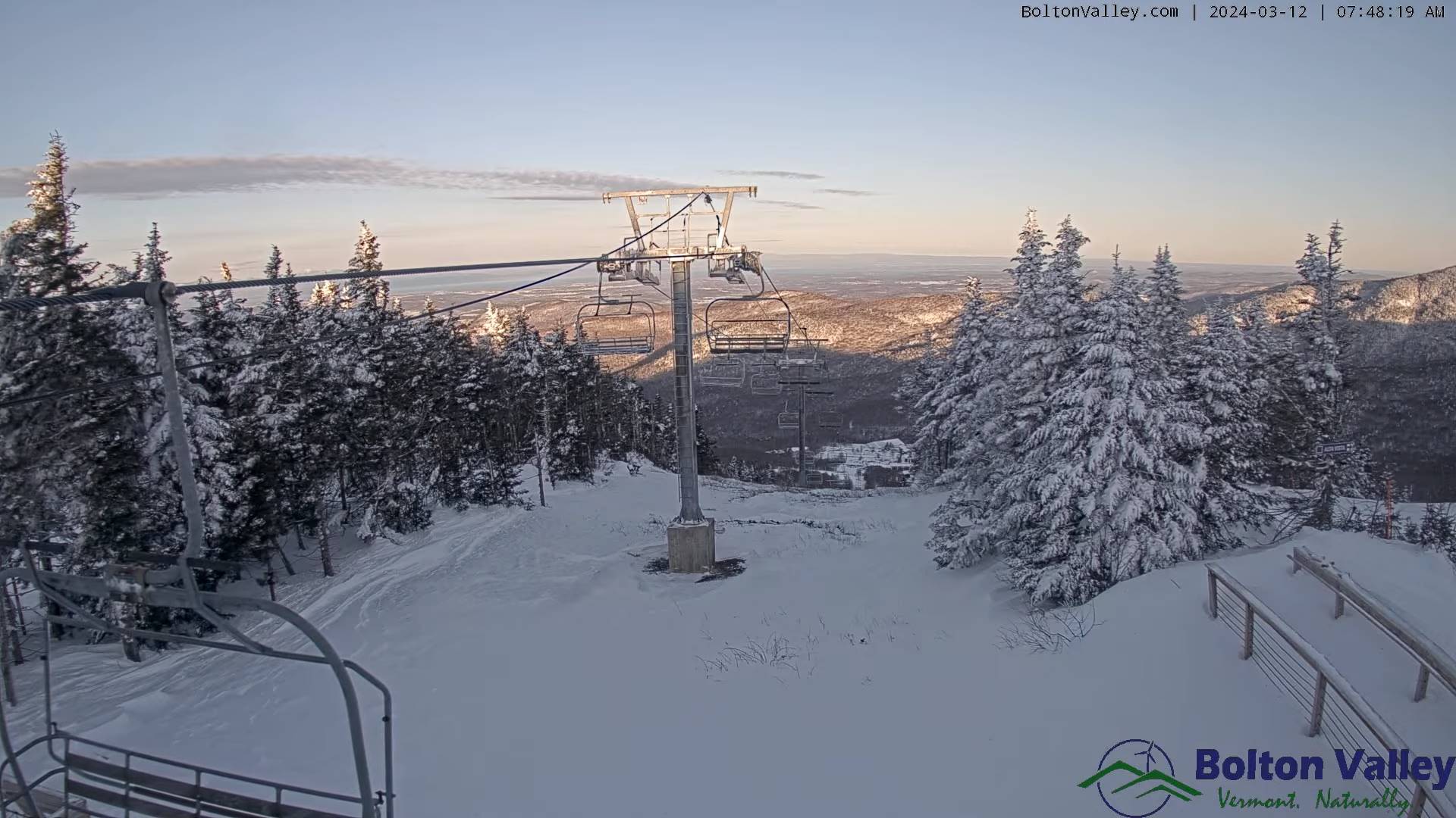
TOMORROW: A beauty with bright sun and blue skies. Warming trend. A high near 40. Northwest winds 10 to 15 mph.
TUESDAY NIGHT: Mostly clear with a few high clouds.A low 20 to 25. Little wind.
WEDNESDAY: Morning sun, then more afternoon clouds. Widely scattered sprinkles late in the afternoon. A high pushing to near 50.Light winds.
Looking further ahead
WEDNESDAY NIGHT: Partly cloudy.A low 32 to 35.
THURSDAY: Mixed sun and clouds. A high in the lower 50s.
FRIDAY: Increasingly cloudy.A rising chance for rain showers in the afternoon.A low in the mid to upper 30s. A high 45 to 50.
SATURDAY: Mainly cloudy. Scattered rain and wet snow showers in the higher terrain. A low around 32. A high 45 to 50.
Average lows mid-teens to low 20s. Average highs mid-30s to low 40s
RH/3-11forecast][end]
