Updated Friday Morning Forecast — January 10th, 2019

Full Wolf Moon 2:21 p.m.

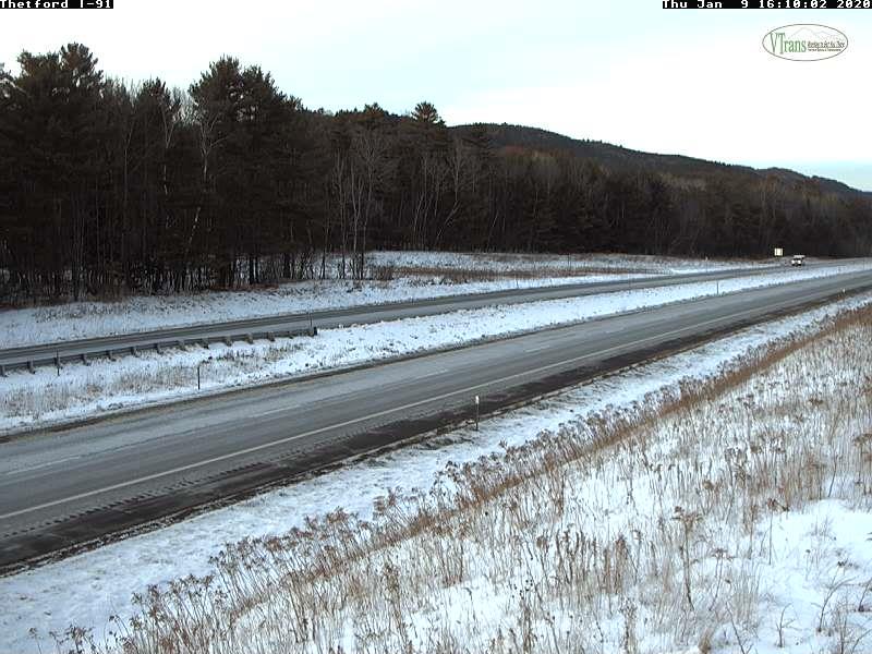
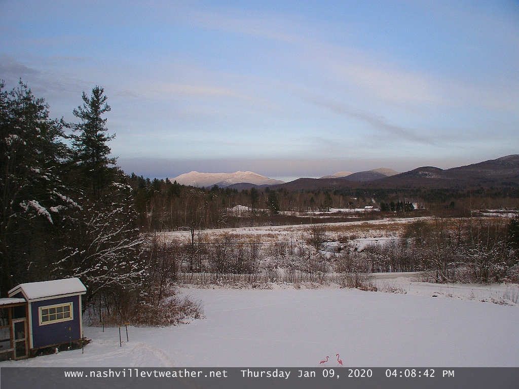
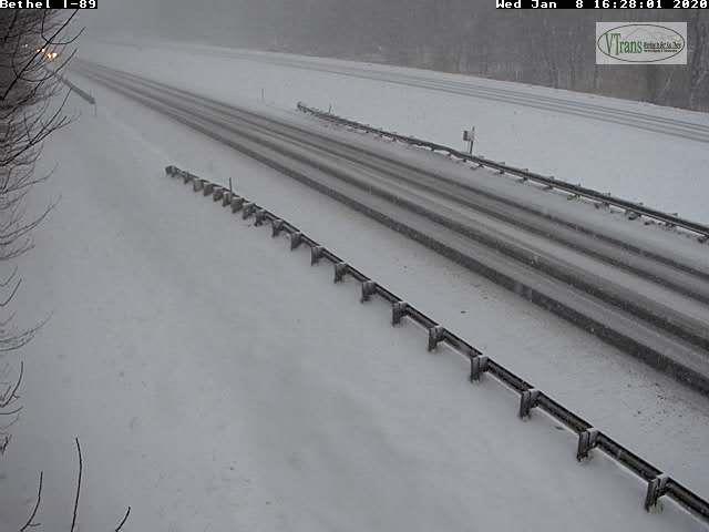
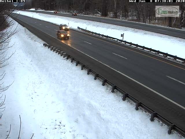
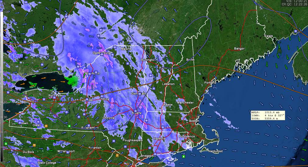
TODAY: Overcast. A brief wintry mix of wet snow, sleet and freezing rain arrives after the morning commute. Watch for slick spots. Widely scattered light rain showers this afternoon and milder. A late afternoon high in the mid to upper 30s. South winds 10 to 15 mph except stronger near Lake Champlain this morning.

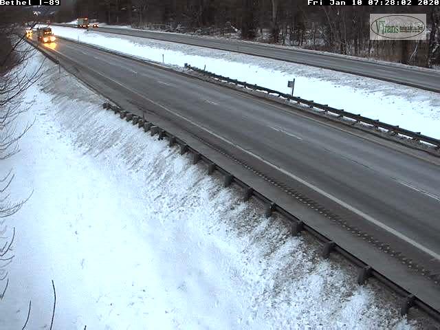
TONIGHT: Mainly cloudy. Light rain showers or sprinkles especially after midnight. A low around 35. South winds 10 mph.

SATURDAY: Gray. Showers becoming steadier late in the day. Areas of fog and milder. A high in the lower 50s…creating snow melt and rising streams and river levels. South breeze 10 to 20 mph.

Looking further ahead…

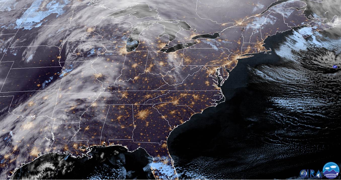
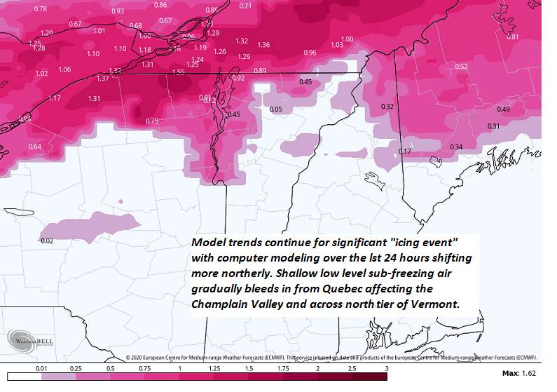
Flood Watch much of the region Saturday Night into Sunday…Winter Storm Watch across the northern Tier and portions of the Champlain Valley

SATURDAY NIGHT: Overcast. Rain likely, moderate at times…except freezing rain potions of northern tier and Champlain Valley. Icing from a trace to a ½” possible. A low 30 to 32 far northern areas, otherwise mid-30s to low 40s.

SUNDAY: Periods of rain likely…moderate at times, with a risk of significant icing northern tier and northern Champlain Valley with hazardous travel. Afternoon rain showers exit late. A high 35 to 45 northern areas and 45 to 55 degrees central and southern areas.

MONDAY: Partly sunny. A low in the mid-20s. A high near 40.

TUESDAY: Filtered sun through high cloudiness. A low in the teens. A high in the low 30s.

Average lows single digits to low teens, average highs in the 20s.

RH/1-9-20[end]

Updated Thursday Evening Forecast — January 9th, 2020

TONIGHT: High overcast. A low 5 to 10 above. Southeast winds 10 to 15 mph.

Full Wolf Moon 2:21 p.m.

TOMORROW: Overcast. A wintry mix of rain, freezing rain and some sleet developing late morning. Watch for slick spots. Occasional light rain showers in the afternoon. A late day high 35 to 40. South winds 10 to 15 mph.

FRIDAY NIGHT: Mainly cloudy. Good chance for a light showers or sprinkles after midnight. A low around 35. South winds 10 mph.

SATURDAY: Gray. Chance for showers becoming steadier late in the day. Areas of fog and milder. A high in the low to mid 50s with lots of snow melt and rising streams and river levels. South breeze 10 to 20 mph.

Looking further ahead…

SATURDAY NIGHT: Overcast. Rain likely, moderate at times…except freezing rain potions of northern tier and Champlain Valley. Icing from a trace to a third of an inch possible. A low 30 to 32 far northern areas, otherwise mid-30s to low 40s.

SUNDAY: Periods of rain likely…moderate at times, with a risk of significant icing northern tier and northern Champlain Valley with hazardous travel. Rain showers exit late. A high 35 to 45 northern areas and 45 to 55 degrees central and southern areas.

MONDAY: Partly to mostly sunny. A low in the mid-20s. A high near 40.

TUESDAY: Partly to mostly sunny. A low in the teens. A high in the low 30s.

Average lows single digits to low teens, average highs in the 20s.

RH/1-9-20[end]

Updated Thursday Morning forecast — January 9th, 2020

TODAY: Pick of the week. Sunny after a few morning clouds before more high clouds late. A high around 20. Northwest winds 10 mph diminishing.

TONIGHT: Overcast. A low 5 to 10 above. Southeast winds 10 to 15 mph.

Full Wolf Moon 2:21 p.m.

FRIDAY: Overcast. A wintry mix of rain, freezing rain and some sleet developing late morning. Watch for slick spots. Occasional light rain showers in the afternoon. A late day high 35 to 40. South winds 10 to 15 mph.

Looking further ahead…

FRIDAY NIGHT: Mainly cloudy. Good chance for a light showers or sprinkles after midnight. A low around 35.

SATURDAY: Gray. Chance for showers becoming steadier late in the day. Areas of fog and milder. A high in the low to mid 50s with lots of snow melt and rising streams and river levels.

SUNDAY: Good chance for periods of rain…moderate at times, with a risk of significant icing northern tier and northern Champlain Valley producing poor travel. Risk of thunder. Wide ranging temperatures…upper 20s to low 30s north, in the 40s central to near 50 southern areas.

MONDAY: Partly to mostly sunny. A low in the mid 20s. A high near 40.

TUESDAY: Partly to mostly sunny. A low in the teens. A high in the low 30s.

Average lows single digits to low teens, average highs in the 20s.

RH/1-9-20[end]

Updated Wednesday Evening Forecast — January 8th, 2020

TONIGHT: Snow showers and heavier snow squalls exiting early this evening. Otherwise becoming partly cloudy with few flurries Northeast Kingdom. A low near 5 above. Northwest winds 10 to 20 mph lowering wind chills.

TOMORROW: Pick of the week. Mostly sunny through mid afternoon then increasing high clouds. A high in the upper teens to around 20. Northwest winds 10 mph diminishing.

THURSDAY NIGHT: Overcast. A low 5 to 10 above. Southeast winds 10 to 15 mph.

FRIDAY: Overcast. A wintry mix of wet snow, sleet and freezing rain likely developing by late morning…with slick travel…changing to occasional light rain showers in the afternoon. A late day high in the mid to upper 30s. South winds 10 to 15 mph.

Looking further ahead…

FRIDAY NIGHT: Mainly cloudy. Good chance for a light showers or sprinkles after midnight. A low around 35

SATURDAY: Gray. Chance for showers becoming steadier late in the day. Areas of fog and milder. A high around 50.

SUNDAY: (Lowered Confidence) Overcast. Chance for periods of rain or mixed precipitation moderate at times, with a risk of icing northern tier and Champlain Valley producing poor travel. Risk of thunder. Wide ranging temperatures…upper 20s to low 30s north, in the 40s central to near 50 southern areas.

MONDAY: Partly to mostly sunny. A low in the 20s. A high near 40.

Average lows single digits to low teens, average highs in the 20s.

RH/1-8-20[end]

Updated Wednesday Morning Forecast — January 8th, 2019

TODAY: Occasional light snow or snow showers…with locally heavier burst of snow late. Accumulation dusting to locally 3”with the most across northern higher terrain. Intervals of sun developing and turning blustery late. A high 30 to 35. West winds pick up 10 to 20 mph.

TONIGHT: Partly cloudy, blustery and frigid. Evening flurries winding down with a light coating. A low zero to 10 above. Northwest winds 10 to 15 mph lowering wind chills.

THURSDAY: Pick of the week. Mostly sunny through mid afternoon then increasing high clouds. A high in the upper teens to around 20. Light winds.

Looking further ahead…

THURSDAY NIGHT: Overcast. A low 5 to 10 above.

FRIDAY: Overcast. A wintry mix of wet snow, sleet and freezing rain likely…with slick travel…changing to occasional light rain toward evening. A late day high in the mid to upper 30s.

SATURDAY: Gray. Periods of light rain likely. Areas of fog and milder. A low around 35. A high around 50.

SUNDAY: (Lowered Confidence) Overcast. Chance for periods of rain or mixed precipitation moderate at times, with a risk of icing northern tier and Champlain Valley producing poor travel. Wide ranging temperatures…upper 20s to low 30s north, in the 40s central to near 50 southern areas.

Average lows single digits to low teens, average highs in the 20s.

RH/1-8-20[end]

Updated Tuesday Evening Forecast — January 7th, 2019

TONIGHT: Cloudy. Occasional flurries developing late this evening with a light skiff of snow overnight. A low around 20. Light southeast winds.

TOMORROW: Scattered snow showers. Accumulation dusting to locally 3”with the most near the Green Mountains. Intervals of sun developing and turning blustery late. A high around 30. West winds pick up 10 to 20 mph.

WEDNESDAY NIGHT: Partly cloudy, blustery and frigid. Evening flurries winding down with a light coating. A low around zero degrees. Northwest winds 10 to 15 mph lowering wind chills.

THURSDAY: Pick of the week. Mostly sunny through mid afternoon then increasing high clouds. A high in the upper teens to around 20. Light winds.

Looking further ahead…

THURSDAY NIGHT: Overcast. A morning low around zero.

FRIDAY: Overcast. Chance for a wintry mix with slick travel…changing to occasional light rain in the afternoon. A late day high in the upper 30s.

SATURDAY: Gray. Chance for rain or rain showers. Areas of fog and milder. A low around 35. A high 45 to 50.

SUNDAY: Overcast. Mixed precipitation…possibly moderate at times with potentially poor travel. A low 15 to 25. A high 35 to 40.

Average lows single digits to low teens, average highs in the 20s.

RH/1-7-20[end]

Updated Tuesday Morning Forecast — January 7th, 2019

TODAY: A flurry or two, then mixed sun and clouds before clouds thicken up late. A high in the lower 30s. Light southwest winds.

TONIGHT: Cloudy. Occasional flurries with light coating of snow. A low around 20. Light south winds.

WEDNESDAY: Occasional snow showers or flurries with a dusting to an inch. Intervals of sun developing and turning blustery late with. A high around 30. West winds 10 to 15 mph.

Looking further ahead…

WEDNESDAY NIGHT: Partly cloudy, blustery and frigid. Isolated flurries and “diamond dust”. A low 5 below to 5 above.

THURSDAY: Pick of the week. Mostly sunny but cold. A high 20 to 25.

FRIDAY: Overcast. Chance for a wintry mix with slick travel…changing to occasional light rain in the afternoon. A morning low around zero. A late day high in the upper 30s.

SATURDAY: Gray. Chance for rain or rain showers. Areas of fog and milder. A low around 35. A high 45 to 50.

SUNDAY: Overcast. Mixed precipitation…possibly moderate at times with potentially poor travel. A low 15 to 25. A high 35 to 40.

Average lows single digits to low teens, average highs in the 20s.

RH/1-7-20[end]

Updated Monday Evening Forecast — January 6th, 2020

TONIGHT: Variable clouds. Scattered mountain snow showers and valley flurries with additional accumulation dusting to a couple inches mainly northern high terrain. A low in the upper teens. Light southwest winds.

TOMORROW: A flurry or two, then mixed sun and clouds before thicken up late. A high near 30. Westerly winds 10 mph diminishing in the afternoon.

TUESDAY NIGHT: Cloudy. Slight chance for a flurry overnight. A low 15 to 20. Light south winds.

WEDNESDAY: Good chance for snow showers & turning blustery later in the afternoon with intervals of sun. A high around 30. West winds 10 to 15 mph.

Looking further ahead…

WEDNESDAY NIGHT: Partly to mostly cloudy. Isolated flurries and “diamond dust”. A low 5 below to 5 above.

THURSDAY: Pick of the week. Mostly sunny but colder. A high around 20.

FRIDAY: Overcast. Chance for mixed precipitation with slick travel…changing to occasional light rain in the afternoon. A morning low around zero. A late day high pushing to near 40.

SATURDAY: Gray. Chance for rain or rain showers. A low 32 to 35. A high 45 to 50.

SUNDAY: Mixed precipitation with potentially poor travel. A low in the mid-20s. A high 35 to 40.

Average lows single digits to low teens, average highs in the 20s.

RH/1-6-20[end]

Updated Monday morning Forecast — January 6th, 2020

TODAY: Lots of clouds. Occasional light snow or flurries developing this morning…with accumulation of ½” to an inch. Colder. A high in the upper 20s. Southeast winds 10 mph.

TONIGHT: Variable clouds. Scattered mountain snow showers and valley flurries with additional minor accumulation. A low mid to upper teens. Light southwest winds.

TUESDAY: A flurry or two, then mixed sun and clouds before more clouds later on. A high 25 to 30. Westerly winds 10 to 15 mph diminishing in the afternoon.

Looking further ahead…

TUESDAY NIGHT: Cloudy. Slight chance for a flurry overnight. A low 15 to 20.

WEDNESDAY: Mainly gray. Good chance for snow showers & turning blustery later in the afternoon. A high around 32.

THURSDAY: Pick of the week. Mostly sunny but colder. A low zero to 10 above. A high in the upper teens to mid-20s.

FRIDAY: Overcast. Chance for snow or mixed precipitation with tricky travel…changing to rain. A morning low in the single digits. A late day high near 40.

Average lows single digits to low teens, average highs in the 20s.

RH/1-6-20[end]

Updated Friday Evening Forecast — January 3rd, 2020

TONIGHT: Overcast. Isolated sprinkles western areas. A low around 30 Northeast Kingdom, and 32 to 35 elsewhere. Light west winds.

TOMORROW: Cloudy. Rain and wet snow developing in the morning. Wet snow falling moderate at times in the afternoon. Slushy accumulation of 2 to 4” valleys with more on the mountain summits. A high near 35. Light north winds.

SATURDAY NIGHT: Cloudy. Occasional light snow. Additional accumulation 1 to 3”. A low 20 to 25. Northwest winds 10 mph.

SUNDAY: Gray. Snow showers…exiting late. A dusting to an inch. A high around 32. Northwest winds 10 to 15 mph.

Looking further ahead…

SUNDAY NIGHT: Overcast. Colder. A low mid-single digits to mid-teens.

MONDAY: Clouding up. Chance for occasional light snow or flurries. Colder. A high 25 to 30.

TUESDAY: Clouds with a flurry or tow departing. Then, partly sunny. A low upper teens. A high in the low 30s.

WEDNESDAY: Gray. Chance for snow, possibly significant accumulation. A low around 20. A high 25 to 30.

Average lows mid-single digits to low teens, average highs mid-20s to near 30.

RH/1-3-20[end]