Updated Monday Morning Forecast — July 27th, 2020

Heat Advisories S Champlain Valley and lower valleys Windsor County…

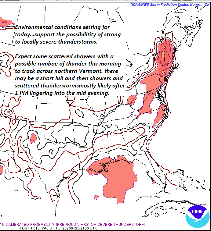
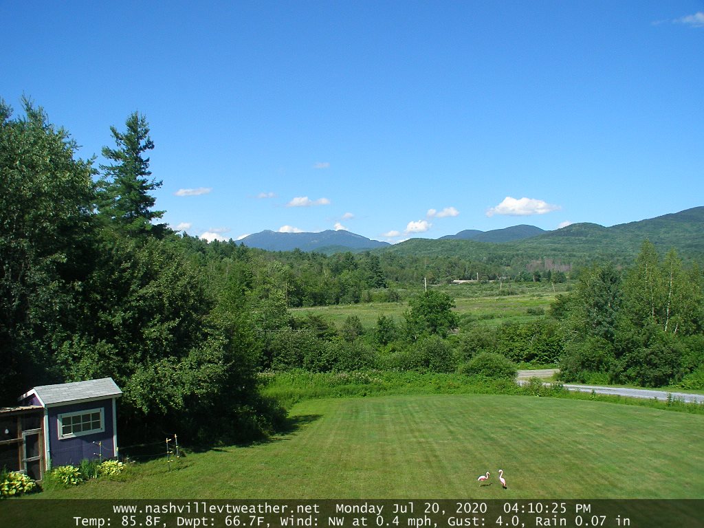
TODAY: Morning showers with an isolated rumble of thunder Barre-Montpelier area north. Otherwise variable clouds. Widely scattered afternoon and evening showers and thunderstorms mainly northern tier region…a few possibly strong to locally severe. Hot and oppressive with a high around 90. Southwest breeze 10 mph.

TONIGHT: Maybe an isolated shower or storm exiting, otherwise partly cloudy, warm and oppressive. A low upper 60s to near 70. Light southwest winds.

TUESDAY: A round showers and thunderstorms some strong with locally heavy downpours late morning into early afternoon then exiting. Partly to mostly sunny late. Sticky with a high around 85 turning less humid late. Light west breeze.

Looking further ahead…

TUESDAY NIGHT: Becoming mostly clear with a few high clouds. Considerable valley fog. Much less humid. A low 55 to 60.

WEDNESDAY: Pick of the week. Partly to mostly sunny with more clouds late. Much more comfortable and pleasant. A high near 85.

THURSDAY: Partly sunny. Chance for a afternoon shower or thunderstorm. A low in the low 60s. A high upper 70s to near 80.

FRIDAY: Widely scattered showers and thunderstorms in the afternoon. A low 55 to 60. A high 75 to 80.

Average lows low 60s, average highs around 80.

RH/7-27[end]

Updated Friday Evening Forecast — July 24th, 2020

· ** Good viewing for Comet Neowise this evening. Find a spot away from city lights with an unobstructed view of the sky.

· Just after sunset, look below the Big Dipper in the northwest sky.

· If you have them, bring binoculars or a small telescope to get the best views of this dazzling display.

TONIGHT: **Mostly clear with some high cloudiness after midnight. Patchy valley fog. A low upper 50s to near 60. Little wind.

TOMORROW: Isolated valley fog burns off to filtered sun through high clouds. Comfortable and pleasant. A high in the low 80s. Light west breeze.

STAURDAY NIGHT: Mostly clear with some high cloudiness. A low 60 to 65. Light southwest winds.

SUNDAY: Hazy warm and increasingly more muggy, with variable high cloudiness. A high in the mid-80s. Southwest breeze 10 mph.

Looking further ahead…

SUNDAY NIGHT: Clouds northern areas with a rising chance for showers & isolated thunderstorms. Otherwise partly cloudy. Oppressively humid and uncomfortable with a low around 70

MONDAY: Mostly cloudy. Warm & sticky. Chance for mainly afternoon showers and thunderstorms. A high in the mid-80s.

TUESDAY: Partly sunny warm & sticky. Chance for mainly afternoon showers and thunderstorms. A low around 70. A high 80 to 85.

WEDNESDAY: Partly to mostly sunny.A low in the low 60s. A high in the low 80s.

Average lows low 60s, average highs around 80.

· ** Good viewing for Comet Neowise this evening. Find a spot away from city lights with an unobstructed view of the sky.

· Just after sunset, look below the Big Dipper in the northwest sky.

· If you have them, bring binoculars or a small telescope to get the best views of this dazzling display.

RH/7-24[end]

Updated Friday morning Forecast — July 24th, 2020

TODAY: Pick of the week. Mostly sunny and not too humid. A high around 80. Light northwest winds.

TONIGHT: Mostly clear with some high cloudiness after midnight. Patchy valley fog. A low upper 50s to near 60. Little wind.

SATURDAY: Isolated valley fog burns off to filtered sun through high clouds. Comfortable and pleasant. A high in the low 80s. Light west breeze.

Looking further ahead…

SATURDAY NIGHT: Mostly clear with some high cloudiness. A low 60 to 65.

SUNDAY: Hazy warm and increasingly more muggy, with variable high cloudiness. A high in the mid-80s

MONDAY: Mostly cloudy. Warm & sticky. Chance for thunderstorms in the early morning hours, and widely scattered late afternoon. A low around 70. A high in the mid-80s.

TUESDAY: Partly sunny warm & sticky. Chance for mainly afternoon showers and thunderstorms. A low in the low 70s. A high 80 to 85.

WEDNESDAY: Partly to mostly sunny.A low in the low 60s. A high near 80.

Average lows low 60s, average highs around 80.

RH/7-24[end]

Updated Thursday Evening Forecast — July 23rd, 2020

TONIGHT: Scattered early evening clouds with a few showers toward southern areas exiting. Otherwise mostly clear except patchy valley fog. A touch cooler. A low upper 50s to around 60. Light northwest winds.

TOMORROW: Pick of the week. Partly sunny mostly sunny and not to humid. A high around 80. Light northwest winds.

FRIDAY NIGHT: Mostly clear with some high cloudiness after midnight. Patchy valley fog. A low upper 50s to near 60. Little wind.

SATURDAY: Isolated valley fog burns off to filtered sun through high clouds. A high in the low 80s. Light west breeze.

Looking further ahead…

STAURDAY NIGHT: Mostly clear with some high cloudiness. A low 60 to 65.

SUNDAY: Hazy warm and increasingly sticky, with lots of sunshine. A high in the mid-80s

MONDAY: Mixed sun and clouds. Warm & sticky. Slight chance for a shower or storm. A low near 70. A high in the mid-80s.

TUESDAY: Partly sunny warm & sticky. Chance for mainly afternoon showers and thunderstorms. A low around 70. A high mid 80s.

Average lows low 60s, average highs around 80.

RH/7-23[end]

Updated Thursday Morning Forecast — July 23rd, 2020

TODAY: Occasional showers this morning, maybe a rumble of thunder. Showers with a good chance for thunderstorms…some strong to locally severe especially central and southern areas with heavy downpours and gusty winds. A high 75 to 80. Light west to southwest winds.

TONIGHT: Early to mid-evening showers and thunderstorms exiting one or two strong to locally severe. Patchy valley fog. A low upper 50s to around 60. Light northwest winds.

FRIDAY: Pick of the week. Partly sunny & moderately humid. A high around 80. Light north winds.

Looking further ahead…

FRIDAY NIGHT: Mostly clear with some high cloudiness. Patchy valley fog. A low upper 50s to near 60.

SATURDAY: Isolated valley fog burns off to filtered sun through high clouds. A high in the low 80s.

SUNDAY: Hazy warm and increasingly sticky, with partly sunny skies. A low 60 to 65. A high in the mid to upper 80s.

MONDAY: Partly sunny warm & sticky. Slight chance for a shower or storm far northern border areas. A low near 70. A high in the mid to upper 80s.

TUESDAY: Partly sunny warm & sticky. Chance for mainly afternoon showers and thunderstorms. A low around 70.

Average lows low 60s, average highs around 80.

RH/7-22[end]

Updated Wednesday Evening Forecast — July 22nd, 2020

TONIGHT: Mainly cloudy. Showers with a chance for a few thunderstorms. Muggy. Patchy valley fog. A low in the mid-60s. Light south winds.

TOMORROW: Variably cloudy. Chance for showers with a few afternoon thunderstorms especially southern and eastern areas. A high 75 to 80. Light west to southwest winds.

THURSDAY NIGHT: Chance for evening showers and thunderstorms exiting. Patchy valley fog. A low in the low 60s. Light northwest winds.

FRIDAY: Pick of the week. Partly sunny & moderately humid. A high around 80. Light north winds.

Looking further ahead…

FRIDAY NIGHT: Mostly clear with some high cloudiness. Patchy valley fog. A low upper 50s to near 60.

SATURDAY: Isolated valley fog burns off to filtered sun through high clouds. A high in the low to mid-80s.

SUNDAY: Hazy warm and increasingly sticky, with partly sunny skies. Scattered showers and thunderstorms far northern areas. A low in the mid-60s. A high 85 to 90.

MONDAY: Partly sunny. Isolated afternoon thunderstorms. A low upper 60s to near 70. A high upper 80s to near 90.

Average lows low 60s, average highs around 80.

RH/7-22[end]

Updated Wednesday morning Forecast — July 22nd, 2020

Half-way point of Meteorological Summer

TODAY: More clouds than sun. A few showers mainly far southern areas this morning. Widely scattered showers with a rumble of thunder possible late this afternoon. A high around 80 and increasingly muggy again. Light south to southeast winds.

TONIGHT: Mainly cloudy. A good chance for showers and a few locally heavy thunderstorms. More humid. Patchy valley fog. A low in the mid-60s. Southeast breeze shifting to southwesterly overnight 10 mph.

THURSDAY: Variably cloudy. Chance for showers with a few afternoon thunderstorms especially southern and eastern areas. A high upper 70s to around 80. Light northwest winds.

Looking further ahead…

THURSDAY NIGHT: Chance for evening showers and thunderstorms exiting. Patchy valley fog. A low in the low 60s.

FRIDAY: Pick of the week. Partly sunny & moderately humid. A high upper 70s to around 80

SATURDAY: Isolated valley fog burns off to filtered sun thru high clouds. A low around 60. A high in the mid-80s.

SUNDAY: Hazy warm and increasingly sticky, with partly sunny skies. Scattered showers and thunderstorms far northern areas. A low 60 to 65. A high 85 to 90.

MONDAY: Partly sunny. Isolated afternoon thunderstorms. A low in the mid-60s. A high upper 80s to near 90.

Average lows low 60s, average highs around 80.

RH/7-22[end]

Updated Tuesday Evening Forecast — July 21st, 2020

TONIGHT: Mostly clear with high cloudiness overnight. Patchy valley fog. A low in the upper 50s. Light north winds.

Peak of summer July 22nd

TOMORROW: Mixed sun and clouds. Maybe a late day shower. A high around 80 and increasingly muggy again. Light south to southeast winds.

WEDNESDAY NIGHT: Mainly cloudy. Scattered showers and a few locally heavy thunderstorms. More humid. Patchy valley fog. A low 65 to 70. Southeast breeze shifting to southwesterly overnight 10 mph.

THURSDAY: Partly sunny. Chance for an afternoon shower or thunderstorm mainly southern areas. A high around 80. Light northwest winds.

Looking further ahead…

THURSDAY NIGHT: Mostly clear. Patchy valley fog. A low around 60.

FRIDAY: Pick of the week. A few clouds mixed with lots of sun. Moderately humid. A high near 80.

SATURDAY: Isolated valley fog burns off to filtered sun thru high clouds. A low upper 50s to around 60. A high near 85.

SUNDAY: Hazy warm and increasingly sticky, with partly sunny skies. Chance for a thunderstorm Sunday night. A low 60 to 65. A high 85 to 90.

MONDAY: Partly sunny. Isolated afternoon thunderstorms. A low in the mid-60s. A high upper 80s to near 90.

Average lows low 60s, average highs around 80.

RH/7-21[end]

Updated Tuesday Morning Forecast — July 21st, 2020

TODAY: Cloudiness for a time this morning. Mostly sunny this afternoon and pleasant. Moderate levels of humidity. A high in the mid-70s to near 80. Northwest winds 10 mph.

TONIGHT: Mostly clear with high cloudiness overnight. Patchy valley fog. A low mid to upper 50s. Light north winds.

Peak of summer July 22nd

WEDNESDAY: Sun and clouds. Widely scattered late day showers and thunderstorms. A high upper 70s and increasingly muggy again. Light south to southeast winds.

Looking further ahead…

WEDNESDAY NIGHT: Mostly cloudy. Scattered showers and thunderstorms, some locally heavy. More humid. A low around 65.

THURSDAY: Partly sunny with more afternoon clouds. Scattered showers and thunderstorms, some locally heavy. A high around 75.

FRIDAY: Pick of the week. Morning fog followed by lots of sunshine. Moderately humid. A low around 60. A high mid-70s to near 80.

SATURDAY: Isolated valley fog burns off to filtered sun thru high clouds. A low upper 50s to around 60. A high near 85.

SUNDAY: Hazy warm and increasingly sticky, with partly to mostly skies. A low 60 to 65. A high 85 to 90.

MONDAY: Variably cloudy. Isolated thunderstorms possible toward evening. A low in the mid-60s. A high upper 80s to near 90.

Average lows low 60s, average highs around 80.

RH/7-21[end]

Updated Monday Evening Forecast — July 20th, 2020

TONIGHT: Scattered clouds becoming mostly clear. Isolated valley fog overnight & less muggy. A low 60 to 65. Light west winds.

TOMORROW: Morning fog burns off to partial morning sun, then increasing sunshine in the afternoon. Moderate levels of humidity. A high in the mid to upper 70s. Northwest winds 10 mph.

TUESDAY NIGHT: Mostly clear. Patchy valley fog. A low mid to upper 50s. Light north winds.

Peak of summer July 22nd

WEDNESDAY: Sun and clouds. Widely scattered late day showers and thunderstorms. A high upper 70s and increasingly muggy again. Light south to southeast winds.

Looking further ahead…

WEDNESDAY NIGHT: Variably cloudy. Chance for showers and thunderstorms. More humid. A low around 65.

THURSDAY: Mixed clouds and sun. Chance for showers and thunderstorms, some locally heavy. A high around 75.

FRIDAY: Pick of the week. Morning fog followed by partly to mostly sunny skies. A low around 60. A high mid-70s to near 80.

SATURDAY: Isolated valley fog burns off to sunshine increasing filtered by high clouds. A low upper 50s to around 60. A high around 80.

Average lows around 60, average highs upper-70s to low 80s.

RH/7-20[end]