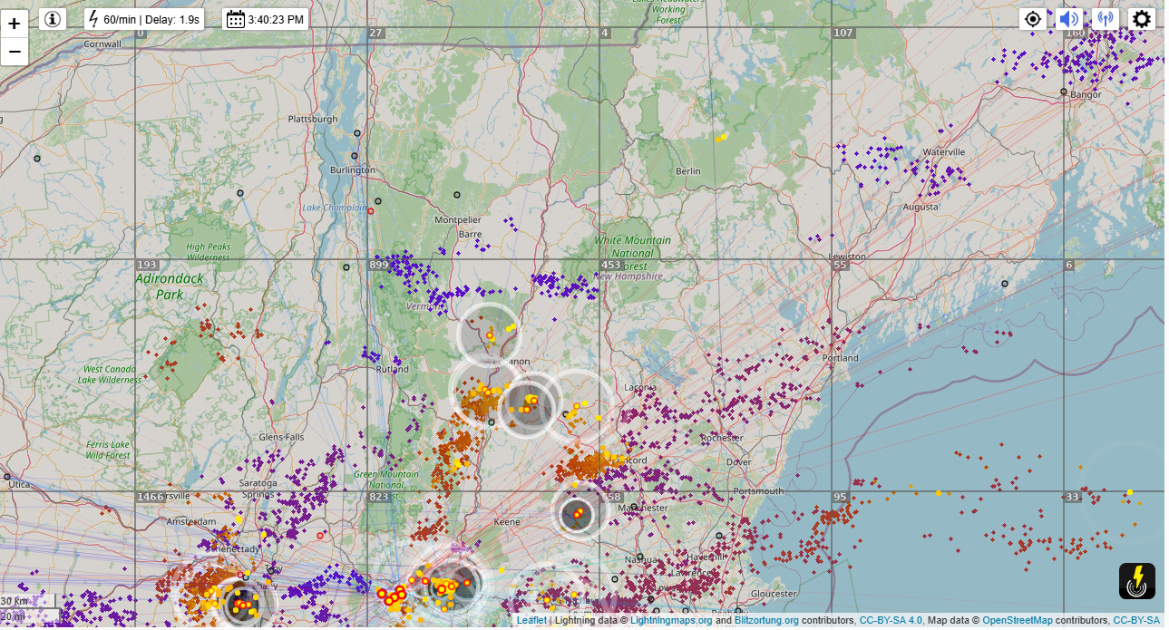
Roger Hill’s Radio Vermont Forecast 3:00 PM MONDAY 6-9-25 COR
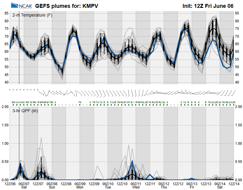
TONIGHT: Lots of clouds. A few passing sprinkles or light showers. A low in the mid-50s. Southeast winds 10 mph.
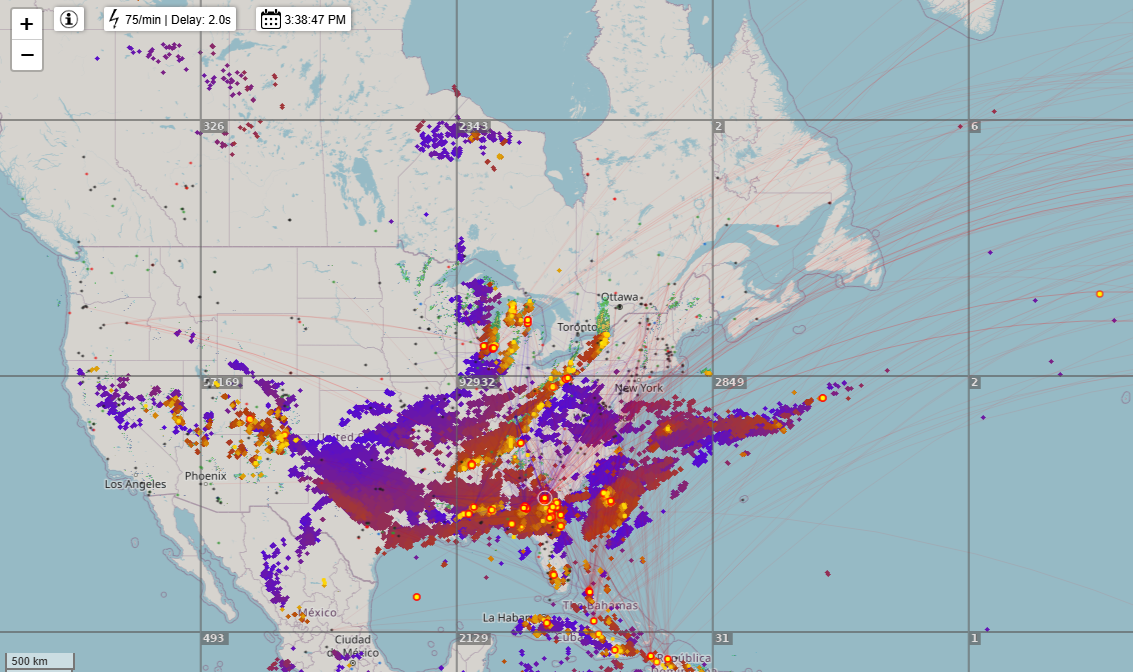
TOMORROW: Mostly cloudy, damp & cool. Showers likely…some moderate at times. Maybe a late day thunderstorm. A high in the low to mid 60s. South around 10 mph.
Full Strawberry Moon 3:43 AM Wednesday Morning
TUESDAY NIGHT: Early evening showers & rumbles of thunder exiting, otherwise clearing and fully moonlit. A low around 50. Light southwest winds.
WEDNESDAY: Partly to mostly sunny. An isolated mountain sprinkle or two. A high in the lower 70s. Westerly breeze 10 to 15 mph.
Looking further ahead
WEDNESDAY NIGHT: Partly cloudy. Chance for a brief shower or two northern areas. A low upper 50s around 60.
THURSDAY: Partly to mostly sunny. Isolated showers far north. Near seasonable in temperature. A high in the low 70s.
FRIDAY: Mixed sun and clouds. Maybe a late day shower with rumbles of thunder. A low around 50. Cool. A high 60 to 65.
SATURDAY: Mainly gray. Chance for a period of rain or showers in the morning. A low 50 to 55. Remaining below normal in temperature. Highs in the 60s.
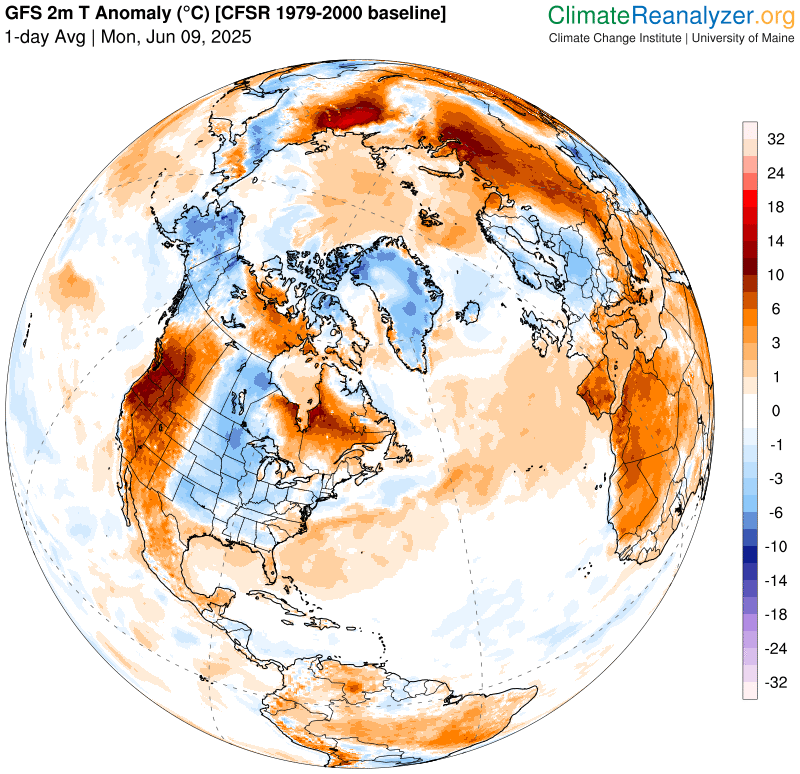
Average low: upper 40s to mid-50s. Average highs: mid 70s

Start of Meteorological summer back on June 6th. (Warmest 90 days climatology)
Summer Solstice June 20th 10:41 PM EDT
Peak of Meteorological Summer July 22nd.
RH/6-6[forecast][end]