
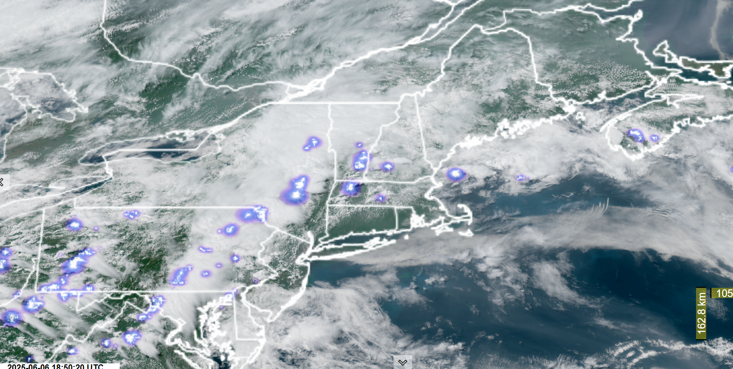
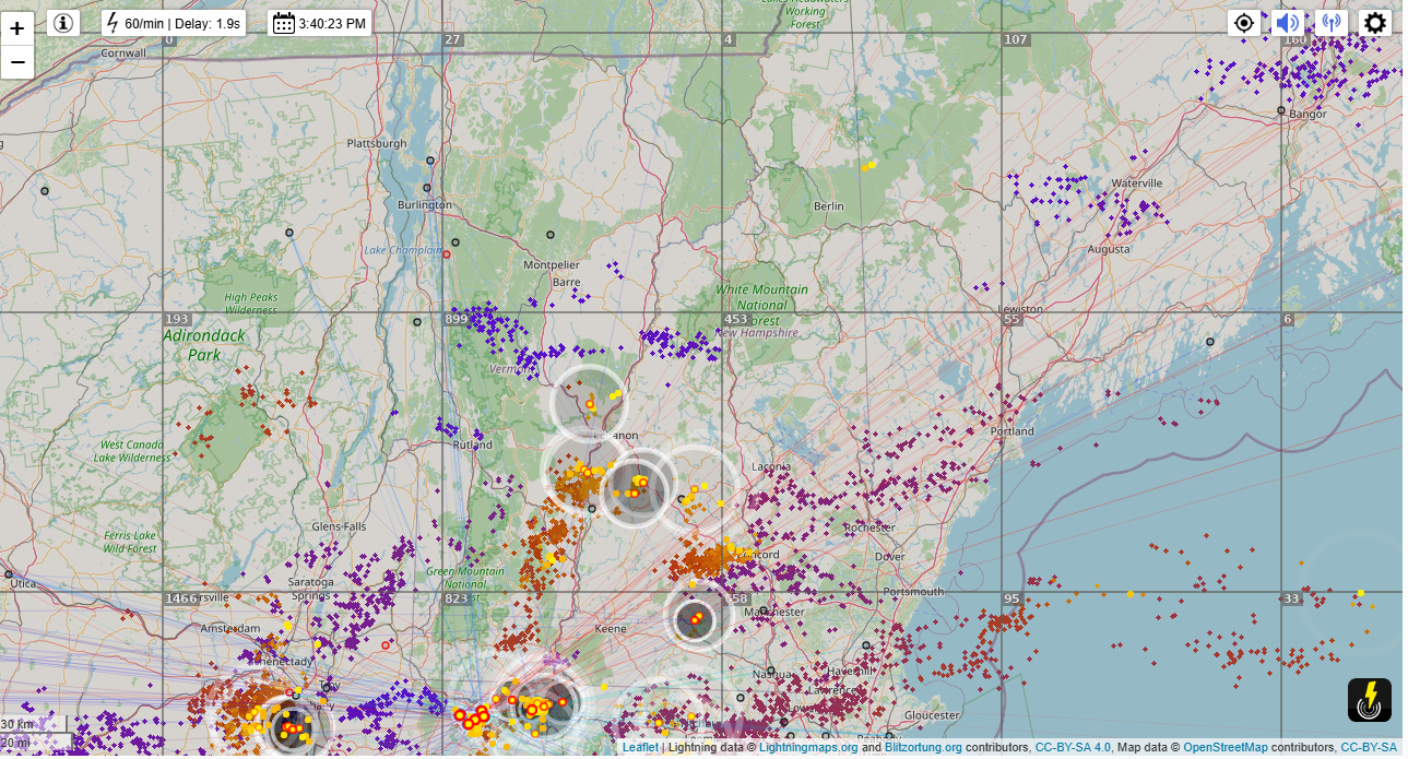
Roger Hill’s Radio Vermont Forecast 3:00 PM FRIDAY 6-6-25
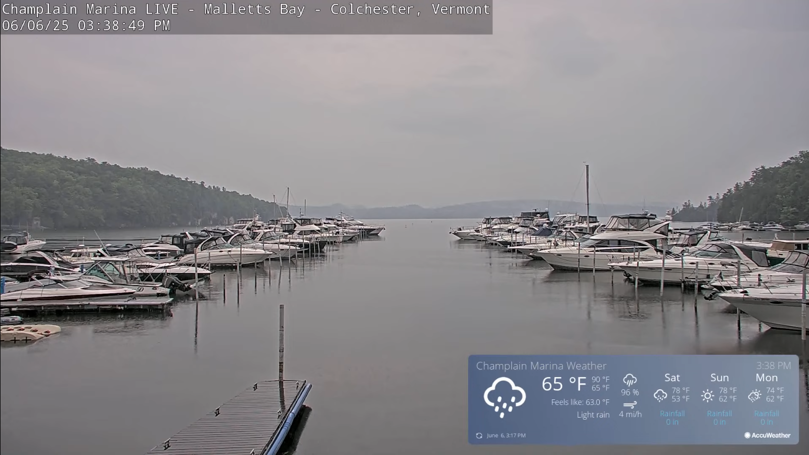
TONIGHT: Mainly cloudy. Showers…with isolated embedded thunderstorms southern areas gradually winding down. A low upper 50s around 60. Little wind.
TOMORROW: Clouds with morning showers southern areas otherwise partial afternoon sunshine with a few late afternoon showers and rumbles of thunder. A high 70 to 75. Light north winds.
SATURDAY NIGHT: Becoming mostly clear. Patchy valley fog. Comfortably cool. A low around 50. Light north to northwest winds.
SUNDAY: Morning sunshine gives way to afternoon cloudiness. A high near 75. Light east winds.
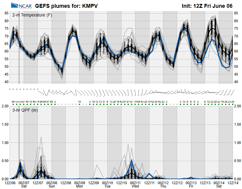
Looking further ahead
SUNDAY NIGHT: Variable clouds. A low mid-50s.
MONDAY: Mixed clouds and sun. Chance for a shower southern areas. A high mid-60s to near 70.
TUESDAY: Lots of clouds. Chance for showers and afternoon thunderstorms some locally heavy. Lows around 55. Highs 65 to 70.
WEDNESDAY: Morning clouds then partly sunny in the afternoon. Chance for a shower. A low near 55. A high in the low 70s.
Average low: upper 40s to around 50. Average highs: 70 to 75.
Start of Meteorological Summer June 6th. (Warmest 90 days climatology)
Summer Solstice June 20th 10:41 PM EDT
Peak of Meteorological Summer July 22nd.
RH/6-6[forecast][end]
