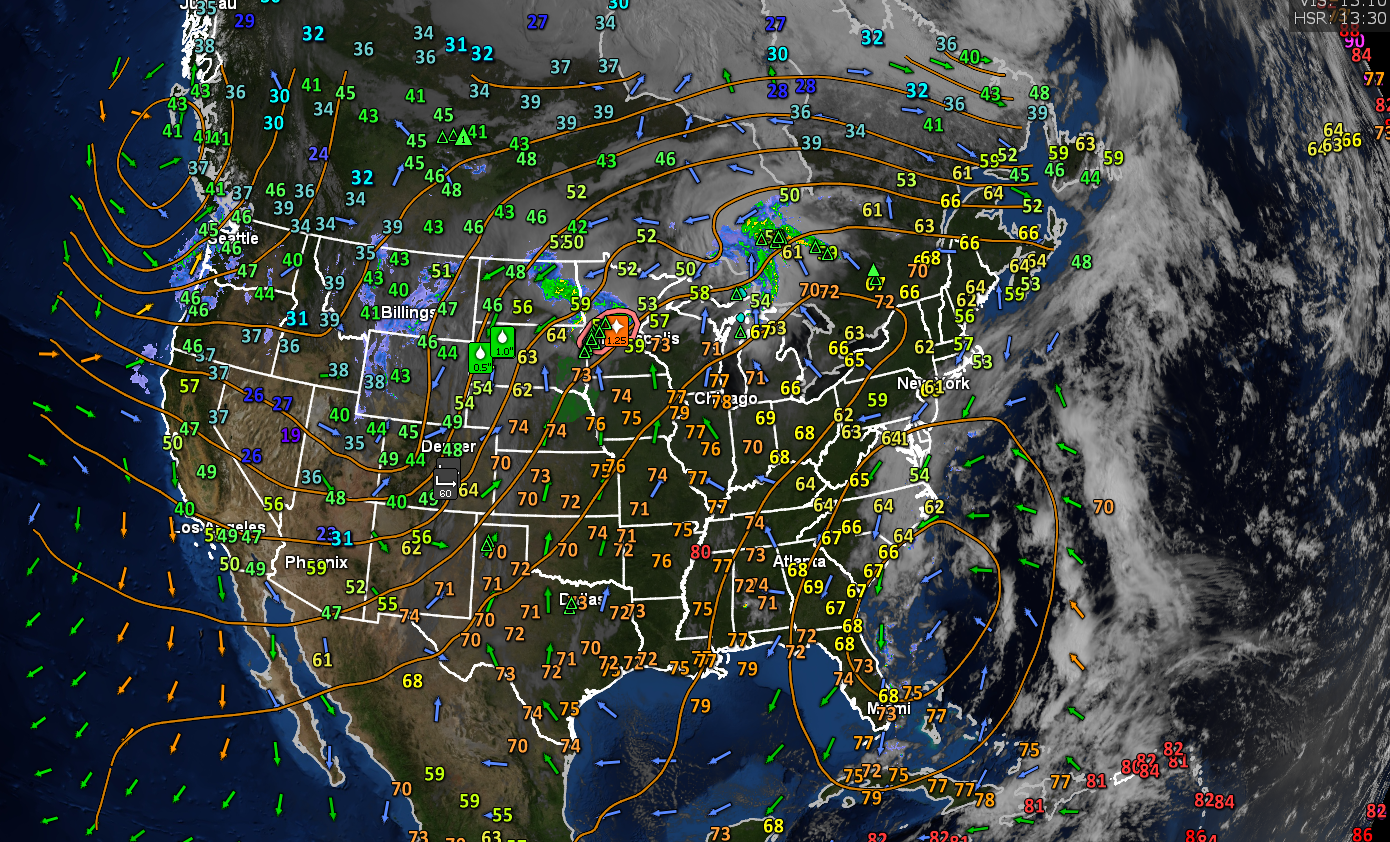
TONIGHT: Mostly clear giving way to partly cloudy skies. A low upper 50s to around 60. Light southwest winds.
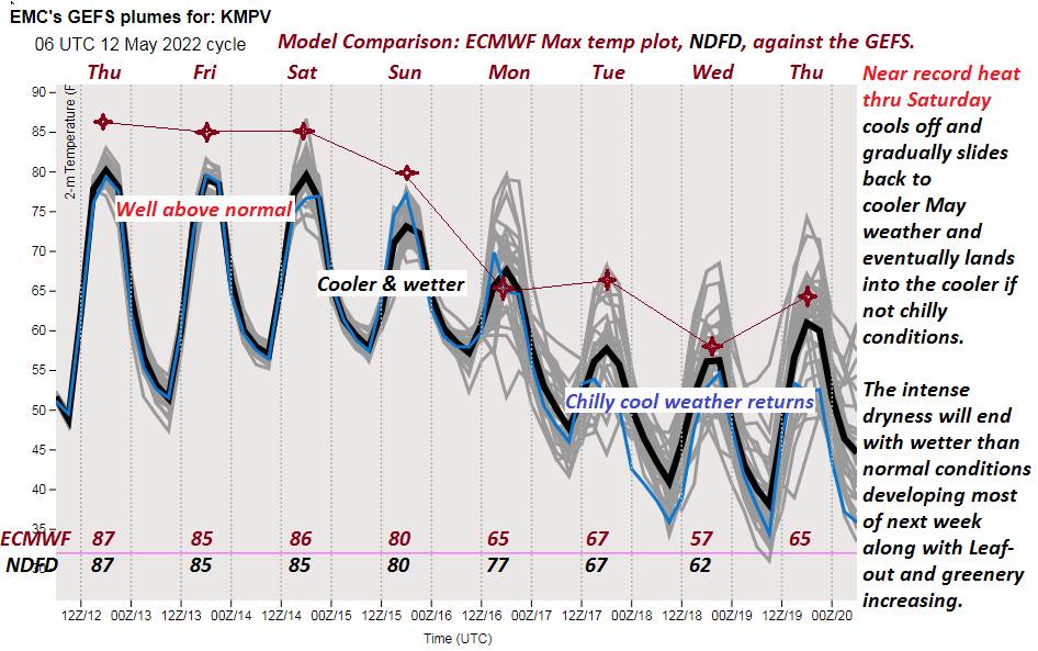
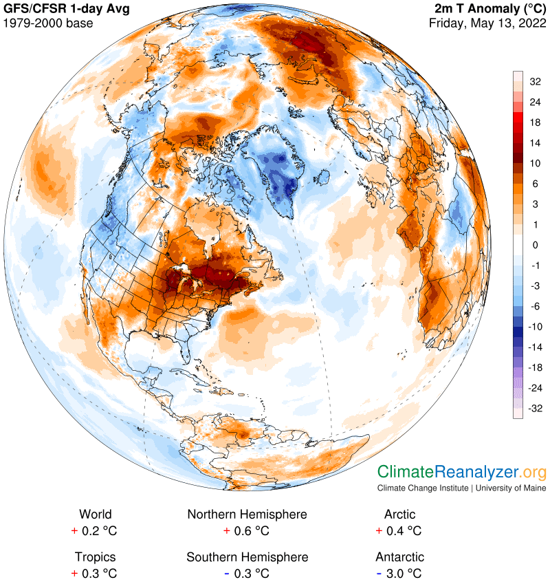
TOMORROW: Sunshine gives way to some afternoon clouds. Widely scattered late afternoon showers and thunderstorms central and northern areas. Warm and slightly muggy. A record to near record high mid to upper 80s. Light southwest winds.
SATURDAY NIGHT: Partly cloudy. A bit muggy. Chance for a shower or thunderstorm northern areas early evening and again overnight. A low near 60. Light southwest winds.

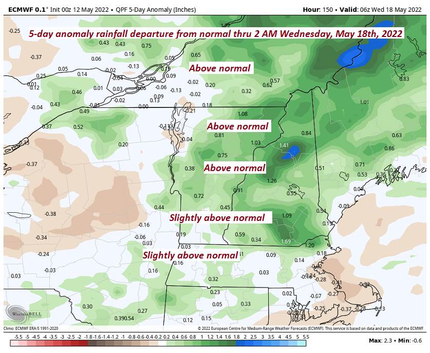
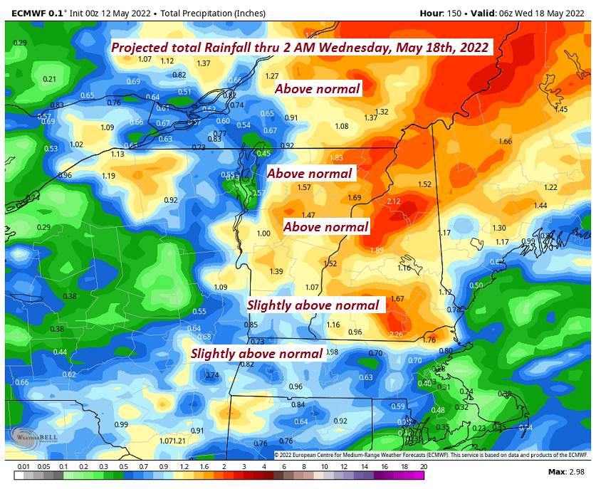
SUNDAY: Intervals of sun. Chance for mainly afternoon showers and thunderstorms. Some briefly heavy. A bit humid. A high mid to upper 70s. Light south winds.
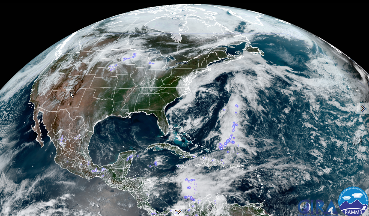
Looking further ahead…
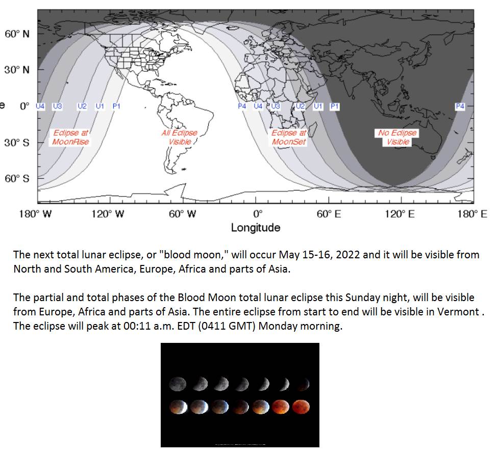
Full Flower Moon 1214 AM with Full Lunar Eclipse (Blood Red moon)
SUNDAY NIGHT: Scattered evening showers and thunderstorms. Otherwise variable clouds. A low in the mid-50s.

MONDAY: Mixed sun and clouds. Chance for showers and thunderstorms, some briefly heavy. Muggy. A high in the mid-70s.
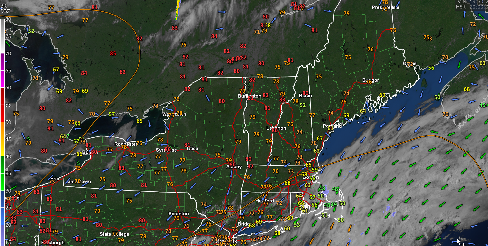
TUESDAY: Mixed clouds and sun & rather blustery. Slight chance for a shower. A low 45 to 50. A high low to mid 60s.
WEDNESDAY: A round of showers early morning then increasing sunshine. A low 40 to 45. Below normal in temperature. A high 55 to 60.
Average lows ranging upper-30s to low 40s. Average highs mid-60s to low 70s
RH/5-13forecast][end]