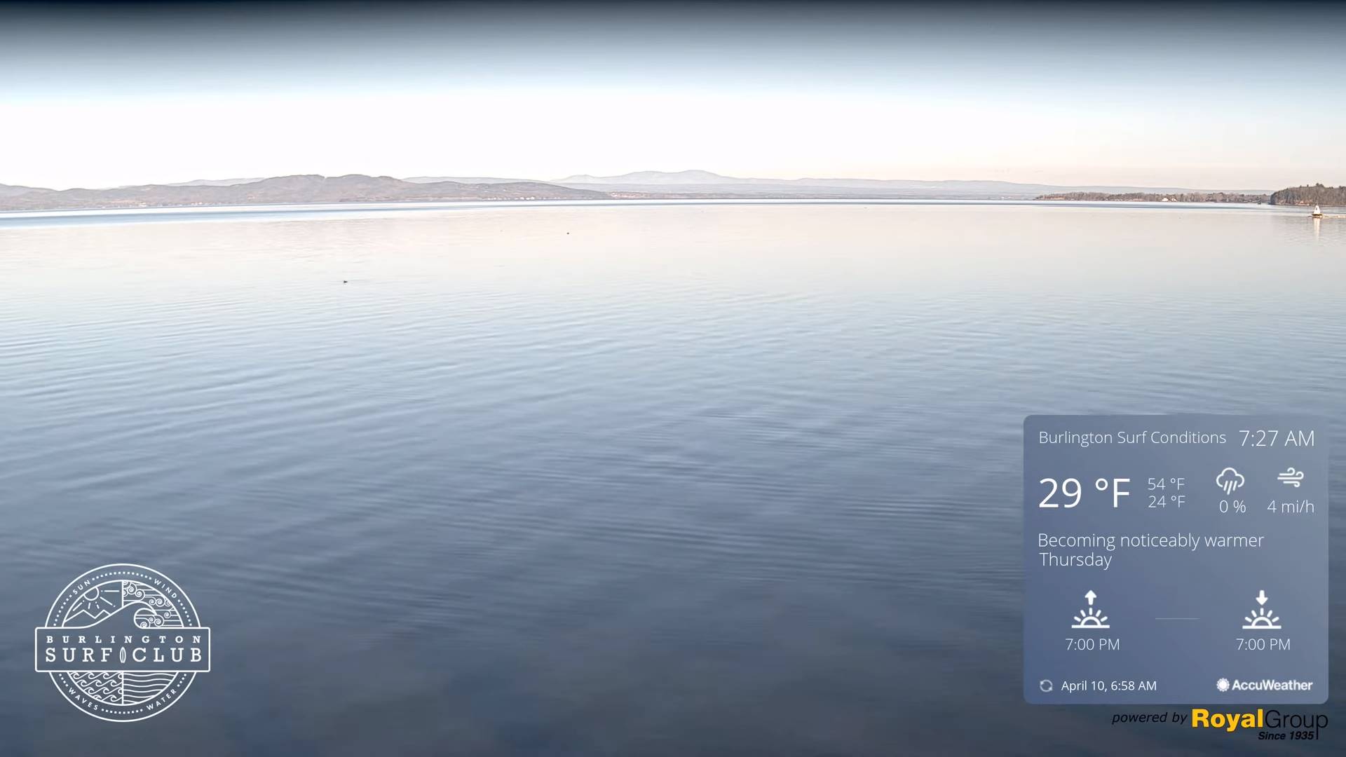
TONIGHT: Mostly clear for time early then partially moonlit. A low mid to upper 30s. Light southwest winds.
TOMORROW: More clouds than sun, breezy to windy. A late day sprinkle northern areas. A high in the mid-60s. Southwest breeze 10 to 25 mph and gusty.
TUESDAY NIGHT: Mostly cloudy. Blustery to windy at times. Maybe an early evening sprinkle far north. A low 40 to 45. West to northwest winds 10 to 25 mph & gusty.
WEDNESDAY: Variable cloudiness with a periods of sunshine. A high in the mid to upper 50s. Northwest winds 10 to 20 mph.
Looking further ahead
WEDNESDAY NIGHT: Occasional cloudy periods with threat for sprinkle. A low about 40.
THURSDAY: Morning clouds, then mostly sunny. A high 70 to 75.
FRIDAY: Sunshine filtered thru high cloudiness. A low upper 40s to around 50. A high mid-70s.
SATURDAY: Variable mainly high cloudiness. Slight chance for a sprinkle late. A low 45 to 50. A high low to mid 70s.
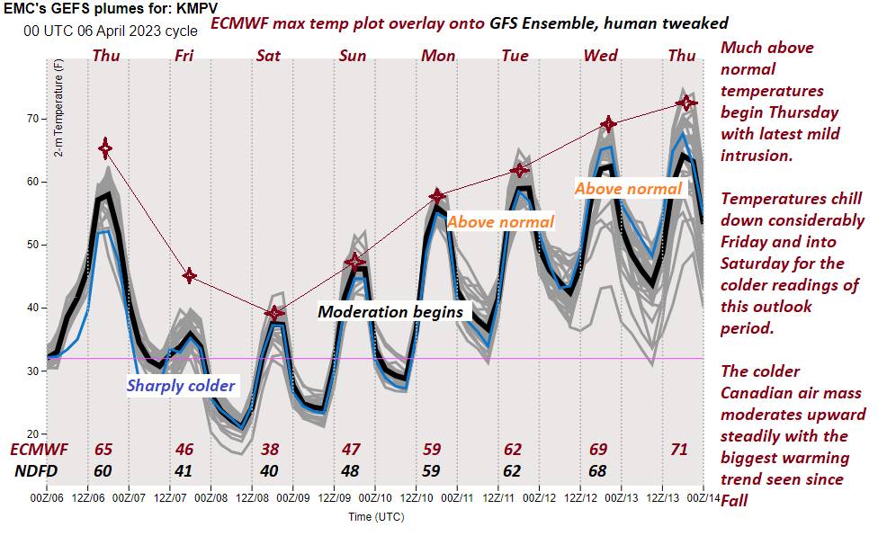
Average lows 30 to 35. Average highs low to mid 50s
Start of Meteorological summer arrives June 6th.
RH/4-10 forecast][end]