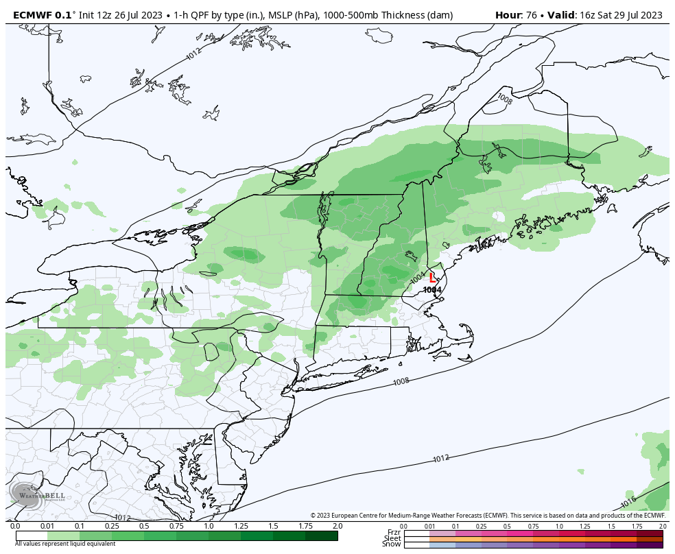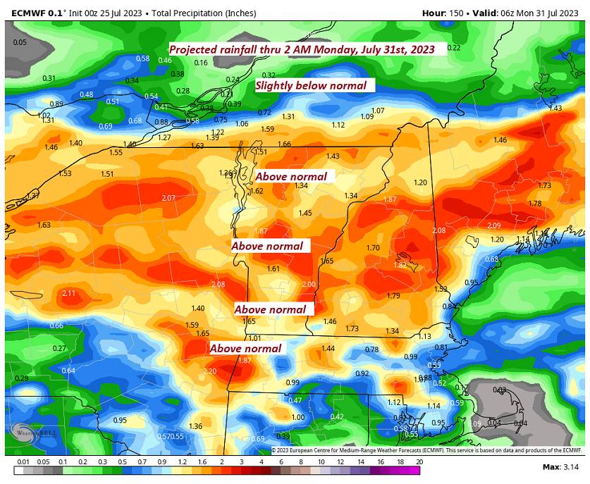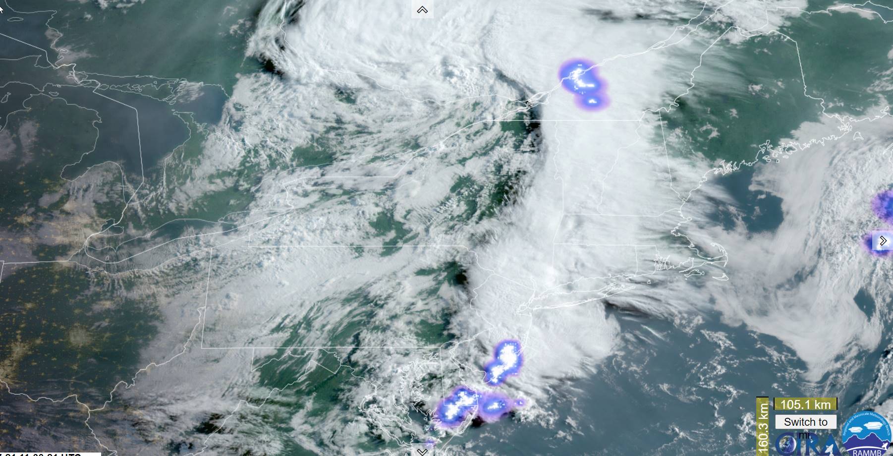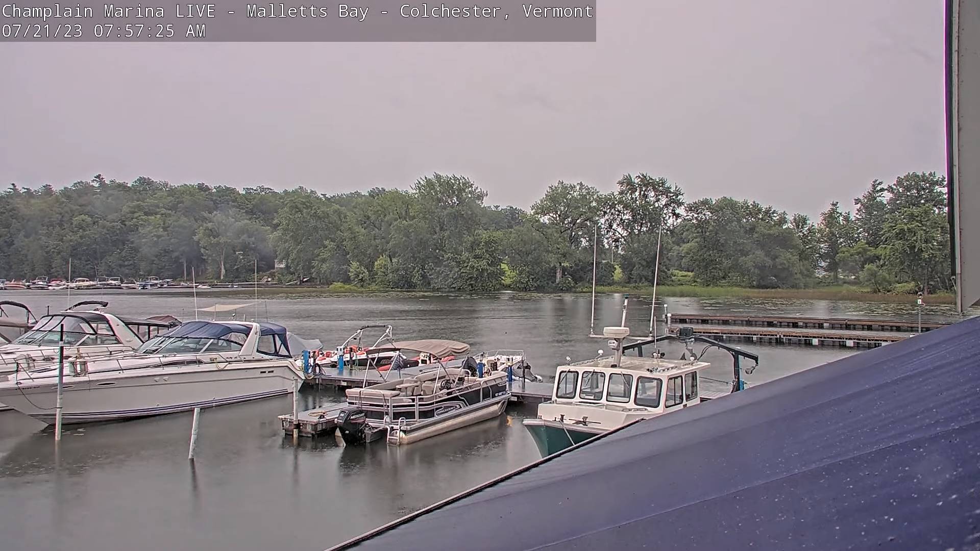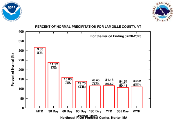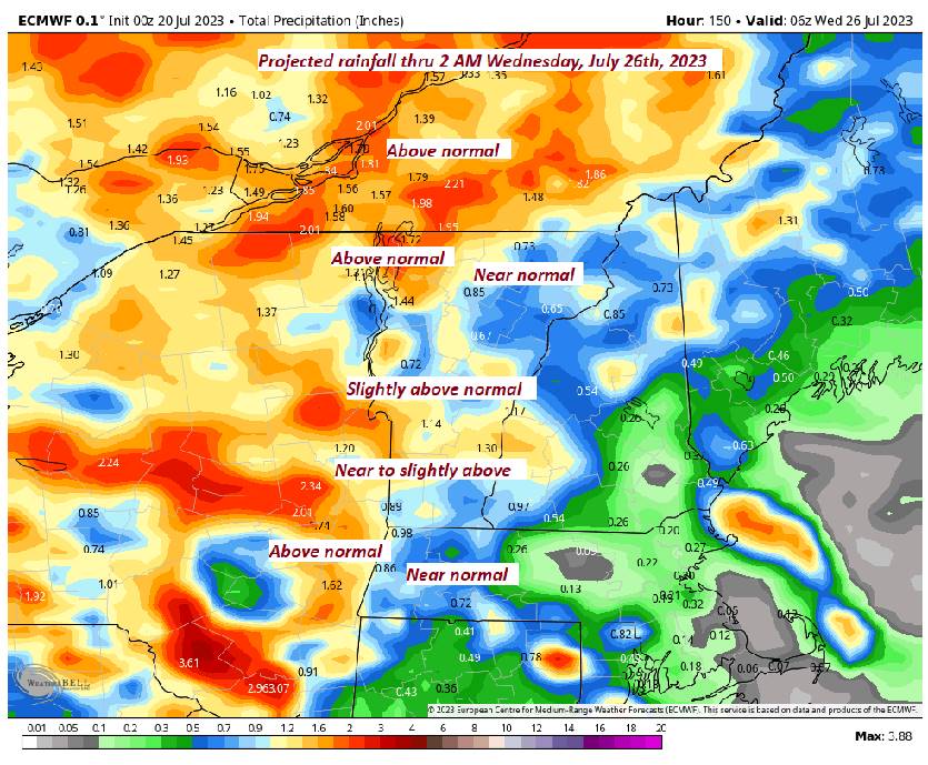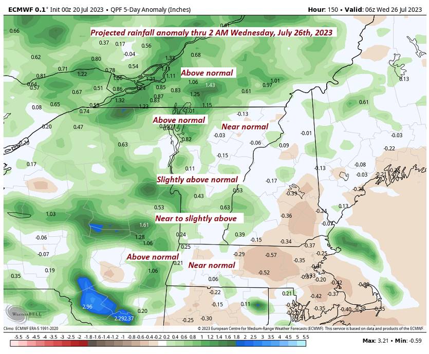
Flood Watch in effect thru this evening
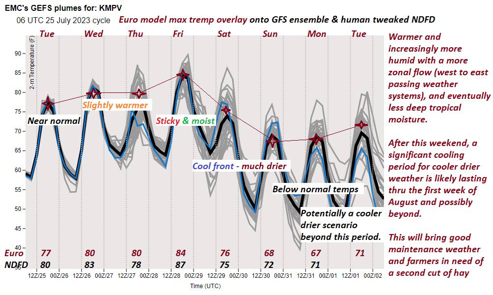
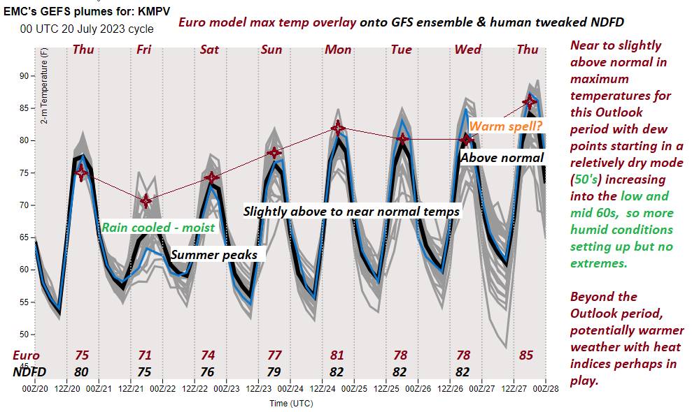
TODAY: Mainly cloudy. Numerous showers or a period of morning rain moderate to briefly heavy…with a few rumbles of thunder. A second round of showers and strong to locally severe thunderstorms redevelops after 2
PM with gusty localized winds and hail possible southern and eastern areas. A high 75 to 80. South winds shifting to southwesterly 10 to 15 mph in the afternoon.
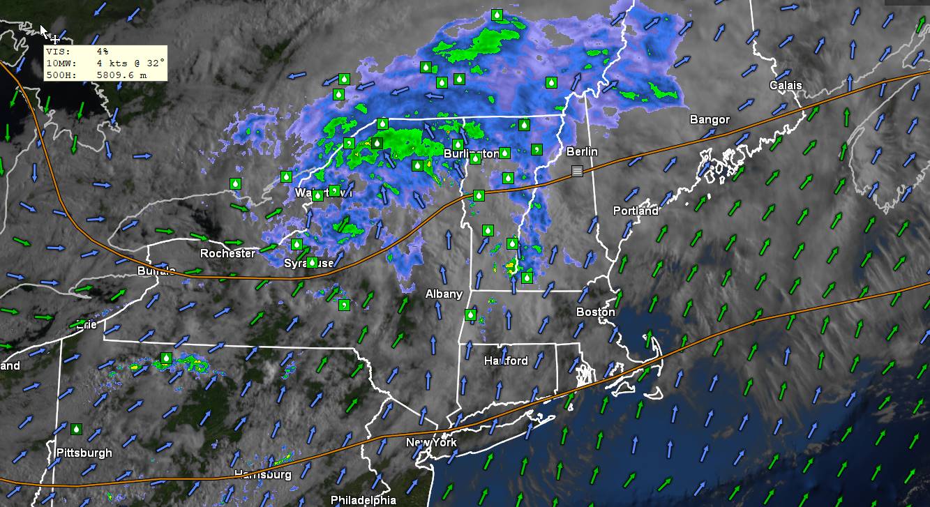
TONIGHT: Isolated early evening showers and strong thunderstorms weaken and exit. Otherwise gradual clearing leading to widespread valley fog. A low in the lower 60s. Light west winds.
FRIDAY: Morning fog, then partly to mostly sunny. Sticky. A high pushing into the upper 80s to near 90, with heat indices in the low to mid 90s. Light west winds.
Looking further ahead
FRIDAY NIGHT: Fair in the evening then increasing cloudiness. Isolated thunderstorms near the Quebec border after midnight. A low around 65.
SATURDAY: Mainly cloudy & very muggy. Chance for rain or showers with embedded heavy thunderstorms. One or two possibly strong. A high mid to upper 70s.
SUNDAY: Sunshine mixing with afternoon clouds. Much less humid and cooler. A low 50 to 55. A high in the low 70s.
MONDAY: Mixed sun and afternoon clouds. Patchy valley fog. A low 50 to 55. A high upper 60s.
Average lows 55 to 60. Average high upper 70s to low 80s.

RH/7-24 forecast][end]