Updated Monday morning forecast — October 23rd, 2023

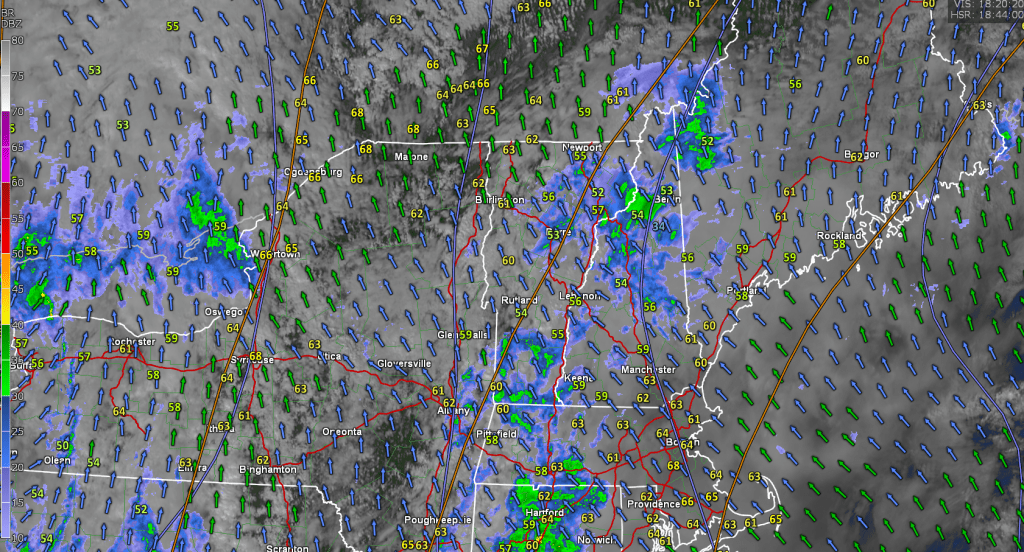
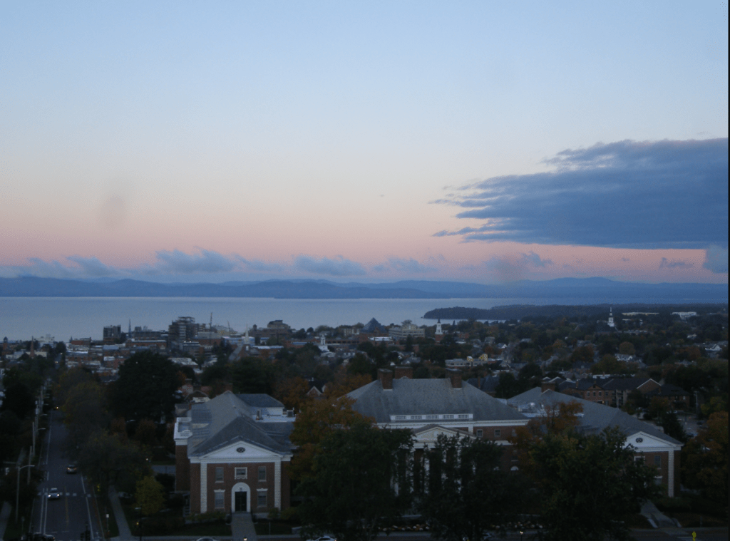
TODAY: Considerable cloudiness with a leftover sprinkle. A few intervals of sun later this afternoon. Chilly. A high just in the upper 40s. Northwest breeze 10 mph.

TONIGHT: Mostly clear with high cloudiness overnight. Patchy valley fog. Scattered frost likely with a low 32 to 35. Little wind.

TUESDAY: Patchy valley fog, burns off to mixed sun and clouds. Turning milder. A high mid to upper 50s. A light south wind.

Looking further ahead

TUESDAY NIGHT: Variable clouds. Slight chance for a sprinkle far northern areas. A low in the mid-40s.

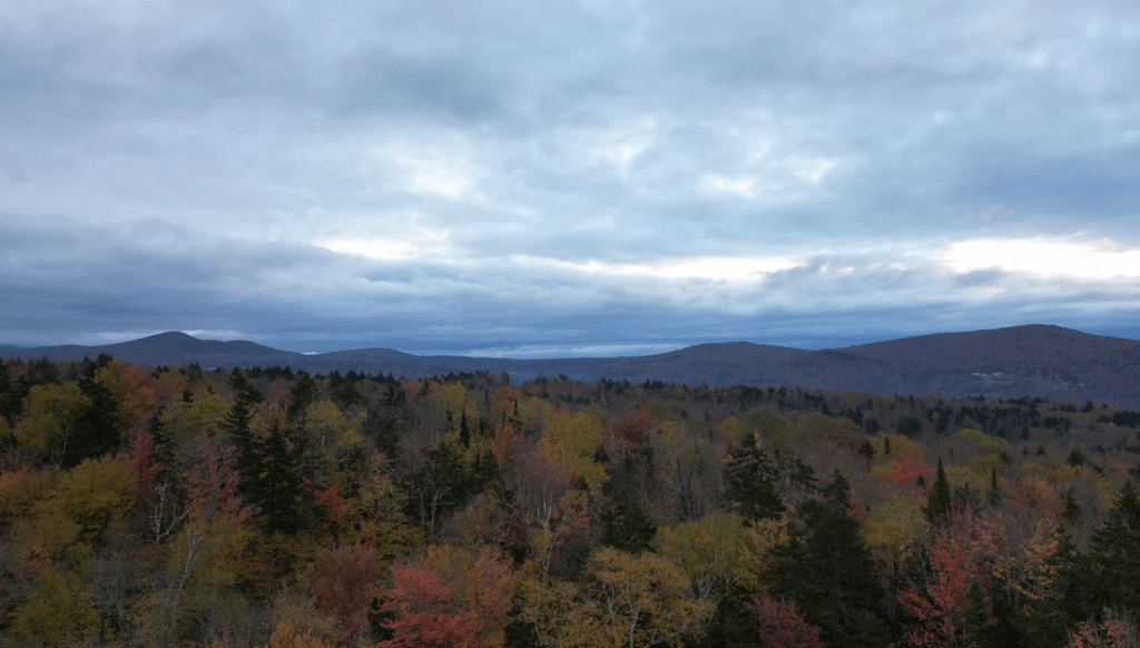
WEDNESDAY: Some partial morning sun, otherwise thickening clouds with a threat for northern sprinkle. Milder. A high around 65.

THURSDAY: Sunshine mixing with more clouds in the afternoon. A low around 45. Warm for the time of year. A high in the upper 60s to near 70.

FRIDAY: Sunshine & mild, becoming filtered thru high cloudiness. A low 50 to 55. A high reaching close to 70.

SATURDAY: Mainly cloudy. Scattered showers developing. A low in the mid-50s. A high in the upper 60s

Average lows 30 to 35. Average highs in the low to mid 50s.

RH/10-23 forecast][end]

Updated Friday Evening Forecast — October 20th, 2023

TONIGHT: Cloudy. Showers…moderate at times this evening becoming more scattered overnight. Little change in temperatures in the low 50s. Light east winds.

TOMORROW: Gray & wet. Periods of rain. Areas of fog. A high of about 55. Light and variable winds become northwesterly at 10 to 15 mph later on.

SATURDAY NIGHT: Overcast.Showers…becoming more scattered overnight.A low 40 to 45. West winds around 10 mph.

SUNDAY: Gray, turning blustery and raw. Periods of rain are moderate at times in northern areas. Scattered showers further south. Temperatures fall through the upper and mid-40s. Northwest winds 10 to 20 mph.

Looking further ahead

SUNDAY NIGHT: Showers winding down, otherwise mostly cloudy. A low in the upper 30s around 40.

MONDAY: Considerable low cloudiness gives way to lots of afternoon sunshine but chilly. The high upper 40s.

TUESDAY: Patchy valley fog, burns off to sunshine with afternoon cloudiness. Scattered frost with a low 32 to 35. A high around 55.

WEDNESDAY: Lots of clouds. Chance for showers. A low around 40. A high mid to upper 50s.

Average lows are in the low to mid-30s. Average highs in the low to mid 50s.

RH/10-20 forecast][end]

Updated Friday morning forecast — October 20th, 2023

TODAY: Lots of clouds. Showers, becoming likely this afternoon spreading south to north, moderate at times. A high in the upper 50s. South to southeast winds 10 to 15 mph.

TONIGHT: Cloudy. Showers…moderate at times this evening becoming more scattered overnight. A low about 50. Light east winds.

SATURDAY: Gray & wet. Periods of rain likely, moderate at times in the afternoon. Areas of fog. A high around 55. Light and variable winds.

Looking further ahead

SATURDAY NIGHT: Overcast.Showers or periods of rain likely…moderate to possibly heavy at times.A low in the mid-40s.

SUNDAY: Gray, turning blustery and raw. Showers or periods of rain moderate at times. Temperatures fall thru the upper and mid-40s.

MONDAY: Considerable low cloudiness gives way to lots of afternoon sunshine but chilly. A low in the upper 30s. A high upper 40s to around 50.

TUESDAY: Patchy valley fog, burns off to sunshine with afternoon cloudiness. A low in the mid-30s. A high around 55.

WEDNESDAY: Lots of clouds. Chance for showers. A low 40 to 45. A high mid to upper 50s.

Average lows in the low to mid 30s. Average highs in the low to mid 50s.

RH/10-19 forecast][end]

Updated Thursday Evening Forecast — October 19th, 2023

TONIGHT: Fair with thickening high clouds. A low in the mid-40s. Light south to southeast winds are stronger across Lake Champlain.

TOMORROW: Mainly gray. Showers, becoming likely in the afternoon, moderate at times late. A high in the upper 50s. South to southeast winds 10 to 15 mph.

FRIDAY NIGHT: Cloudy. Showers…moderate at times in the evening becoming more scattered overnight. A low upper 40s to around 50. Light east winds.

SATURDAY: Gray & wet. Periods of rain are likely, moderate at times in the afternoon. Areas of fog. A high in the mid-50s. Light and variable winds.

Looking further ahead

SATURDAY NIGHT: Overcast.Good chance for lingering showers…moderate at times.A low in the upper 40s.

SUNDAY: Gray, and turning blustery. Good chance for showers to continue. Little change in temperature around 50.

MONDAY: Morning clouds then increasingly sunny. A low around 40. A high low 50s.

TUESDAY: Patchy valley fog, burns off to sunshine with some high clouds. A low around 32. A high around 55.

WEDNESDAY: Mostly cloudy. Chance for showers in northern areas. A low in the 40s. A high around 60.

Average lows are in the low to mid-30s. Average highs in the low to mid-50s.

RH/10-19 forecast][end]

Updated Thursday Morning Forecast — October 19th, 2023

TODAY: Areas of low clouds and fog…eventually give way to partial sunshine. A high of about 60. South to southwest winds 10 mph.

TONIGHT: Fair with thickening mainly high clouds. A low mid to upper 40s. Light south winds are stronger near Lake Champlain.

FRIDAY: Cloudy. A rising chance for afternoon showers, becoming moderate at times late. A high in the upper 50s. South breeze 10 to 15 mph.

Looking further ahead

FRIDAY NIGHT: Cloudy. Showers are moderate to briefly heavy at times. A low near 50.

SATURDAY: Gray & wet. Showers, or periods of rain are likely, moderate to heavy at times. Areas of fog. A high in the mid-50s.

SUNDAY: Gray, and turning blustery. Good chance for showers to continue. Temperatures gradually falling into the upper 40s.

MONDAY: Clouds giving way to periods of sun. A low in the upper 30s. A high 45 to 50.

TUESDAY: Patchy valley fog, burns off to filtered sunshine thru high clouds. A low around 32. A high 50 to 55.

Average lows are in the low to mid-30s. Average highs in the low to mid-50s.

RH/10-18 forecast][end]

Updated Wednesday Evening Forecast — October 18th, 2023

TONIGHT: Becoming mostly clear.Patchy valley fog.A low in the upper 30s. Light south winds.

TOMORROW: Morning fog then lots of sunshine with a few more afternoon clouds. A high near 60. South to southwest winds 10 mph.

THURSDAY NIGHT: Fair with increasing clouds. A low around 45. Light south winds are stronger near Lake Champlain.

FRIDAY: Considerable cloudiness. A threat of a sprinkle in the afternoon. A high in the low 60s. South breeze 10 to 15 mph.

Looking further ahead

FRIDAY NIGHT: Cloudy. Showers are likely…moderate at times. A low near 50.

SATURDAY: Gray & damp. Showers likely. Areas of fog. A high mid to upper 50s.

SUNDAY: Gray, and turning blustery. There is a good chance for periods of rain or showers to continue. A low 40 to 45. A high 50 to 55.

MONDAY: Clouds gradually give way to intervals of sun. A low in the upper 30s. A high near 50.

Average lows in the low to mid-30s. Average highs in the low to mid-50s.

RH/10-18 forecast][end]

Updated Wednesday Morning Forecast — October 18th, 2023

TODAY: Clouds with intervals of sun developing. An isolated sprinkle is still possible to the north. A high in the middle 50s. Light southwest winds.

TONIGHT: Mostly clear. Patchy valley fog.A low in the upper 30s. Light south winds.

THURSDAY: Morning fog then lots of sunshine with a few more afternoon clouds. A high near 60. South to southwest winds 10 mph.

Looking further ahead

THURSDAY NIGHT: Fair with increasing clouds. A low around 45.

FRIDAY: Mostly cloudy. A threat for a sprinkle in the afternoon with showers likely after dark…moderate at times. A high in the low 60s.

SATURDAY: Gray & damp. Showers likely. Areas of fog. A low near 50. A high mid to upper 50s.

SUNDAY: Overcast, and turning blustery. There is a good chance for periods of rain or showers to continue. A low 40 to 45. A high 50 to 55.

MONDAY: Morning clouds then partly to mostly sunny in the afternoon. A low in the upper 30s. A high near 50.

Average lows are in the low to mid-30s. Average highs in the low to mid-50s.

RH/10-18 forecast][end]

Updated Tuesday Evening Forecast — October 17th, 2023

TONIGHT: Partly to mostly cloudy. A low upper 30s around 40. Little wind.

TOMORROW: Intervals of sun. A high 55 to 60. Light southwest winds.

WEDNESDAY NIGHT: Mostly clear.Patchy valley fog.A low in the upper 30s. Light south winds.

THURSDAY: Morning fog then lots of sunshine with a few more afternoon clouds. A high around 60. South to southwest winds 10 mph.

Looking further ahead

THURSDAY NIGHT: Fair with increasing clouds. A low around 45.

FRIDAY: Mostly cloudy. A threat for a sprinkle. A high in the low 60s.

SATURDAY: Mainly gray. Good chance for showers arriving later on. A low near 50. The high in the upper 50s.

SUNDAY: Mainly gray, turning blustery. Chance for showers. A low 40 to 45. A high 50 to 55.

MONDAY: Becoming partly to mostly sunny. A low around 35. A high 45 to 50.

Average lows in the low to mid-30s. Average highs in the low to mid-50s.

RH/10-17 forecast][end]

Updated Tuesday Morning Forecast — October 17th, 2023

TODAY: Lots of clouds with a few breaks of sun. Widely scattered light showers especially afternoon. A high near 55. Light northwest winds.

TONIGHT: Becoming partly cloudy. A low upper 30s around 40. Little wind.

WEDNESDAY: Clouds giving way to partial afternoon sun. A high 55 to 60. Light southwest winds.

Looking further ahead

WEDNESDAY NIGHT: Mostly clear.A low in the upper 30s.

THURSDAY: Morning sun followed by some afternoon clouds. A high around 60.

FRIDAY: Thickening mainly high clouds. A threat for a few sprinkles. A low around 45. A high in the low 60s.

SATURDAY: Gray with a few breaks of sunshine in western areas. Chance for showers spreading northward. A low near 50. The high upper 50s.

SUNDAY: Mainly gray. Chance for showers or periods of rain. Becoming blustery late. A low 40 to 45. A high

50 to 55.

MONDAY: Becoming partly to mostly sunny. A low around 35. A high 45 to 50.

Average lows are in the low to mid-30s. Average highs in the low to mid-50s.

RH/10-17 forecast][end]

Updated Monday Evening Forecast — October 16th, 2023

TONIGHT: Mostly cloudy. A few sprinkles. A low 40 to 45. Light north to northwest winds.

TOMORROW: Lots of clouds. Widely scattered light showers especially in northern areas. A high 50 to 55. Light northwest winds.

TUESDAY NIGHT: Becoming partly cloudy. A low around 40. Little wind.

WEDNESDAY: Clouds with a few intervals of sun. A high in the mid to upper 50s. Light southwest winds.

Looking further ahead

WEDNESDAY NIGHT: Variable clouds.A low in the upper 30s.

THURSDAY: Morning sun then partly cloudy in the afternoon. A high in the lower 60s.

FRIDAY: Mostly cloudy. A low around 45. A high in the low 60s.

SATURDAY: Lots of clouds with intervals of sun in western areas. A rising chance for showers spreading south to north. A low in the upper 40s. The high upper 50s to near 60.

Average lows are in the low to mid-30s. Average highs in the low to mid-50s.

RH/10-16 forecast][end]