Updated Monday Morning Forecast — October 30th, 2023

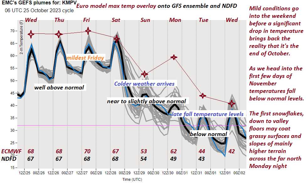
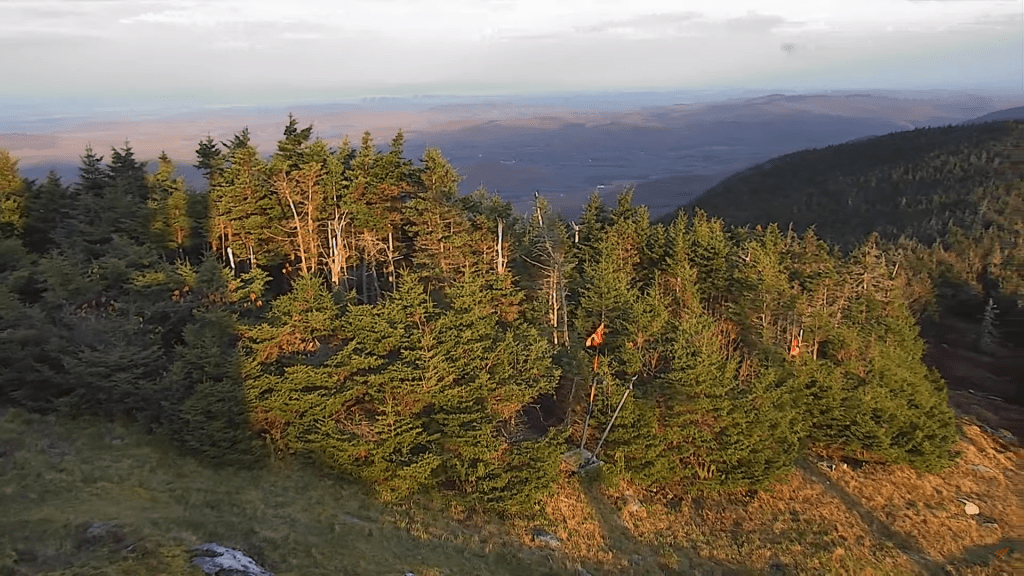
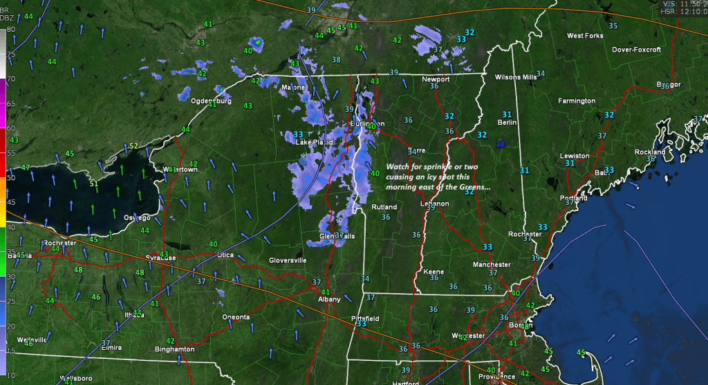
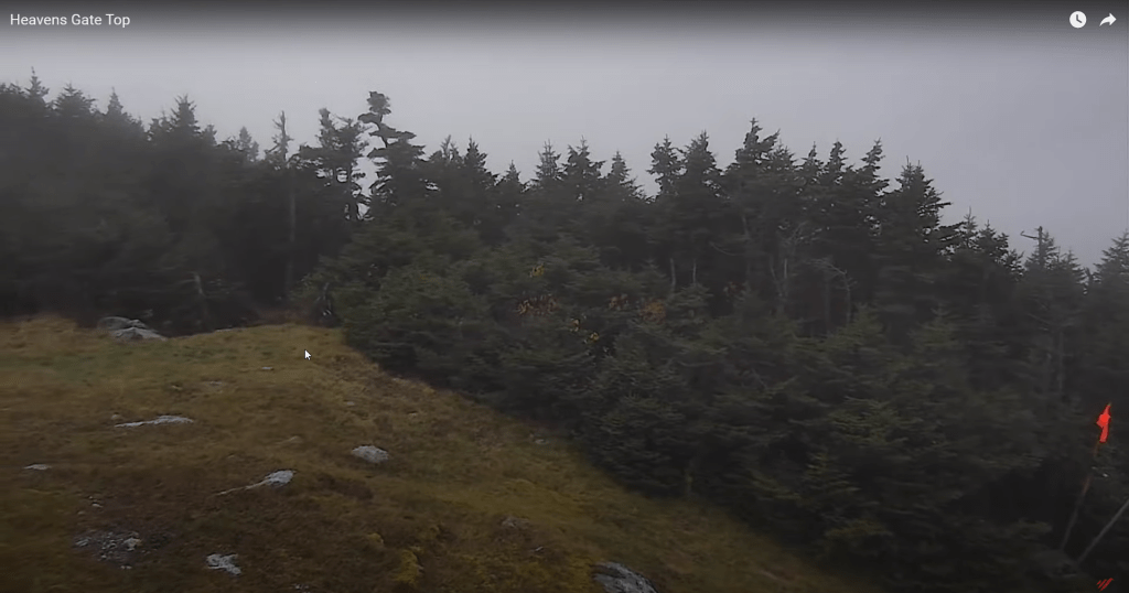
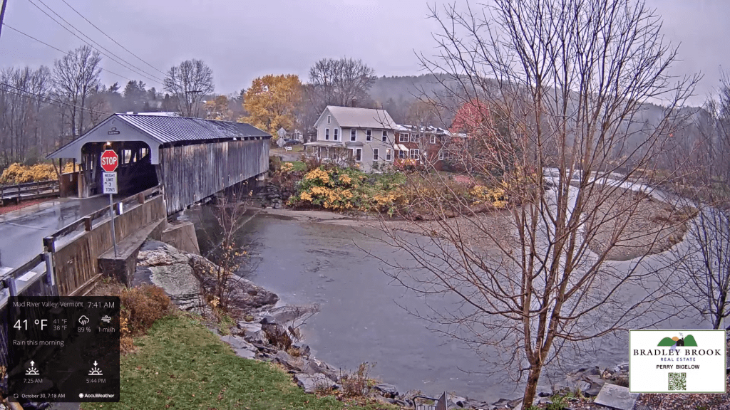
TODAY: Gray. Periods of rain…moderate at times, occasionally mixed with wet snow central and northern Green Mountain summits and higher terrain of the Northeast Kingdom. A high around 45. Light wind becoming northwest 10 mph.

TONIGHT: Widely scattered rain showers mixed with wet snowflakes this evening exiting overnight to partial clearing. A low in the upper 20s to about 30. Northwest winds 10 mph.

TUESDAY: Periods of sun mixing with more clouds. A high only around 40. Light northwest winds.

Looking further ahead

TUESDAY NIGHT Halloween: Partly cloudy. A low around 25.

WEDNESDAY: Mostly cloudy. Scattered wet snow showers or flurries with slick travel in the morning higher terrain. A high mid to upper 30s.  

THURSDAY: Lots of sunshine. A low in the mid-20s. A high 40 to 45.

FRIDAY: Partly to mostly cloudy. Chance for rain showers northern areas. A low upper 20s. A high 45 to 50.

SATURDAY: Increasing clouds. A low around 35. A high around 50.

Average lows upper 20s to mid-30s. Average highs mid-40s to low 50s.

RH/10-30 forecast][end]

Updated Friday Evening Forecast — October 27th, 2023

TONIGHT: Mostly cloudy. A spotty shower or sprinkle in northern areas. A low in the 50s. Light southwest breeze, stronger near Lake Champlain.

Full Hunters Moon 4:24 PM

TOMORROW: Showers winding down in the afternoon, with increasing sunshine. Breezy at times. A high 65 to 70. Winds shifting southwest to northwesterly in the afternoon at 10 to 20 mph and gusty.

SATURDAY NIGHT: High cloudiness and dimly moonlit. Thickening clouds overnight.A low in the mid-30s. Northwest winds 10 mph.

SUNDAY: Considerable cloudiness with showers or periods of light rain developing. Wet snowflakes in northern Green Mountain summits. Sharply colder. A high in the mid to upper 40s. Light northwest winds.

Looking further ahead

SUNDAY NIGHT: Cloudy. Periods of rain likely, mixed with wet snow on higher mountain summits. A low in the upper 30s.

MONDAY: Cloudy. Periods of rain mixed with wet snow mountain summits. A high of around 45

TUESDAY: Periods of sunshine after a frosty morning. A low in the upper 20s. A high 40 to 45.

WEDNESDAY: Cloudy. A rising chance for wet accumulating snow & slippery travel on elevated terrain mixed with rain valley floors mainly in southern Vermont. A morning low of 25 to 30. A high mid to upper 30s.  

Average lows are 30 to 35. Average highs in the low to mid-50s.

RH/10-27 forecast][end]

Updated Friday Morning Forecast — October 27th, 2023

TODAY: Morning fog burns off to periods of sun, then more clouds this afternoon. Isolated sprinkles in northern areas this afternoon. A high around 70. Southwest winds 10 mph.

TONIGHT: Lots of clouds. A spotty shower or sprinkle north. A low in the 50s. Southwest breeze 10 mph.

Full Hunters Moon 4:24 PM

SATURDAY: Scattered showers and damp in the morning, exiting to partial afternoon sunshine. Breezy at times. A high in the upper 60s. Northwest winds 10 to 20 mph.

Looking further ahead

SATURDAY NIGHT: High cloudiness.A low 35 to 40.

SUNDAY: Thickening clouds leading to a rising likelihood for rain…possibly mixing with wet snowflakes mountain summits. Chilly & raw. A high in the upper 40s.

MONDAY: Cloudy. Good chance for showers or periods of rain, moderate at times… possibly mixing with wet snowflakes mountain summits. A morning low mid to upper 30s. A high around 45

TUESDAY: Periods of sunshine after a frosty morning. A low in the upper 20s. A high 40 to 45.

WEDNESDAY: Cloudy. A rising chance for wet accumulating snow & slippery travel mixed with rain valley floors. A low ranging thru the 20s. A high in the mid to upper 30s.

Average lows 30 to 35. Average highs in the low to mid 50s.

RH/10-27 forecast][end]

Updated Thursday Evening Forecast — October 26th, 2023

TONIGHT: Clouds linger in northern areas with a few passing light showers, mainly this evening. Otherwise partly cloudy. A low near 55. Light south winds are stronger near Lake Champlain.

TOMORROW: Sunshine with more afternoon cloudiness. Above normal temperature. Isolated sprinkles in northern areas. The high upper 60s to near 70. Southwest winds 10 mph.

FRIDAY NIGHT: Lots of clouds. A spotty shower or sprinkle north. A low in the mid-50s. Southwest breeze 10 mph.

SATURDAY: Scattered showers and damp in the morning, exiting to intervals of afternoon sun. Breezy at times. A high in the upper 60s. Northwest winds 10 to 20 mph.

Looking further ahead

SATURDAY NIGHT: High cloudiness.A low 40 to 45.

SUNDAY: Thickening clouds leading to a rising likelihood for rain…possibly moderate at times. Colder and raw. A high in the upper 40s.

MONDAY: Cloudy. Chance for lingering showers…possibly mixed with wet snowflakes on higher terrain. A morning low around 40. A high 45 to 50.

TUESDAY: Periods of sunshine after a frosty morning. A low in the upper 20s. A high in the mid-40s.

Average lows are 30 to 35. Average highs in the low to mid-50s.

RH/10-26 forecast][end]

Updated Thursday morning forecast — October 26th, 2023

TODAY: Mostly cloudy but mild. Maybe a sprinkle in southern areas this morning. A high in the mid-60s. Light southwest breeze.

TONIGHT: Becoming partly cloudy with more clouds in northern areas.Scattered passing showers this evening in northern areas. A low near 55. Light south winds.

FRIDAY: Sunshine with more afternoon cloudiness. Mild. Isolated sprinkles far north. The high upper 60s to near 70. Southwest winds 10 mph.

Looking further ahead

FRIDAY NIGHT: Increasingly cloudy. A spotty shower or sprinkle. A low in the mid-50s.

SATURDAY: Scattered showers, damp, otherwise cloudy periods, then partial clearing late. A high in the upper 60s.

SUNDAY: Filtered sunshine in the morning, then thickening clouds leading to a chance for rain or showers…moderate at times. A low 40 to 45. A high in the upper 40s.

MONDAY: Cloudy. Chance for rain or showers. A low around 40. A high 45 to 50.

Average lows are 30 to 35. Average highs in the low to mid-50s.

RH/10-23 forecast][end]

Updated Wednesday Evening Forecast — October 25th, 2023

TONIGHT: Variable clouds. Patches of valley fog. A low in the mid-40s to low 50s. Light southwest winds.

TOMORROW: Cloudy periods give way to increasing sunshine. Pleasantly mild. A high 65 to 70. Light southwest breeze.

THURSDAY NIGHT: Variable clouds.Chance for a few a passing showers in northern areas. A low 50 to 55. Light south winds.

FRIDAY: Sunshine with more afternoon cloudiness. Mild. Isolated sprinkles far north. A high around 70. Southwest winds 10 mph.

Looking further ahead

FRIDAY NIGHT: Increasingly cloudy. A spotty shower or sprinkle. A low in the mid to upper 50s.

SATURDAY: Scattered showers and damp, otherwise cloudy periods, then partial clearing late. A high in the mid to upper 60s.

SUNDAY: Filtered sunshine in the morning, then thickening clouds leading to a chance for rain or showers…moderate at times. A low in the upper 30s. A high 50 to 55.

MONDAY: Cloudy. Chance for rain or showers. A low in the 40s. A high in the 50s.

Average lows are 30 to 35. Average highs in the low to mid-50s.

RH/10-23 forecast][end]

Updated Wednesday morning Forecast — October 25th, 2023

TODAY: A few peeks of early sun, otherwise gray. Scattered sprinkles in northern areas. Warmer. A high around 65. Light southwest winds.

TONIGHT: Evening clouds then mostly clear overnight. Considerable valley fog. A low in the low to mid-40s. Light southwest winds.

THURSDAY: Pick of the week. Morning valley fog, then partly to mostly sunny. Pleasantly mild. A high in the upper 60s. Light west to southwest breeze.

Looking further ahead

THURSDAY NIGHT: Variable clouds.Chance for a few showers in northern areas. A low ranging from the upper 40s to mid-50s.

FRIDAY: Mixed clouds & sun. Mild with isolated sprinkles in the afternoon. A high around 70.

SATURDAY: Scattered showers and damp, otherwise mainly gray, with partial clearing developing late. A low in the mid to upper 50s. A high in the mid to upper 60s.

SUNDAY: Filtered sunshine in the morning, then thickening clouds leading to a chance for rain or showers…moderate at times. A low in the upper 30s. A high 50 to 55.

MONDAY: Cloudy. Chance for rain or showers. A low in the 40s. A high in the 50s.

Average lows are 30 to 35. Average highs in the low to mid-50s.

RH/10-23 forecast][end]

Updated Tuesday evening Forecast — October 24th, 2023

TONIGHT: Variable clouds. The threat for some sprinkles across northern areas. A low 40 to 45. Light south winds breezier near Lake Champlain.

TOMORROW: A few peeks of early sun, then otherwise gray. A few sprinkles in northern areas. Warmer. A high mid to upper 60s. Light southwest winds.

WEDNESDAY NIGHT: Evening clouds then mostly clear overnight. Considerable valley fog. A low around 45. Light southwest winds.

THURSDAY: Pick of the week. Morning valley fog, then partly to mostly sunny. Pleasantly mild. A high in the upper 60s. Light west to southwest breeze.

Looking further ahead

THURSDAY NIGHT: Variable clouds. There is a chance for a few showers in northern areas. A low in the low 50s.

FRIDAY: Variable clouds. Mild with widely scattered brief showers in the afternoon. A high around 70.

SATURDAY: Scattered showers and damp, otherwise mainly gray, with partial clearing developing late. A low near 55. A high in the mid-60s.

SUNDAY: Filtered sunshine in the morning, then thickening clouds leading to a chance for showers. A low in the mid to upper 50s. A high 50 to 55.

Average lows are 30 to 35. Average highs in the low to mid-50s.

RH/10-23 forecast][end]

Updated Tuesday Morning Forecast — October 24th, 2023

TODAY: Possible sprinkle…and isolated icy spots before 9 AM. Considerable valley fog gives way to clouds and intervals of sunshine. Turning milder. A high in the mid to upper 50s. A light south wind.

TONIGHT: Variable clouds. Slight chance for a sprinkle in far northern areas. A low 40 to 45. Light southwest winds.

WEDNESDAY: Some brief partial morning sun, otherwise gray. Chance for a few sprinkles or light showers in northern areas. Milder. A high in the mid to upper 60s. Light south winds.

Looking further ahead

WEDNESDAY NIGHT: Evening clouds then mostly clear overnight. Considerable valley fog. A low around 45.

THURSDAY: Morning valley fog, then partly to mostly sunny in the afternoon. Pleasantly mild. A high in the upper 60s.

FRIDAY: Maybe a morning sprinkle, otherwise cloudiness mixing breaks of sun. A low in the low 50s. A high around 70.

SATURDAY: Scattered showers and damp, otherwise mainly gray, with a few breaks of afternoon sunshine. A low near 55. A high in the mid-60s.

Average lows 30 to 35. Average highs in the low to mid 50s.

RH/10-23 forecast][end]

Updated Monday Evening Forecast — October 23rd, 2023

TONIGHT: Becoming mostly clear for a time then more clouds overnight. Isolated valley fog areas of frost with the low near 32 degrees. Little wind.

TOMORROW: Patchy valley fog, burns off to sunshine mixed with cloudy periods. Turning milder. The high upper 50s. A light south wind.

TUESDAY NIGHT: Variable clouds. Slight chance for a sprinkle in far northern areas. A low in the mid-40s. Light southwest winds.

WEDNESDAY: Some brief partial morning sun, otherwise clouding up with scattered passing showers, especially near the Quebec border. Milder. A high in the low to mid-60s. Light south winds.

Looking further ahead

WEDNESDAY NIGHT: Mostly cloudy. A low around 45.

THURSDAY: Partly sunny and pleasantly mild. A high in the upper 60s.

FRIDAY: Mixed sunshine and clouds. A low 50 to 55. A high reaching into the low 70s.

SATURDAY: Mainly cloudy. Scattered showers developing. A low 50 to 55. A high in the mid-60s

Average lows are 30 to 35. Average highs in the low to mid-50s.

RH/10-23 forecast][end]