
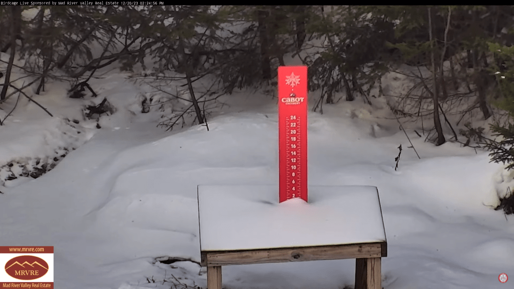
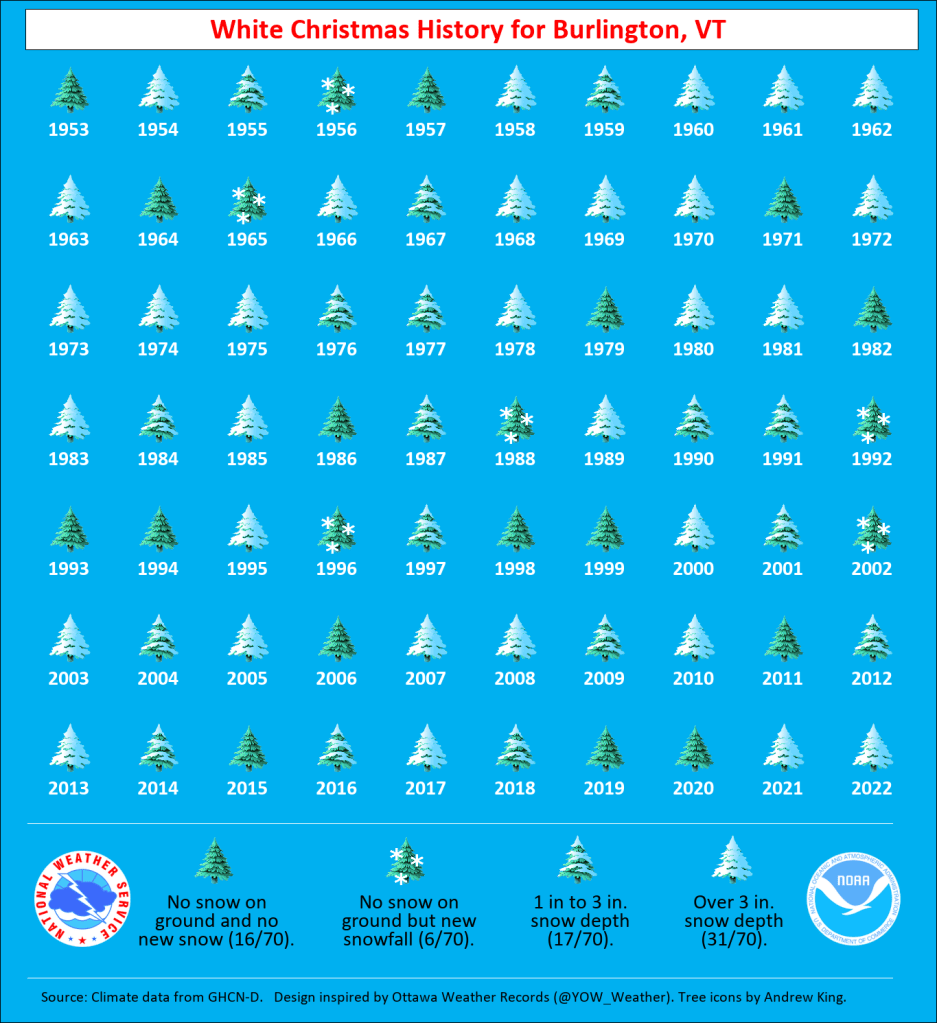
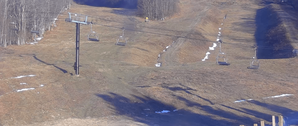
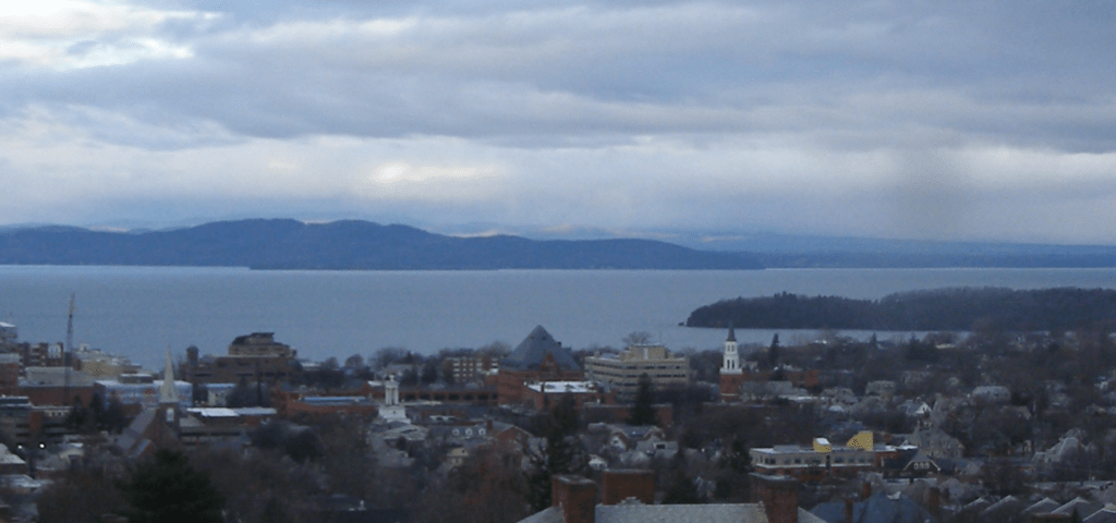
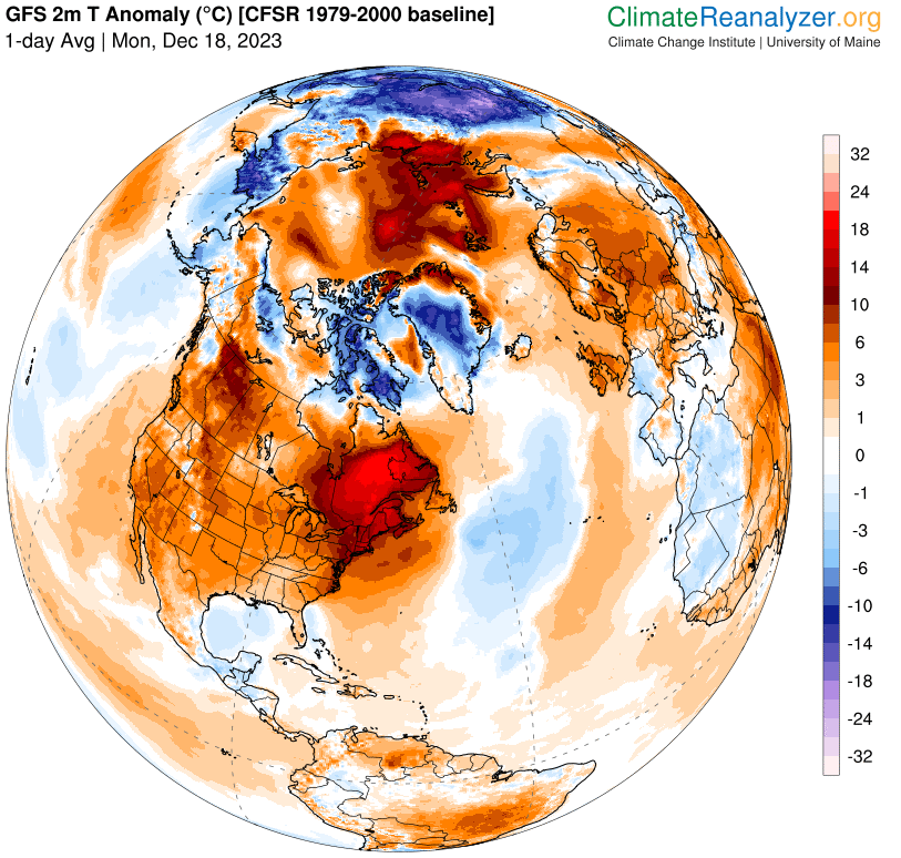
Strato-cumulus clouds this early AM also a few stray snowflakes technically for a trace of snow. We might have another dusting of snow in the mountains on Saturday late day/evening. Not a lot of opportunity for replacement snow in the next week.

TONIGHT: Cloudy periods this evening then clearing overnight.A low in the mid to upper teens. North winds continue at 10 mph.
TOMORROW: Mostly sunny. A high in the upper 20s. Northerly winds continuing 10 mph.

Winter Solstice December 21st 10:27 PM Thursday evening….
THURSDAY NIGHT: Clear with a couple high clouds. A low ranging 5 to 15 above. Light north winds.
FRIDAY: Sunshine with a few high clouds late.A high 25 to 30. Little wind.
Looking further ahead

FRIDAY NIGHT: A few high clouds. A low in the upper teens.
SATURDAY: Clouds with an occasional break or interval of sun. A high in the upper 30s.
SUNDAY: Sunshine mixing with more clouds late. A low 20 to 25. A high 40 to 45.
MONDAY CHRISTMAS DAY: Sunshine filtered thru high cloudiness. A low around 25. A high in the mid-40s.
TUESDAY: Mostly cloudy. A rising chance for rain & possible mixed precipitation later on. A low around 30. A high 40 to 45.
Average lows upper single digits to mid-teens. Average highs upper 20s to mid-30s
RH/12-19forecast][end]
TODAY: Sunny. A high around 35. Light northwest winds.
TONIGHT: Partly to mostly cloudy northern areas, otherwise clear.A low in the mid to upper teens. North winds 10 mph.
THURSDAY: Mostly sunny. A high in the upper 20s. North winds 10 mph.
Looking further ahead
Winter Solstice December 21st 10:27 PM Thursday evening….
THURSDAY NIGHT: Clear. A low upper single digits, to mid-teens.
FRIDAY: Sunshine with a few high clouds late.A high 25 to 30.
SATURDAY: Increasing clouds. A low 15 to 20. A high 35 to 40.
SUNDAY: Partly cloudy. A low 20 to 25. A high 40 to 45.
MONDAY CHRISTMAS DAY: Partly to mostly sunny. A low 25 to 30. A high in the mid-40s.
TUESDAY: Mostly cloudy. A rising chance for rain or showers late. A low around 30. A high 45 to 50.
Average lows upper single digits to mid-teens. Average highs upper 20s to mid-30s
RH/12-19forecast][end]
TODAY: Intervals of sunshine this morning give way to lots of clouds. A round or two of flurries or light mountain snow showers. A dusting to a half inch accumulation across elevated terrain. Temperatures in the mid to upper 30s. Southwest winds shifting to northwesterly 10 to 15 mph.
TONIGHT: Evening clouds, then clearing and colder. A low upper teens to around 20. Light northwest winds.
WEDNESDAY: Sunny. A high around 35. Light northwest winds.
Looking further ahead
WEDNESDAY NIGHT: Scattered clouds to mostly clear skies.A low in the mid to upper teens.
Winter Solstice December 21st 10:27 PM Thursday evening….
THURSDAY: A few morning northern clouds then sunny. A high in the mid-20s.
FRIDAY: Sunshine becoming filtered thru high clouds.A low upper single digits, to mid-teens. A high in the mid-20s.
SATURDAY: Increasing mainly high cloudiness. A low around 15. A high near 35.
SUNDAY: Morning clouds northern areas, then partly sunny. A low 20 to 25. A high pushing to near 40.
MONDAY CHRISTMAS DAY: Sunny. A low in the 20s. A high in the low to mid 40s.
Average lows are in the upper single digits to mid-teens. Average highs upper 20s to mid-30s
RH/12-19forecast][end]
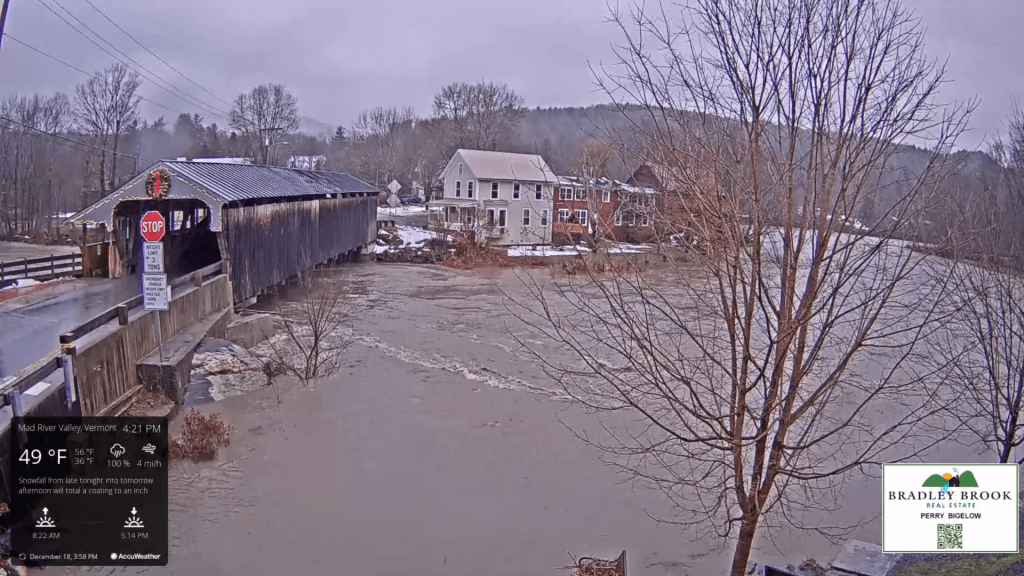
Flood Watch remains in effect thru Tuesday morning…
TONIGHT: A few early evening showers drying up. Otherwise partly to mostly cloudy. Colder. A low in the lower 30s. Southwest winds 10 mph.
TOMORROW: Intervals of sunshine then lots of clouds. Chance for a round of wet snow showers or flurries with less than an inch accumulation. A high near 35. Southwest winds shifting to northwesterly 10 to 20 mph.
TUESDAY NIGHT: Evening clouds, then clearing and colder. A low 20 to 25. Light northwest winds.
WEDNESDAY: Sunny & little more seasonable. A high around 35. Light northwest winds.
Looking further ahead
WEDNESDAY NIGHT: Scattered clouds to mostly clear skies.A low 15 to 20.
Winter Solstice December 21st 10:27 PM Thursday evening….
THURSDAY: A few morning northern clouds then sunny. A high around 25.
FRIDAY: Bright sunshine and blue skies. A low upper single digits, to mid-teens. A high in the mid-20s.
SATURDAY: A few morning clouds then mostly sunny. A low in the teens. A high in the mid-30s.
SUNDAY: Mostly sunny with a few clouds far north. A low 15 to 20. A high 32 to 35.
Average lows upper single digits to mid-teens. Average highs upper 20s to mid-30s
RH/12-18forecast][end]
Wind Advisory western slopes and northern tier regions thru 4 PM. Flood Watch thru Tuesday morning…
TODAY: Gray but very mild. Breezy to windy with windblown rain…heavy at times this morning into the early afternoon. Record high temperatures peak in the mid-50s. Southeasterly winds pick up to 15 to 30 mph with gusting 45 mph, shifting to westerly 10 to 25 mph with higher gusts in southern areas.
TONIGHT: A few early evening showers drying up. Otherwise partly to mostly cloudy. A low upper 20s to lower 30s. Southwest winds 10 to 15 mph.
TUESDAY: A few morning breaks of sun then lots of clouds with a few wet snow showers or flurries with little accumulation. A high in the low to mid 30s. Southwest winds shifting to northwesterly 10 to 20 mph.
Looking further ahead
TUESDAY NIGHT: Early evening clouds, then clearing and colder. A low 20 to 25.
WEDNESDAY: Mostly sunny & little more seasonable. A high around 35.
Winter Solstice December 21st 10:27 PM Thursday evening….
THURSDAY: A few morning clouds northern and western areas, then mostly sunny. A low 20 to 25. A high 25 to 30.
FRIDAY: Bright sunshine and blue skies. A low upper single digits, to mid-teens. A high around 25.
Average lows upper single digits to mid-teens. Average highs upper 20s to mid-30s
RH/12-18forecast][end]
TONIGHT: Overcast.Rain…this evening, mainly light with areas of dense fog developing. A few leftover sprinkles overnight. Watch for icy spots. A low about 32 to 35. Light south winds.
TOMORROW: Mainly gray. A few light rain showers in northern areas. A high near 40. Little wind.
SATURDAY NIGHT: Widely scattered light rain showers with pockets of freezing rain & possible slick travel northern tier regions. A low in the low 30s.
SUNDAY: Clouds with a break or two of sun. Rain likely in the afternoon…transitioning to wet snow late across upper mountain slopes. A high in the upper 30s.
Looking further ahead

SUNDAY NIGHT: Overcast. Rain going over to accumulating wet snow down to valley floors…moderate to heavy at times with several inches likely.. A low near 32.
MONDAY: Gray. Good chance for occasional light accumulating snow showers or flurries. A high 32 to 35.
TUESDAY: Intervals of sun after a morning mountain flurry. Lows 10 to 15. Highs in the mid-20s.

WEDNESDAY: High cloudiness but fair and cold. A low in the single digits above zero. A high 20 to 25.
Average lows upper teens to mid-20s. Average highs are mid-30s to around 40.
Note – off for the next two weeks….
RH/12-1forecast][end]
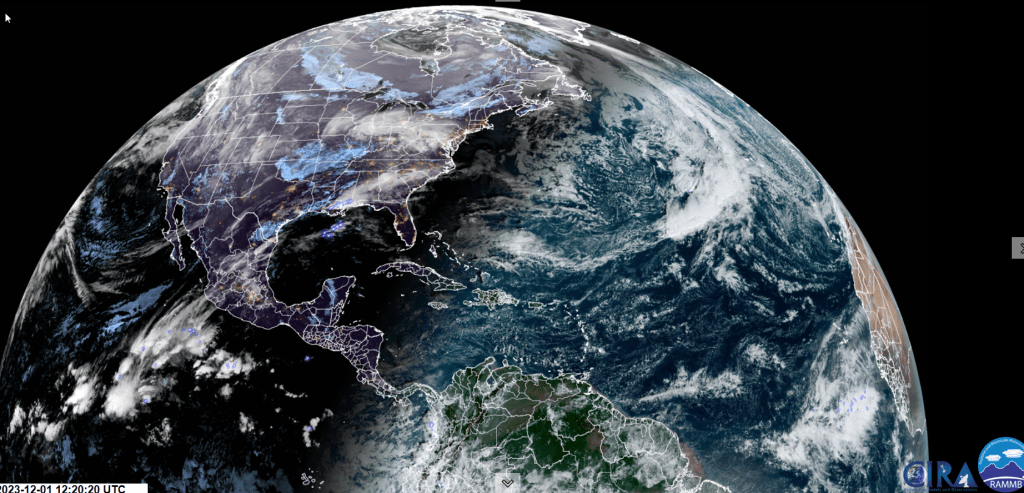
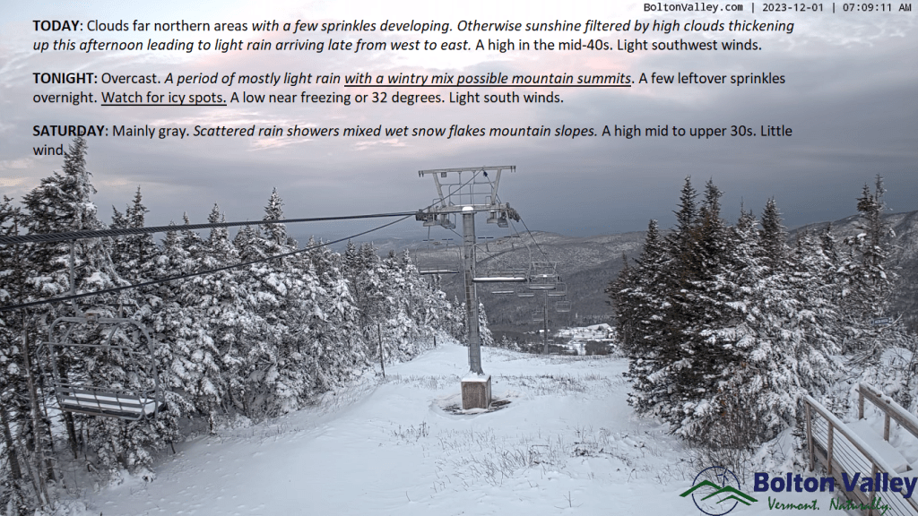
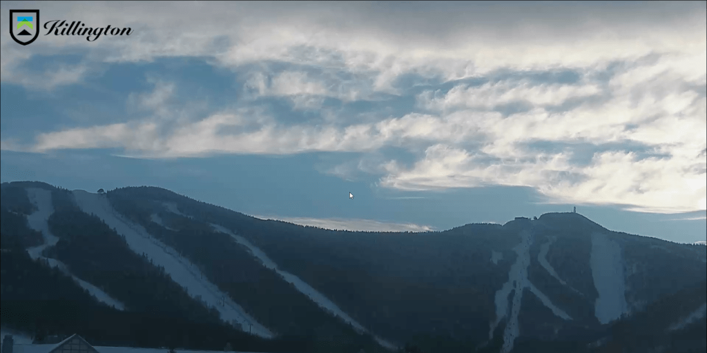
TODAY: Clouds in far northern areas with a few sprinkles developing. Otherwise, sunshine filtered by high clouds thickening up this afternoon leading to light rain arriving late from west to east. A high in the mid-40s. Light southwest winds.
TONIGHT: Overcast.A period of mostly light rain with a wintry mix possible mountain summits. A few leftover sprinkles overnight. Watch for icy spots.A low near freezing or 32 degrees. Light south winds.
SATURDAY: Mainly gray. Scattered rain showers mixed wet snow flakes mountain slopes. A high mid to upper 30s. Little wind.
Looking further ahead
SATURDAY NIGHT: Widely scattered light rain showers with pockets of freezing rain & possible slick travel northern tier regions. A low 32 to 35.
SUNDAY: Clouds with a break or two of sun. Rain showers likely…with wet snow developing late across mountains slopes. A high in the mid-30s.
SUNDAY NIGHT: Overcast. Good chance for rain transitioning to accumulating wet snow. A few to several inches possible above valley floors especially in southern and central areas. A low around 30.
MONDAY: Gray. Good chance for occasional light accumulating snow showers or flurries. Temperatures near 32 degrees falling gradually falling thru the 20s.
TUESDAY: Intervals of sun after a morning flurry. Lows 15 to 25. Highs mid to upper 20s.
Average lows upper teens to mid-20s. Average highs mid-30s to around 40.
RH/12-1forecast][end]
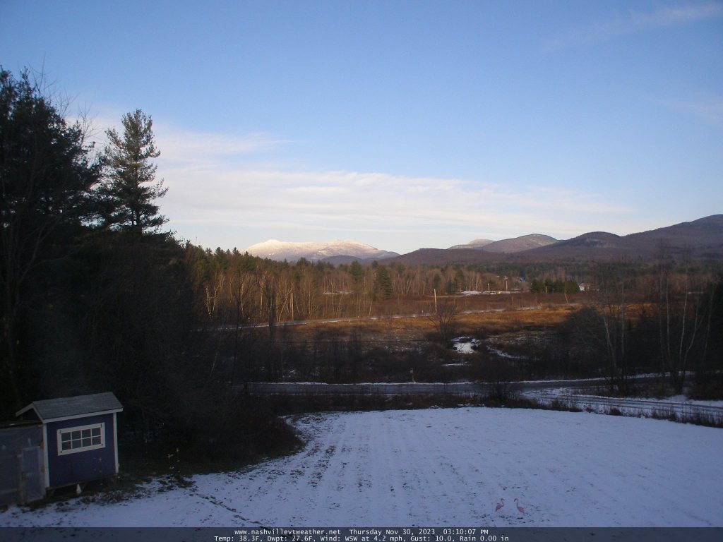
TONIGHT: Fair with high clouds. An evening low around 32. Southwest winds 10 mph stronger near Lake Champlain.
TOMORROW: Becoming mostly cloudy but milder. A few sprinkles far north, give way to periods of light rain later in the afternoon. A high pushing into the mid-40s. Light southwest winds.
FRIDAY NIGHT: Overcast.A period of light rain with a wintry mix above 1500 ft. exiting to isolated leftover sprinkles around midnight. Watch for icy spots. A low 32 to 35. Light south winds.
SATURDAY: Mainly gray. Scattered rain showers. A high mid to upper 30s. Little wind.
Looking further ahead
SATURDAY NIGHT: Widely scattered light rain showers with pockets of freezing rain with slick travel. A low around 32.
SUNDAY: Clouds with a break or two of sun. Chance for rain showers or a wintry mix mainly higher terrain. A high in the mid to upper 30s.
SUNDAY NIGHT: Overcast. Chance for rain changing to accumulating wet snow, possibly significant. A low near 30.
MONDAY: Gray. Chance for accumulating wet snow with significant amounts in the morning tapering to scattered flurries in the afternoon. Temperatures near 32 degrees falling into the 20s late.
TUESDAY: Partly sunny. Lows 15 to 25. Highs mid to upper 20s.
Average lows upper teens to mid-20s. Average highs mid-30s to around 40.
RH/11-30forecast][end]
