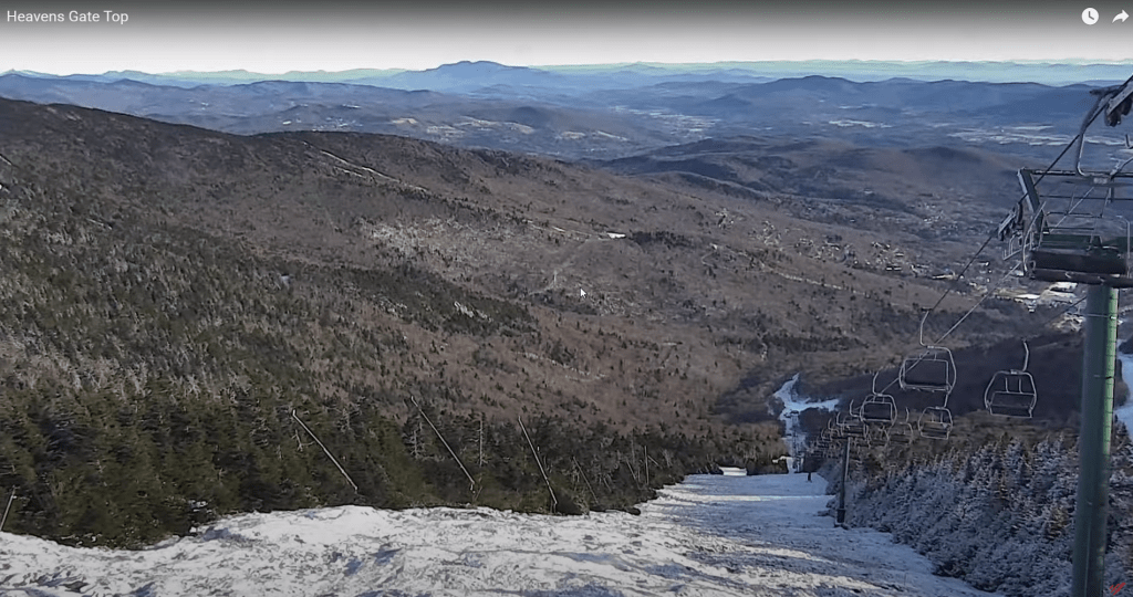
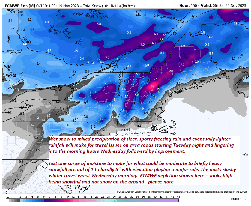
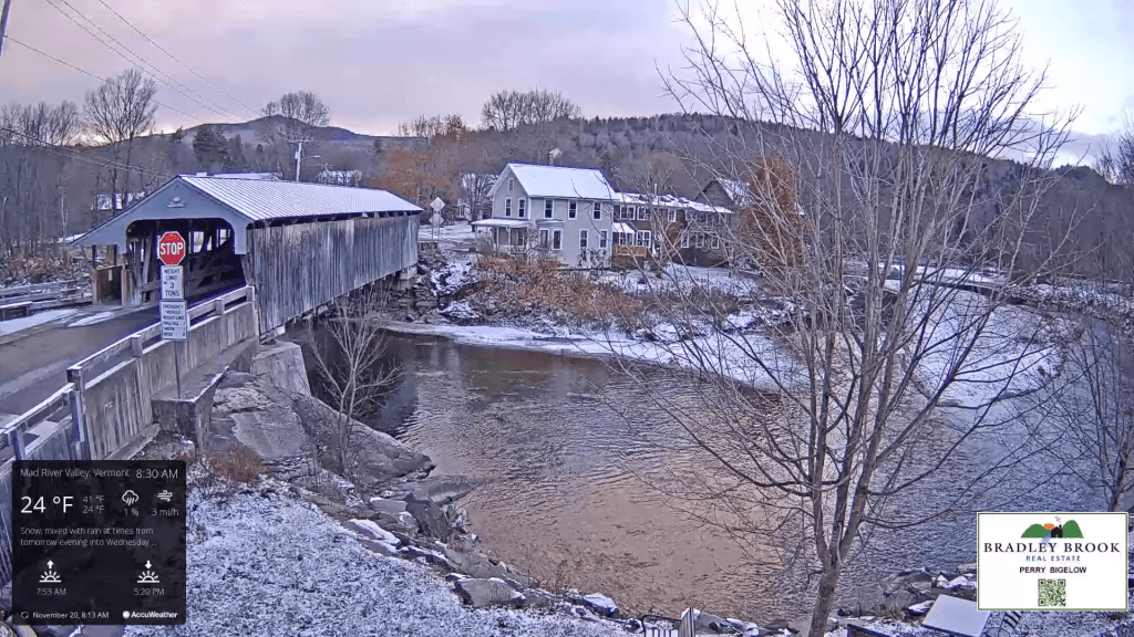
Better than 90% done with this storm as warmer air transitions frozen precip to liquid. Pushing 5″ in many areas east of the Green Mountains overnight…roads to gradually improve…but slushy slow going lingers thru this morning for a time yet.

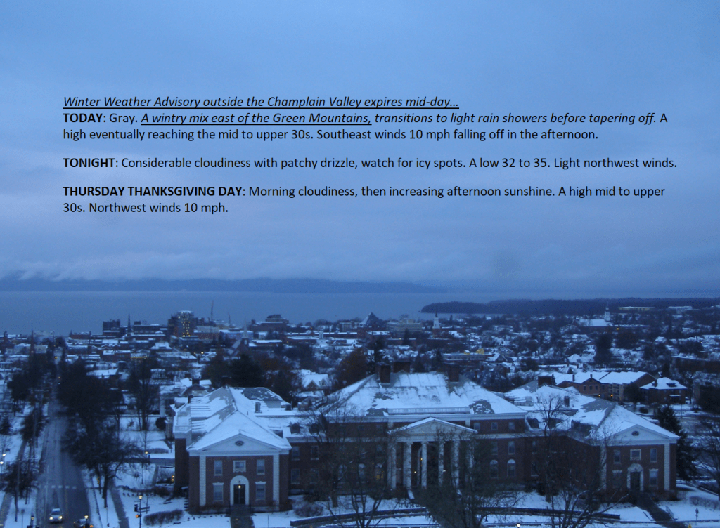
Winter Weather Advisory 4 PM this evening thru 1 PM Wednesday outside of the Champlain Valley
TONIGHT: Overcast & blustery at times. Accumulating wet snow moderate at times this evening. Accumulations of an inch western valleys…before going over to rain…and 2 to isolated 5” east of the Greens. Sleet and pockets of freezing rain developing around daybreak. Watch for slushy/icy travel. A low upper 20s to around 30, rising overnight. Winds southeasterly 10 to 20 mph with higher gusts mountain summits and western slopes.
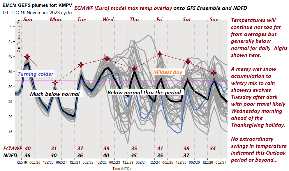
TOMORROW: A wintry mix in the morning affecting travel, transitions to light rain showers late morning tapering off in the afternoon. Otherwise gray. A high upper 30s to near 40. Southeast winds 10 mph falling off in the afternoon.
WEDNESDAY NIGHT: Considerable cloudiness. A low 30 to 35. Light northwest winds.
THURSDAY THANKSGIVING DAY: Morning cloudiness, then increasing afternoon sunshine. A high 35 to 40. Northwest winds 10 mph.
Looking further ahead
THURSDAY NIGHT: Mostly cloudy.Scattered flurries in northern areas with a minor coating. A low 25 to 30.
FRIDAY: Mostly cloudy with scattered flurries, then periods of afternoon sunshine. A high holding near 30 in the morning then falling into the 20s in the afternoon.
SATURDAY: Mostly sunny but chilly. A low near 15. A high in the lower 30s.
SUNDAY: Morning clouds give way to intervals of sunshine. A low in the teens. Highs low to mid-30s.
MONDAY: Lots of clouds. Chance for rain or snow showers. Lows in the 20s. Highs in the 30s.
Average lows in the 20s. Average highs upper 30s to mid-40s
RH/11-21forecast][end]
TODAY: A few high clouds with mostly sunny skies for a time, then thickening high clouds later on. A high in the mid-30s. Light southeast winds.
Winter Weather Advisory 4 PM this evening thru 1 PM Wednesday outside of the Champlain Valley
TONIGHT: Overcast & blustery at times. Periods of accumulating wet snow developing in the evening…moderate at times with an inch or two western areas…and 1 to 4” along and east of the Greens…before a wintry mix and eventually some rain in western valleys. Watch for slushy/icy travel. A low of about 30 to 32 degrees rising some overnight. Winds southeasterly 10 to occasionally 20 mph and gusty in the mountains.
WEDNESDAY: A morning wintry mix in the morning transitions to light rain showers by mid-day ending in the afternoon. Otherwise gray. A high 35 to 40. Southeast winds 10 mph falling off in the afternoon.
Looking further ahead
WEDNESDAY NIGHT: Considerable cloudiness. A low 30 to 35.
THURSDAY THANKSGIVING DAY: Morning cloudiness, then increasing afternoon sunshine. A high 35 to 40.
FRIDAY: Mostly cloudy with scattered flurries, then periods of afternoon sunshine. A low 25 to 30. A high holding near 30 in the morning then falling into the 20s in the afternoon.
SATURDAY: Partly cloudy northern areas, otherwise lots of sunshine. Colder & blustery. A low near 15. A high in the low to mid 30s.
Average lows in the 20s. Average highs upper 30s to mid-40s
RH/11-21forecast][end]
TONIGHT: Clear this evening then some high clouds overnight. A low mid to upper teens. Little wind.
TOMORROW: Filtered sunshine, then clouding up late. A high in the mid-30s. Light southeast winds.
TUESDAY NIGHT: Overcast & blustery at times. Periods of accumulating wet snow developing in the evening…moderate at times with an inch or two western areas…and 1 to 4” along and east of the Greens…before a wintry mix and eventually some rain in western valleys. Watch for slushy/icy travel. A low of about 30 to 32 degrees rising some overnight. Winds southeasterly 10 to occasionally 20 mph and gusty in the mountains.
WEDNESDAY: A morning wintry mix in the morning transitions to light rain showers by mid-day ending in the afternoon. Otherwise gray. A high 35 to 40. Southeast winds 10 mph falling off in the afternoon.

Looking further ahead
WEDNESDAY NIGHT: Considerable cloudiness. A low 32 to 35.
THURSDAY THANKSGIVING DAY: Morning cloudiness, then increasing afternoon sunshine. A high 35 to 40.
FRIDAY: Mostly cloudy with scattered flurries, then periods of afternoon sunshine. A low 25 to 30. A high holding near 30 in the morning then falling into the 20s in the afternoon.
SATURDAY: Partly cloudy northern areas, otherwise lots of sunshine. Colder & blustery. A low near 15. A high in the low to mid-30s.

Average lows are in the 20s. Average highs upper 30s to mid-40s
RH/11-20forecast][end]
TODAY: A few clouds northern areas with a few flurries early, otherwise bright sun and blue skies but cold. A high in the upper 20s to about 30. Light northwest winds.
TONIGHT: Clear this evening then some high clouds overnight. A low ranging thru the teens. Little wind.
TUESDAY: Filtered morning sun then thickening high clouds. A high in the low to mid 30s. Light southeast winds increasing to around 10 mph late.
Looking further ahead
TUESDAY NIGHT: Overcast & blustery at time. Periods of accumulating wet snow developing…moderate at times with an inch or two western areas…to locally 4 inches southern and eastern areas…before mixing with sleet and pockets of freezing rain. Watch for poor travel conditions. A low ranging from the upper 20s to near 32 degrees western areas.
WEDNESDAY: Mixed precipitation with slushy/icy travel early…transitioning to light rain showers. Otherwise mainly gray. A high in the mid to upper 30s.
THURSDAY THANKSGIVING DAY: Morning cloudiness, then increasing afternoon sunshine. A low near 32 degrees. A high 35 to 40.
FRIDAY: Some morning clouds with scattered flurries, then periods of afternoon sunshine. A low 25 to 30. A high in the low 30s.
Average lows in the 20s. Average highs upper 30s to mid-40s
RH/11-20forecast][end]

TONIGHT: Overcast. A period of rain developing early this evening from northwest to southeast, moderate at times. A low in the upper 30s. Winds shifting to northwesterly 10 mph.
TOMORROW: Early rain showers mixing with a little wet snow briefly before exiting to intervals of sunshine. Blustery and colder, temperatures falling into the mid-30s. Northwest winds 10 mph.
SATURDAY NIGHT: Mostly clear in the evening with more clouds overnight. Rising chance for a few mountain flurries far northern areas. A low around 25. Light southwest winds.
SUNDAY: Clouds with intervals of sun & turning blustery. Scattered snow showers mixed with rain warmer valleys. Some coatings of accumulation across elevated terrain. A high 35 to 40. Winds becoming west to northwesterly 10 to 15 mph.
Looking further ahead

SUNDAY NIGHT: A few northern clouds otherwise becoming mostly clear. A low 20 to 25.
MONDAY: Some clouds northern areas early, then sunny. A high in the lower 30s.
TUESDAY: Increasingly cloudy & becoming breezy. Rising chance for accumulating wet snow changing to rain, Accumulation of couple three inches more elevated terrain. A low in the upper teens. A high in the mid and upper 30s.

WEDNESDAY: Chance for rain & wet snow showers giving way to periods of sunshine. A low around 32. A high in the low 40s.
Average lows mid-20s to 30. Average highs low to mid 40s
RH/11-17forecast][end]
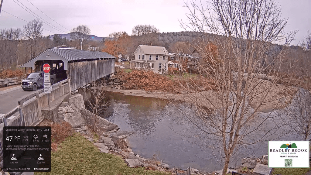
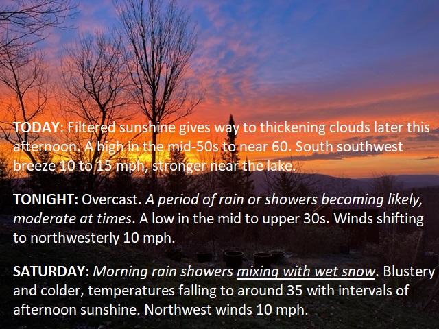
TODAY: Filtered sunshine gives way to thickening clouds later this afternoon. A high in the mid-50s to near 60. South southwest breeze 10 to 15 mph, stronger near the lake.
TONIGHT: Overcast. A period of rain or showers becoming likely, moderate at times. A low in the mid to upper 30s. Winds shifting to northwesterly 10 mph.
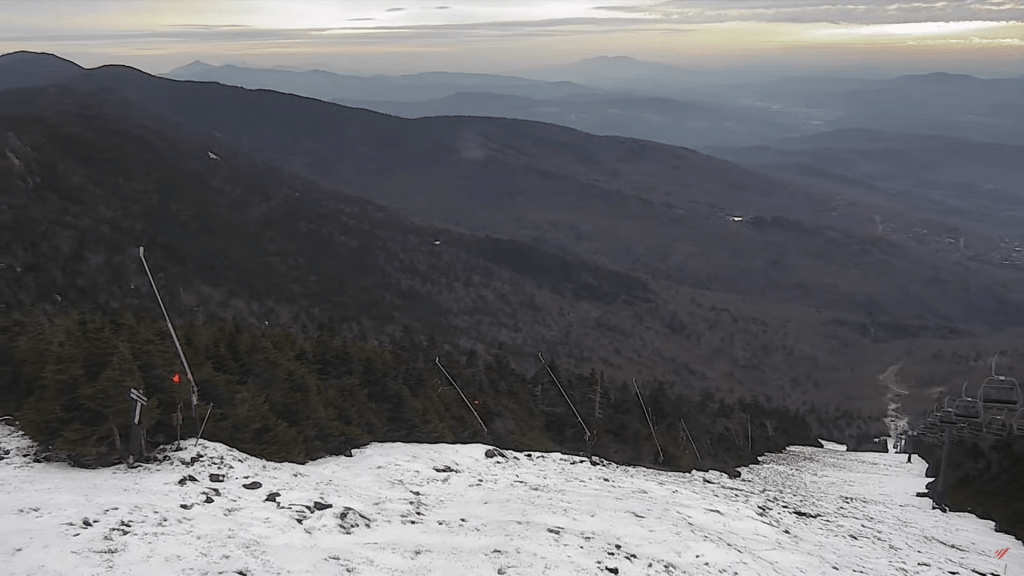
SATURDAY: Morning rain showers mixing with wet snow. Blustery and colder, temperatures falling to around 35 with intervals of afternoon sunshine. Northwest winds 10 mph.
Looking further ahead
SATURDAY NIGHT: Scattered clouds then clearing. A low around 25.
SUNDAY: Clouds with intervals of sun. Scattered snow showers or flurries with minor accumulations. A high 35 to 40.
MONDAY: Some clouds in northern areas early, then sunny. A low 20 to 25. A high in the lower 30s.
TUESDAY: Increasingly cloudy & becoming breezy. Rising chance for accumulating wet snow changing to rain, Accumulation of a couple/three inches…more elevated terrain. A low in the upper teens. A high in the mid and upper 30s.
WEDNESDAY: Chance for rain & wet snow showers giving way to periods of sunshine. A low around 32. A high in the low 40s.
Average lows are mid-20s to 30. Average highs low to mid-40s
RH/11-17forecast][end]

TONIGHT: Mostly clear with a couple high clouds. A low 32 to 35. Light south winds, stronger near Lake Champlain.
TOMORROW: Filtered sunshine to thickening clouds late. A high reaching into the mid-50s. South southwest breeze 10 to 15 mph, stronger near the lake.
FRIDAY NIGHT: Overcast. A period of rain or showers becoming likely, moderate at times. A low upper 30s to mid-40s. Winds shifting to northwesterly 10 mph.
SATURDAY: Morning rain showers mixing with wet snow. Blustery and sharply colder, temperatures falling to around 35 with intervals of afternoon sunshine. Northwest winds 10 mph.
Looking further ahead
SATURDAY NIGHT: Scattered clouds then clearing. A low 20 to 25.
SUNDAY: Clouds with intervals of sun. Scattered snow showers or flurries with minor coatings. A high mid to upper 30s.

MONDAY: Some clouds in northern areas early, then sunny. A low 20 to 25. A high of about 32 degrees.
TUESDAY: Increasingly cloudy & becoming breezy. Rising chance for accumulating wet snow & mixed precipitation. A low around 30. A high mid to upper 30s.
WEDNESDAY: Chance for rain or wet snow showers giving way to periods of sunshine. A low 25 to 30. A high in the low to mid-40s.
Average lows are mid-20s to 30. Average highs low to mid-40s
RH/11-16 forecast][end]
